| Tidal state |
Low |
| Site located? |
Yes |
| Proximity to coast edge |
Coast edge |
| Coastally eroding? |
active sea erosion |
| Threats |
structural damage/decay |
| Visibility above ground |
Highly visible (substantial remains) |
| Access |
easily accessible - no restrictions |
| Local knowledge |
is well known |
| Description |
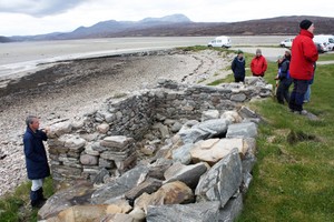
On the SW side of Ard Thunga is a 5 m by 5 m mortared stone structure. The walls of this building survive to nine courses (c 1.9 m high). The top of the N wall is flush with the raised ground at the rear that has been built up for the modern road causeway across the Kyle. The NE corner is abutted by the massive boulder revetment of that road. There is an opening for a door in the W wall that is 1 m wide and survives to 1.5 m high. The interior of the structure is now filled with boulder-rubble and tumble that appears to have been pushed in from above, probably at the time the causeway was constructed. This building relates to the older ferry across the Kyle and may have been used to signal the ferryman when moored at the far side (W) of the Kyle. The building is only about 1 m from the HWM at the S and has been badly affected by the construction of the causeway at the N.
26/05/2013
As described. The building is marked as a Signal House on the OS 6 inch 2nd edition (1892-1905), but not on the 1st edition (1843-1882.
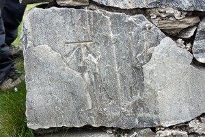
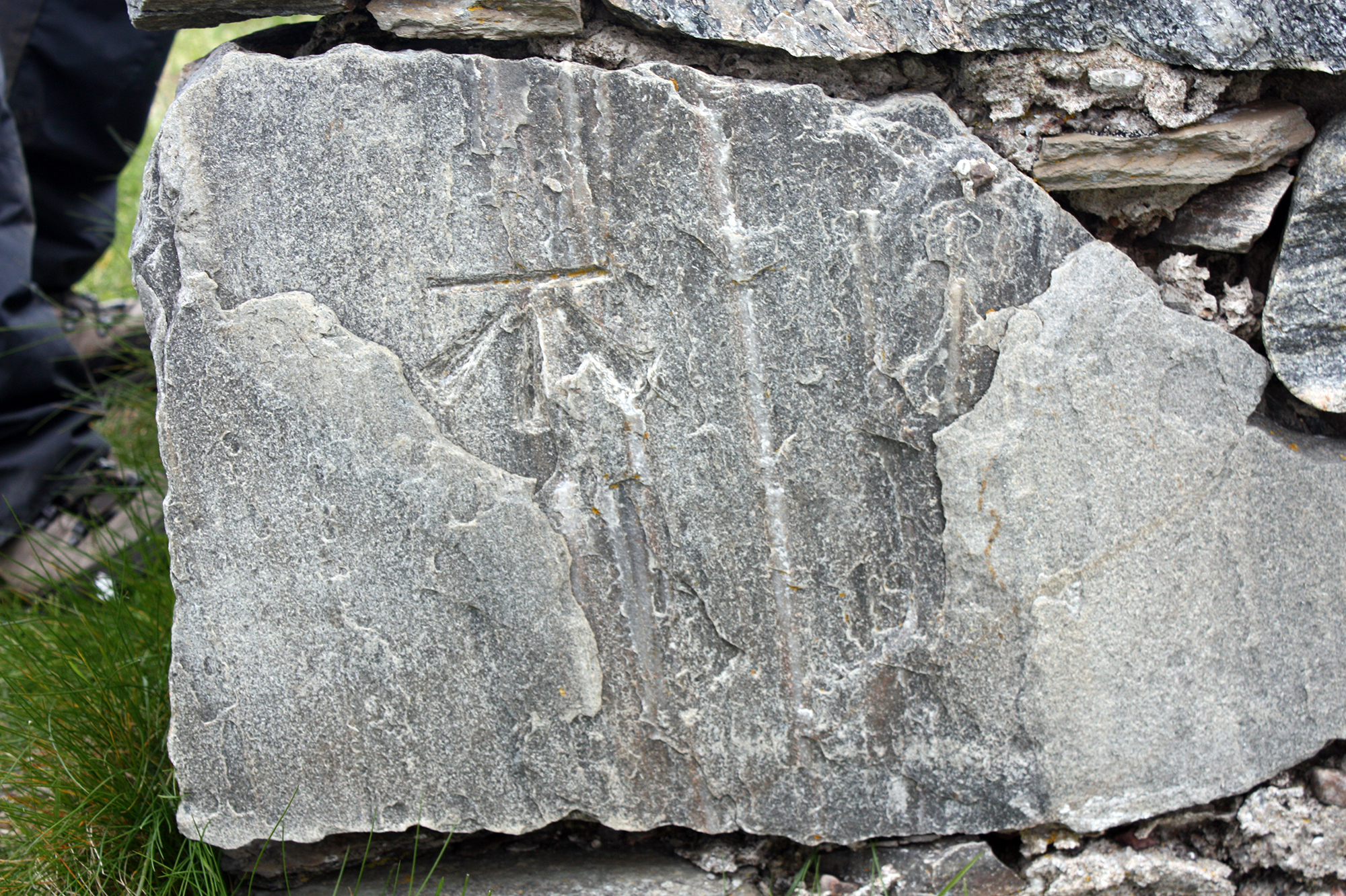
There is a nice OS bench mark carved into the quoin on the northwest corner of the building. |
|