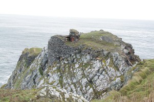
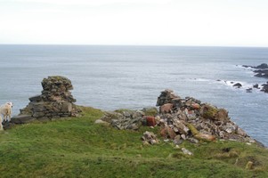
The fragmentary ruins of Fast Castle occupy a flat-topped promontory, surrounded on three sides by cliffs which reach to 30m in height. The fortification is said to have it origins in the 12th C. It has been the subject of excavations carried out by the Edinburgh Archaeological Field Society in the 1970's and 1980's. It is accessed via a modern footbridge, but would originally have been equipped with a draw bridge. On the promontory, the remains of a curtain wall and the hall survive, together with fragmentary remains of several other structures. The masonry is severely weathered in places and vulnerable to further structural collapse. On the landward side of the promontory a series of depressions in the grassy hillside may mark the locations of excavated features. The castle, together with a series of field boundaries and low earthworks, located on the plateau above the castle, are visible on 1946 AP's(B17 7009-10 15/4/46). The earthworks are visible but less evident on later AP's (OS 65/02 432-3 28/3/65, B739 952-3 30/7/73).
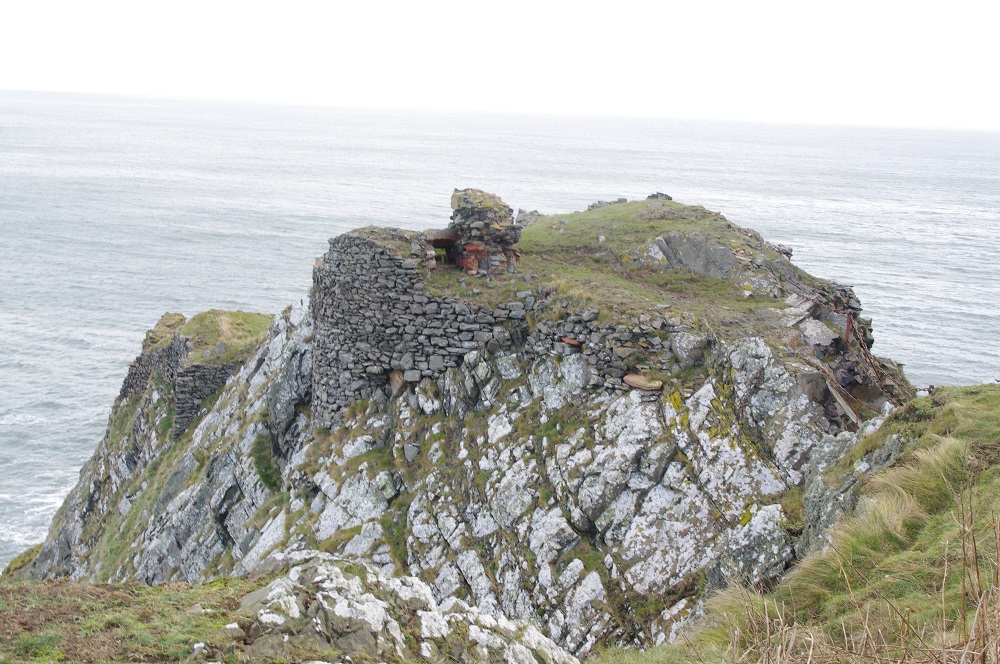
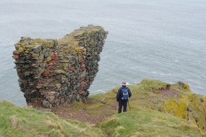
A site visit on 1st February 2014 by Mr Hugh Dinwoodie noted that the formerly prominent, approximately 3m high, masonry of the north-east corner of the Great Hall of the Castle, had collapsed, largely into rubble on its western side (rather than slipping entirely down the cliff on the east, which might have been expected had the wind been from the west). The rubble included sandstone blocks, remains of the former aumbry once incorporated in the upstanding ruin (illustrated, courtesy of RCAHMS, in “Fast Castle History from 1602” (Mitchell 1988)). Local information from an inhabitant of nearby cottages suggested that the masonry had in fact collapsed ‘two or three years ago, in a winter gale’ – that is, in 2011 or 2012 rather than more recently. It might be worth enquiring from others for a closer estimate of this date.
Location
386100.00
671040.00
27700
55.9322205
-2.2240515
Submitted photographs
Image
Date
Caption
User
04/03/2014
Fast Castle by Hugh Dinwoodie. Showing the masonry on the western cliff face.
EllieSCHARP
05/03/2014
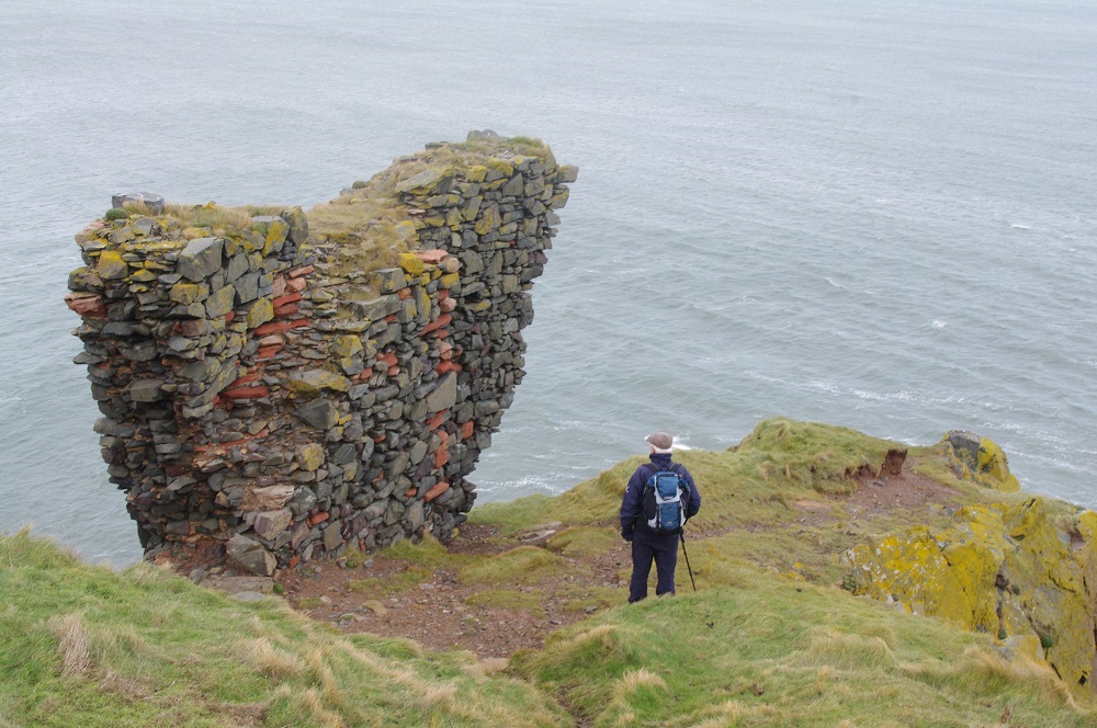
Fast Castle by Hugh Dinwoodie. Showing the remains of the Hall and the collapsed NE corner.
EllieSCHARP
05/03/2014
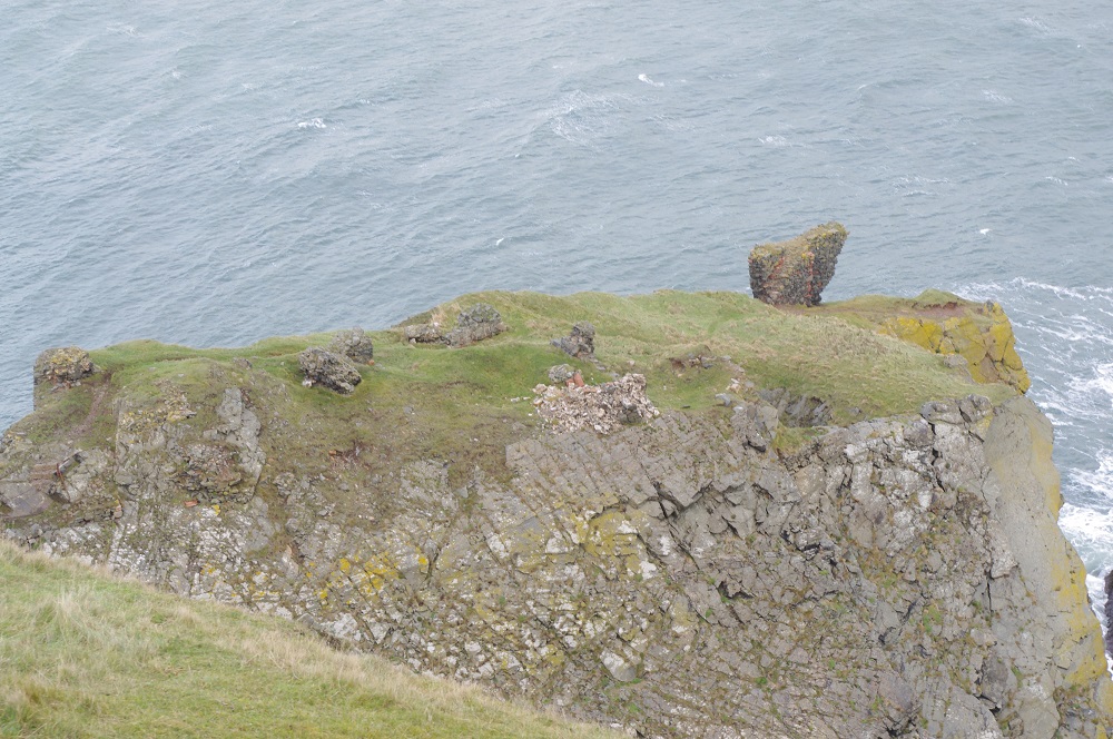
Fast Castle by Hugh Dinwoodie. Showing the remains of the NW range.
EllieSCHARP
05/03/2014
Fast Castle by Hugh Dinwoodie. Showing the prominent surviving NW range and the collapsed masonry of the Hall.
EllieSCHARP
04/03/2014
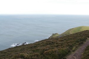
Fast Castle by Hugh Dinwoodie. Showing the site and the surrounding landscape
EllieSCHARP
01/02/2014
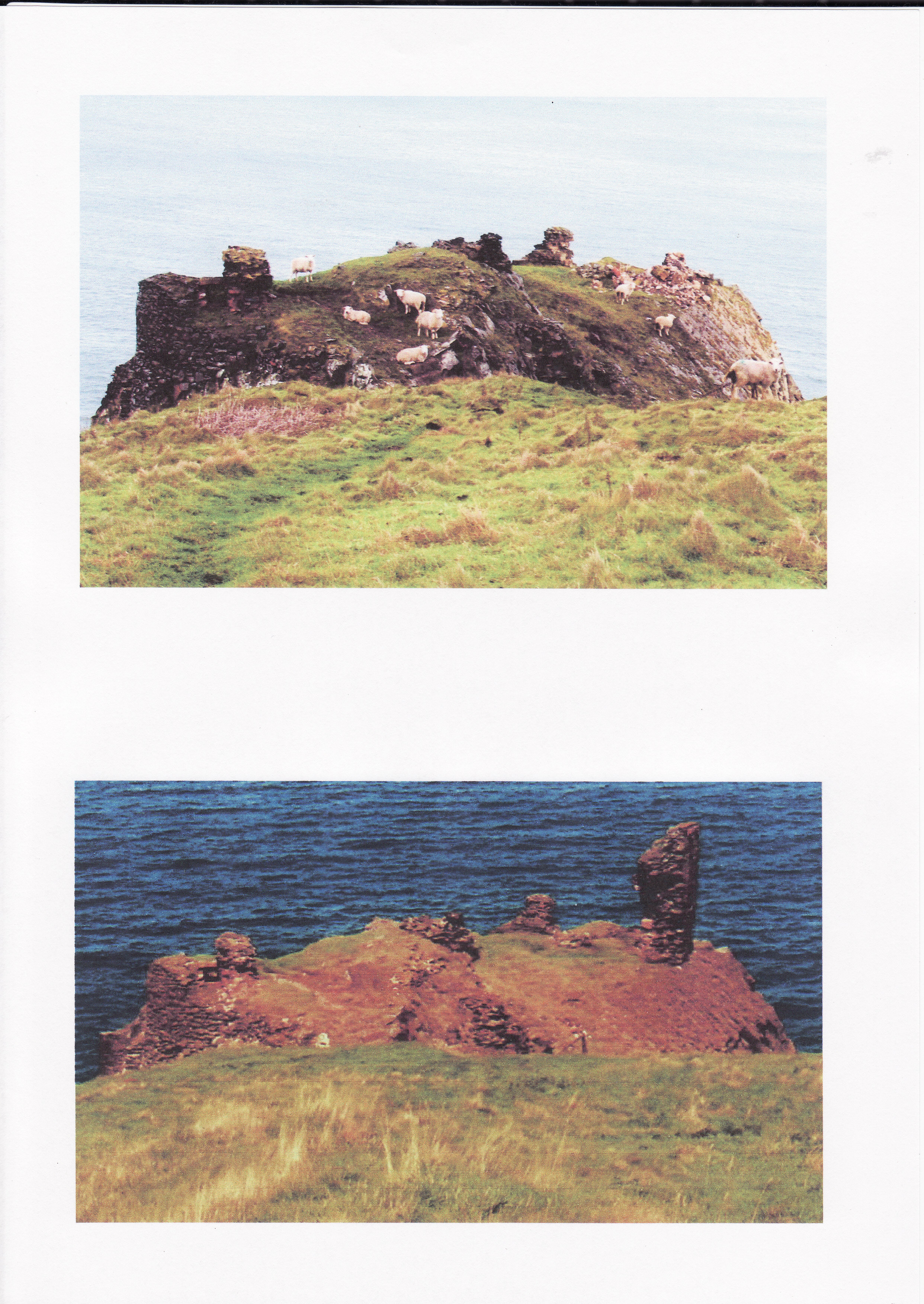
Fast Catle 2000 and 2014 by Hugh Dinwoodie
EllieSCHARP
Submitted updates
Update id
Date
User
1565
01/02/2014
EllieSCHARP
Site located?
Yes
Proximity to coast edge
< 10m
Threats
structural damage/decay
Visibility above ground
Highly visible (substantial remains)
Access
accessible - difficult terrain
Local knowledge
is well known; has local associations/history
Description
The fragmentary ruins of Fast Castle occupy a flat-topped promontory, surrounded on three sides by cliffs which reach to 30m in height. The fortification is said to have it origins in the 12th C. It has been the subject of excavations carried out by the Edinburgh Archaeological Field Society in the 1970's and 1980's. It is accessed via a modern footbridge, but would originally have been equipped with a draw bridge. On the promontory, the remains of a curtain wall and the hall survive, together with fragmentary remains of several other structures. The masonry is severely weathered in places and vulnerable to further structural collapse. On the landward side of the promontory a series of depressions in the grassy hillside may mark the locations of excavated features. The castle, together with a series of field boundaries and low earthworks, located on the plateau above the castle, are visible on 1946 AP's(B17 7009-10 15/4/46). The earthworks are visible but less evident on later AP's (OS 65/02 432-3 28/3/65, B739 952-3 30/7/73).
A site visit on 1st February 2014 by Mr Hugh Dinwoodie noted that the formerly prominent, approximately 3m high, masonry of the north-east corner of the Great Hall of the Castle, had collapsed, largely into rubble on its western side (rather than slipping entirely down the cliff on the east, which might have been expected had the wind been from the west). The rubble included sandstone blocks, remains of the former aumbry once incorporated in the upstanding ruin (illustrated, courtesy of RCAHMS, in “Fast Castle History from 1602” (Mitchell 1988)). Local information from an inhabitant of nearby cottages suggested that the masonry had in fact collapsed ‘two or three years ago, in a winter gale’ – that is, in 2011 or 2012 rather than more recently. It might be worth enquiring from others for a closer estimate of this date.
Talk to other local people about the damage to the structure for a closer estimate of the date.