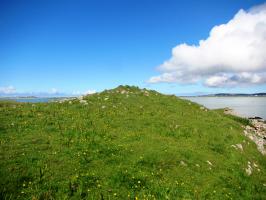
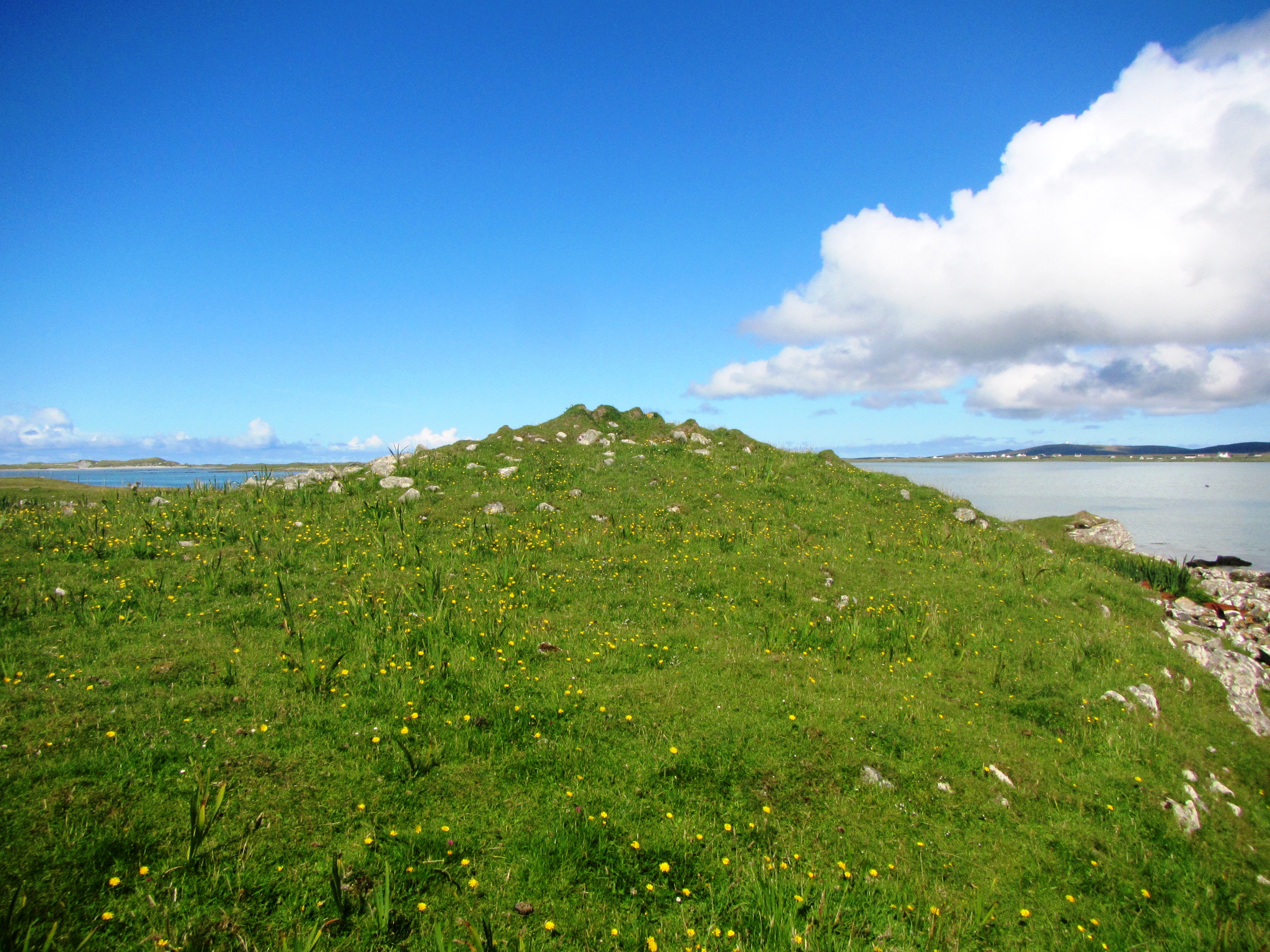
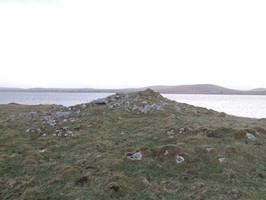
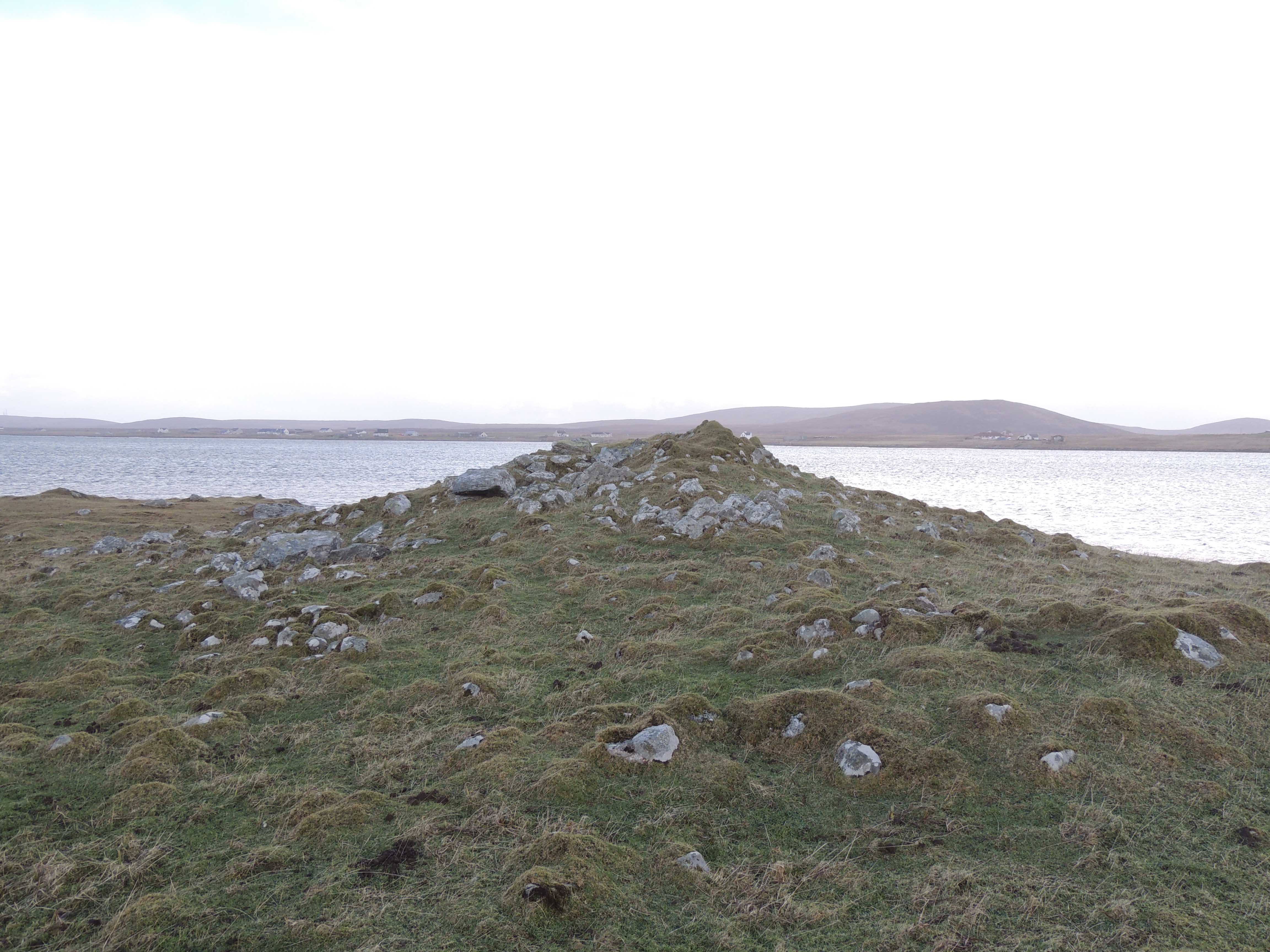
Description from RCAHMS Carnan nan Long is a mound, above the shore, about 40ft in diameter and 10ft high with indications of a chamber c. 15ft by 4ft. On the west of its summit are two large stone slabs. Henshall gives the dimensions as c. 110ft long, 64ft wide at the N end and 32ft at the S, the height agreeing with Beveridge. It is oriented NNE to SSW (bearing 198). Vague foundations of a building are apparent at the NW corner while the NE corner has been eroded by the sea.
The remains of a much mutilated cairn are generally as described by Henshall except for the overall dimensions (c. 26m long by 20m wide). There are only slight indications of a chamber although one orthostat remains in situ.
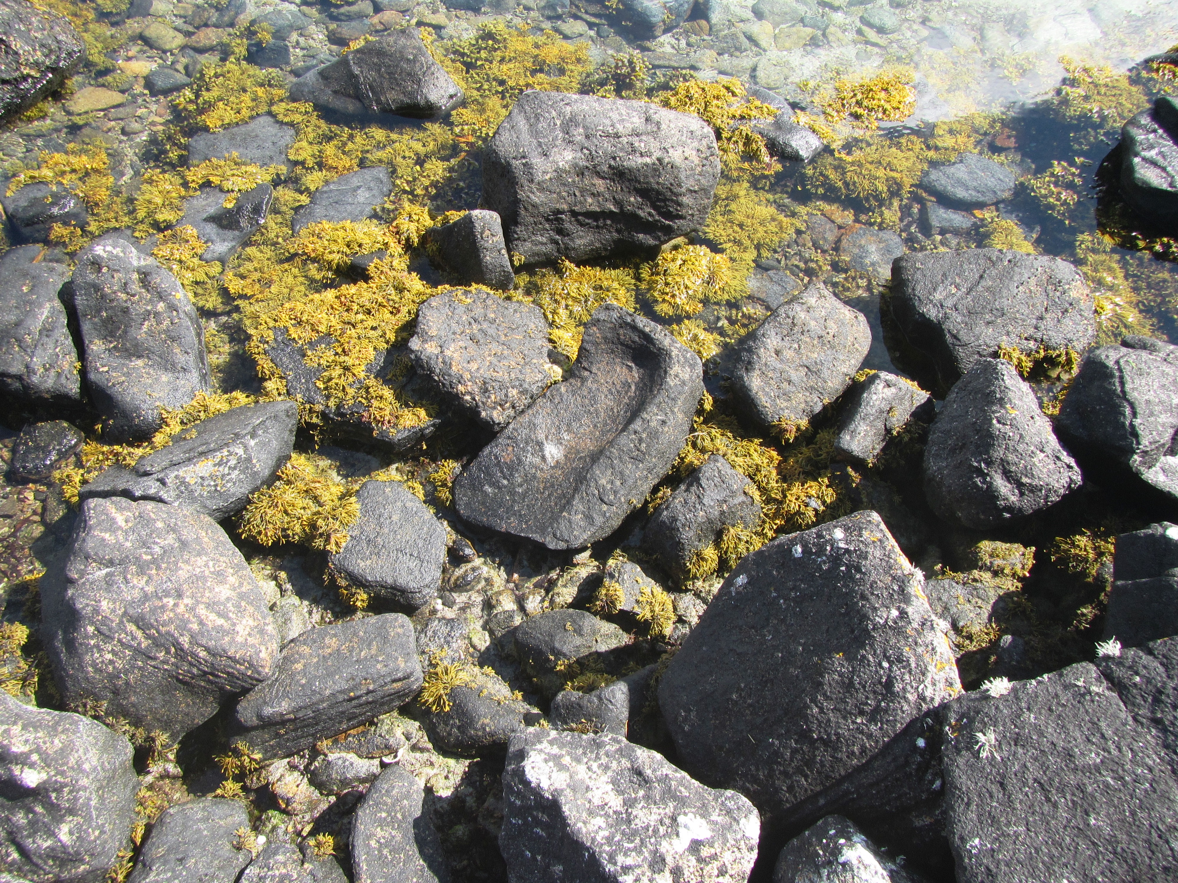
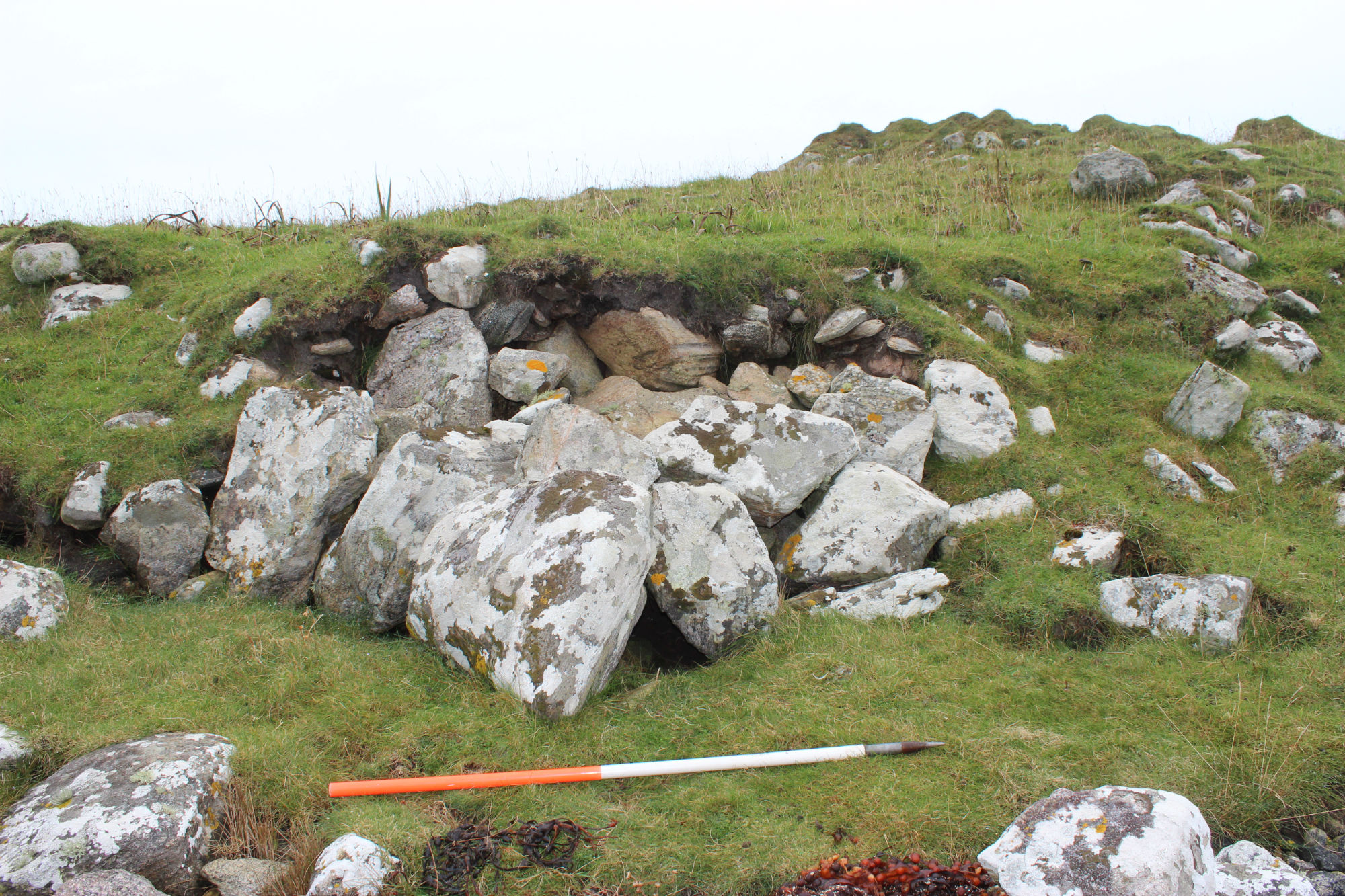
Shoreupdate 22/09/2014. Generally as described. Eroding face is stable, someone has piled stones to protect the eroding edges.
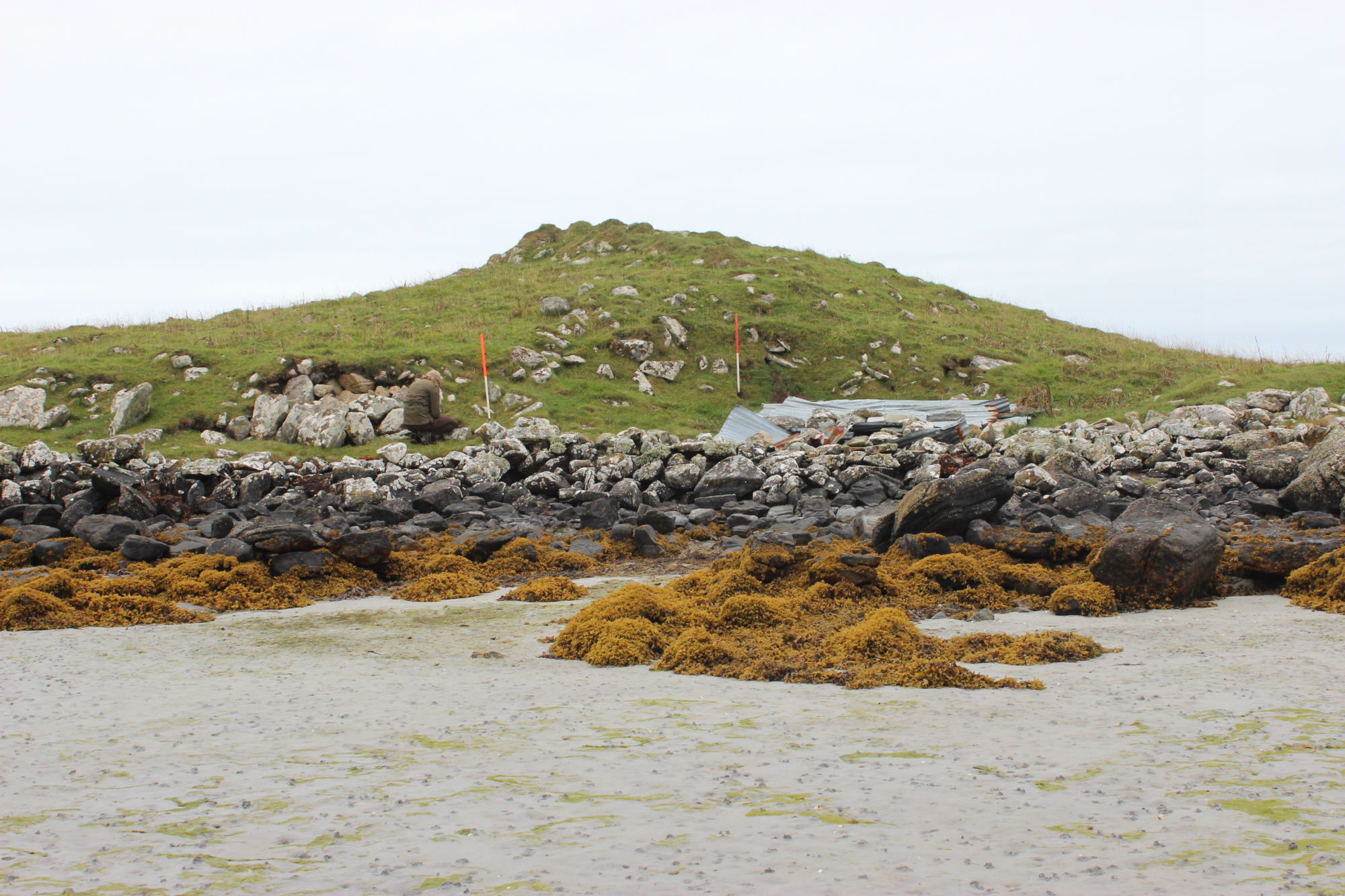
Visit by UCAG Committee, 6th August 2023. A broken Saddle Quern was found at the site, close to the high tide-line on the North-East facing shore. The wall protecting the site, visible on satellite imagery, has tumbled and is no longer useful protection, however the crofter has provided protection from grazing animals by way of a stock fence.
Location
79070.00
863669.00
27700
57.5488014
-7.3669934
Submitted photographs
Image
Date
Caption
User
07/08/2023
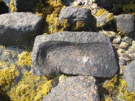
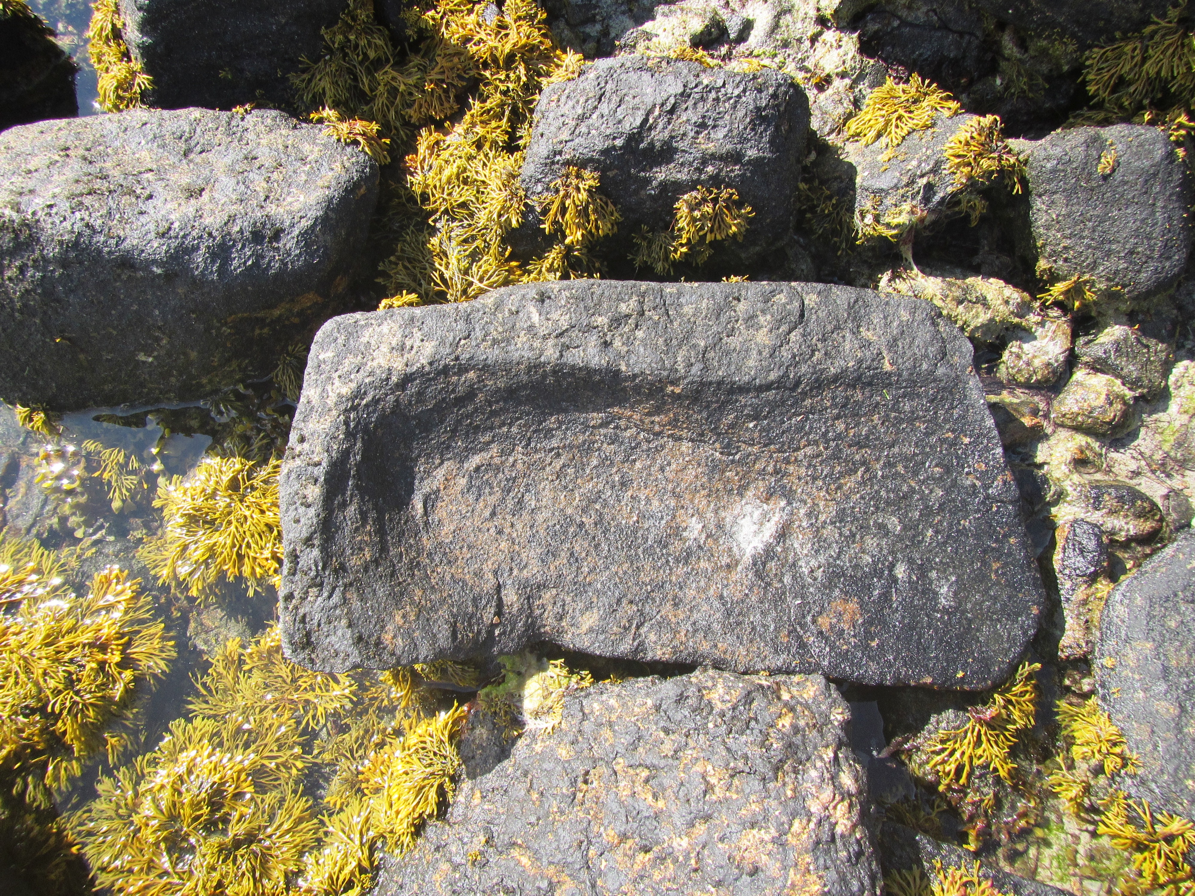
Close-up of the Saddle Quern
Smilemaker
07/08/2023
The Saddle Quern in situ, as found
Smilemaker
07/08/2023
Carnan nan Long viewed from the South
Smilemaker
22/09/2014
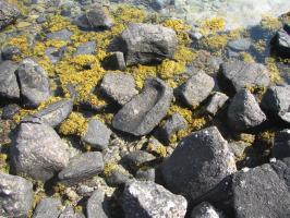
Baleshare, Carnan Nan Long, detail of piled up boulders
training1
26/01/2014
Chambered Cairn
rcauger
22/09/2014
General view of seaward side of mound, looking SW
training1
Submitted updates
Update id
Date
User
4499
07/08/2023
Smilemaker
Tidal state
High
Site located?
Yes
Proximity to coast edge
Coast edge
Coastally eroding?
has eroded in the past
Other threats
The wall protecting the site, visible on satellite imagery, has tumbled and is no longer useful protection, however the crofter has provided protection from grazing animals by way of a stock fence - thankfully without a barbed topping wire.
Description
Visit by UCAG Committee, 6th August 2023.
ad hoc visits for assessments. A well protected site with only likely threats from northerly approaching storms.
Comments
A new find - a broken Saddle Quern was found at the site, close to the high tide-line on the North-East facing shore. An otter track crosses the headland back from the cairn and fresh, active spraint mounds can be seen on the shore edge
1785
22/09/2014
training1
Tidal state
Mid
Site located?
Yes
Proximity to coast edge
Coast edge
Coastally eroding?
has eroded in the past
Visibility above ground
Highly visible (substantial remains)
Visibility in section
Limited visibility in section
Access
accessible on foot (no footpath)
Description
Description from RCAHMS Carnan nan Long is a mound, above the shore, about 40ft in diameter and 10ft high with indications of a chamber c. 15ft by 4ft. On the west of its summit are two large stone slabs. Henshall gives the dimensions as c. 110ft long, 64ft wide at the N end and 32ft at the S, the height agreeing with Beveridge. It is oriented NNE to SSW (bearing 198). Vague foundations of a building are apparent at the NW corner while the NE corner has been eroded by the sea.
The remains of a much mutilated cairn are generally as described by Henshall except for the overall dimensions (c. 26m long by 20m wide). There are only slight indications of a chamber although one orthostat remains in situ.
Shoreupdate 22/09/2014. Generally as described. Eroding face is stable, someone has piled stones to protect the eroding edges. Demote from priorities
Demote from priorities to priority 3. Monitor
Comments
Ad hoc coastal defence of piled boulders against eroding edge
1547
26/01/2014
rcauger
Description
RCAUGER noted that this site is mislabelled as it is nowhere near Loch Paible. On the current 25000 OS map it is down as a chambered cairn. Due to this information, the description has been changed to that from RCAHMS