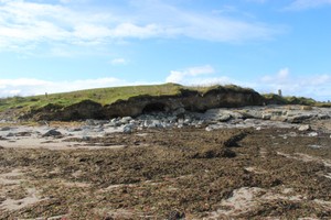
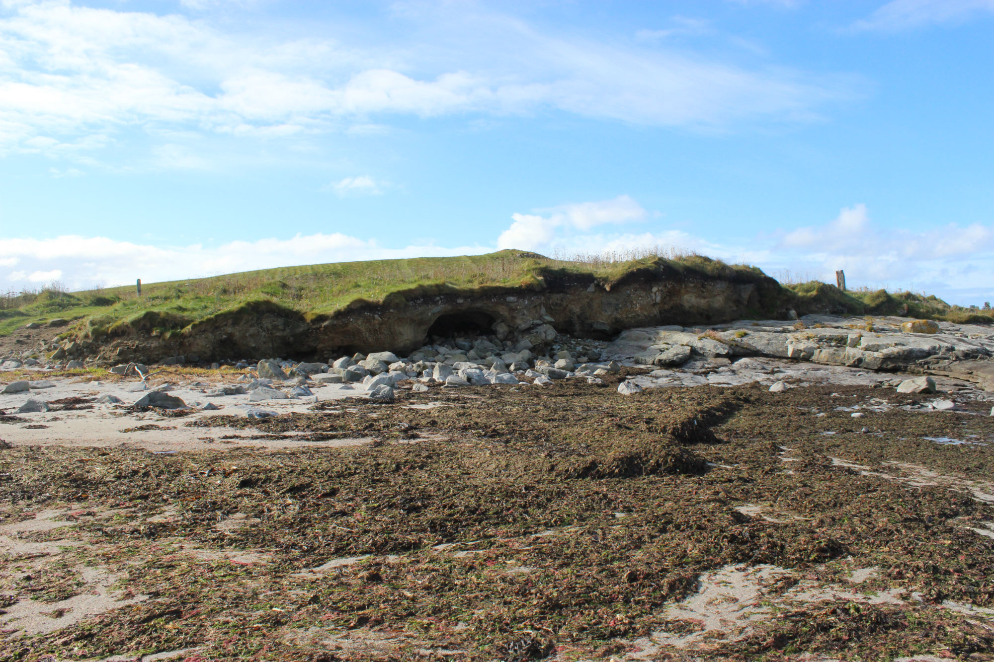
There are extensive settlement remains eroding out of a much disturbed mound on a small tidal islet which lies between the shore and the island of Orosay. When surveyed by RCAHMS in 1965, the islet was said to measure 50 yards by 20 yards (approximately 50m by 20m); it has now been reduced to an overall diameter of some 15m. The site has been damaged both by coastal erosion and by human activities associated with the nearby seaweed factory. Plastic pipes have been inserted through the mound, resulting in the subsequent creation of 'wormholes' by the sea. Recent storm damage has removed much of the turf cover from the mound, exposing old ground surfaces both in plan and in section. These comprise of organic soils and compacted peat ash. Inclusions within these surfaces include shell, animal bone, struck quartz, decorated prehistoric pottery, possibly Iron Age in date, together with a large number of struck flint flakes. In several places on the south and east sides of the mound it appears that fragments of walling survive. In some cases, the stonework can be verified but elsewhere it is difficult to distinguish from the natural rock formation in this area, which is reminiscent of built stonework. More invasive assessment would be required to determine the nature and extent of the surviving structural remains. This site is already extremely badly damaged and much reduced in size. It is actively eroding and unlikely to survive for much longer. It is recommended that a site assessment is carried out immediately.
ShoreUPDATE September 2014
The top of the mound is now stabilised and well vegetated.
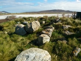
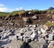
2 limited areas of erosion on the north and south faces where organic soil and cultural deposits are exposed in the section. A small area of walling is visible on the east side. Small amounts of pottery and struck quartz were found.
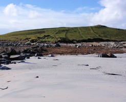
Accessible at low tide.
December 2015
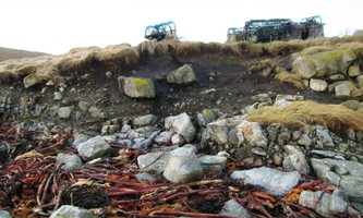
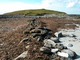
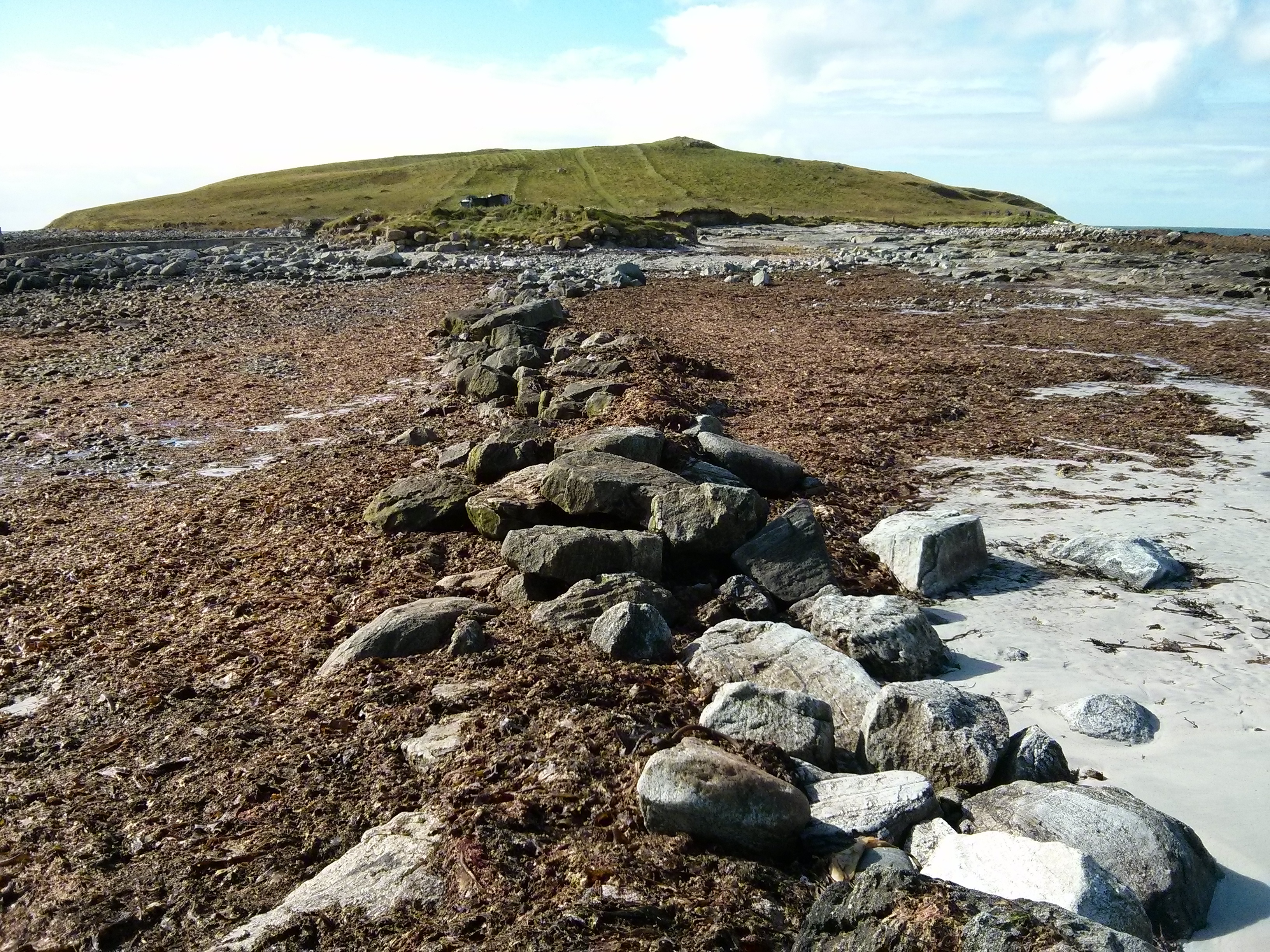
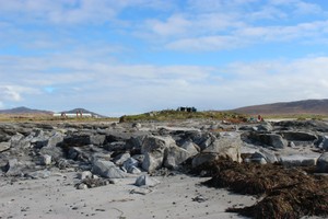
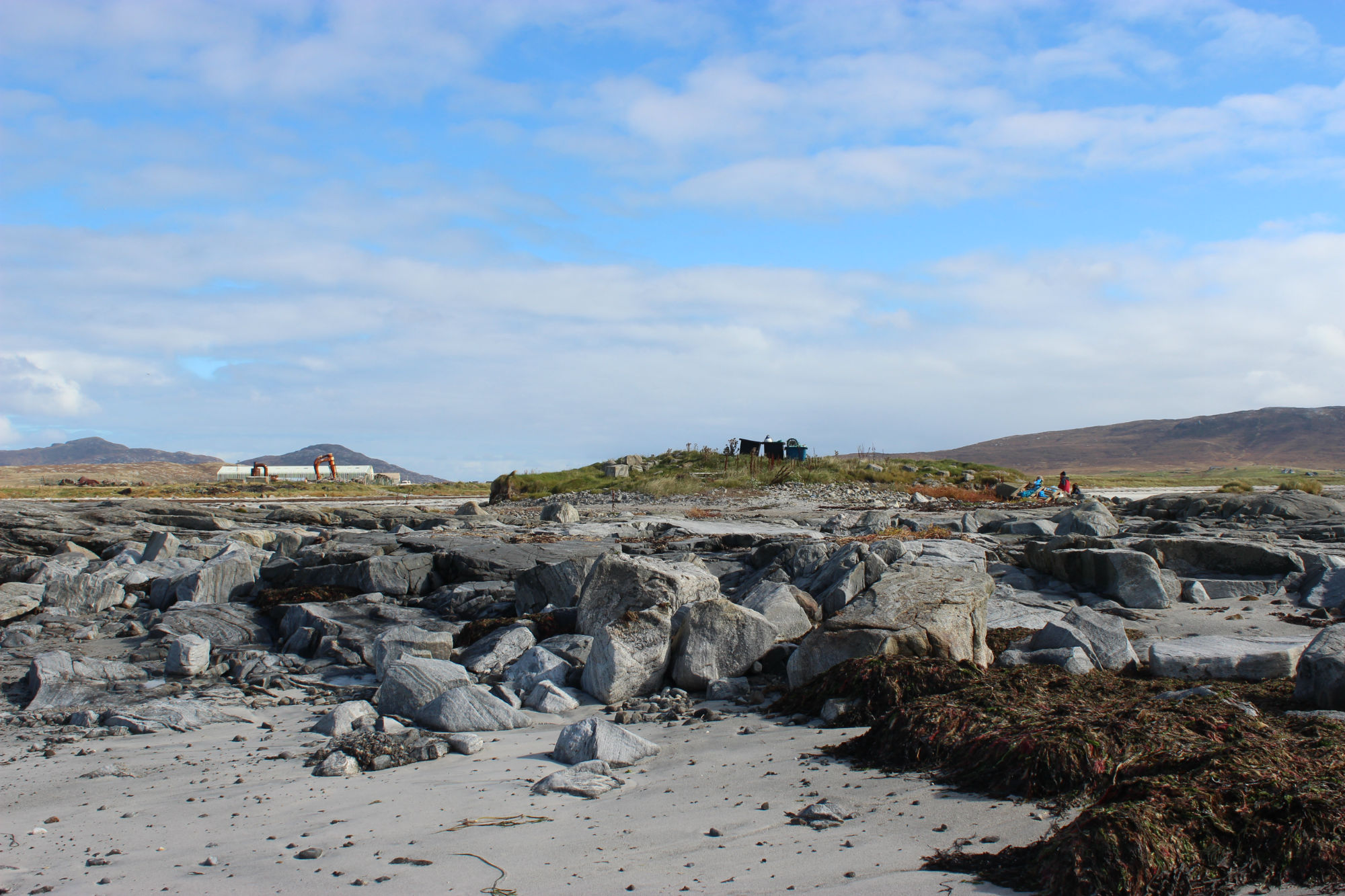
The site continues to deteriorate here. The site is now a tidal island whereas within living memory it formed part of a dry peninsula linking Orosay to South Uist. There are many creels and other fishing gear stored on the surface, which might give some protection. The outline of possible walls forming a sub rectangular structure are visible below the vegetation. There are marked exposed active erosion faces to the north and south faces where they are exposed to tidal and wave activity.
The site was excavated by Southampton and Reading Universities as part of the Neolithic Stepping Stones project in 2013. Approx 80% of the site was excavated to bedrock
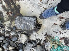
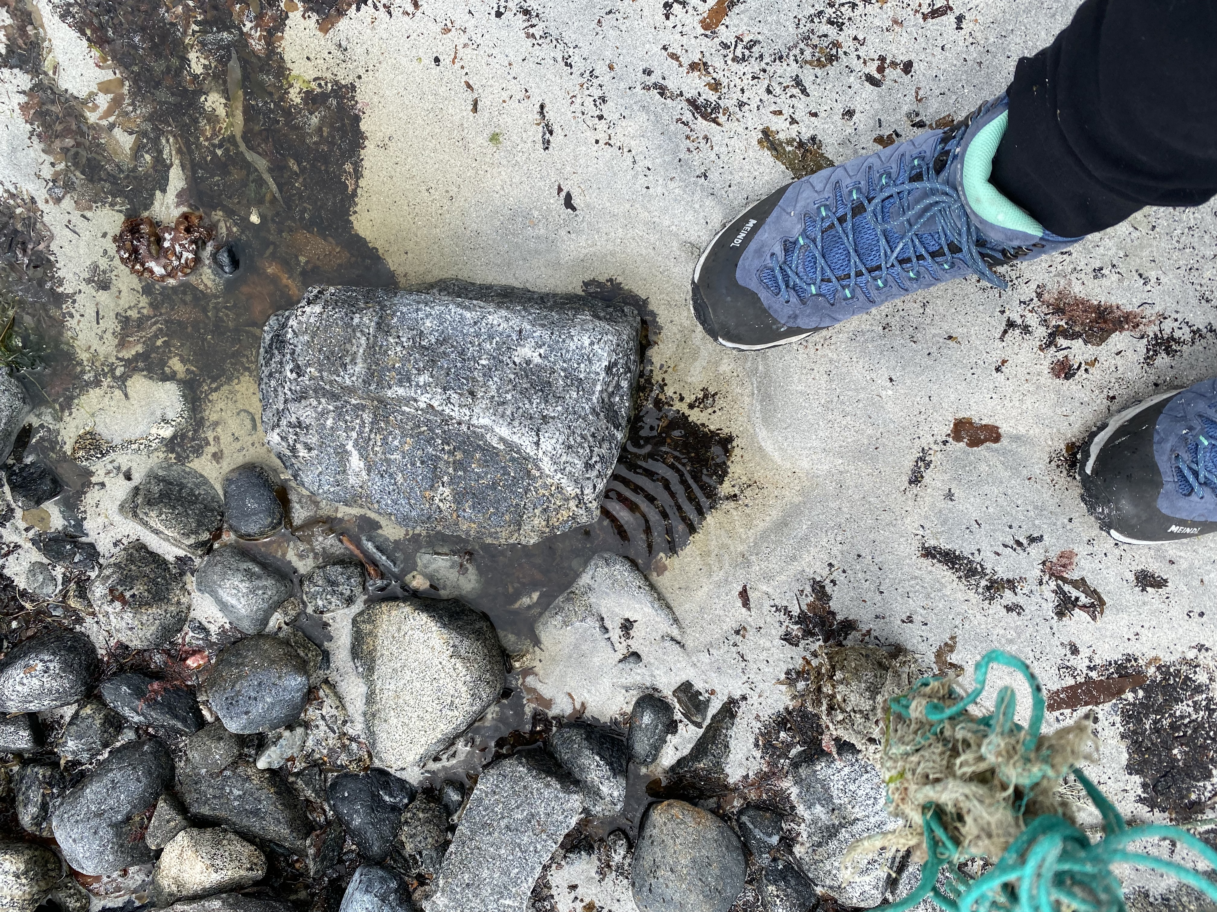
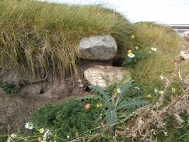
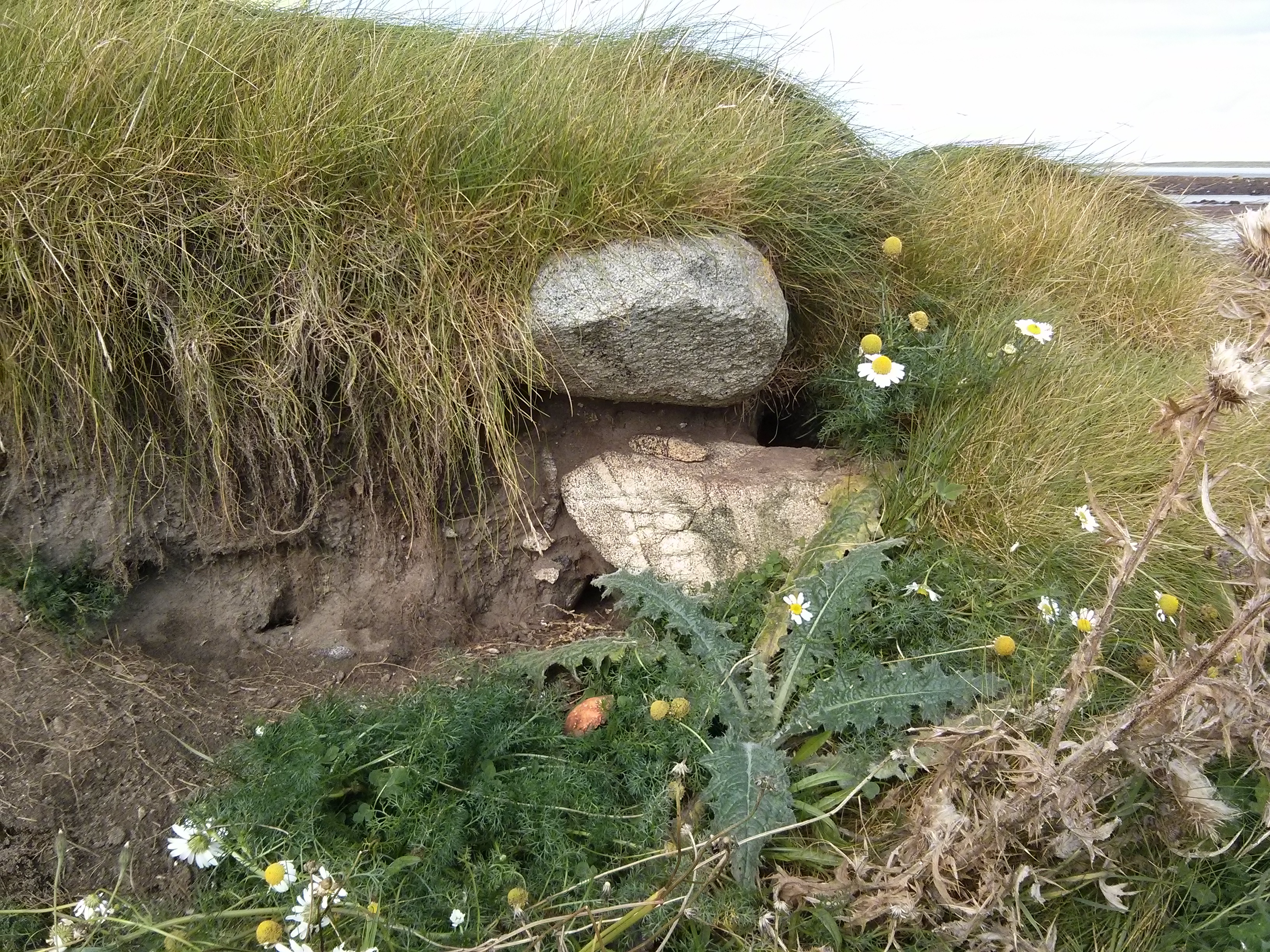
Sea and stone tidal erosion of the site. A stone which appears to have a carved edge on one side and many new deposits of peat, which were not previously visible on the isthmus.
Location
73020.00
817345.00
27700
57.1302299
-7.4062324
Submitted photographs
Image
Date
Caption
User
13/06/2022
stone with inner ? carved area.
BGR: NF 73054 17381
aw
12/12/2015
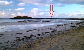
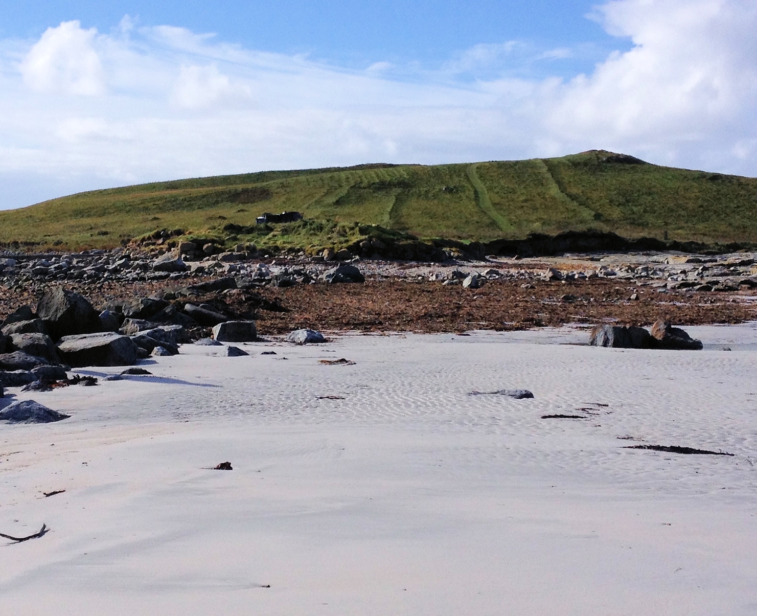
The site in context
Smilemaker
12/12/2015
the Southern exposure
Smilemaker
24/09/2014
Orosay. An Doirlinn (8918)
MartynJ
24/09/2014
Orosay. An Doirlinn (8918)
MartynJ
24/09/2014
Orosay. An Doirlinn (8918)
MartynJ
24/09/2014
Orosay. An Doirlinn (8918)
training1
24/09/2014
Orosay. An Doirlinn (8918)
training1
24/09/2014
Orosay. An Doirlinn (8918)
Annie
24/09/2014
Orosay. An Doirlinn (8918)
Annie
Submitted updates
Update id
Date
User
3995
13/06/2022
aw
Tidal state
Low
Site located?
Yes
Proximity to coast edge
Intertidal
Coastally eroding?
active sea erosion
Other threats
tractor and van tyre damage
Access
easily accessible - no restrictions
Local knowledge
is well known
Description
Sea and stone tidal erosion of the site. A stone which appears to have a carved edge on one side and many new deposits of peat. I walk there often and have not seen peat on the isthmus before.
2304
12/12/2015
Smilemaker
Tidal state
Mid
Site located?
Yes
Proximity to coast edge
Coast edge
Coastally eroding?
active sea erosion; has eroded in the past
Threats
other
Other threats
Used as storage for creels and fishing accoutrements
Visibility above ground
Highly visible (substantial remains)
Visibility in section
Clearly visible in section
Access
accessible - difficult terrain
Local knowledge
is well visited
Description
There are extensive settlement remains eroding out of a much disturbed mound on a small tidal islet which lies between the shore and the island of Orosay. When surveyed by RCAHMS in 1965, the islet was said to measure 50 yards by 20 yards (approximately 50m by 20m); it has now been reduced to an overall diameter of some 15m. The site has been damaged both by coastal erosion and by human activities associated with the nearby seaweed factory. Plastic pipes have been inserted through the mound, resulting in the subsequent creation of 'wormholes' by the sea. Recent storm damage has removed much of the turf cover from the mound, exposing old ground surfaces both in plan and in section. These comprise of organic soils and compacted peat ash. Inclusions within these surfaces include shell, animal bone, struck quartz, decorated prehistoric pottery, possibly Iron Age in date, together with a large number of struck flint flakes. In several places on the south and east sides of the mound it appears that fragments of walling survive. In some cases, the stonework can be verified but elsewhere it is difficult to distinguish from the natural rock formation in this area, which is reminiscent of built stonework. More invasive assessment would be required to determine the nature and extent of the surviving structural remains. This site is already extremely badly damaged and much reduced in size. It is actively eroding and unlikely to survive for much longer. It is recommended that a site assessment is carried out immediately.
ShoreUPDATE September 2014
The top of the mound is now stabilised and well vegetated.
2 limited areas of erosion on the north and south faces where organic soil and cultural deposits are exposed in the section. A small area of walling is visible on the east side. Small amounts of pottery and struck quartz were found.
Accessible at low tide.
December 2015 The site continues to deteriorate here. The site is now a tidal island whereas within living memory it formed part of a dry peninsula linking Orosay to South Uist. There are many creels and other fishing gear stored on the surface, which might give some protection. The outline of possible walls forming a sub rectangular structure are visible below the vegetation. There are marked exposed active erosion faces to the north and south faces where they are exposed to tidal and wave activity.
The site was excavated by Southampton and Reading Universities as part of the Neolithic Stepping Stones project in 2013. Approx 80% of the site was excavated to bedrock
Remove from priorities, the site has been fully excavated
1797
24/09/2014
Annie
Tidal state
Low
Site located?
Yes
Proximity to coast edge
Coast edge
Coastally eroding?
active sea erosion; has eroded in the past
Threats
animal burrows
Visibility above ground
Not visible
Visibility in section
Limited visibility in section
Access
accessible on foot (no footpath)
Local knowledge
don't know
Description
There are extensive settlement remains eroding out of a much disturbed mound on a small tidal islet which lies between the shore and the island of Orosay. When surveyed by RCAHMS in 1965, the islet was said to measure 50 yards by 20 yards (approximately 50m by 20m); it has now been reduced to an overall diameter of some 15m. The site has been damaged both by coastal erosion and by human activities associated with the nearby seaweed factory. Plastic pipes have been inserted through the mound, resulting in the subsequent creation of 'wormholes' by the sea. Recent storm damage has removed much of the turf cover from the mound, exposing old ground surfaces both in plan and in section. These comprise of organic soils and compacted peat ash. Inclusions within these surfaces include shell, animal bone, struck quartz, decorated prehistoric pottery, possibly Iron Age in date, together with a large number of struck flint flakes. In several places on the south and east sides of the mound it appears that fragments of walling survive. In some cases, the stonework can be verified but elsewhere it is difficult to distinguish from the natural rock formation in this area, which is reminiscent of built stonework. More invasive assessment would be required to determine the nature and extent of the surviving structural remains. This site is already extremely badly damaged and much reduced in size. It is actively eroding and unlikely to survive for much longer. It is recommended that a site assessment is carried out immediately.
ShoreUPDATE September 2014
The top of the mound is now stabilised and well vegetated. 2 limited areas of erosion on the north and south faces where organic soil and cultural deposits are exposed in the section. A small area of walling is visible on the east side. Small amounts of pottery and struck quartz were found.
Accessible at low tide.
Remove from priorities. The site has been fully excavated as part of the Neolithic Stepping Stones Project http://www.reading.ac.uk/archaeology/research/neolithicsteppingstones/_/Outer_Hebrides_Excavations.html