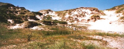
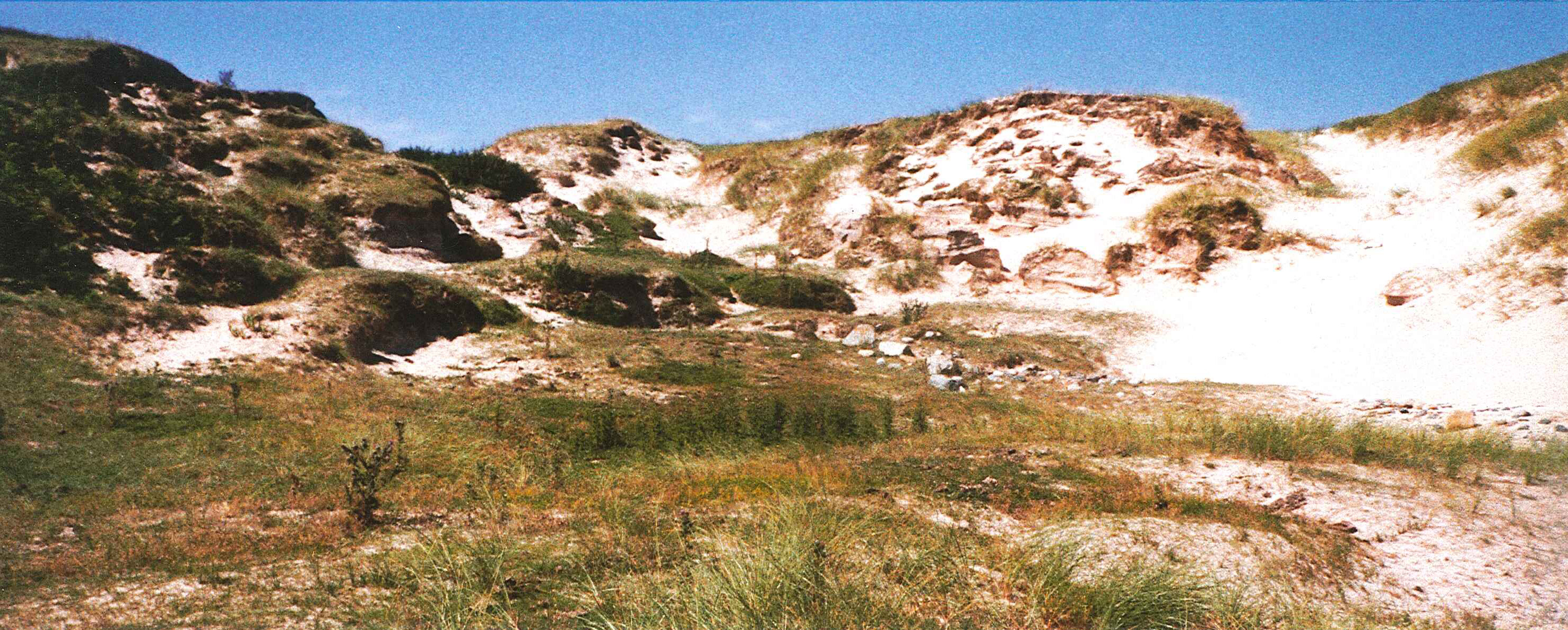
In a blow out amongst shifting and sparsely vegetated sand dunes there are traces of an old ground surface (OGS). This is visible over a wide area, mostly in small exposures at the sides and near to the base of blow out areas. In this blow out, which measures approximately 30m by 10m and up to 2.5m deep, the OGS is visible as a grey-brown sandy soil layer, exposed both in section at the sides of the dunes and in plan in small patches close to the base of the blow out. The OGS covers deposits of blown sand and is in turn covered by further deep deposits of blown sand. Towards the top of the dune section, one major and several smaller turf lines can be seen, presumably representing more stable periods in the recent past when the dunes were more extensively covered with vegetation. The floor of the blow out hollow is covered with a deflation surface containing frequent marine shell and animal bone. Some of the bone appears fresh and may represent cattle and sheep burials of recent date. On the N side of this blow out, an in-situ charcoal rich deposit lies on the OGS. Inspection of this revealed that it contained a concentration of cremated bone. A rescue excavation conducted by the present authors recovered what survived of this deposit. Specialist analyses, currently underway, have revealed that the bone may be human and that the fuel used included both oak wood and probably peat. It is currently thought that this deposit may represent the remains of a cremation pyre since the deposits do not appear to have been contained within a structure or a pit, but rather to have been spread out over the ground surface. It is probable that further remains are present within this area and continued monitoring is recommended.
ShoreUPDATE 24 June 2015
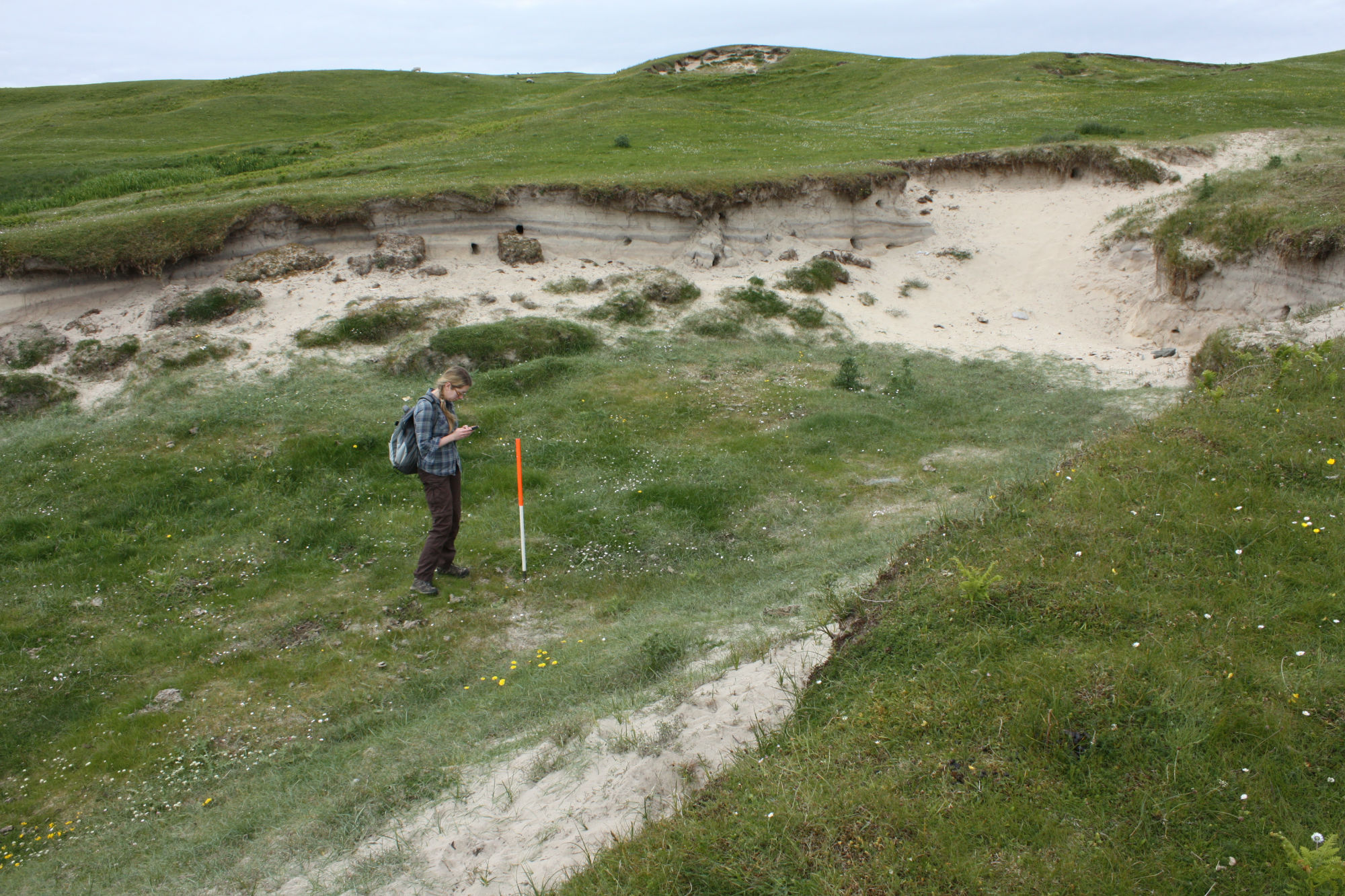
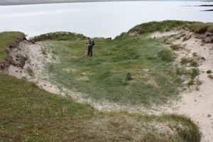
This immediate area appears to be stabilising and this blowout is becoming vegetated. The sections are exposed but the base is covered in marram grass and less archaeological material is visible now than during the original survey. The ubiquitous OGS seen across Ardnave peninsula (and in other dune systems on the Rhinns of Islay) is visible in the upper part of the sections but any archaeological deposits in the base of the blow out are now largely obscured by grass.
Location
129061.00
672901.00
27700
55.8728523
-6.3329821
Submitted photographs
Image
Date
Caption
User
26/06/2015
The site in Sept 2004
Torran
26/06/2015
Ardnave general view of blow out showing vegetated base and OGS visible in section
training1
26/06/2015
Ardnave general view of blow out showing vegetation on base and exposed sections
training1
Submitted updates
Update id
Date
User
2157
26/06/2015
training1
Site located?
Yes
Proximity to coast edge
< 10m
Coastally eroding?
has eroded in the past
Visibility above ground
Not visible
Visibility in section
Limited visibility in section
Description
In a blow out amongst shifting and sparsely vegetated sand dunes there are traces of an old ground surface (OGS). This is visible over a wide area, mostly in small exposures at the sides and near to the base of blow out areas. In this blow out, which measures approximately 30m by 10m and up to 2.5m deep, the OGS is visible as a grey-brown sandy soil layer, exposed both in section at the sides of the dunes and in plan in small patches close to the base of the blow out. The OGS covers deposits of blown sand and is in turn covered by further deep deposits of blown sand. Towards the top of the dune section, one major and several smaller turf lines can be seen, presumably representing more stable periods in the recent past when the dunes were more extensively covered with vegetation. The floor of the blow out hollow is covered with a deflation surface containing frequent marine shell and animal bone. Some of the bone appears fresh and may represent cattle and sheep burials of recent date. On the N side of this blow out, an in-situ charcoal rich deposit lies on the OGS. Inspection of this revealed that it contained a concentration of cremated bone. A rescue excavation conducted by the present authors recovered what survived of this deposit. Specialist analyses, currently underway, have revealed that the bone may be human and that the fuel used included both oak wood and probably peat. It is currently thought that this deposit may represent the remains of a cremation pyre since the deposits do not appear to have been contained within a structure or a pit, but rather to have been spread out over the ground surface. It is probable that further remains are present within this area and continued monitoring is recommended.
ShoreUPDATE 24 June 2015
This immediate area appears to be stabilising and this blowout is becoming vegetated. The sections are exposed but the base is covered in marram grass and less archaeological material is visible now than during the original survey. The ubiquitous OGS seen across Ardnave peninsula (and in other dune systems on the Rhinns of Islay) is visible in the upper part of the sections but any archaeological deposits in the base of the blow out are now largely obscured by grass.