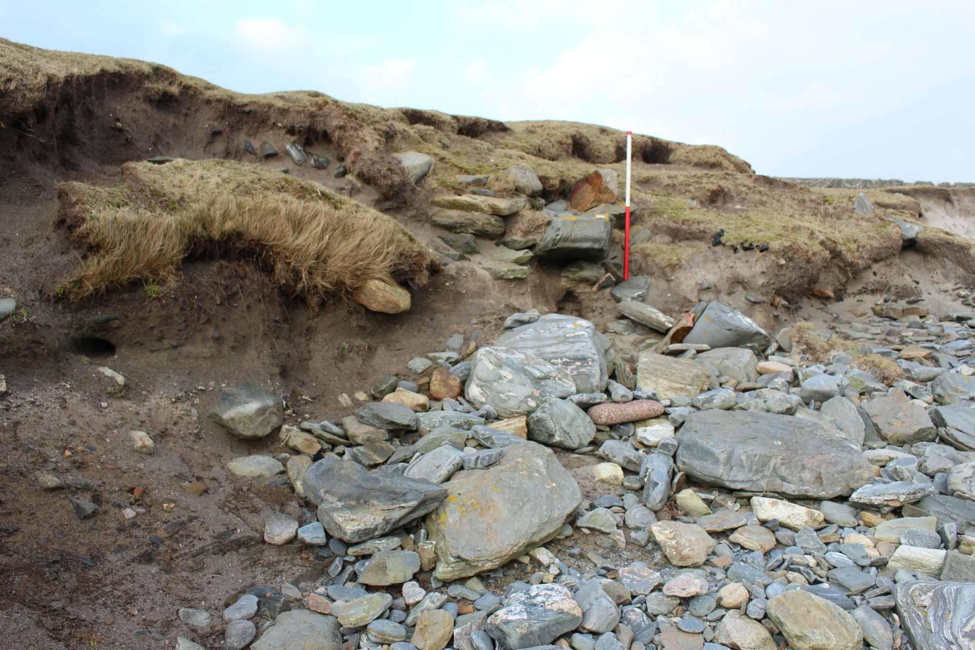
A rectangular structure, measuring about 15m by 6m, lies on the coast edge and is actively eroding. One side wall and parts of the end walls are exposed and actively collapsing. In the coastal section, the west side wall can be seen to stand up to six courses or 0.95m high. It is built on a sandy soil and is covered with a layer of windblown sand. The stones within the wall measure 0.6m by 0.3m, on average. The east side wall, which is slightly bowed, and most of the north and south ends are covered with turf and are not under immediate threat. The remains may be those of a Viking/Norse period house.
29/05/14
As described. South wall and southwest corner gone. Southeast corner up to 5 courses survive. Interior archaeological deposits comprise c. 30cm of reddish brown homogenous clayey sand. This overlies natural sand and till, and is overlaid by c. 0.5m of blown sand. No artefacts noticed, however 3 angular quartz chunks recovered from base of section. One appears very like a core. These may not be associated with the structure.
ShoreUPDATE 23/02/2018
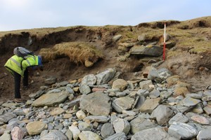
As described, though further damaged by erosion. The coast edge here continues to erode and a large piece of turf has recently slumped onto the section from above. The walling at the southeast corner seen in 2014 to stand to 5 courses has been damaged and undermined. Large stones on the beach immediately in front of the section may be the remains of eroded walls.
21/09/2019
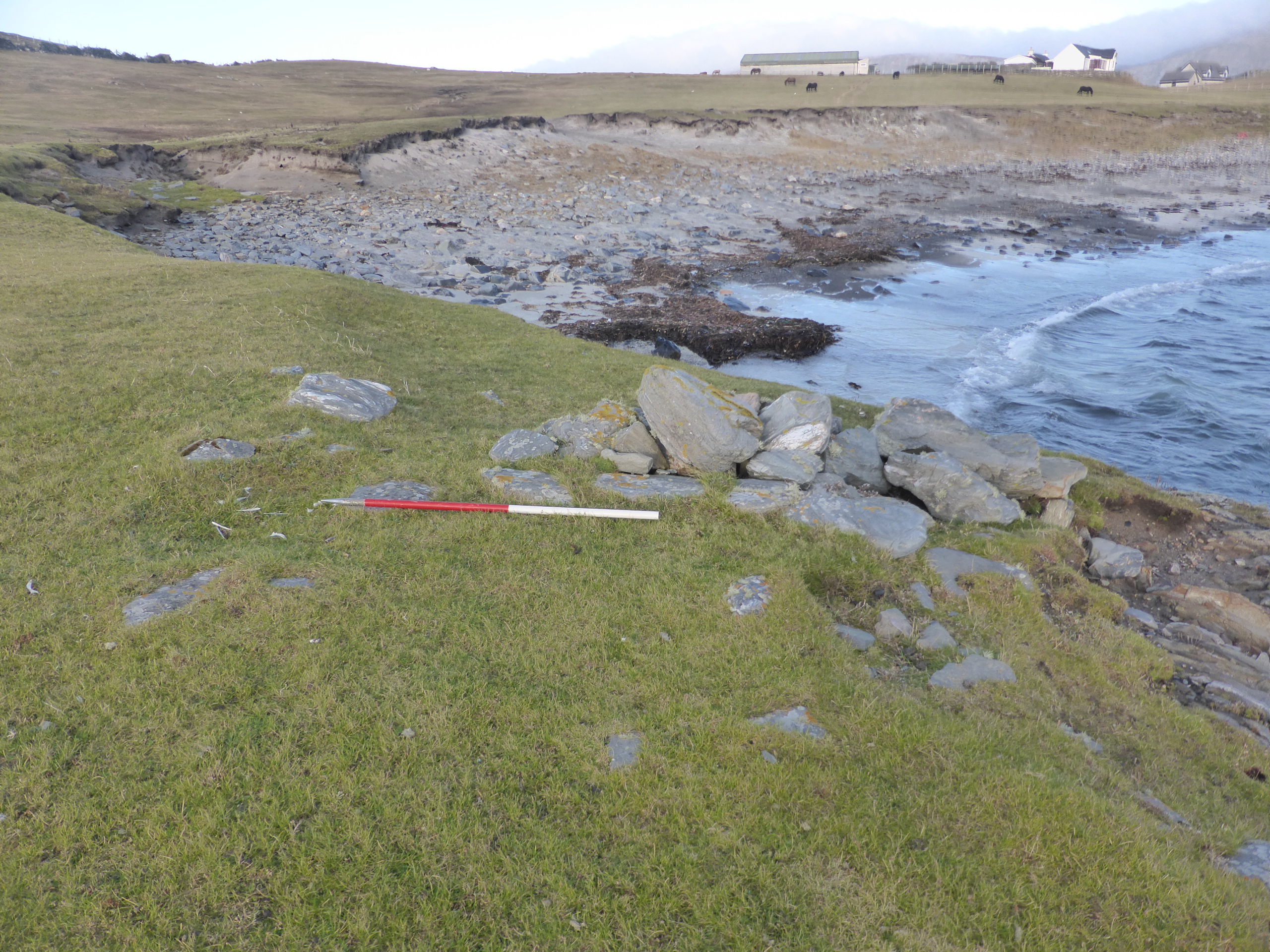
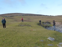
As described, coast edge remains unstable, eroding and very vulnerable. Further remains noted in hinterland include low spread banks forming outline of long rectilinear building and further low stony linear banks which may indicate further associated buried features. Two lightly-built stone structures in coast edge / on beach adjacent to eroding building on south east side have been tentatively recorded as a possible pair of nausts (SCHARP ID 13756) but are now too badly damaged by stream and coastal erosion to be confidently identified. Coast edge here is very unstable and eroding, with extensive animal burrowing of sandy hinterland exacerbating coastal erosion.
Location
436408.00
1131068.00
27700
60.0627022
-1.3478401
Submitted photographs
Image
Date
Caption
User
23/02/2018
21/09/2019 Eroding stone wall sa seen September 2019
training1
23/02/2018
21/09/2019 linear arrangement of stones visible through turf
training1
23/02/2018
21/09/2019 The low banks defining the outline of a long rectangular building beneath the turf behind the coast edge
training1
23/02/2018
Feb 2018: Detail of eroding south wall and interior
joannahambly
23/02/2018
Feb 2018: Closer view of eroding south wall
joannahambly
23/02/2018
Feb 2018: General view looking west
joannahambly
23/02/2018
Feb 2018: Slumped coast edge showing the extent of erosion here
joannahambly
29/05/2014
Showing 'floor' deposits inside structure overlain with blown sand
training1
29/05/2014
Closer view of eroding south wall
training1
29/05/2014
General view looking west
training1
Submitted updates
Update id
Date
User
3096
23/02/2018
joannahambly
Tidal state
Low
Site located?
Yes
Proximity to coast edge
Coast edge
Coastally eroding?
active sea erosion; active wind erosion (in dunes only); has eroded in the past
Threats
animal burrows
Visibility in section
Clearly visible in section
Description
A rectangular structure, measuring about 15m by 6m, lies on the coast edge and is actively eroding. One side wall and parts of the end walls are exposed and actively collapsing. In the coastal section, the west side wall can be seen to stand up to six courses or 0.95m high. It is built on a sandy soil and is covered with a layer of windblown sand. The stones within the wall measure 0.6m by 0.3m, on average. The east side wall, which is slightly bowed, and most of the north and south ends are covered with turf and are not under immediate threat. The remains may be those of a Viking/Norse period house.
29/05/14 As described. South wall and southwest corner gone. Southeast corner up to 5 courses survive. Interior archaeological deposits comprise c. 30cm of reddish brown homogenous clayey sand. This overlies natural sand and till, and is overlaid by c. 0.5m of blown sand. No artefacts noticed, however 3 angular quartz chunks recovered from base of section. One appears very like a core. These may not be associated with the structure.
ShoreUPDATE 23/02/2018
As described, though further damaged by erosion. The coast edge here continues to erode and a large piece of turf has recently slumped onto the section from above. The walling at the southeast corner seen in 2014 to stand to 5 courses has been damaged and undermined. Large stones on the beach immediately in front of the section may be the remains of eroded walls.
Maintain priority status
1656
29/05/2014
training1
Tidal state
Mid
Site located?
Yes
Proximity to coast edge
Coast edge
Coastally eroding?
active sea erosion
Threats
animal burrows
Visibility above ground
Limited visibility (partial remains)
Visibility in section
Limited visibility in section
Access
accessible on foot (no footpath)
Local knowledge
don't know
Description
A rectangular structure, measuring about 15m by 6m, lies on the coast edge and is actively eroding. One side wall and parts of the end walls are exposed and actively collapsing. In the coastal section, the west side wall can be seen to stand up to six courses or 0.95m high. It is built on a sandy soil and is covered with a layer of windblown sand. The stones within the wall measure 0.6m by 0.3m, on average. The east side wall, which is slightly bowed, and most of the north and south ends are covered with turf and are not under immediate threat. The remains may be those of a Viking/Norse period house.
29/05/14
As described. South wall and southwest corner gone. Southeast corner up to 5 courses survive. Interior archaeological deposits comprise c. 30cm of reddish brown homogenous clayey sand. This overlies Natural sand and till, and is overlaid by c. 0.5m of blown sand. No artefacts noticed, however 3 angular quartz chunks recovered from base of section. One appears very like a core. These may not be associated with the structure.
Structure eroding. This would be an ideal community evaluation/excavation. Good access, Burra history society locally and museum seems to have classroom style space.