Cleat (6827)
Condition
| 1 | |
| Coastal exposure: probable burial cairn | |
| Bronze Age, Iron Age | |
| 3614 | |
| Orkney |
Description
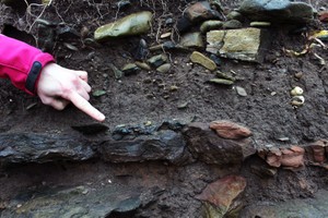
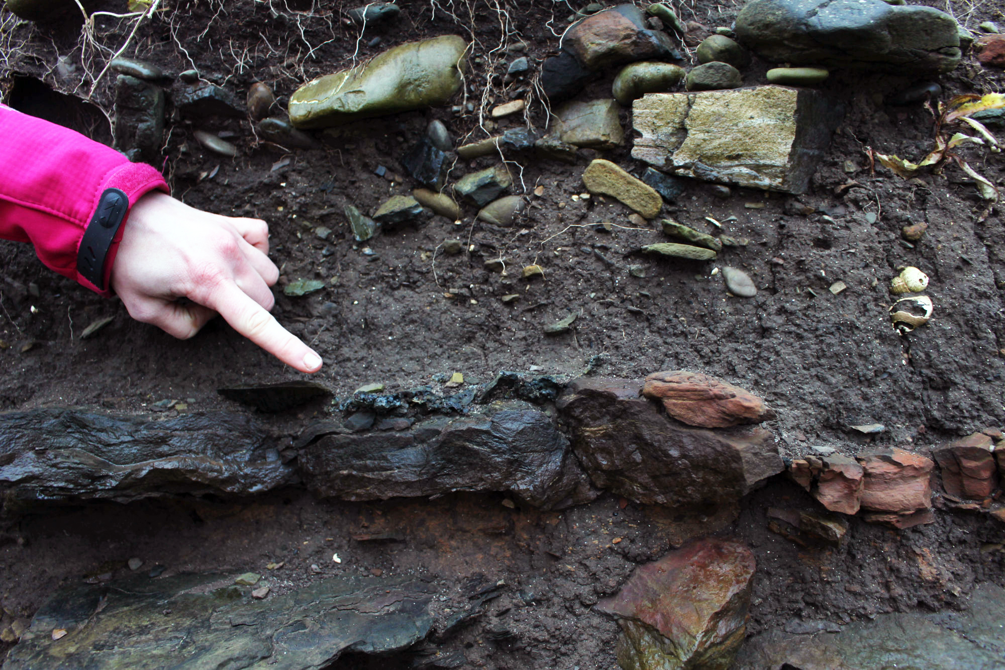
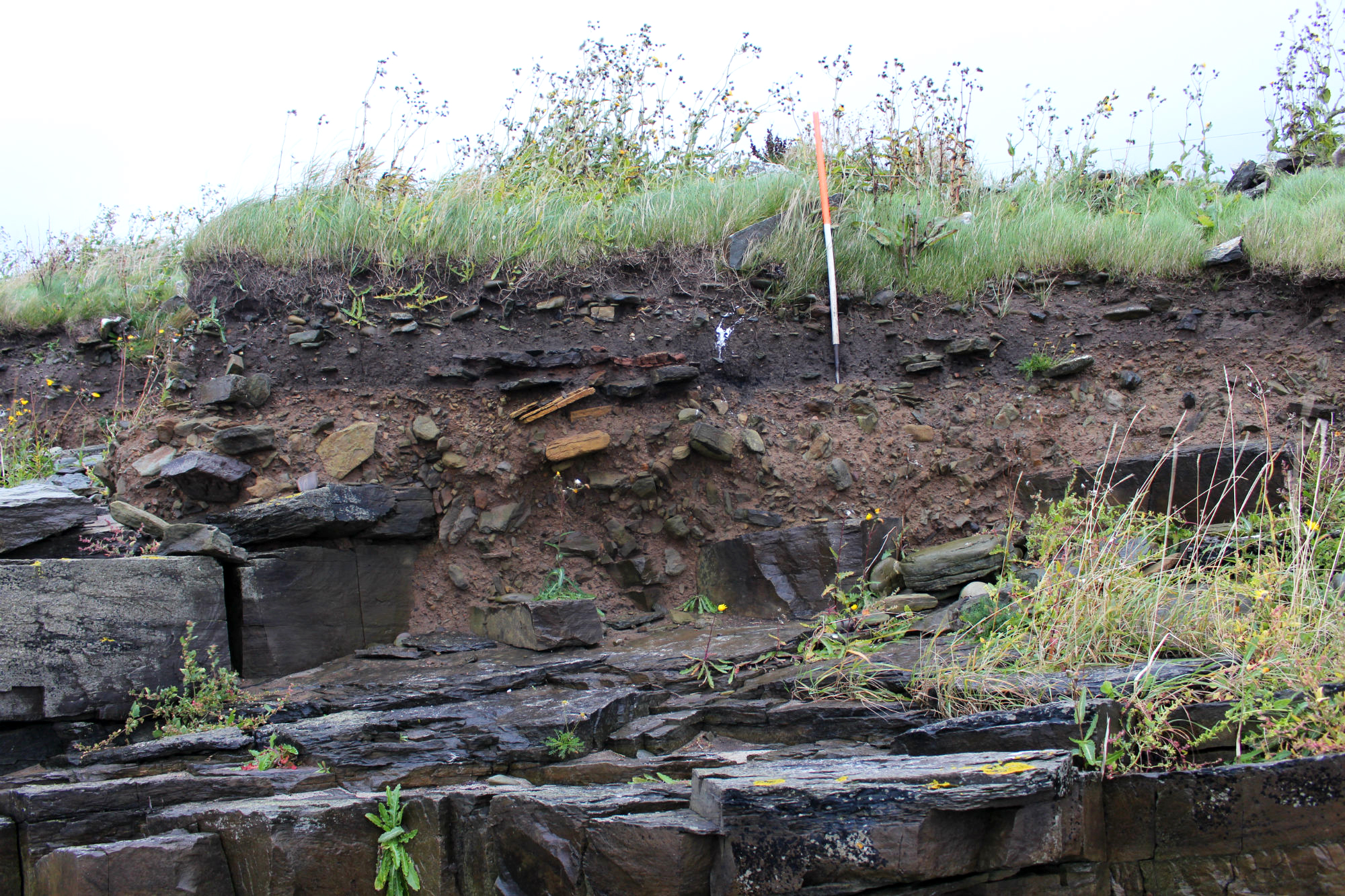
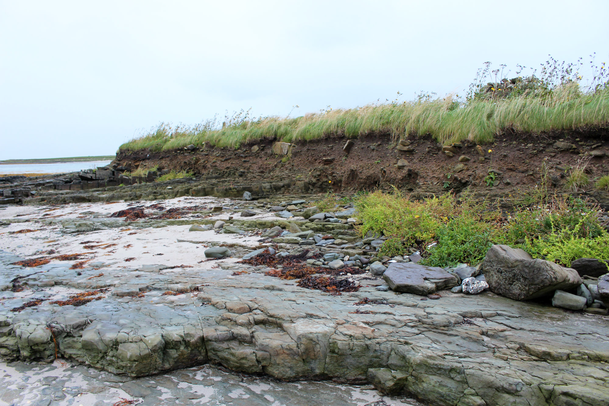
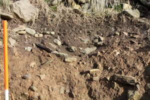
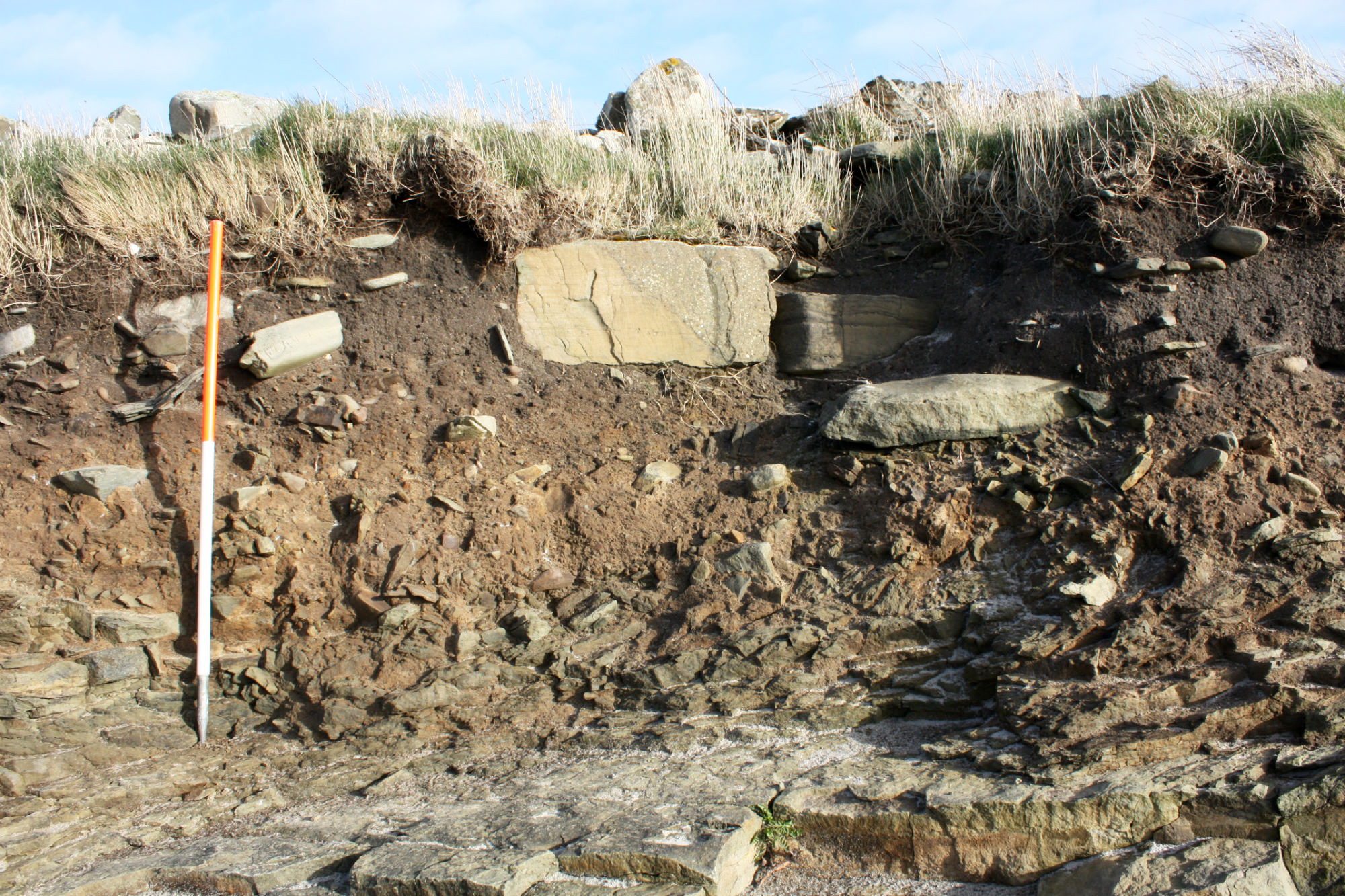
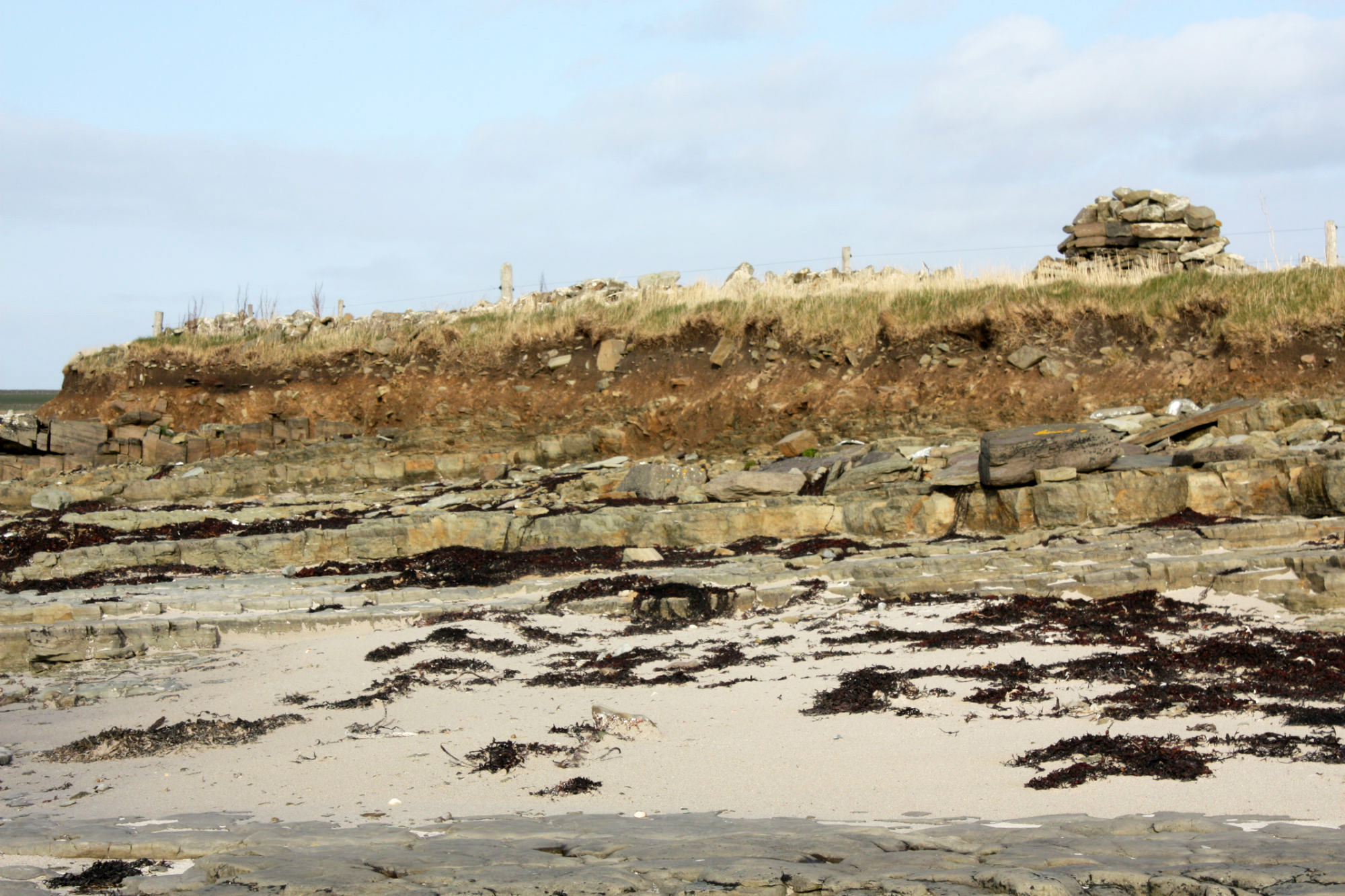
| Previously, a structure exposed in the coastal section and thought to be part of a cist was presumed to be almost destroyed by erosion. The removal of further deposits from around the cist now indicate that it is surrounded by anthropogenic soils, probably within a kerbed mound. One side of the cist box, formed from a single slab (70mm x 30mm x 7mm) protrudes from the section face. The remainder of the cist has been removed by erosion, leaving a void. From the size of the projecting slab and the size of the void it can be estimated that the cist measured in the region of 0.55m in width by 0.79m in length. To the west side of the cist, a group of flat slabs extend outwards for 2m, covering a layer of ashy, organic soil which constitutes the basal deposits of the mound. A small fragment of unworked flint was noted in the ashy soil deposits. To the east side of the cist, peatash lenses extend outwards for 4m to abut large stone blocks. These blocks appear to mark the limit of the site and may form an external kerb. The ashy layers are interspersed with lenses of redeposited till and bands of charcoal rich soil. The surface of the underlying till in this area is reddened, apparently due to episodes of burning. There is no sign of a mound in the hinterland. The site is very vulnerable to continued erosion by the sea. ShoreUPDATE 22/04/2013: More or less as described except further structures and deposits are visible. Burnt midden deposits and stone structures extend for at least 50m along the exposed section face. The general stratigraphy of the archaeological section from the base comprises bedrock overlain by till/subsoil, burnt midden material, stone tumble, mixed soil, storm beach, topsoil and turf. Visible structural remains, which are all located upon and within the burnt midden deposits and below the stone tumble are as follows: 2 stone cists (one noted in the original survey); 1 shallow bowl-shaped stone lined feature filled with fire-cracked stone; 4 areas of concentrated burning/hearths; a c. 3m long exposure of horizontally laid stone slab flooring or paving, possibly a structure. Archaeological material noted includes; fish bone, frequent fire-cracked cobbles; frequent animal bone; rare marine shell. ShoreUPDATE 18/09/2017: Site has deteriorated a little since 2013. Two cist-like structures still visible. At least 2 hearths visible. A layer of in-situ iron slag was noted upon the burnt sandstone base of one of the hearths. |
Location
| 370390.00 | |
| 1043020.00 | |
| 27700 | |
| 59.2726402 | |
| -2.5212369 |
Submitted photographs
| Image | Date | Caption | User |
|---|---|---|---|

|
06/01/2015 | A further hearth in Sept 2017 | joannahambly |

|
|||
|
06/01/2015 | Detail of iron slag upon hearth base in Sept 2017 | joannahambly |
|
|||

|
06/01/2015 | Hearth with burnt stone base in Sept 2017 | joannahambly |
|
|||

|
06/01/2015 | Showing box-like structures Sept 2017, looking S | joannahambly |

|
|||

|
06/01/2015 | General view of section showing some structures in Sept 2017, looking E | joannahambly |
|
|||

|
06/01/2015 | Showing tumble upon burnt midden deposits | training1 |

|
|||

|
06/01/2015 | Horizontally laid stone slabs - possible surface | training1 |

|
|||

|
06/01/2015 | Concentrated burning, possible hearth | training1 |

|
|||
|
06/01/2015 | Stone lined bowl-shaped feature filled with fire-cracked cobbles | training1 |

|
|||

|
06/01/2015 | Stone cist originally identified in CZAS survey | training1 |
|
|||

|
06/01/2015 | Representative view of section, looking SE | training1 |
|
|||
Submitted updates
| Update id | Date | User | ||||||||||||||||||||
|---|---|---|---|---|---|---|---|---|---|---|---|---|---|---|---|---|---|---|---|---|---|---|
| 3037 | 18/09/2017 | joannahambly | ||||||||||||||||||||
|
||||||||||||||||||||||
| 1893 | 06/01/2015 | training1 | ||||||||||||||||||||
|
||||||||||||||||||||||