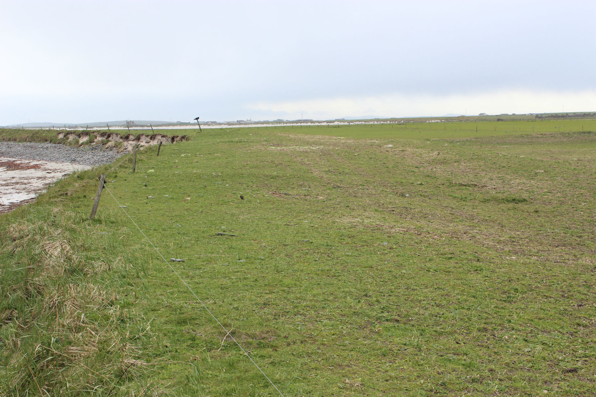
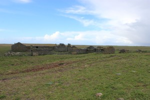
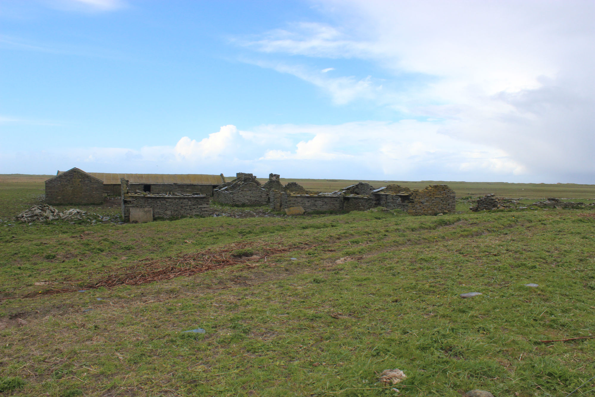
This farmstead was built in a U-shaped plan, around a central yard and includes parallel house and byre ranges. The byres have slab partitions. The farm is now abandoned and the buildings are in a state of disrepair. Some fragments of the original flagstone roofs survive, but the buildings are mostly roofless. The coast edge in front of the farm has been eroded by the sea and substantial deposits of organic soil layers are exposed for over 100m. These are up to 0.8m thick and contain inclusions of peatash, shell, mammal and fish bone and charcoal. It is unclear if these deposits are directly related to the last farmstead on the site or if they predate it; it is probable, however, that they represent settlement over an extended period of time. Ref.: RCAHMS & NMS (1998) 'Scottish Farm Buildings Survey: Orkney', #10.
16/05/2015
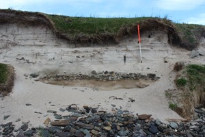
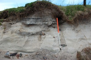
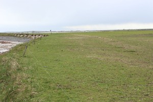
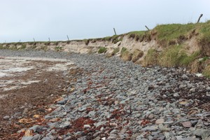
Very limited exposures of fragments of buried soil and cultural deposits intermittently exposed in seaward side of a large low mound. These are above a storm beach and blown sand and do not appear to be of any great antiquity. Only the very edge of the mound is being eroded so it is possible more substantial deposits survive towards its centre. These are not yet being eroded.
Location
369500.00
1045600.00
27700
59.2957458
-2.5372155
Submitted photographs
Image
Date
Caption
User
16/05/2015
Representative view of deposits above stormbeach
training1
16/05/2015
Detail of section, looking W
training1
16/05/2015
View of mound in relation to coastedge, looking SW
training1
16/05/2015
HellieHow farmstead, looking NW
training1
16/05/2015
View of seaward edge of mound, looking SW
training1
Submitted updates
Update id
Date
User
2046
16/05/2015
training1
Site located?
Yes
Proximity to coast edge
Coast edge
Coastally eroding?
active sea erosion; has eroded in the past
Visibility above ground
Not visible
Visibility in section
Not visible
Access
accessible on foot (no footpath)
Local knowledge
is well visited; has local associations/history
Description
This farmstead was built in a U-shaped plan, around a central yard and includes parallel house and byre ranges. The byres have slab partitions. The farm is now abandoned and the buildings are in a state of disrepair. Some fragments of the original flagstone roofs survive, but the buildings are mostly roofless. The coast edge in front of the farm has been eroded by the sea and substantial deposits of organic soil layers are exposed for over 100m. These are up to 0.8m thick and contain inclusions of peatash, shell, mammal and fish bone and charcoal. It is unclear if these deposits are directly related to the last farmstead on the site or if they predate it; it is probable, however, that they represent settlement over an extended period of time. Ref.: RCAHMS & NMS (1998) 'Scottish Farm Buildings Survey: Orkney', #10.
16/05/2015
Very limited exposures of fragments of Buried soil and cultural deposits intermittently exposed in seaward side of a large low mound. These are above a storm beach and blown sand and do not appear to be of any great antiquity. Only the very edge of the mound is being eroded so it is possible more substantial deposits survive towards its centre. These are not yet being eroded.
Re-assign priority 3 or less
Comments
The mound of Hellie How has a local story and is part of a circular walk