Bay of Lopness/Newark Settlement Mound (6681)
Condition
| 1 | |
| Coastal exposure, mounds, (?) fish trap | |
| Early Medieval, Medieval | |
| 306538 | |
| Orkney |
Description
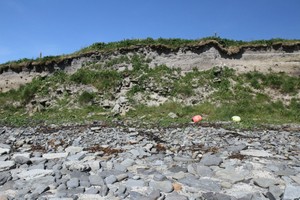
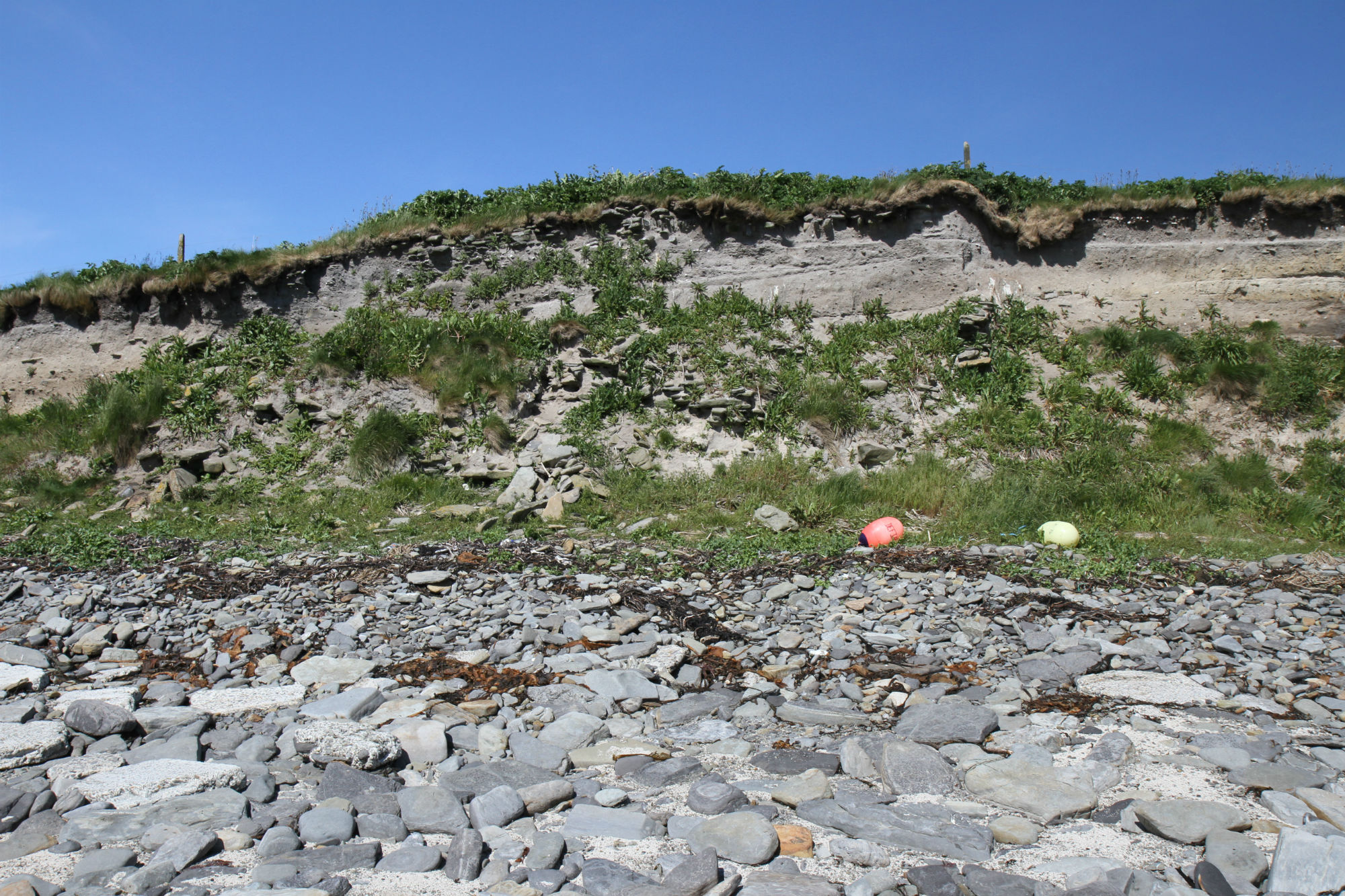
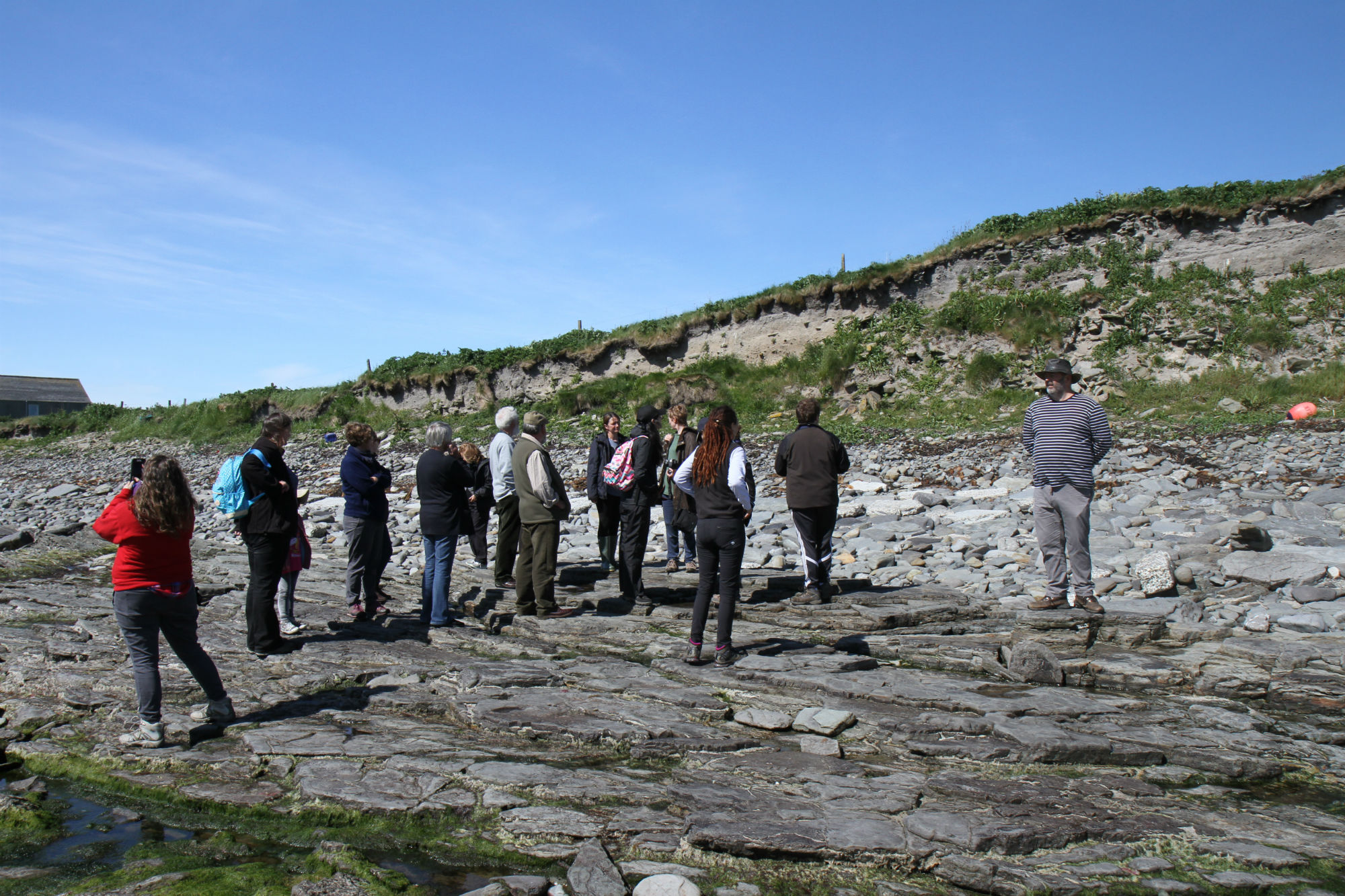
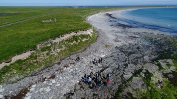
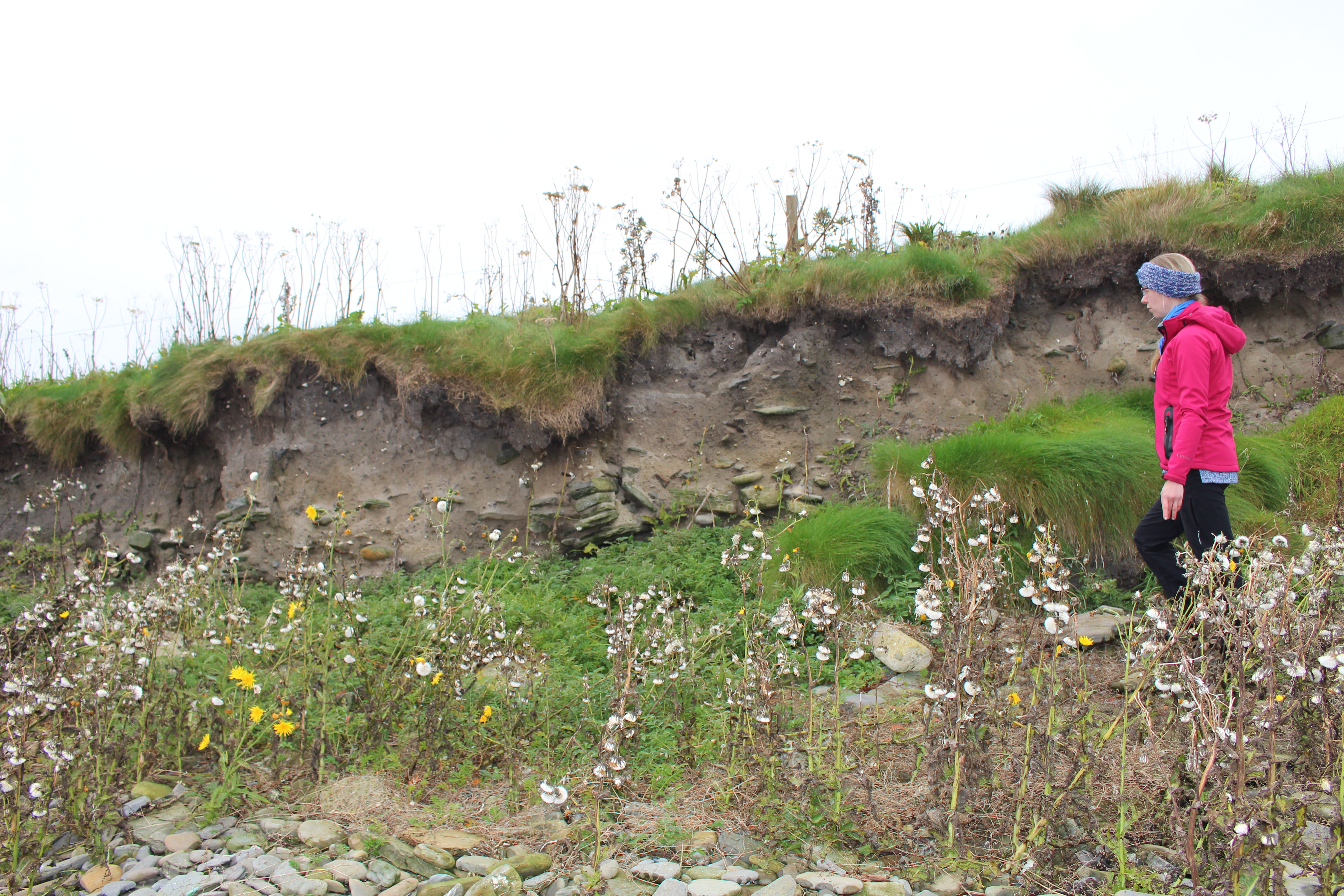
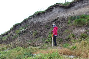
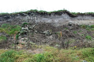
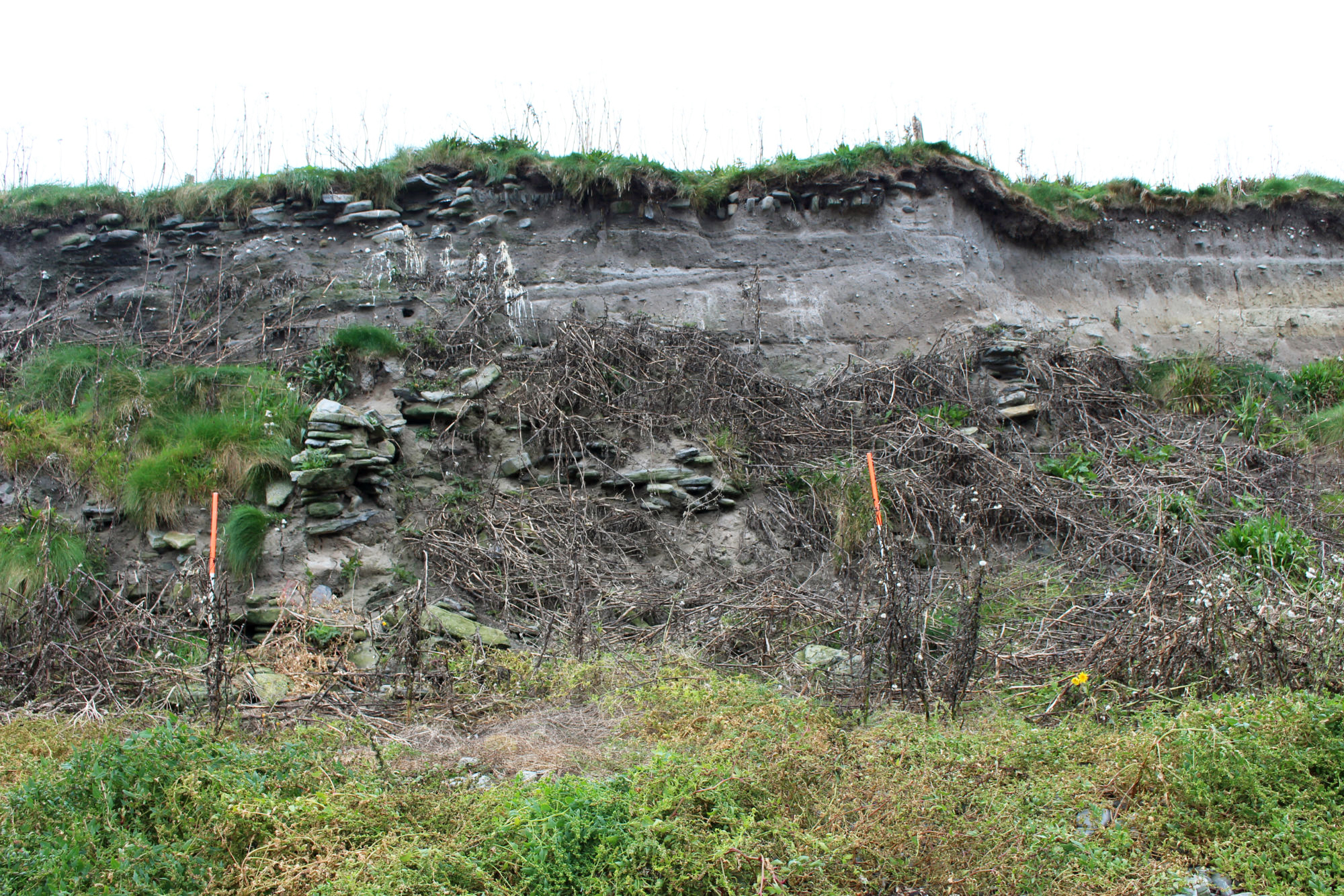
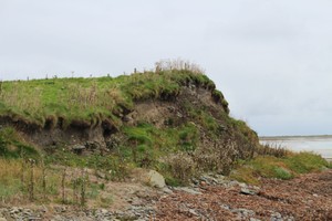
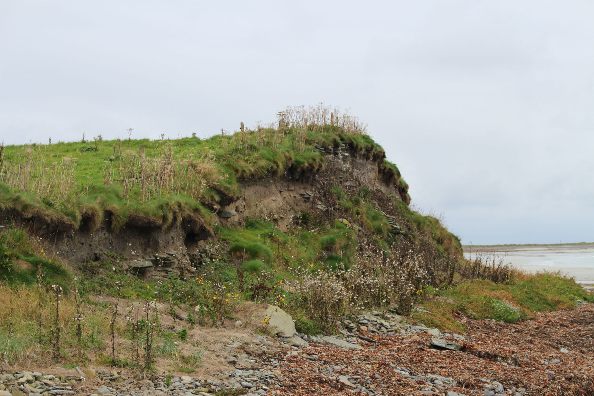
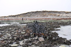
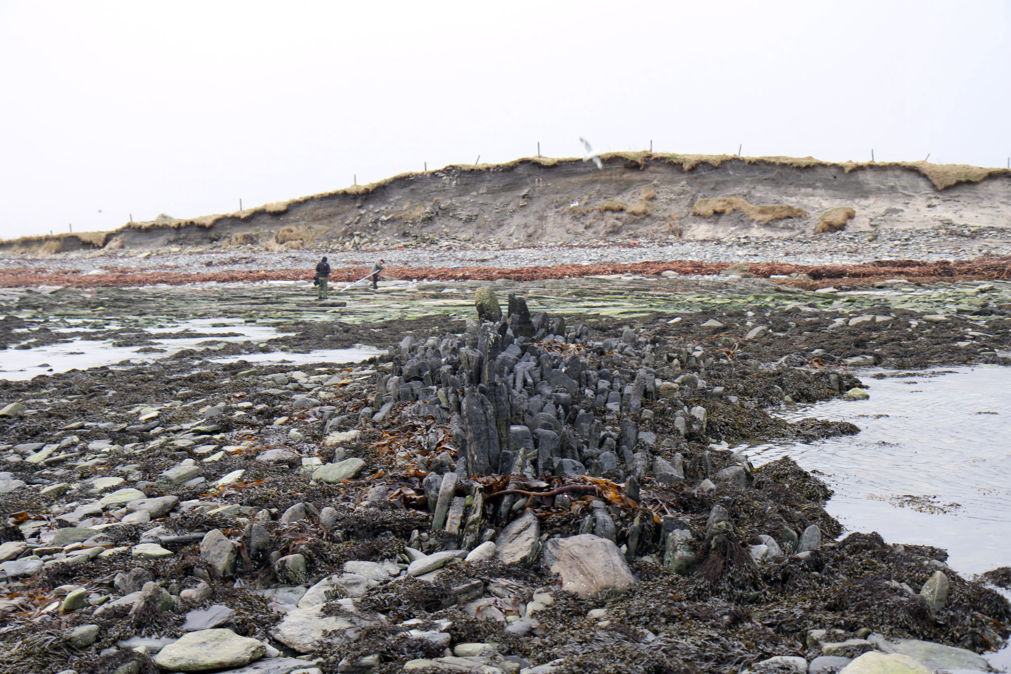
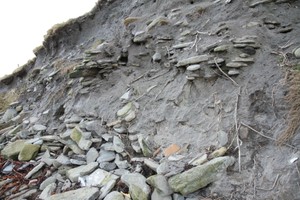
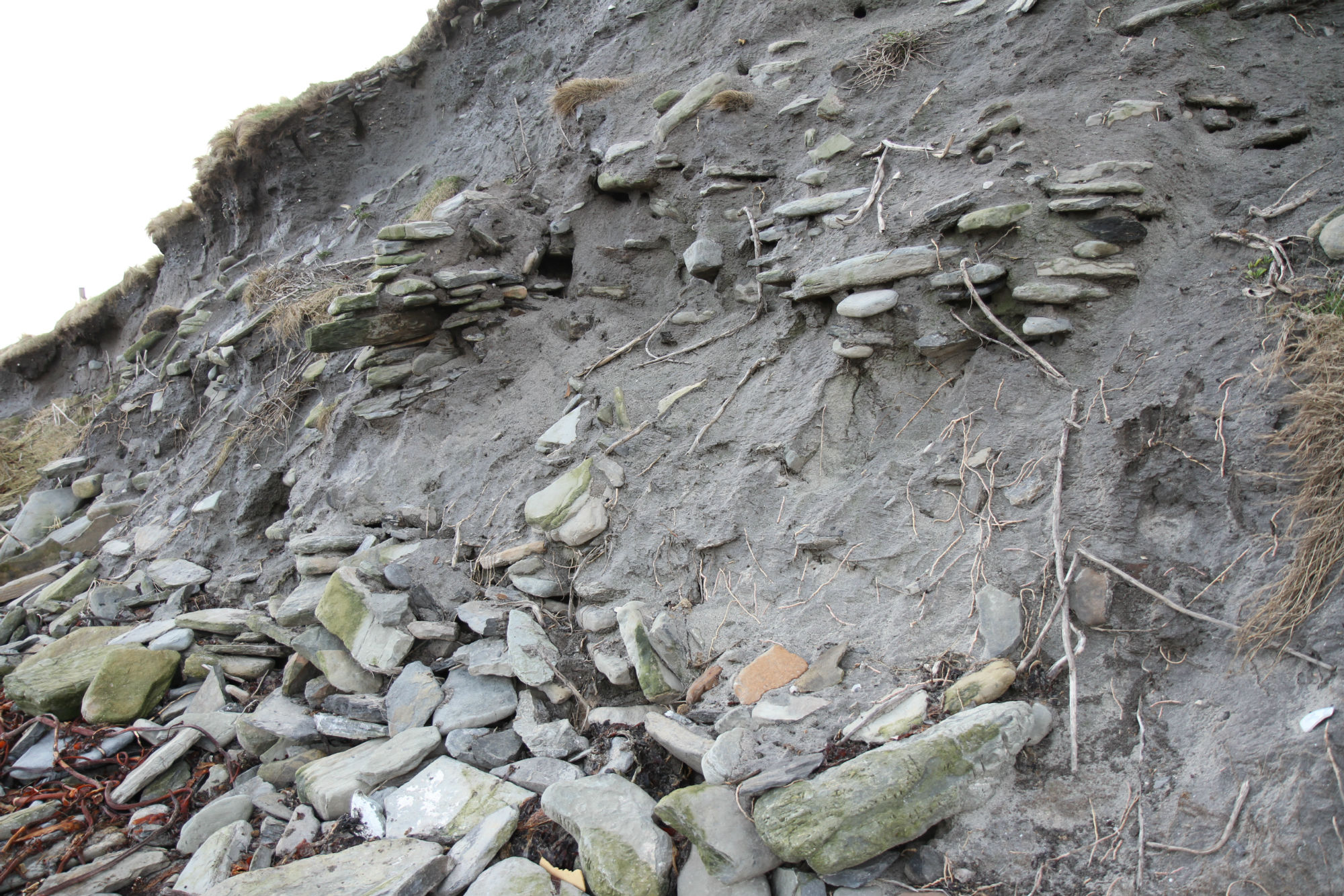
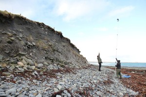
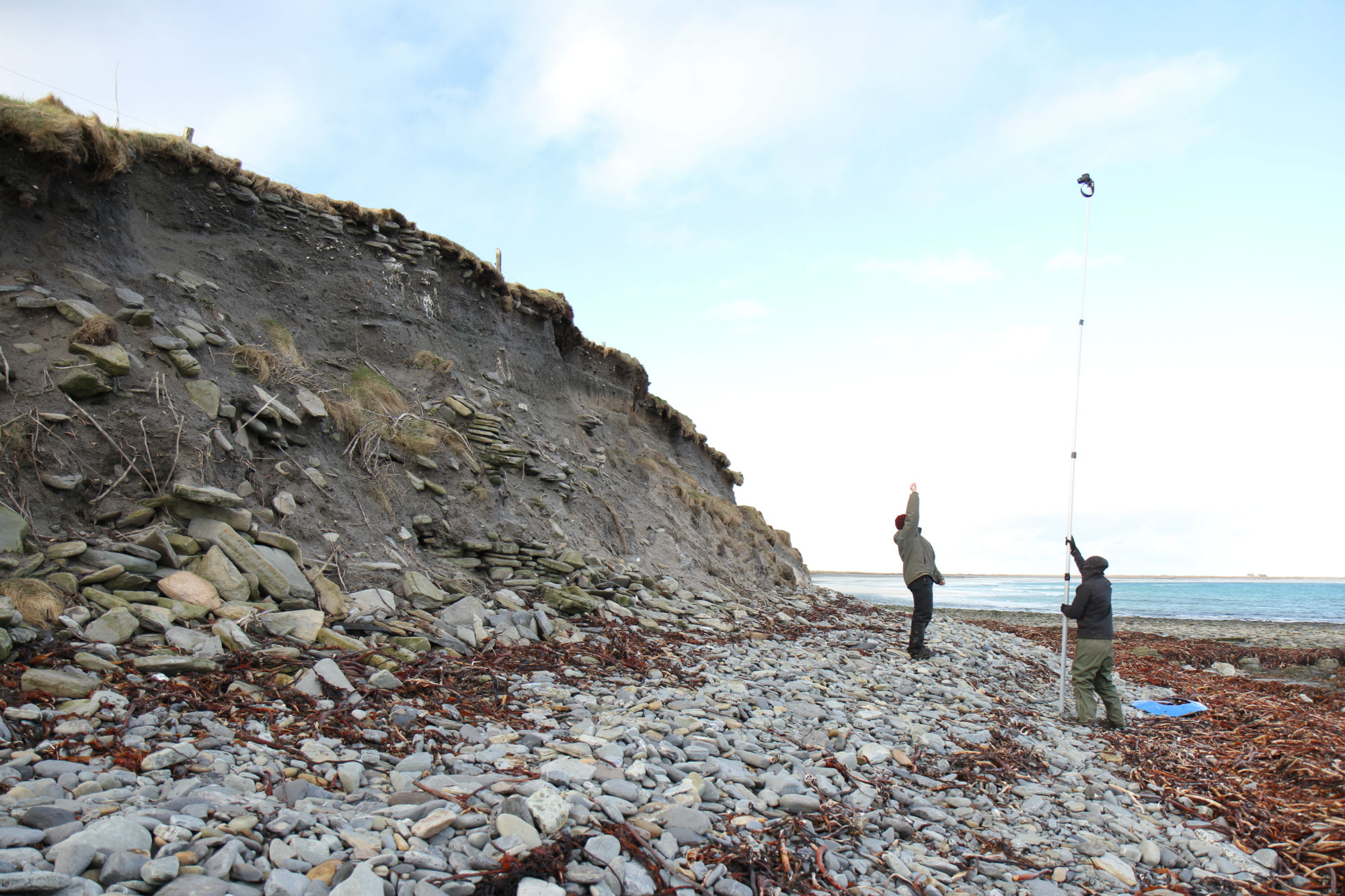
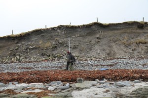
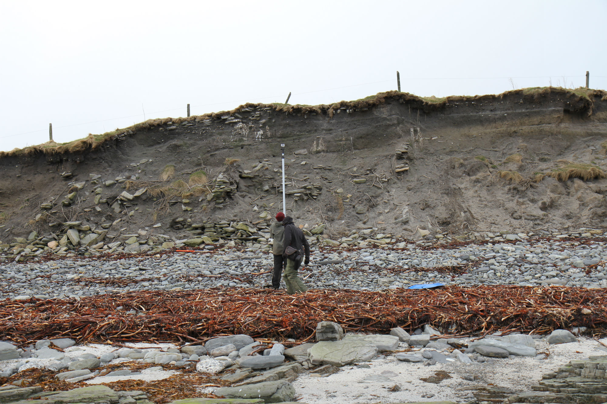
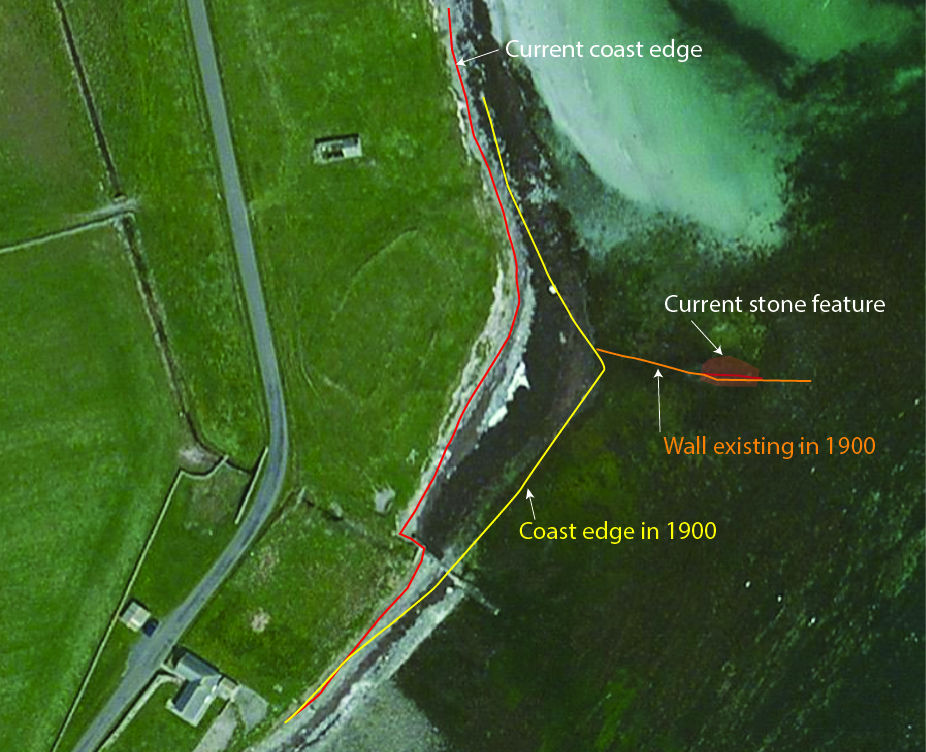
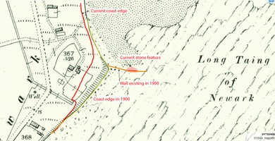
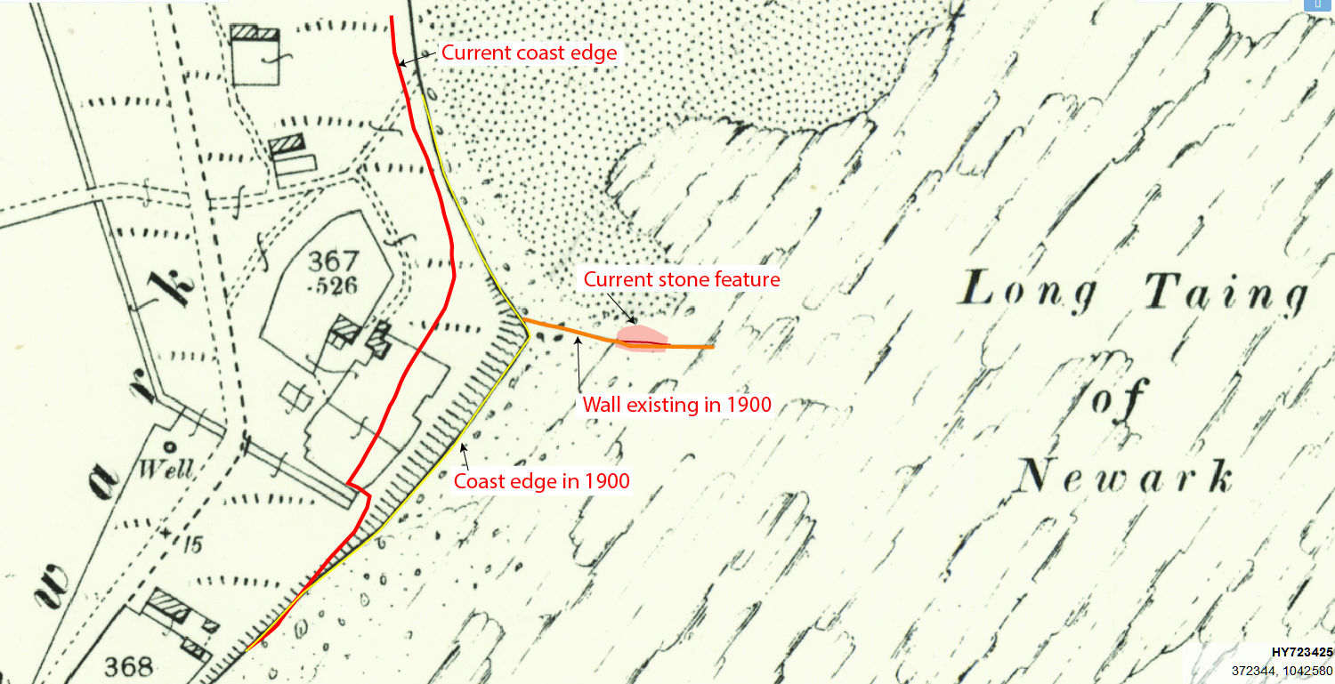
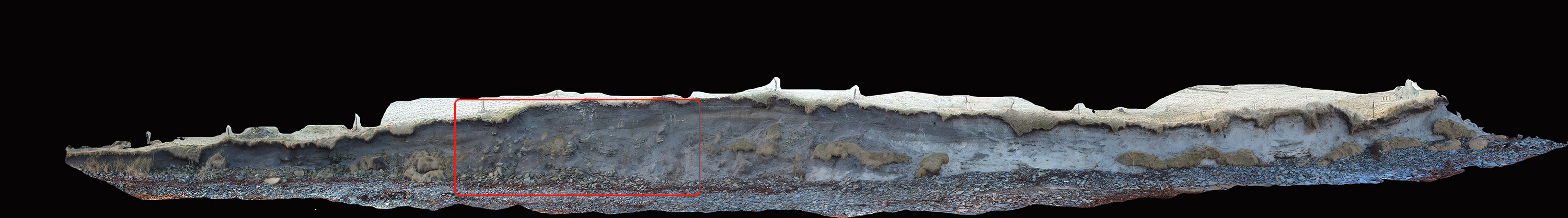
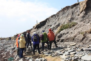
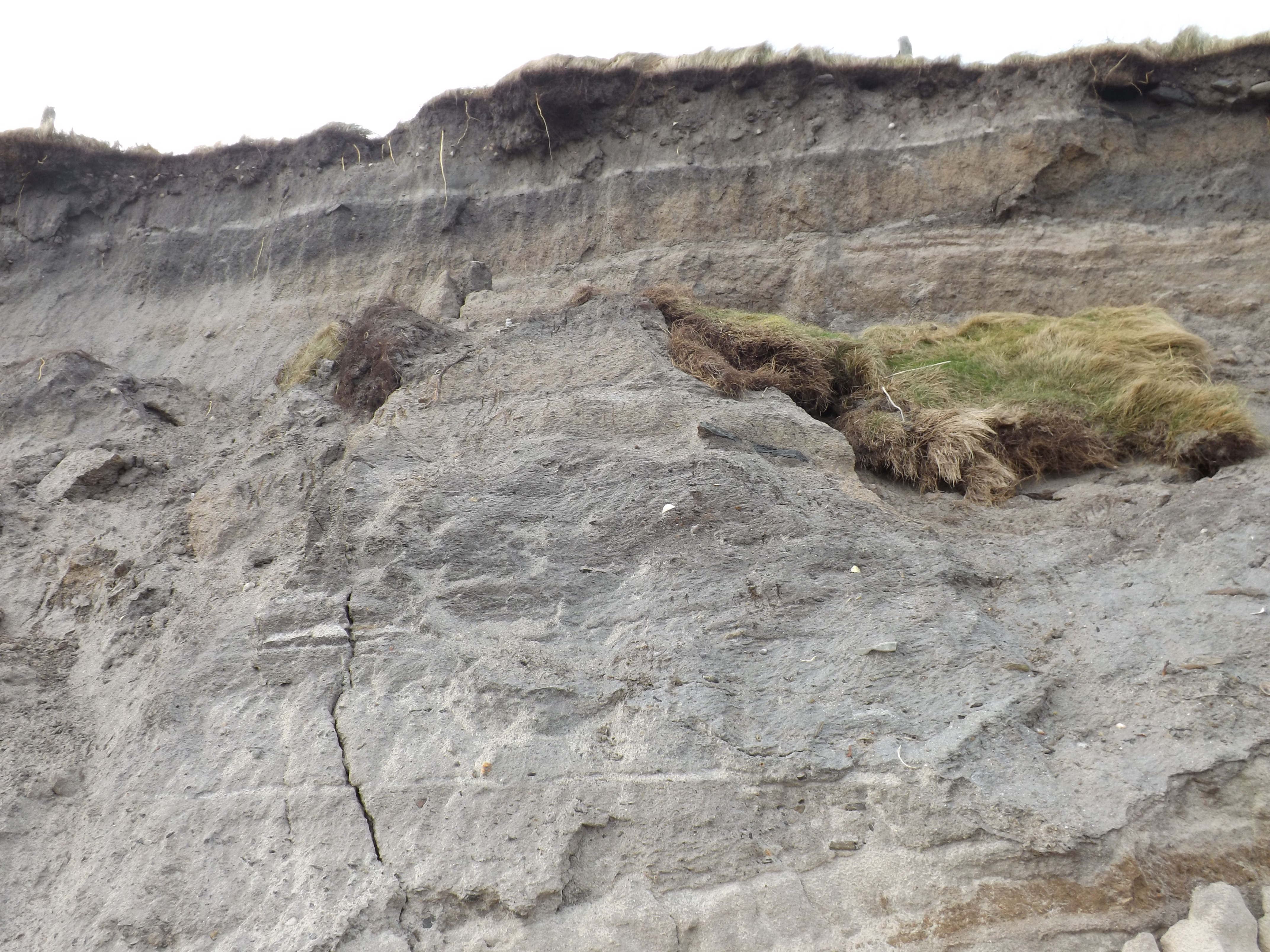
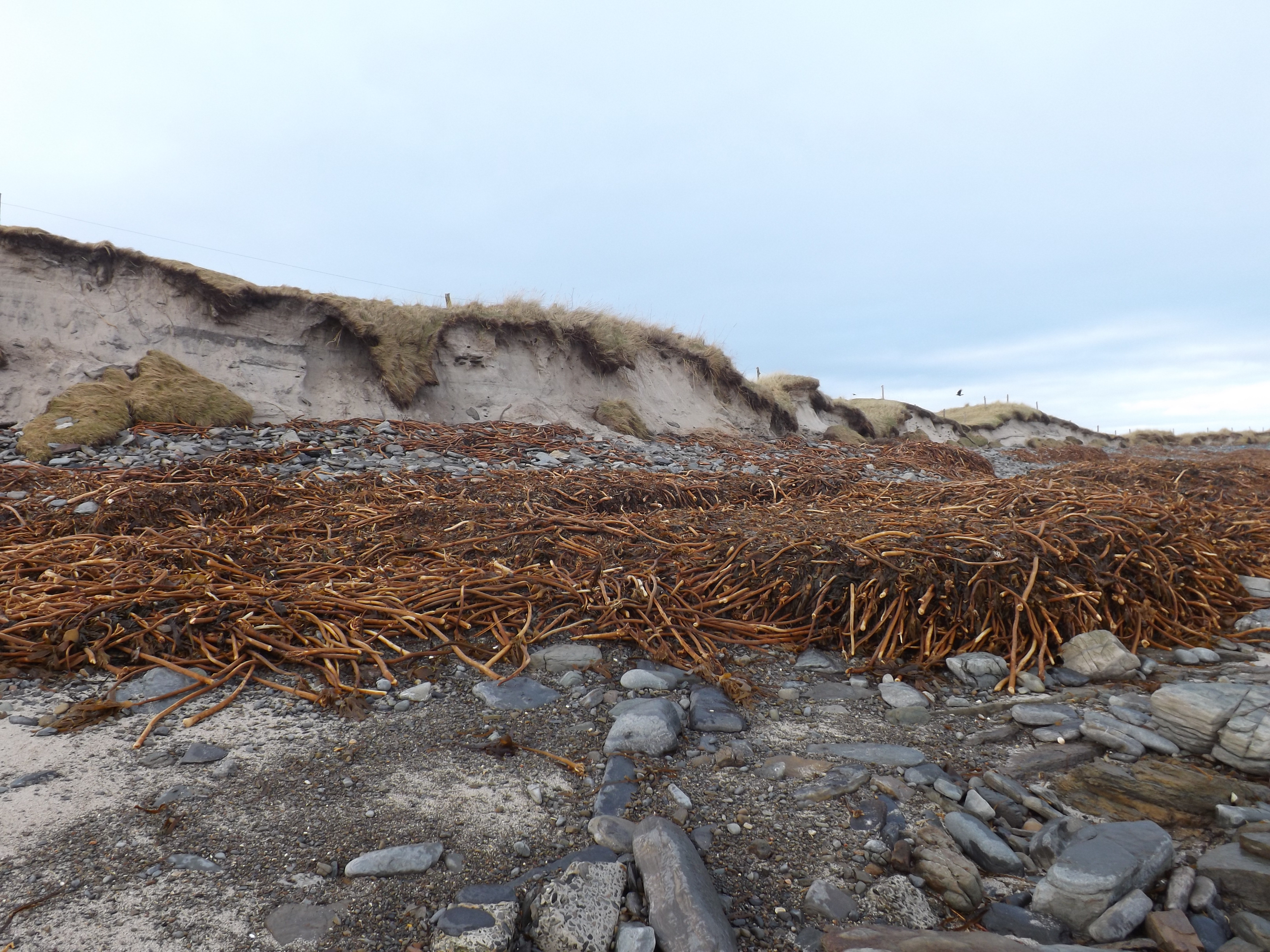
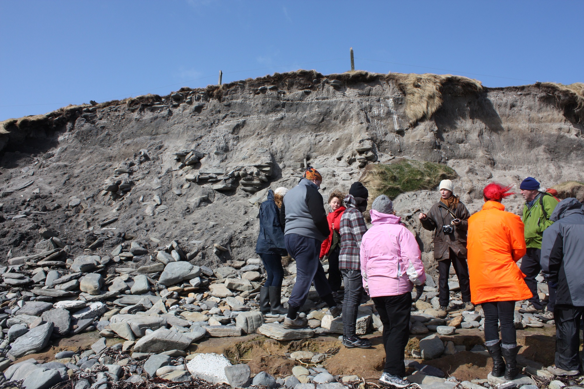
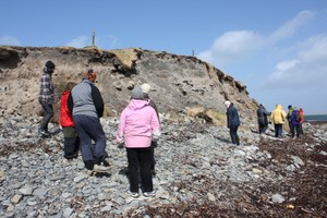
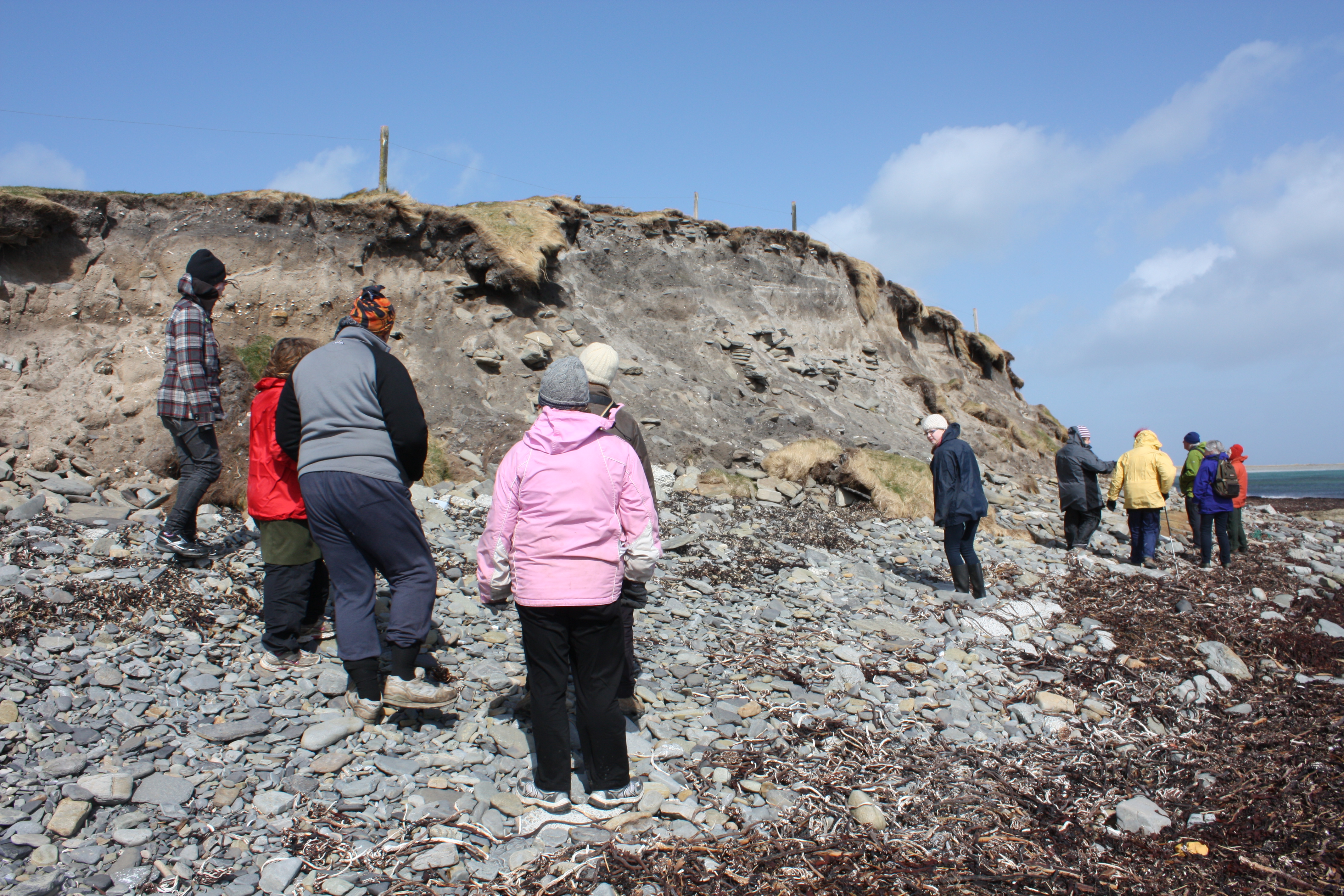
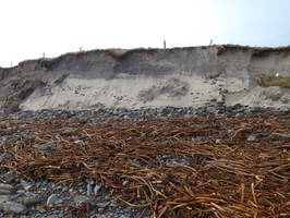
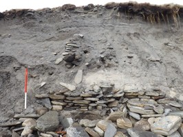
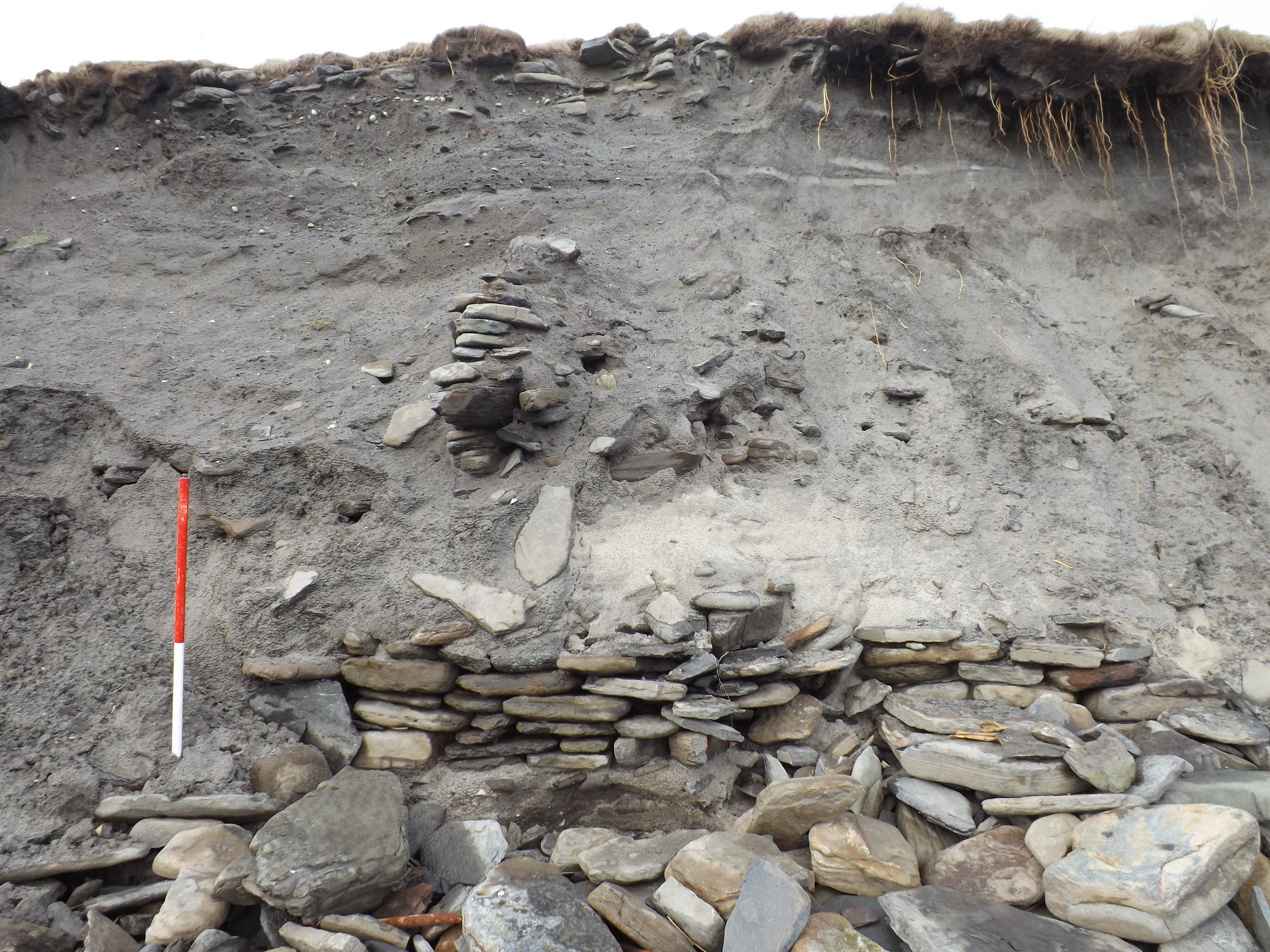
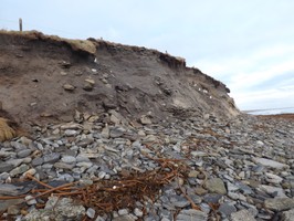
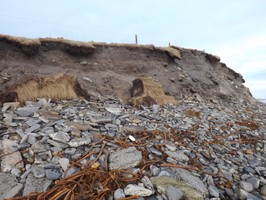
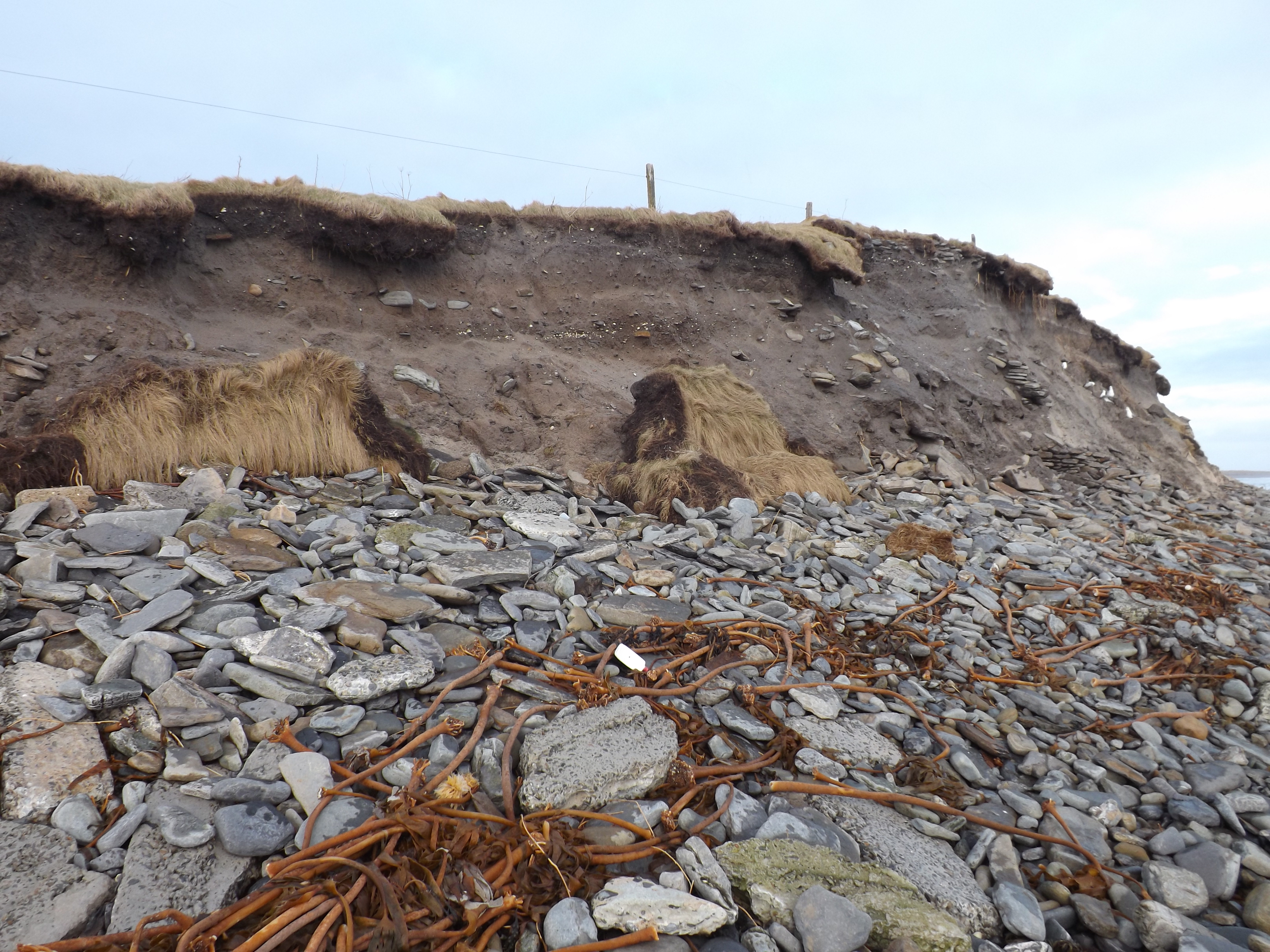
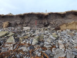
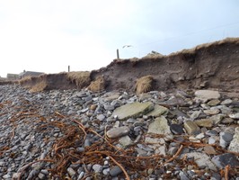
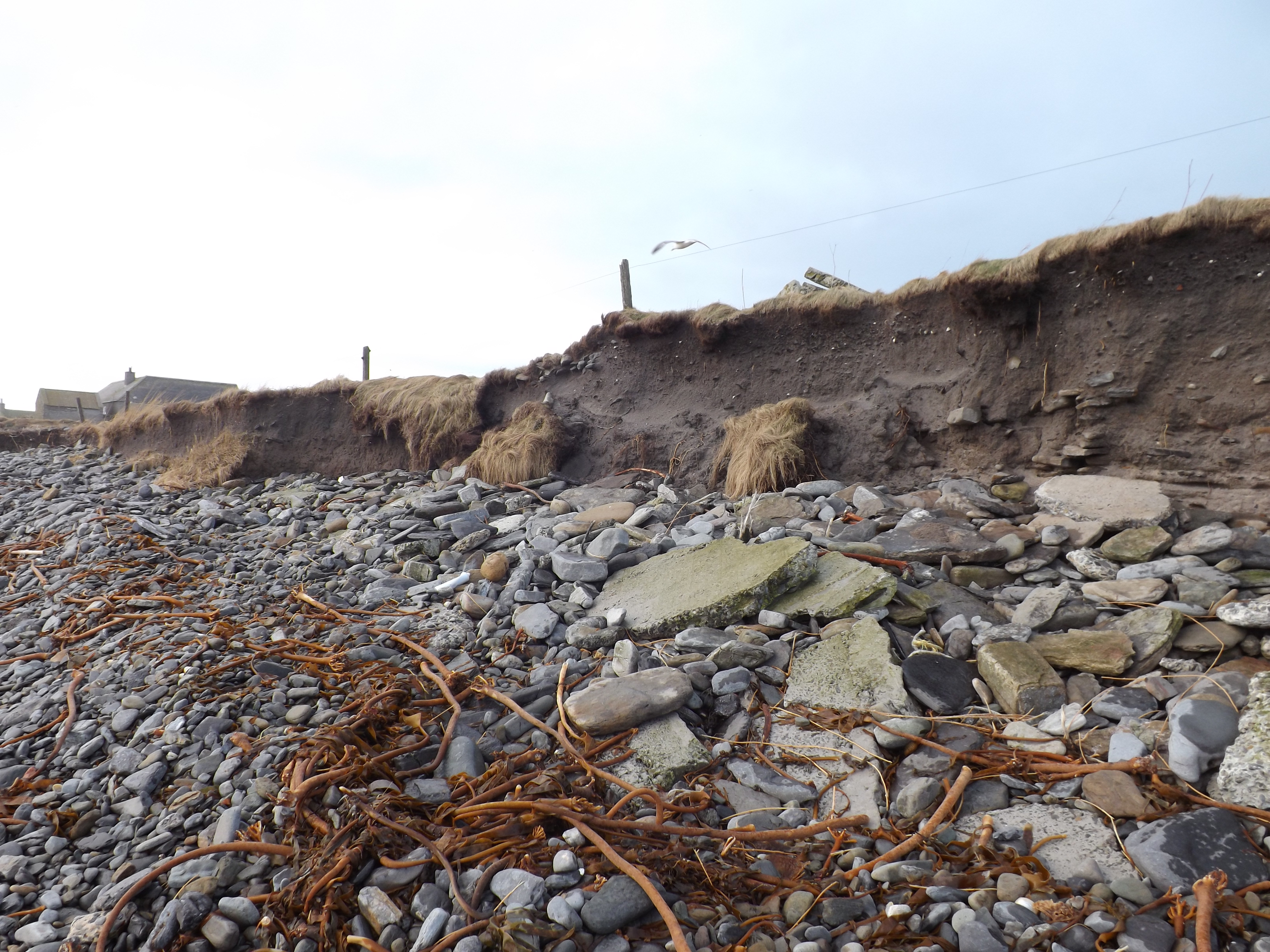
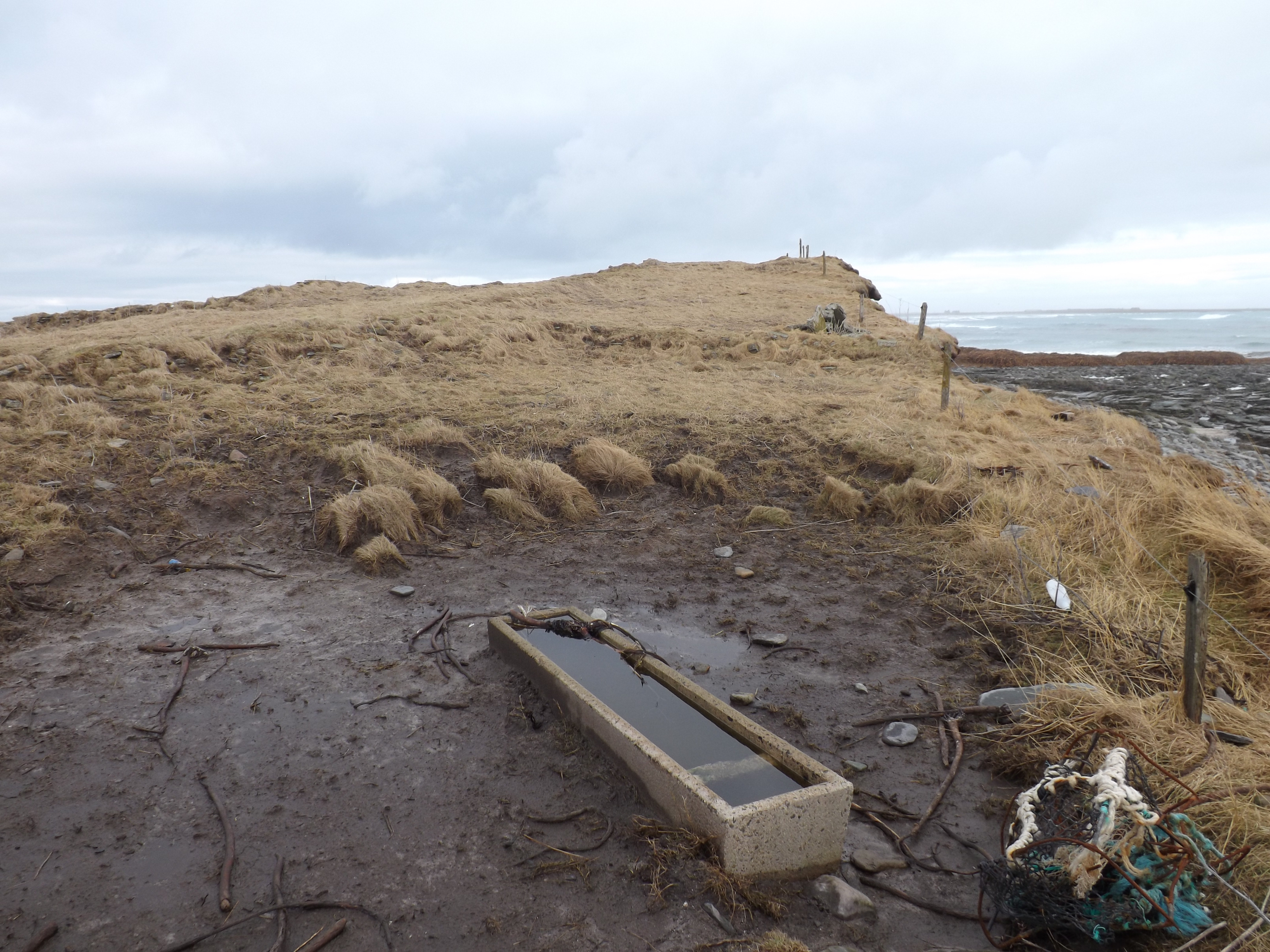
| Substantial archaeological deposits are exposed in an extensive erosion face to the seaward side of a large mound. The exposure measures some 50m in length overall, with the central 15m containing the greatest depth of deposits. The visible archaeological deposits are up to 1m thick and may be even more extensive since the base of the section is obscured by drifts of windblown sand. In the main, the deposits comprise successive layers of anthropogenic soils with inclusions of shell, charcoal, fish and mammal bone. One very distinctive layer contains frequent fish bone which was seen to include a number of entire articulated skeletons. The rocky intertidal area in front of the section face, Long Taing of Newark, has several linear concentrations of stone which appear to have been artificially set in place, possibly to form a fish trap. One possible interpretation may be that fish-processing was carried out at this site and that it was associated with the nearby settlement at Newark (SY35), which appears to be of Viking/Norse date. ShoreUPDATE 9th Feb 2014: The site has been affected by coastal erosion over the last 2 months. Less than half of the mound now survives. Structures are now visible as follows: From S-N from modern drain outlet; 1. Two parallel walls built at modern beach level, cross sectioned by erosion (photo 3). This is S of main midden deposits. 2. N of parallel walls and main midden deposits, apparently separated from it by band of sand - a series of drystone walls, unclear if circular/rectilinear, but one distinct dog-leg is clear (photos 4,5,11). These structures are at modern beach level. 3. Rectilinear structures? Norse type - two are visible, one overlying the above-described drystone walls and at least one to the N of this (photos 11,15,16,17). These structures are c.1m above current beach level, seemingly built on windblown sand. This site relates to NMRS sites 306538 AND 313943 ShoreUPDATE March 2016: Structures more visible since the previous visit in May 2015. A further structure (Site 13229) is now visible eroding from the base of the dune c. 15 metres north of the main complex. Comparison ofthe 1900 OS and current satellite imagery shows that coastline here has retreated by 25-30m. Dry stone structures at the top of the section are almost certainly the remains of 18th/19th century buildings mapped on the 1st and 2nd edition OS, now eroding. UPDATE June 2018 As described, erosion continuing with collapse of some of the stonework in the section |
Location
| 372403.00 | |
| 1042531.00 | |
| 27700 | |
| 59.2683868 | |
| -2.4858594 |
Submitted photographs
| Image | Date | Caption | User |
|---|---|---|---|
|
18/06/2018 | June 2018: structures in section and collapsed stonework | training1 |
|
|||

|
18/06/2018 | June 2018: eroding section | training1 |
|
|||
|
18/06/2018 | June 2018: Aerial view of site and coast | training1 |

|
|||

|
09/02/2014 | South end of section in Sept 2017 | joannahambly |
|
|||
|
09/02/2014 | Section in Sept 2017 looking S | joannahambly |

|
|||
|
09/02/2014 | Section in Sept 2017 | joannahambly |
|
|||
|
09/02/2014 | Section in Sept 2017 looking N | joannahambly |
|
|||
|
09/02/2014 | View of section from intertidal wall (site 13233), looking W | joannahambly |
|
|||
|
09/02/2014 | Looking S | joannahambly |
|
|||
|
09/02/2014 | Looking N | joannahambly |
|
|||
|
09/02/2014 | Site, looking W | joannahambly |
|
|||

|
09/02/2014 | Current Bing satellite showing 1900 coastline | joannahambly |
|
|||
|
09/02/2014 | 25 inch OS surveyed 1900 showing current coastline | joannahambly |
|
|||

|
09/02/2014 | Location of main group of structures erosing from section | joannahambly |
|
|||
|
09/02/2014 | Looking S | training1 |

|
|||

|
09/02/2014 | View of ash and midden deposits associated with mound | cparker |
|
|||

|
09/02/2014 | Looking N along northern edge of mound. Occasional bands of midden material and possible structures | cparker |
|
|||

|
09/02/2014 | April 2013. Closer view of drystone structures, looking W | training1 |
|
|||
|
09/02/2014 | April 2013, central part of mound showing drystone structures and midden deposits, looking NW | training1 |
|
|||
|
09/02/2014 | Possible drystone structures in windblown sand N of main mound material | cparker |

|
|||
|
09/02/2014 | Detail of drystone structures, looking W | cparker |
|
|||
|
09/02/2014 | At least 4 episodes of drystone walling visible in main part of mound, looking N | cparker |

|
|||
|
09/02/2014 | Looking N from parallel walls towards centre of mound containing thickest midden deposits and further drystone walling | cparker |
|
|||
|
09/02/2014 | Parallel drystone walls and possible floor? exposed in southern end of mound section, looking W | cparker |

|
|||
|
09/02/2014 | General view along south edge of mound looking S towards modern drain, | cparker |
|
|||

|
09/02/2014 | General view top of mound, looking N | cparker |
|
|||
Submitted updates
| Update id | Date | User | ||||||||||||||||||||||
|---|---|---|---|---|---|---|---|---|---|---|---|---|---|---|---|---|---|---|---|---|---|---|---|---|
| 3314 | 18/06/2018 | training1 | ||||||||||||||||||||||
|
||||||||||||||||||||||||
| 1569 | 09/02/2014 | cparker | ||||||||||||||||||||||
|
||||||||||||||||||||||||