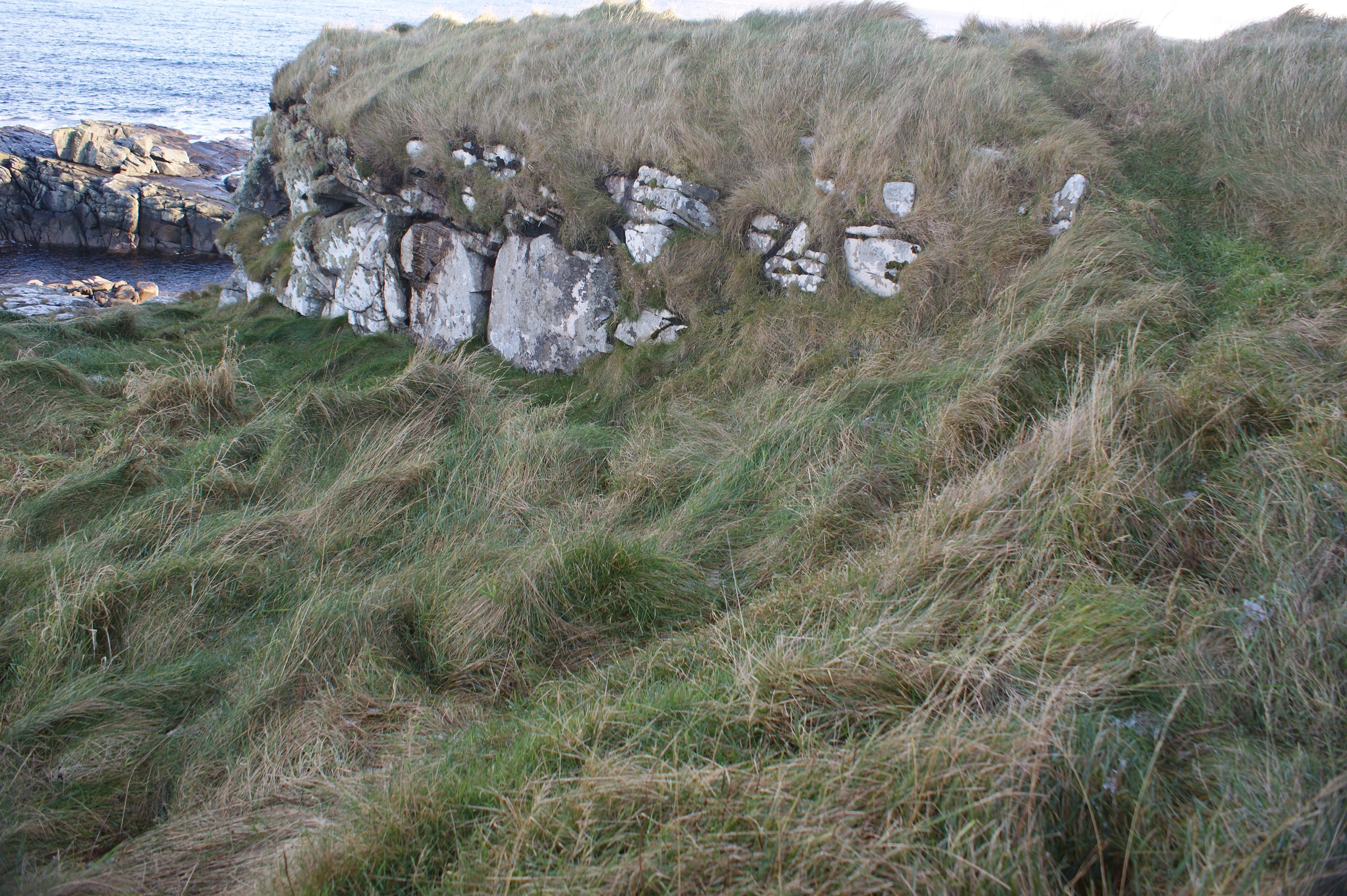
The broch stands on a broad platform or raised area, surrounded by the remains of at least six other buildings. These structures are not clearly defined and are largely visible as shallow depressions. They have been described individually below, but it is probable that some may originally have been conjoined. There are indications that the settlement was surrounded by a curvilinear enclosure bank. (i) The grassy broch mound is located on the coast edge. It is about 15m in diameter and survives to a height of about 2.5m. Some stonework is visible in a series of small exposures which are located towards the base of the broch on the NW side. (ii) To the SE side of the broch, an oval structure is eroding from the coast edge. Visible as a slight depression with portions of coursed walling exposed, it measures 3m in width and survives to a length of 6m. (iii) To the SW side of the broch, a second structure has a subrectangular or oval form. It measures 5m by 6m and is defined by a slight earthen bank with occasional stones protruding. (iv) A poorly defined circular structure, 6m in diameter, is located to the W side of the broch. (v) A circular structure lying between structures (iii) and (iv) is visible as a shallow depression 6m in diameter. Remnants of an internal stone facing survive. (vi) To the NNW side of the area, a circular structure visible as a shallow depression measures 6m in diameter. (vii) An oval structure lies to the N side of the area. It measures 6m in length by 3m in width and is visible as a shallow depression.
Visited 22/11/15 - Site located, as described.
Location
440020.00
1114710.00
27700
59.9155006
-1.2861358
Submitted photographs
Image
Date
Caption
User
22/11/2015
Broch mound, Brough Geo
EstherR
22/11/2015
The coast edge at Brough Geo
EstherR
22/11/2015
Coast edge and site of structure 2
EstherR
Submitted updates
Update id
Date
User
2293
22/11/2015
EstherR
Site located?
Yes
Threats
none
Visibility above ground
Highly visible (substantial remains)
Access
accessible on foot (footpath)
Description
The broch stands on a broad platform or raised area, surrounded by the remains of at least six other buildings. These structures are not clearly defined and are largely visible as shallow depressions. They have been described individually below, but it is probable that some may originally have been conjoined. There are indications that the settlement was surrounded by a curvilinear enclosure bank. (i) The grassy broch mound is located on the coast edge. It is about 15m in diameter and survives to a height of about 2.5m. Some stonework is visible in a series of small exposures which are located towards the base of the broch on the NW side. (ii) To the SE side of the broch, an oval structure is eroding from the coast edge. Visible as a slight depression with portions of coursed walling exposed, it measures 3m in width and survives to a length of 6m. (iii) To the SW side of the broch, a second structure has a subrectangular or oval form. It measures 5m by 6m and is defined by a slight earthen bank with occasional stones protruding. (iv) A poorly defined circular structure, 6m in diameter, is located to the W side of the broch. (v) A circular structure lying between structures (iii) and (iv) is visible as a shallow depression 6m in diameter. Remnants of an internal stone facing survive. (vi) To the NNW side of the area, a circular structure visible as a shallow depression measures 6m in diameter. (vii) An oval structure lies to the N side of the area. It measures 6m in length by 3m in width and is visible as a shallow depression.
Visited 22/11/15 - Site located, as described.
No visible evidence of active erosion, site on solid rock. Reassign to priority 3 and monitor.