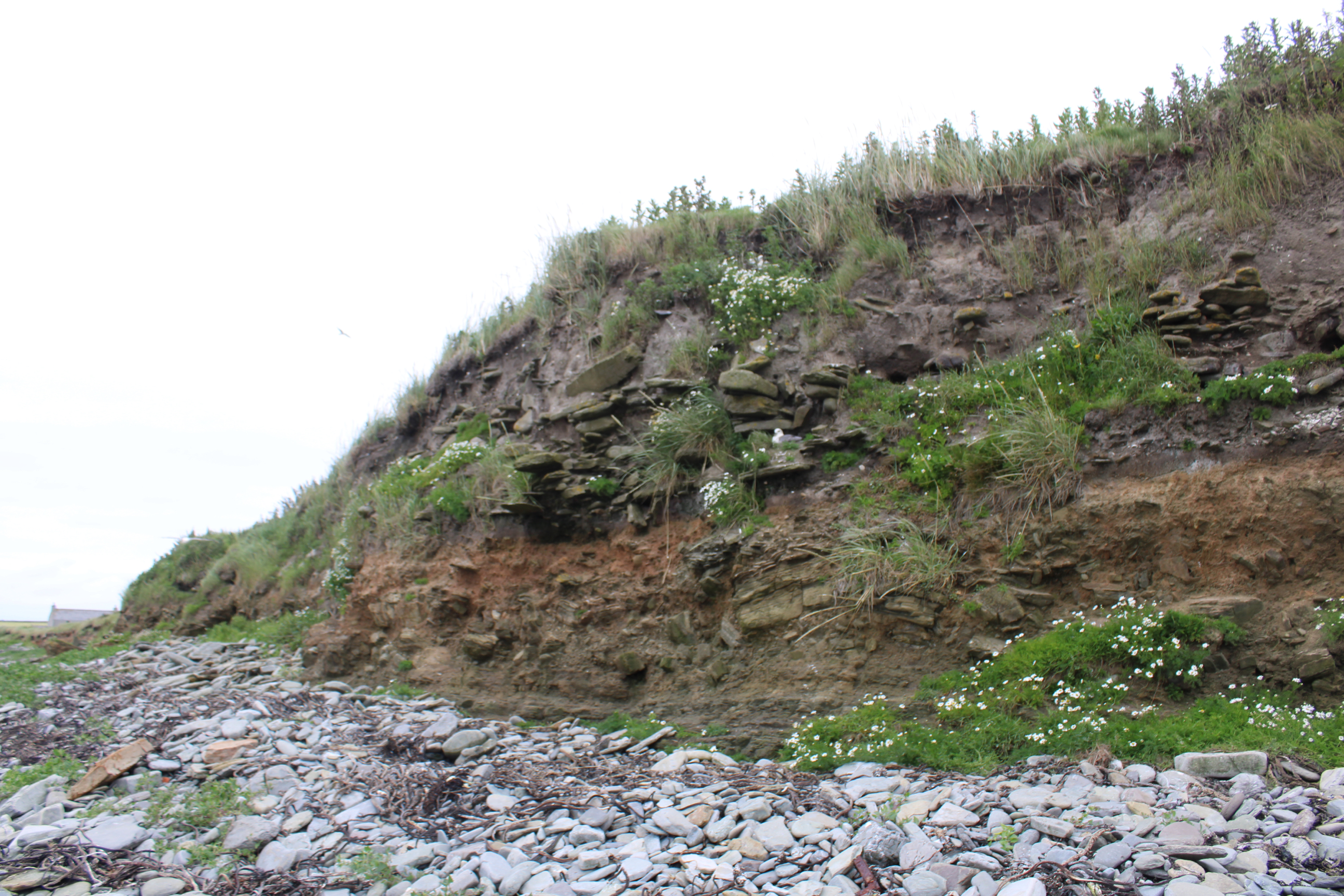
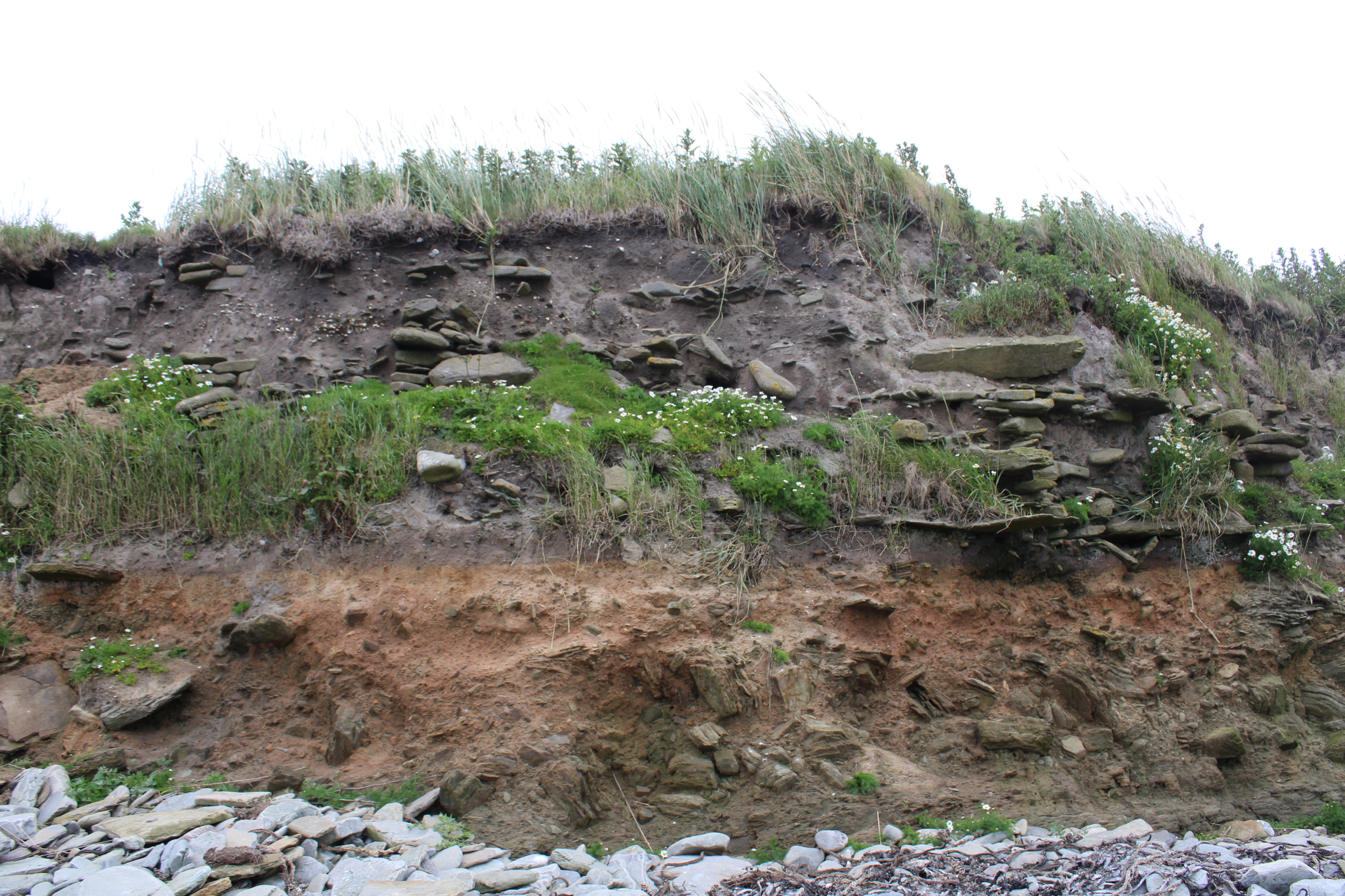
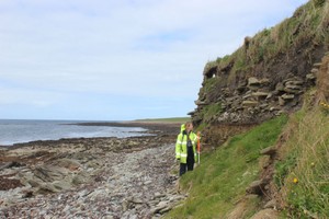
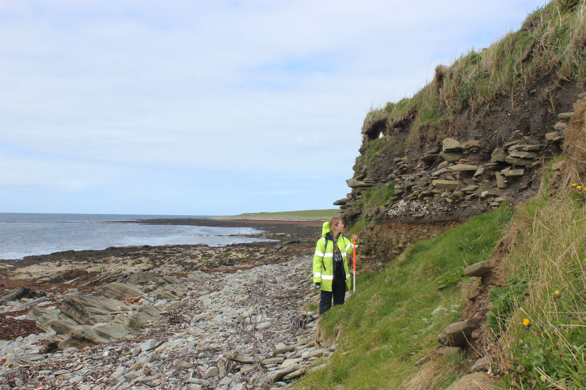
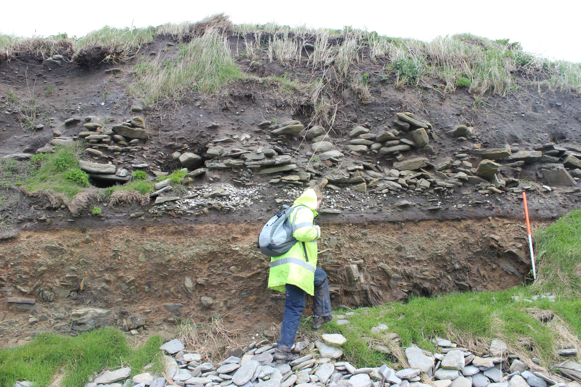
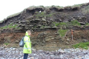
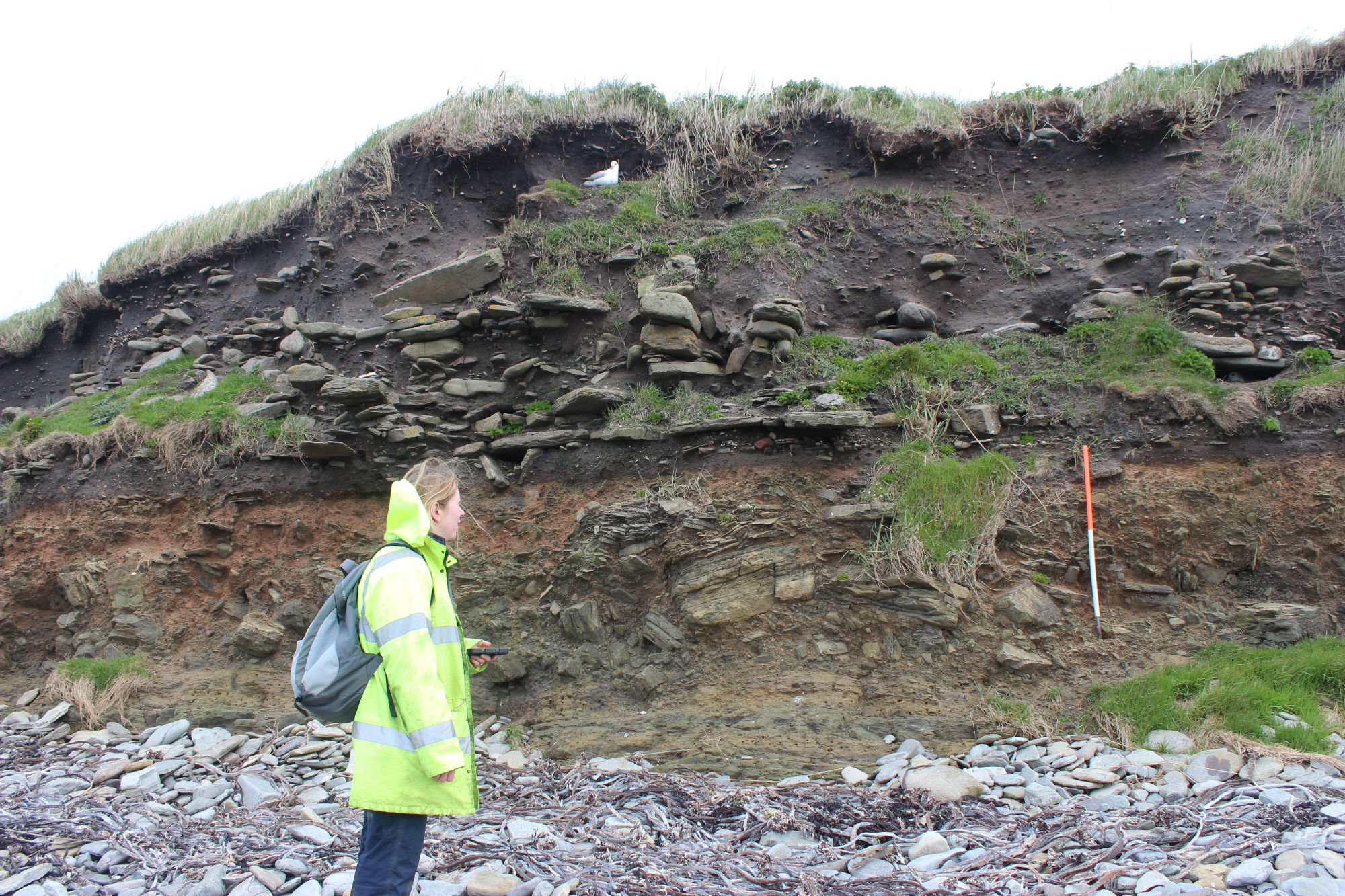
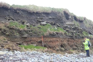
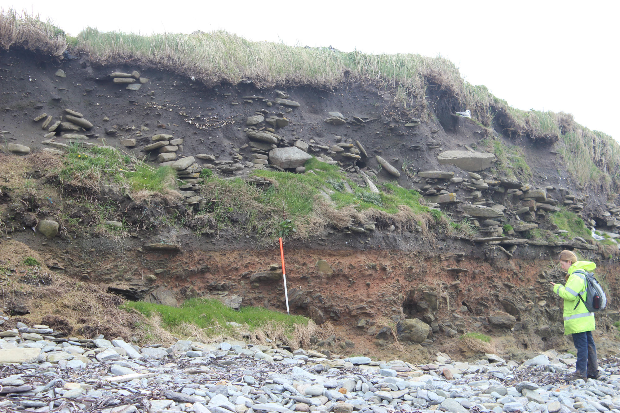
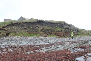
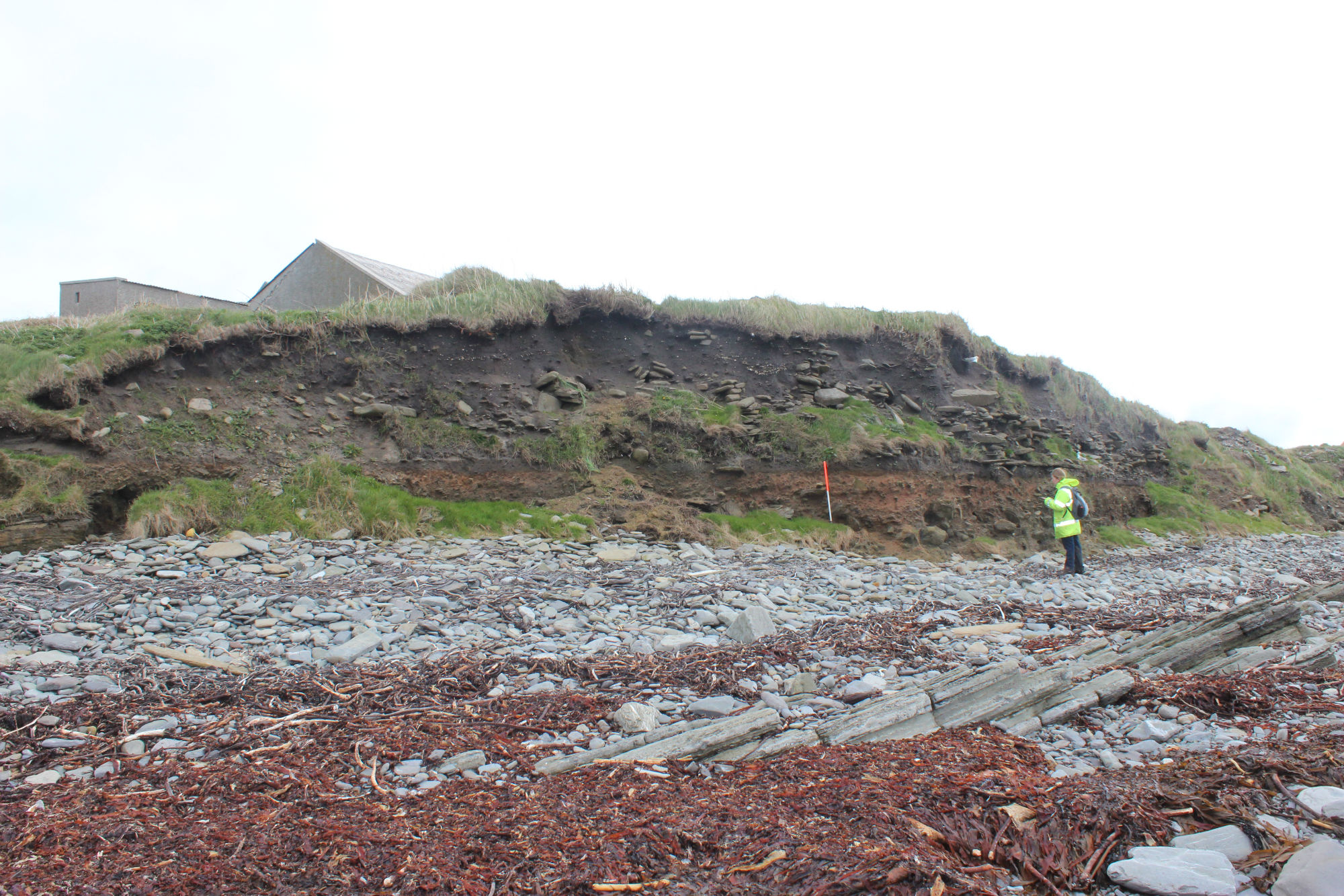
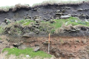
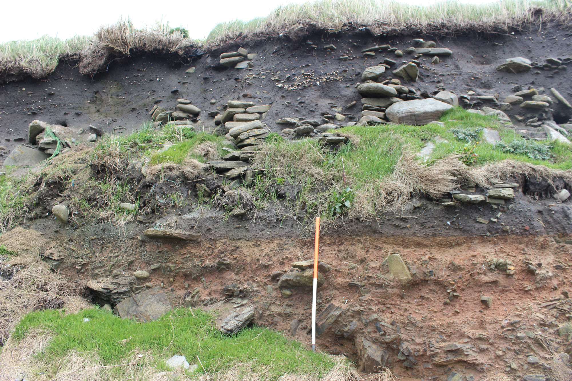
Substantial archaeological deposits and structural remains are exposed in the coastal section around the headland at Whitehowe. The cliff stands up to 4m high and, of this, up to 2m is comprised of archaeological deposits. The exposure extends for about 30m. At the base of the section, glacial till is covered by a cultivation soil, which in turn is covered by a layer of blown sand. The earliest structural remains visible in the section are built over this layer of sand. They comprise a flagged surface, associated with up to three separate structures and a series of stone-lined drains. The walls of the structures vary in construction; one is double faced with a hollow core, others appear to be revetted. The impression gained is that the structures are conjoined or closely associated. Layers of anthropogenic soils and midden-type deposits surround and fill into the structures, and there is some indication of a secondary phase of construction. Further deposits of shell midden and agricultural soils fill into the uppermost structures and render the area level. Although the deposits exposed at this site are extensive, they are not capable of ready interpretation. The earliest remains relate to cultivation while later remains suggest a substantial settlement which was occupied over long duration. At the abandonment of the settlement, the area appears to have been farmed once again. The farmstead which now occupies part of the site is of 18-20th C date. The later structures visible in section are reminiscent of Viking or Norse buildings, but this can not be conclusively demonstrated with the available evidence. Since this phase of activity occurs at an intermediate stage in the life of the site, it is probable that the earlier remains may be of prehistoric date. The remains have already been affected by coastal erosion and very vulnerable to further losses. It is very unlikely, given its physical circumstances and extent that this site can be provided with coastal defences and therefore it must be assessed, excavated or abandoned. As a first step, it is recommended that an assessment should be carried out as a matter of urgency to ascertain the extent, date and nature of the remains.
ShoreUPDATE 13 May 2015
As described. Soils, paving, walling and midden visible in section. Dumping of modern material over coast edge at north and south ends of site. The site is actively eroding and vulnerable.
As described. Remains very vulnerable.
Location
348400.00
1050620.00
27700
59.3387642
-2.9088094
Submitted photographs
Image
Date
Caption
User
16/07/2022
Coast edge and features in section
Ellie
16/07/2022
Structures in section
Ellie
13/05/2015
King's Craig general view of the coast edge in front of the settlement mound
training1
13/05/2015
King's Craig southern part of section
training1
13/05/2015
King's Craig middle part of section
training1
13/05/2015
King\'s Craig northern end of section
training1
13/05/2015
King's Craig general view of the settlement mound
training1
13/05/2015
King\'s Craig structural remains and midden at north end of section
training1
Submitted updates
Update id
Date
User
4021
16/07/2022
Ellie
Tidal state
Mid
Site located?
Unsure
Proximity to coast edge
Coast edge
Coastally eroding?
active sea erosion; has eroded in the past
Description
As described. Remains very vulnerable.
2038
13/05/2015
training1
Tidal state
Low
Site located?
Yes
Proximity to coast edge
Coast edge
Coastally eroding?
active sea erosion; has eroded in the past
Visibility in section
Clearly visible in section
Access
accessible on foot (no footpath)
Description
Substantial archaeological deposits and structural remains are exposed in the coastal section around the headland at Whitehowe. The cliff stands up to 4m high and, of this, up to 2m is comprised of archaeological deposits. The exposure extends for about 30m. At the base of the section, glacial till is covered by a cultivation soil, which in turn is covered by a layer of blown sand. The earliest structural remains visible in the section are built over this layer of sand. They comprise a flagged surface, associated with up to three separate structures and a series of stone-lined drains. The walls of the structures vary in construction; one is double faced with a hollow core, others appear to be revetted. The impression gained is that the structures are conjoined or closely associated. Layers of anthropogenic soils and midden-type deposits surround and fill into the structures, and there is some indication of a secondary phase of construction. Further deposits of shell midden and agricultural soils fill into the uppermost structures and render the area level. Although the deposits exposed at this site are extensive, they are not capable of ready interpretation. The earliest remains relate to cultivation while later remains suggest a substantial settlement which was occupied over long duration. At the abandonment of the settlement, the area appears to have been farmed once again. The farmstead which now occupies part of the site is of 18-20th C date. The later structures visible in section are reminiscent of Viking or Norse buildings, but this can not be conclusively demonstrated with the available evidence. Since this phase of activity occurs at an intermediate stage in the life of the site, it is probable that the earlier remains may be of prehistoric date. The remains have already been affected by coastal erosion and very vulnerable to further losses. It is very unlikely, given its physical circumstances and extent that this site can be provided with coastal defences and therefore it must be assessed, excavated or abandoned. As a first step, it is recommended that an assessment should be carried out as a matter of urgency to ascertain the extent, date and nature of the remains.
ShoreUPDATE 13 May 2015
As described. Soils, paving, walling and midden visible in section. Dumping of modern material over coast edge at north and south ends of site. The site is actively eroding and vulnerable.