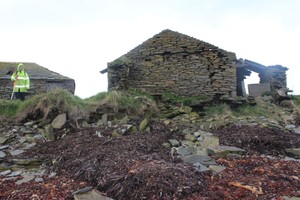
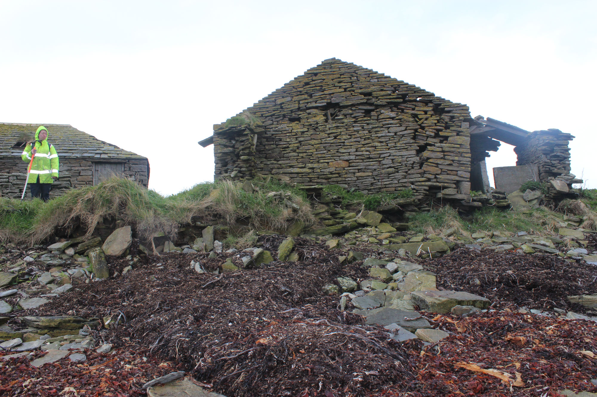
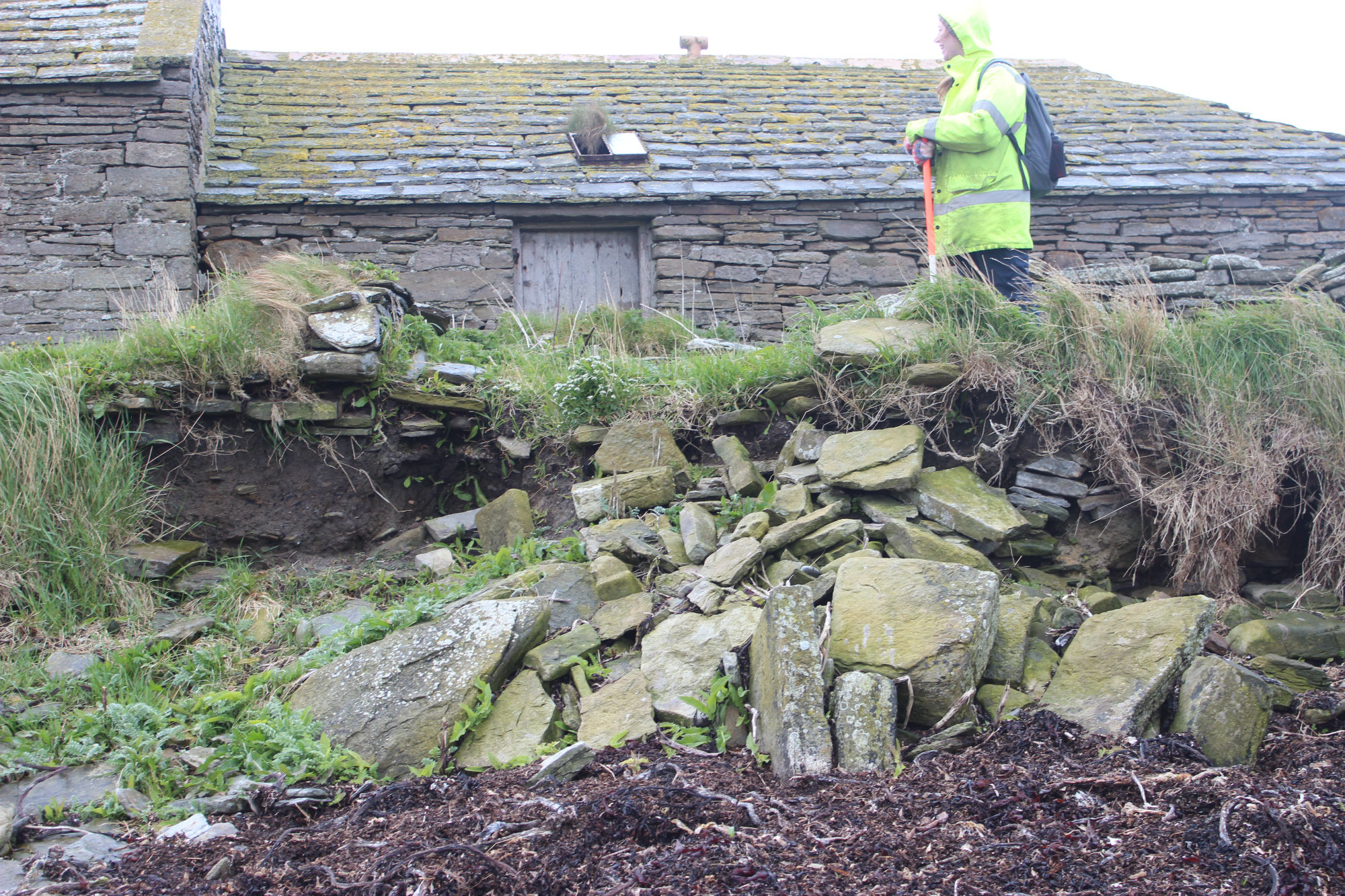
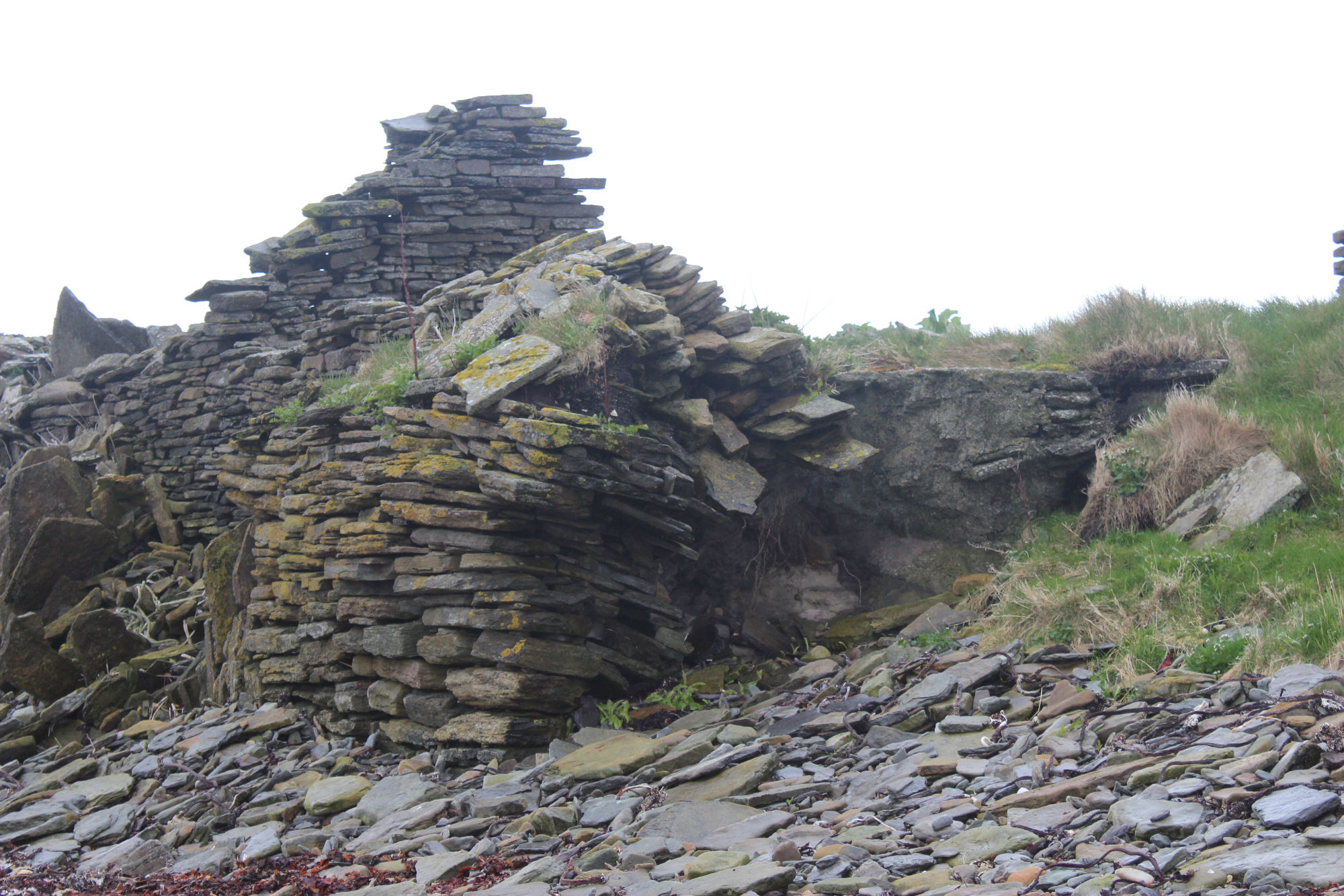
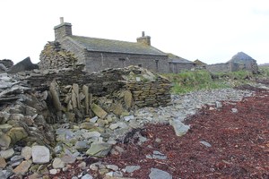
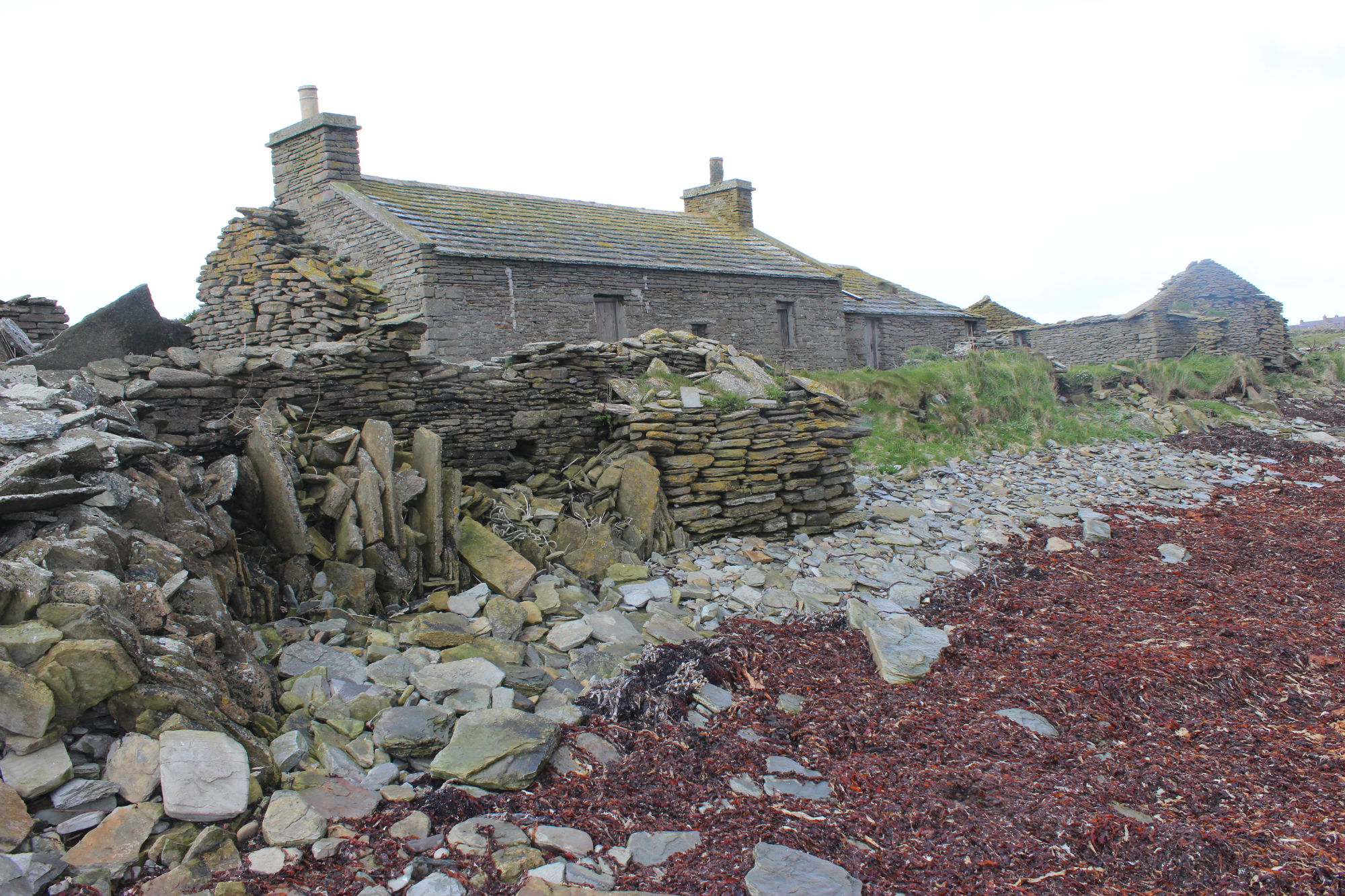
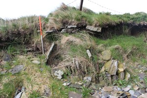
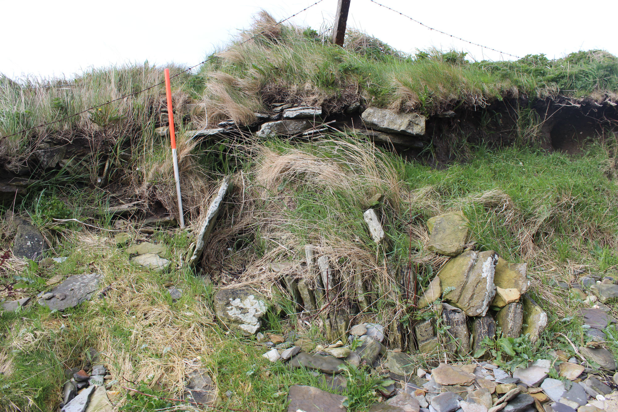
A ruinous farmstead, comprising a dwelling house and outbuildings, is built on a slight rise, which appear to be a farm mound of earlier date. Previously, numerous upright slabs, thought to be part of a settlement, were visible in exposure. Coastal erosion has since severely truncated the mound and has undermined several of the buildings. The deposits currently exposed in the coastal section comprise organic soils related to the farm mound and occassional large stones. The site is very vulnerable to further losses and should be kept under surveillance in case further archaeological deposits are exposed.
ShoreUPDATE 13 May 2015
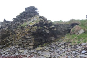
The farm buildings are being eroded and undermined; a layer of flat stones representing a possible paved surface and organic soils are visible in section in the coast edge. Lengths of stonework visible in the coast edge appear to be two phases of historic coastal defence and buttressing for the farmstead.
The erosion is severe and ongoing, though the features and deposits visible in the section all appear to relate to the post-medieval farmstead and attempts to defend it from erosion.
Location
349920.00
1051270.00
27700
59.3447838
-2.8822451
Submitted photographs
Image
Date
Caption
User
13/05/2015
Hookin, collapsing buildings being undermined by erosion
training1
13/05/2015
Hookin, farmstead and deposits in section
training1
13/05/2015
Hookin, collapsing buildings and buttressing at coast edge
training1
13/05/2015
Hookin, general view of the eroding farmstead
training1
13/05/2015
Hookin, historic coastal defence stonework in coast edge
training1
Submitted updates
Update id
Date
User
2033
13/05/2015
training1
Tidal state
Low
Site located?
Yes
Proximity to coast edge
Coast edge
Coastally eroding?
active sea erosion; has eroded in the past
Threats
structural damage/decay
Visibility above ground
Highly visible (substantial remains)
Visibility in section
Clearly visible in section
Access
accessible on foot (footpath)
Description
A ruinous farmstead, comprising a dwelling house and outbuildings, is built on a slight rise, which appear to be a farm mound of earlier date. Previously, numerous upright slabs, thought to be part of a settlement, were visible in exposure. Coastal erosion has since severely truncated the mound and has undermined several of the buildings. The deposits currently exposed in the coastal section comprise organic soils related to the farm mound and occassional large stones. The site is very vulnerable to further losses and should be kept under surveillance in case further archaeological deposits are exposed.
ShoreUPDATE 13 May 2015
The farm buildings are being eroded and undermined; a layer of flat stones representing a possible paved surface and organic soils are visible in section in the coast edge. Lengths of stonework visible in the coast edge appear to be two phases of historic coastal defence and buttressing for the farmstead.
The erosion is severe and ongoing, though the features and deposits visible in the section all appear to relate to the post-medieval farmstead and attempts to defend it from erosion.