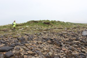
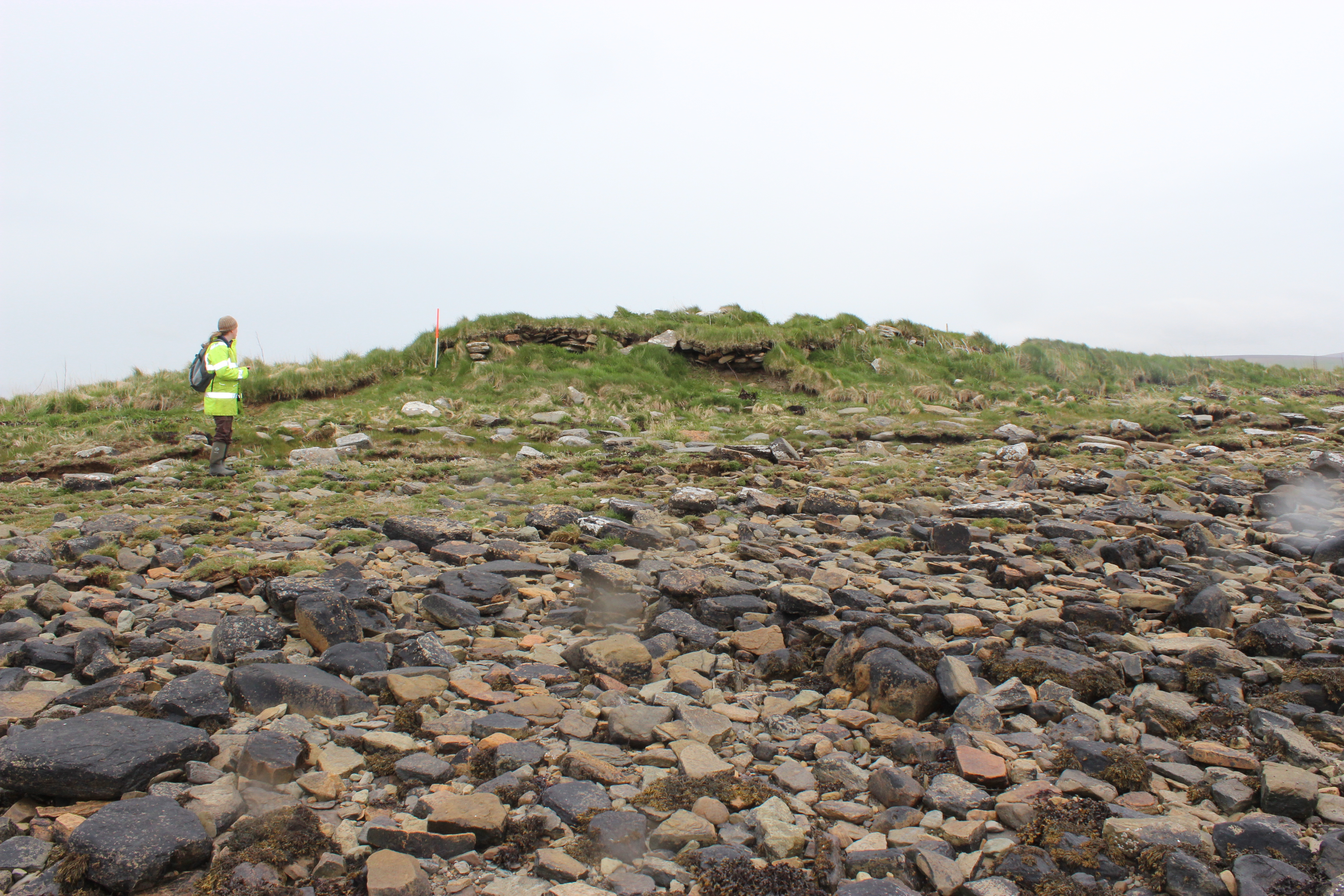
Part of a curving wall exposed in the coastal section appears to belong to an oval or sub-circular structure, measuring some 10m in diameter. The wall stands up to 3 courses or 0.45m high and is associated with deposits of burnt bone, charcoal and peat ash lenses. The site is currently being eroded and should be assessed in the near future.
ShoreUPDATE 10 May 2015
As described. Stonework is visible in section, but the coast edge is mostly vegetated. Located in a generally vulnerable area.
Update: 25/04/2019
The mentioned curved structure has a sheep hold built on top of it, which measures c. 5 meters wide. Small areas of active erosion though most of it remains highly vegetated. The mentioned ashy and charcoal layers are visible in the coastal edge.
Location
328090.00
1010590.00
27700
58.9763985
-3.2525356
Submitted photographs
Image
Date
Caption
User
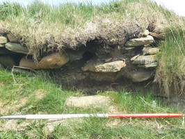
25/04/2019
West facing section of anthropogenic layers under potential rubble
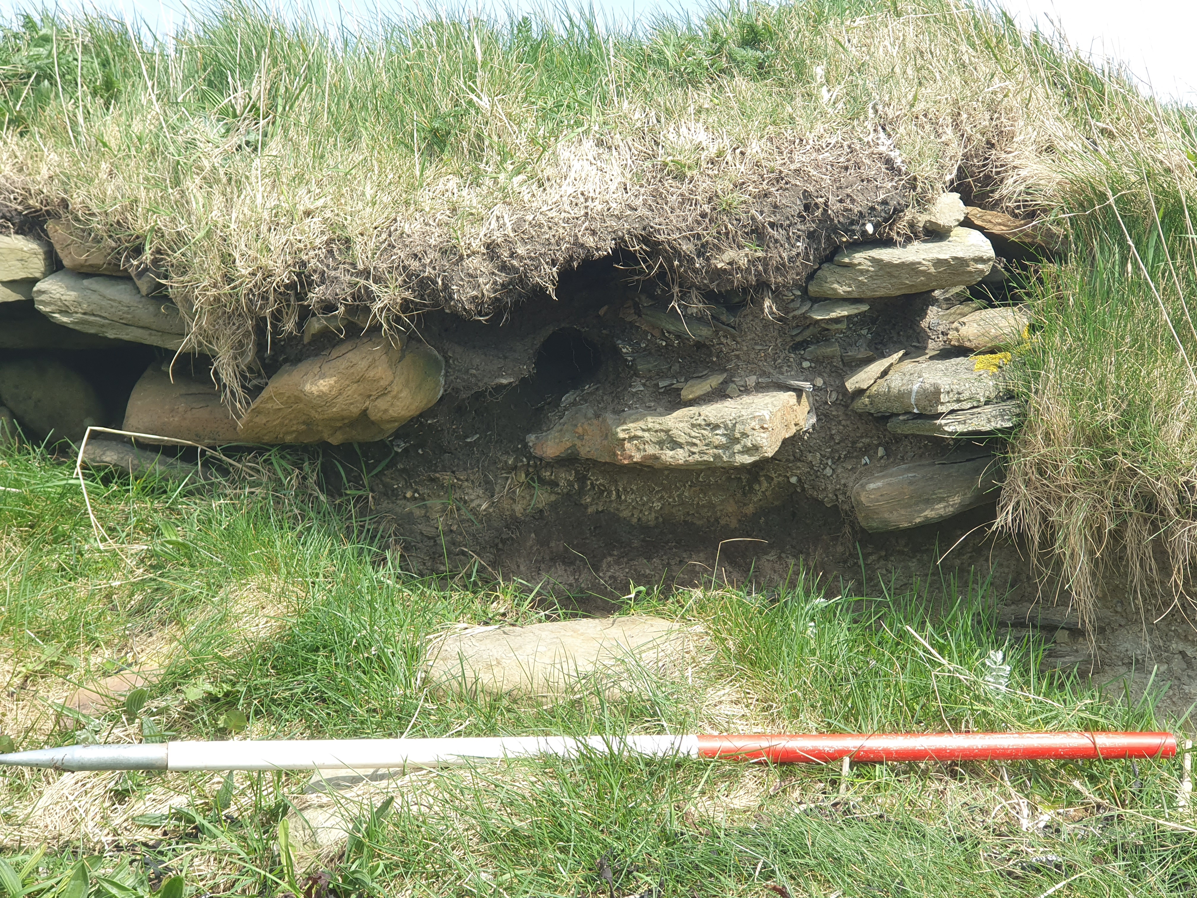
Alexandria4
25/04/2019
West facing section of wall-like structure
Alexandria4
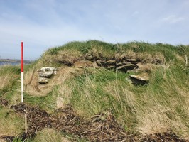
11/05/2015
Cummi Ness detail of coastal exposure showing showing stonework
training1
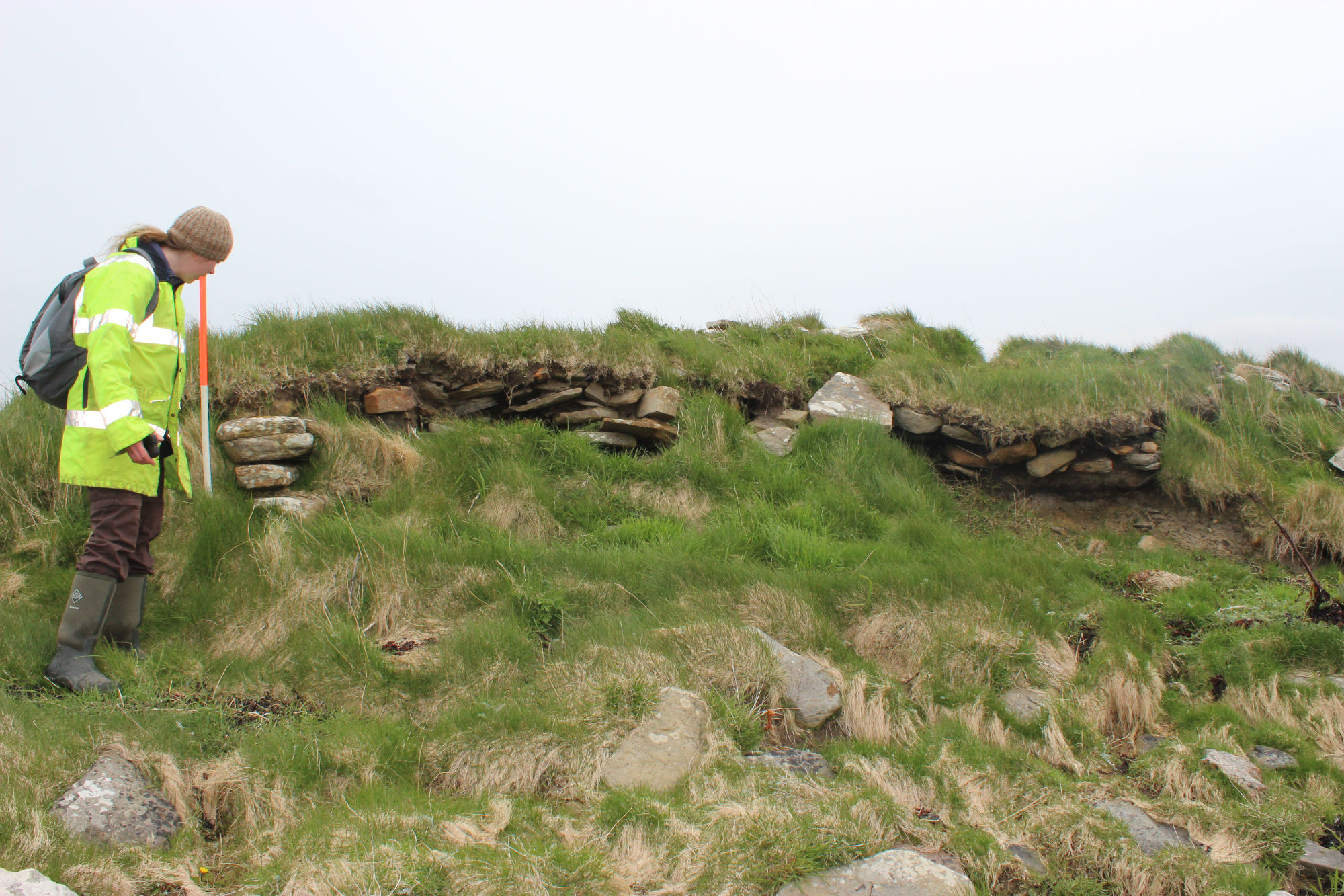
11/05/2015
Cummi Ness general view of site and coast edge
training1
Submitted updates
Update id
Date
User
3242
25/04/2019
Alexandria4
Tidal state
High
Site located?
Yes
Proximity to coast edge
< 10m
Coastally eroding?
active sea erosion
Threats
vegetation growth; structural damage/decay; water erosion (e.g. stream, etc)
Visibility above ground
Limited visibility (partial remains)
Visibility in section
Limited visibility in section
Access
accessible on foot (no footpath)
Local knowledge
don't know
Description
Part of a curving wall exposed in the coastal section appears to belong to an oval or sub-circular structure, measuring some 10m in diameter. The wall stands up to 3 courses or 0.45m high and is associated with deposits of burnt bone, charcoal and peat ash lenses. The site is currently being eroded and should be assessed in the near future.
ShoreUPDATE 10 May 2015
As described. Stonework is visible in section, but the coast edge is mostly vegetated. Located in a generally vulnerable area.
Update: 25/04/2019
The mentioned curved structure has a sheep hold built on top of it, which measures c. 5 meters wide. Small areas of active erosion though most of it remains highly vegetated. The mentioned ashy and charcoal layers are visible in the coastal edge.