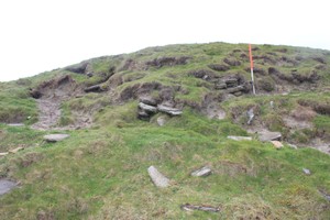
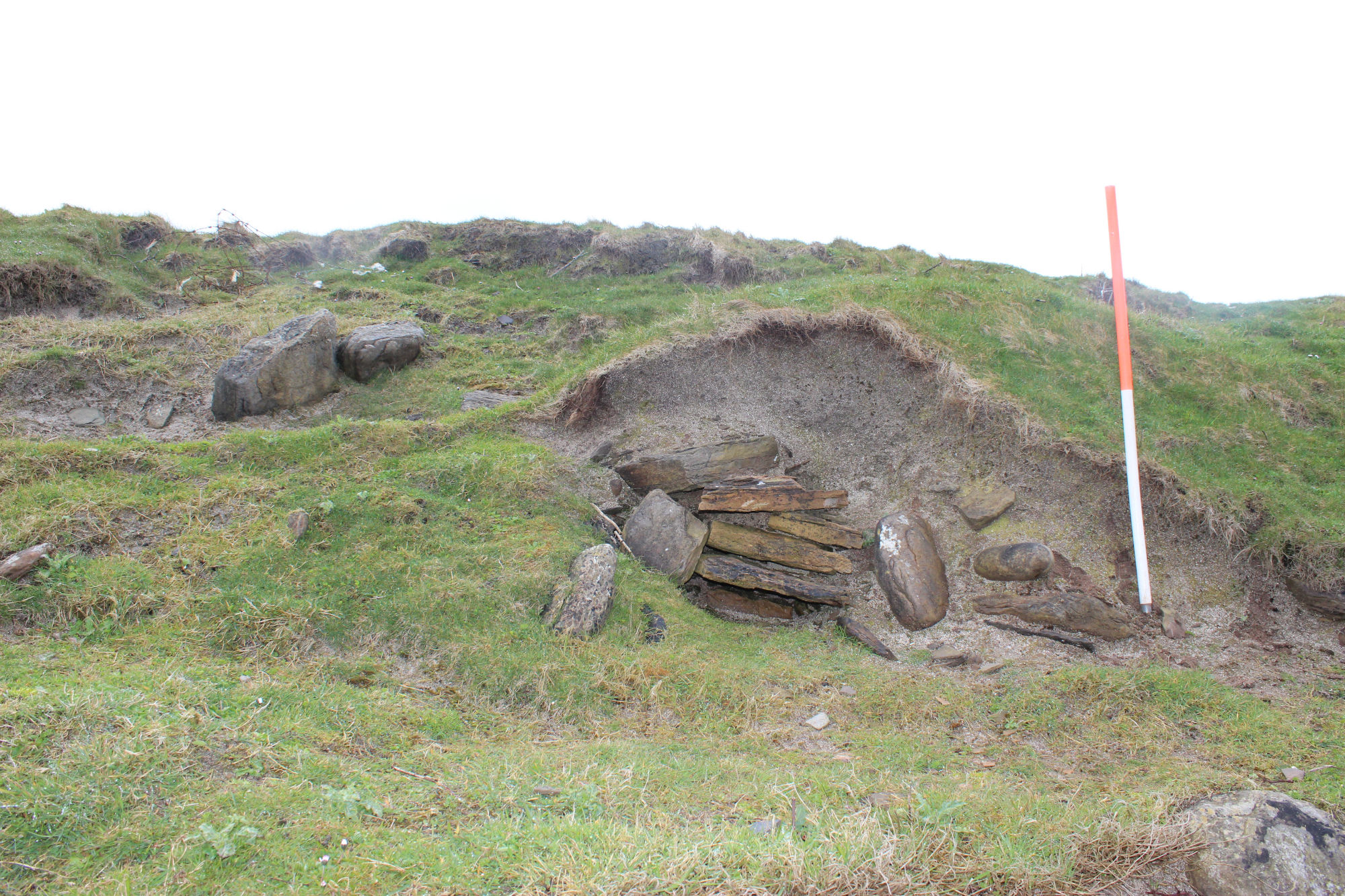
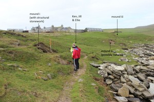
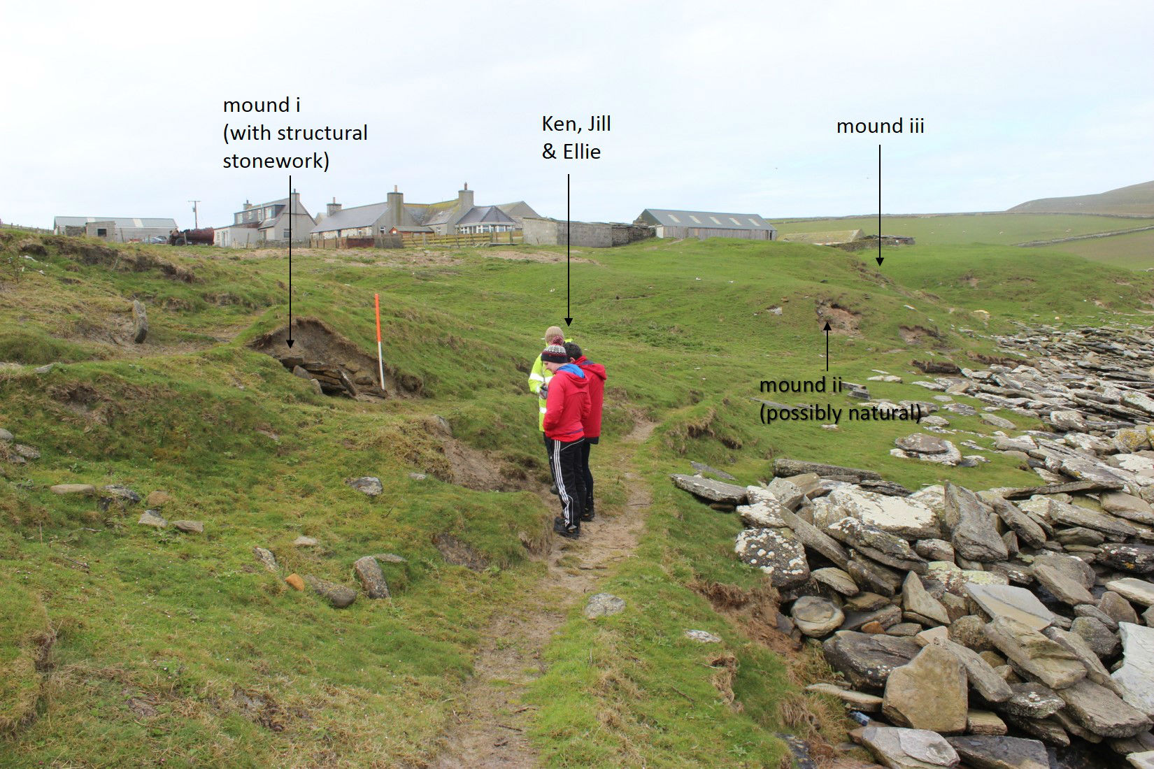
(i) Stone deposits are visible in an exposure, caused by aeolian erosion, to one side of a small oval mound. The mound, which is mostly grass-covered, measures 10m by 4m and stands up to 1.5m in height. It appears to be largely comprised of blown sand deposits which may have built up around a structure. The visible stone comprises slabs which have been set into a column along with several flat slabs, which may be part of a surface. (ii) A second small grass-covered oval mound, situated 15m to the west of (i) measures 7m by 3m. It is aligned east-west and stands to 1m high. Some stone is visible in a small exposure on its seaward side; but it is not clear whether these deposits form part of a structure or are of natural origin. iii) A third mound, approximately 30m in diameter and 2m high, lies to the east side of a track leading to the beach. It is grass-covered and, again, appears to be largely composed of blown sand. A possible stone setting, which resembles a drain or cist, lies at the foot of the seaward side of this mound. The origin of this mound is unclear and it may be entirely natural, but as with (i) above, it may represent a structure encased in a covering of blown sand.
ShoreUPDATE 13/05/2015.
Site as described. Structural stone was noted in mound i and mound iii, indicating that these are probably both structures buried in blown sand. It remains unclear whether mound ii is natural. No anthropogenic deposits were noted in any of the three mounds or association with the structural features noted.
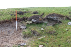
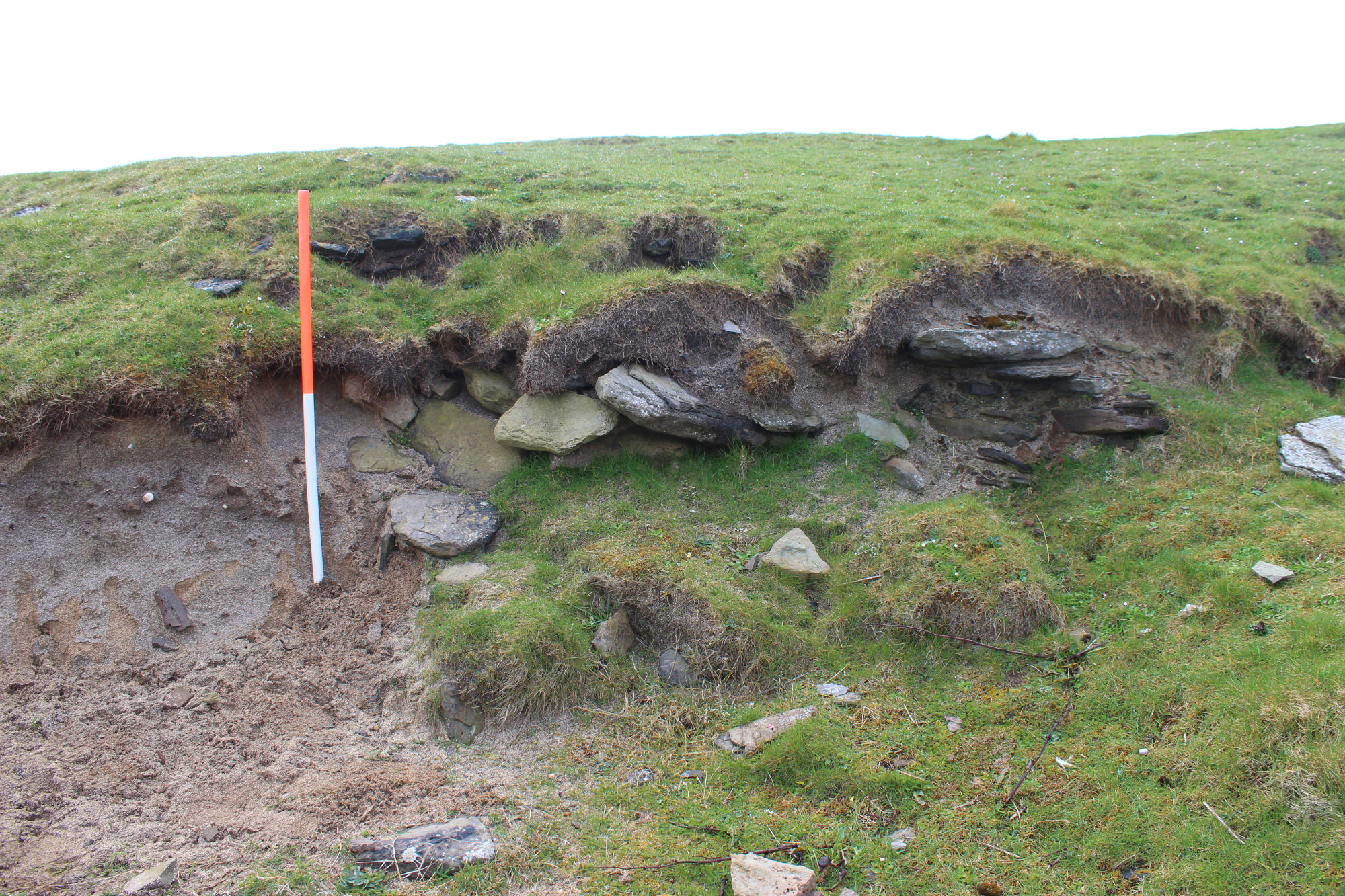
In mound i, structural stone including a column of masonry is visible in an exposure with two edge-set stones in alignment visible on the surface of the mound adjacent to this. The middle mound (ii) is as described, with some stone visible in an exposure on the northwest side, though it remains unclear whether this is natural. Mound iii has a number of small exposures on its seaward side. Several contain structural stonework indicating walls and possible surfaces, edge set stones visible towards the base of the mound are probably the remains of the cist structure noted on the original survey. The stonework currently exposed in this mound seem to indicate that this is also a structure buried in blown sand.
Location
341370.00
1049040.00
27700
59.3236580
-3.0319345
Submitted photographs
Image
Date
Caption
User
12/05/2015
Noup mound iii showing the stonework exposed in the seaward side
training1
12/05/2015
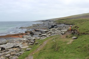
Noup view of the coast edge in front of the mounds
training1
12/05/2015
Noup mound ii showing the exposed face and the possibly natural stone
training1
12/05/2015
Noup mound i showing the masonry and edge set stones
training1
12/05/2015
Noup general view showing the three mounds in relation to each other