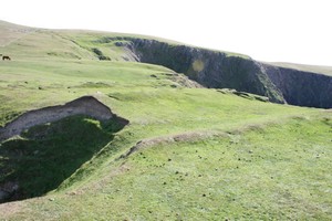
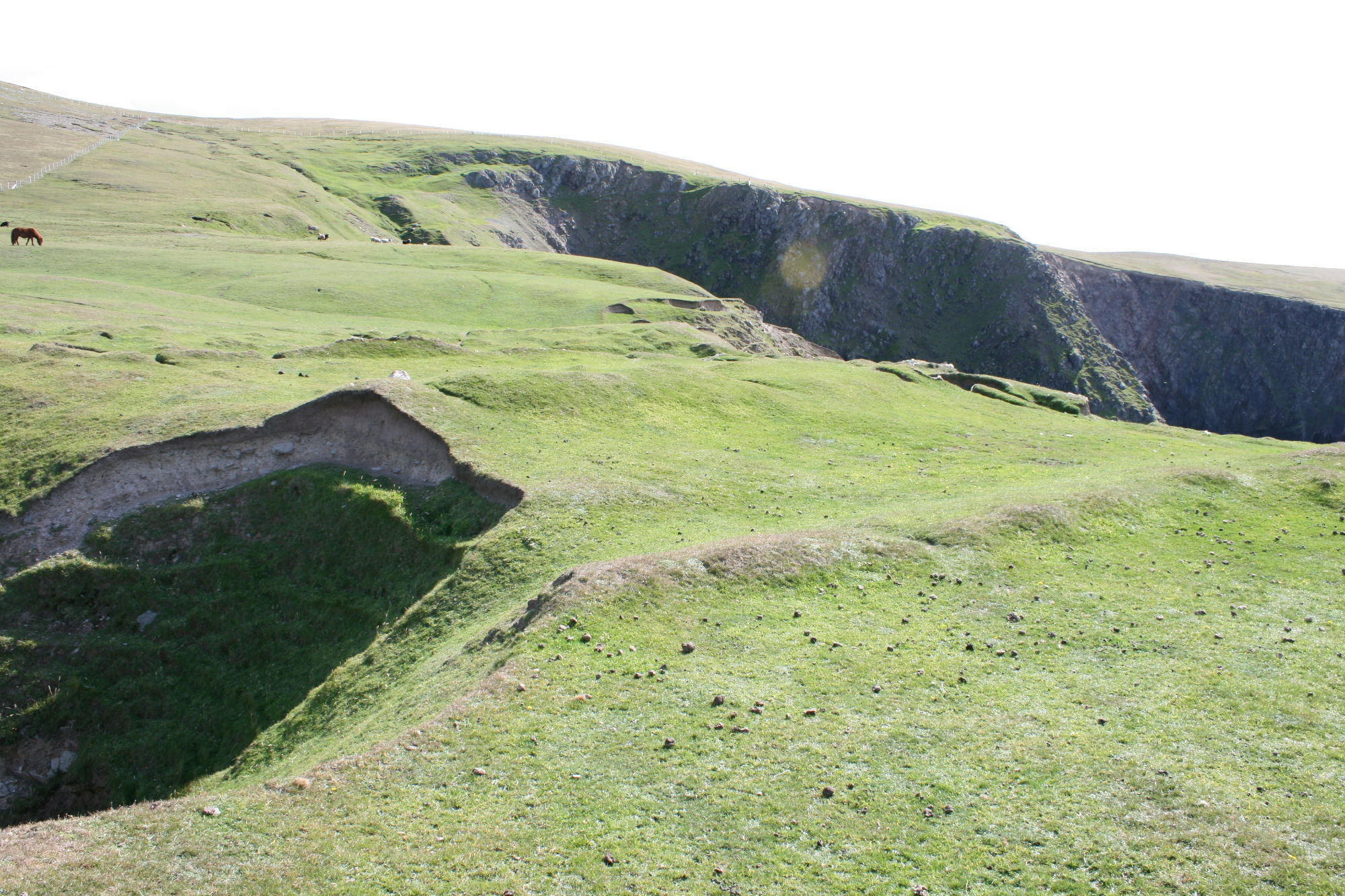
A long narrow promontory, surrounded by high vertical cliffs, is divided by a series of banks which run across its width. The scale of these barriers is more than that required merely for stock management and it is likely that this may be a defended promontory, probably of prehistoric date. There are possible structural remains situated at the seaward end of the promontory. The site is very exposed and the terminals of the banks have already been damaged by erosion. The various elements found at the site are described here, as encountered moving from the landward to the seaward end of the promontory: (i) A natural glacial gully, up to 1.5m deep, cuts across the neck of the promontory at its landward end. (ii) At a distance of 16m further west (seaward), a rectangular enclosure is defined by earthen and stone banks. This enclosure extends across the entire width of the promontory and is 7m long. The remnants of a stone structure and stone revetted bank lie within this enclosure. (iii) Further along the promontory another earthen bank, standing up to 0.6m high, extends across the width of the promontory neck. (iv) At a distance of 4m westward of (iii), an earthen bank, 2m in width, stands up to 0.4m high. There is the faint suggestion of a rectangular structure or enclosure at the west end of this bank. (v) Further seaward along the promontory are a line of boulders which extend, intermittently, across the neck of land.
ShoreUPDATE 21 August 2008
As described. This site sits on high cliffs, there is some minor damage to the ends of the banks, but this is due to slippage rather than to erosion, and impacts on a tiny fraction of the monument. As the cliffs are approximately 50m in height and were judged to be stable in the Coastal Zone Assessment of the area, the threat of erosion to the site is negligible.
Location
417100.00
1153300.00
27700
60.2635689
-1.6927853
Submitted photographs
Image
Date
Caption
User
21/08/2008
Weinnia Nes,s, detail of the section through the bank
training1
21/08/2008
Weinnia Ness, showing the earthwork banks
training1
21/08/2008
Weinnia Ness, general view of the top of the promontory
training1
21/08/2008
Weinnia Ness, showing landslip in the foreground and the high cliffs of the promontory
training1
Submitted updates
Update id
Date
User
2183
21/08/2008
training1
Site located?
Yes
Proximity to coast edge
Coast edge
Coastally eroding?
has eroded in the past
Threats
other
Other threats
landslip
Description
A long narrow promontory, surrounded by high vertical cliffs, is divided by a series of banks which run across its width. The scale of these barriers is more than that required merely for stock management and it is likely that this may be a defended promontory, probably of prehistoric date. There are possible structural remains situated at the seaward end of the promontory. The site is very exposed and the terminals of the banks have already been damaged by erosion. The various elements found at the site are described here, as encountered moving from the landward to the seaward end of the promontory: (i) A natural glacial gully, up to 1.5m deep, cuts across the neck of the promontory at its landward end. (ii) At a distance of 16m further west (seaward), a rectangular enclosure is defined by earthen and stone banks. This enclosure extends across the entire width of the promontory and is 7m long. The remnants of a stone structure and stone revetted bank lie within this enclosure. (iii) Further along the promontory another earthen bank, standing up to 0.6m high, extends across the width of the promontory neck. (iv) At a distance of 4m westward of (iii), an earthen bank, 2m in width, stands up to 0.4m high. There is the faint suggestion of a rectangular structure or enclosure at the west end of this bank. (v) Further seaward along the promontory are a line of boulders which extend, intermittently, across the neck of land.
ShoreUPDATE 21 August 2008
As described. This site sits on high cliffs, there is some minor damage to the ends of the banks, but this is due to slippage rather than to erosion, and impacts on a tiny fraction of the monument. As the cliffs are approximately 50m in height and were judged to be stable in the Coastal Zone Assessment of the area, the threat of erosion to the site is negligible.