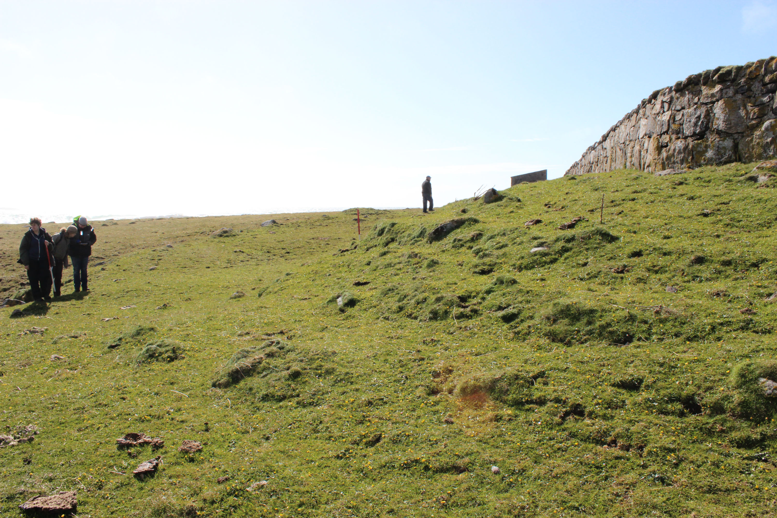
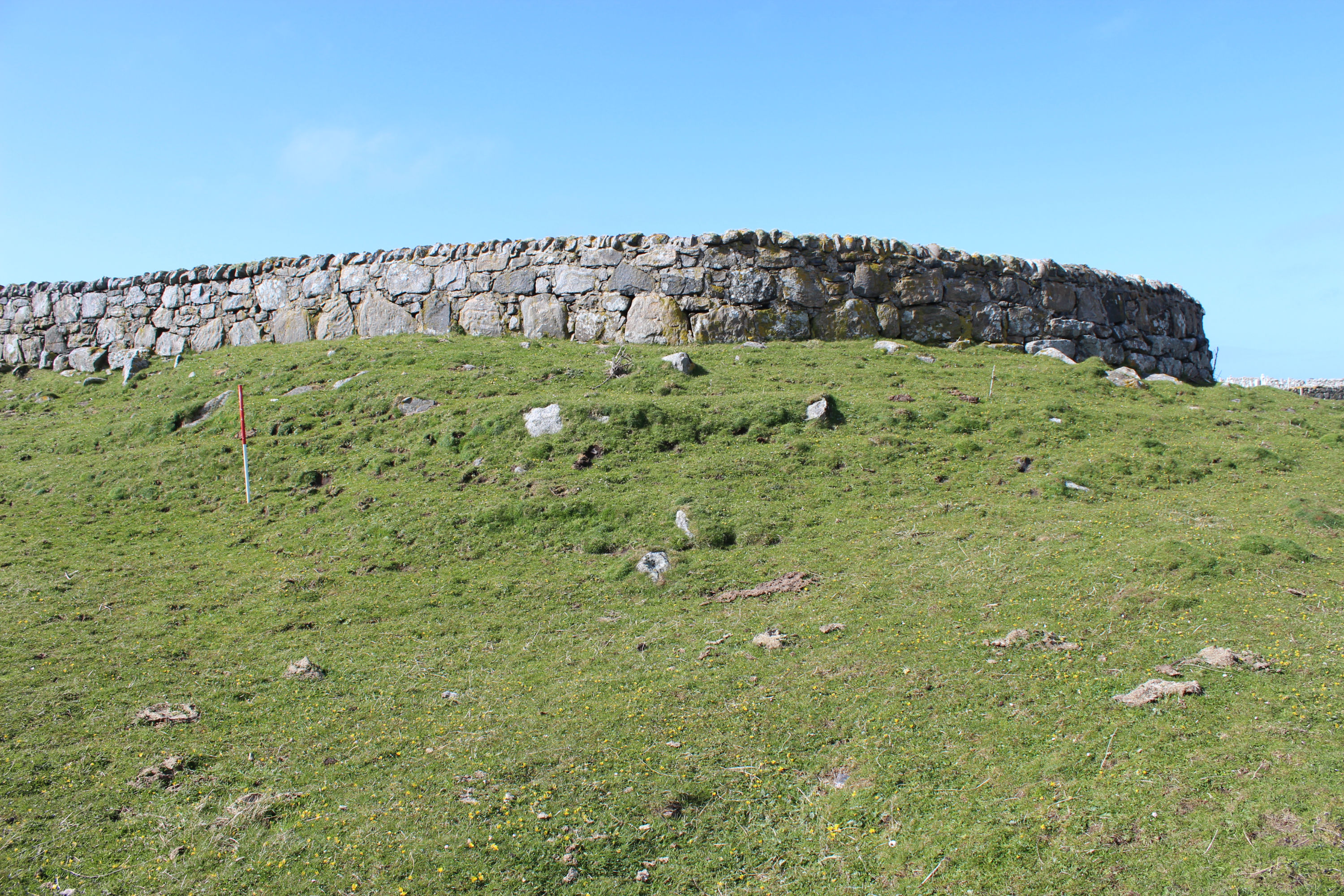
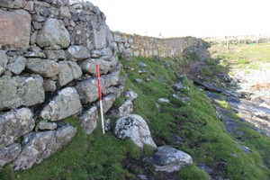
A battered well-constructed stone wall swings in an arc of about 18m diam below the wall of the modern cemetery, which actually follows the line of this earlier wall and uses it as a foundation. Inside the cemetery at this point there is a substantial mound. We identify the wall and mound as the buried remains of a broch, situated immediately overlooking the natural dyke which forms a protected harbourage at this point on the headland. Between the broch and the edge of the dyke are the remains of a bank which curve west¬wards, and make an enclosure around the broch on this side, with a possible entrance to the west. To the north of the broch, exposed in the steep and eroding edge of the machair, is a midden. We recovered fifteen reddish-brown gritty handmade sherds, one with an applied and impressed cordon, probably of the early first millennium AD. We also found limpet shells, fragments of butchered animal bone, teeth of sheep and pig, and five fish ¬vertebra. (PL.4A,4B)
05/05/2016 ShoreUPDATE
site as described.
Location
64794.00
801666.00
27700
56.9841194
-7.5205774
Submitted photographs
Image
Date
Caption
User
05/05/2016
General view of the broch mound inside the cemetery
training1
05/05/2016
General view of the broch mound and cemetery wall
training1
05/05/2016
General view of the broch mound with cemetery wall on top
training1
05/05/2016
Cemetery wall following line of broch wall
training1
05/05/2016
Detail of midden material exposed in eroding coast edge
training1
05/05/2016
Eroding face with broch wall and midden, cemetery wall constructed on top
training1
Submitted updates
Update id
Date
User
2623
05/05/2016
training1
Tidal state
Mid
Site located?
Yes
Proximity to coast edge
Coast edge
Coastally eroding?
active sea erosion; has eroded in the past
Threats
none; stock erosion
Visibility above ground
Limited visibility (partial remains)
Visibility in section
Clearly visible in section
Access
accessible on foot (footpath)
Local knowledge
is well known; has local associations/history
Description
A battered well-constructed stone wall swings in an arc of about 18m diam below the wall of the modern cemetery, which actually follows the line of this earlier wall and uses it as a foundation. Inside the cemetery at this point there is a substantial mound. We identify the wall and mound as the buried remains of a broch, situated immediately overlooking the natural dyke which forms a protected harbourage at this point on the headland. Between the broch and the edge of the dyke are the remains of a bank which curve west¬wards, and make an enclosure around the broch on this side, with a possible entrance to the west. To the north of the broch, exposed in the steep and eroding edge of the machair, is a midden. We recovered fifteen reddish-brown gritty handmade sherds, one with an applied and impressed cordon, probably of the early first millennium AD. We also found limpet shells, fragments of butchered animal bone, teeth of sheep and pig, and five fish ¬vertebra. (PL.4A,4B)
05/05/2016 ShoreUPDATE site as described.
Maintain priority 2. The erosion is encroaching upon the cemetery wall immediately to the north of the broch mound, and the archaeological impact should be considered in any future work to rebuild the wall or construct a coastal defence for the cemetery.