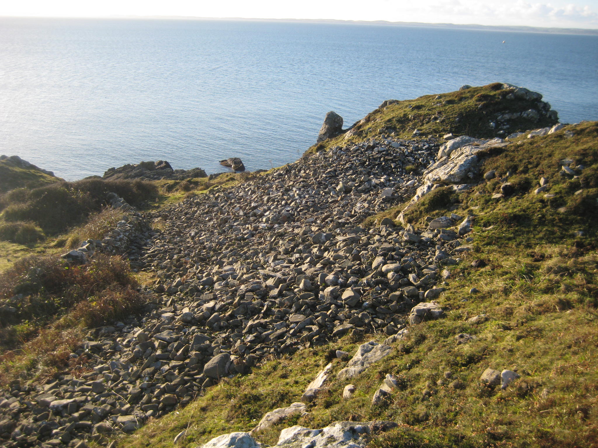
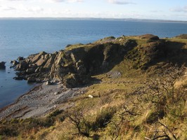
Consists of 2 stone ramparts cutting across promontory on landward approach. Slight erosion of outer rampart on NE face from cattle trampling. Inner rampart has been deliberately collapsed in centre, probably to provide building material for relatively modern drystone dyke which cuts the inner rampart. Subsidence to E of site, possibly accounting for mass of rubble at foot of cliff. NE aspect, 30-40m above sea level. Outer rampart is 65m x 6m x 1.7m, inner rampart is 54m x 5m x 1.5m.
As described above. Low level threat from stock erosion but site is in a stable condition.
Location
221570.00
552190.00
27700
54.8326607
-4.7796011
Submitted photographs
Image
Date
Caption
User
01/12/2012
Laigh Sinniness promontory fort
pickin
01/12/2012
Laigh Sinniness promontory fort
pickin
Submitted updates
Update id
Date
User
530
01/12/2012
pickin
Site located?
Yes
Proximity to coast edge
>50m
Coastally eroding?
has eroded in the past
Threats
stock erosion
Visibility above ground
Highly visible (substantial remains)
Visibility in section
Clearly visible in section
Access
accessible on foot (footpath)
Local knowledge
don't know
Description
Consists of 2 stone ramparts cutting across promontory on landward approach. Slight erosion of outer rampart on NE face from cattle trampling. Inner rampart has been deliberately collapsed in centre, probably to provide building material for relatively modern drystone dyke which cuts the inner rampart. Subsidence to E of site, possibly accounting for mass of rubble at foot of cliff. NE aspect, 30-40m above sea level. Outer rampart is 65m x 6m x 1.7m, inner rampart is 54m x 5m x 1.5m.
As described above. Low level threat from stock erosion but site is in a stable condition.