Eoropie (3307)
Description
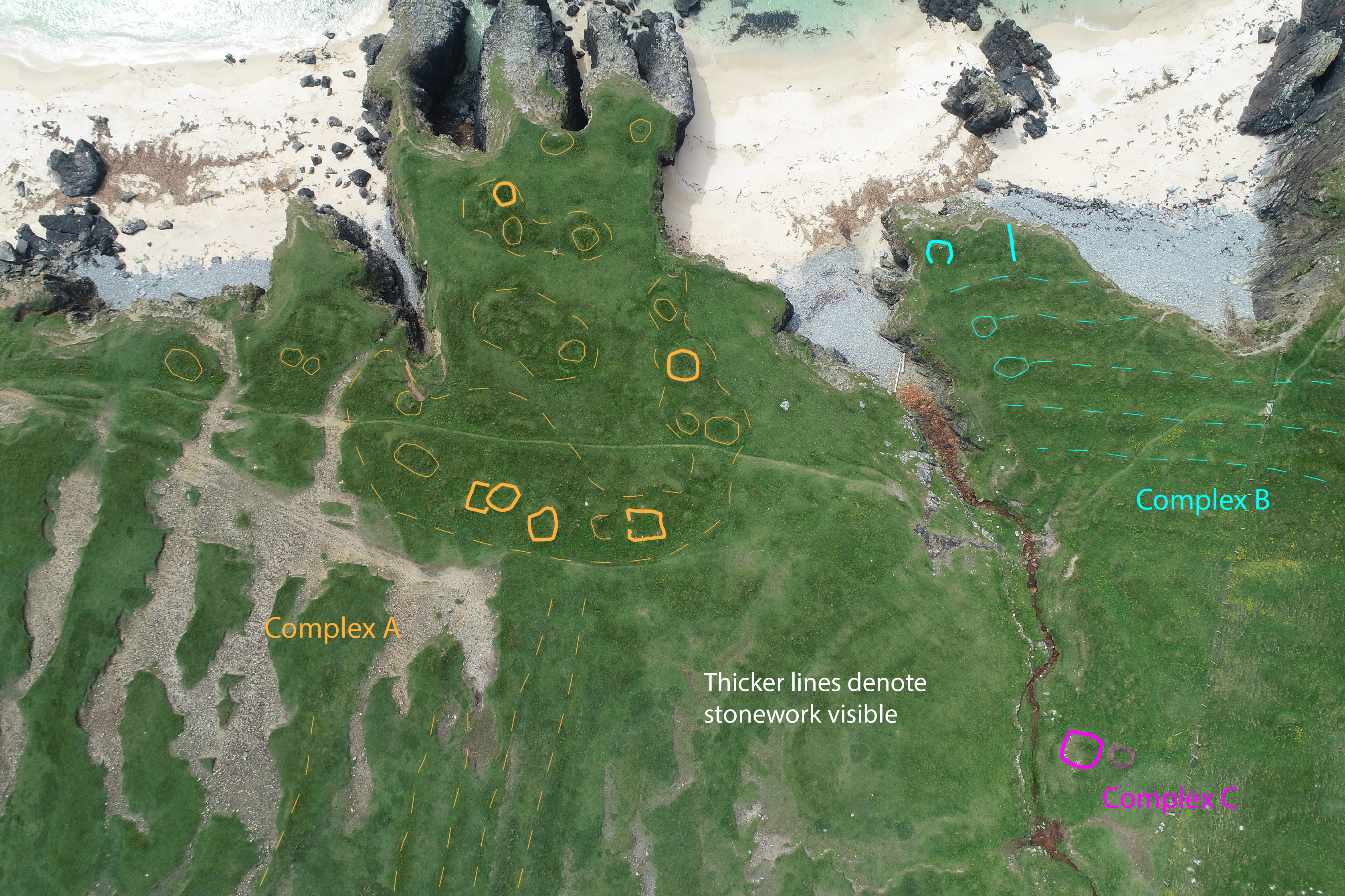
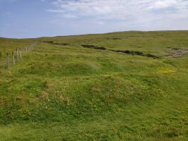
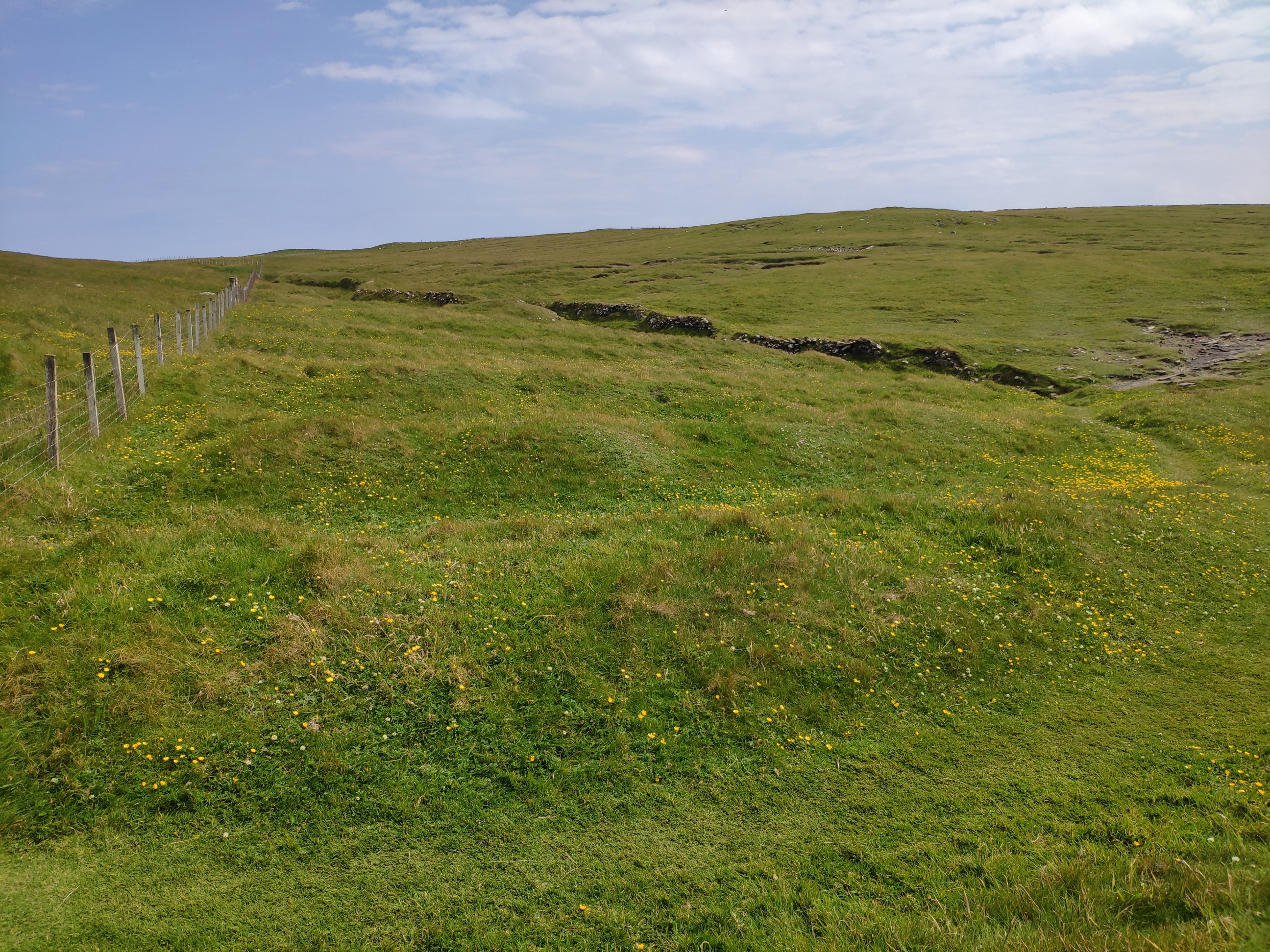
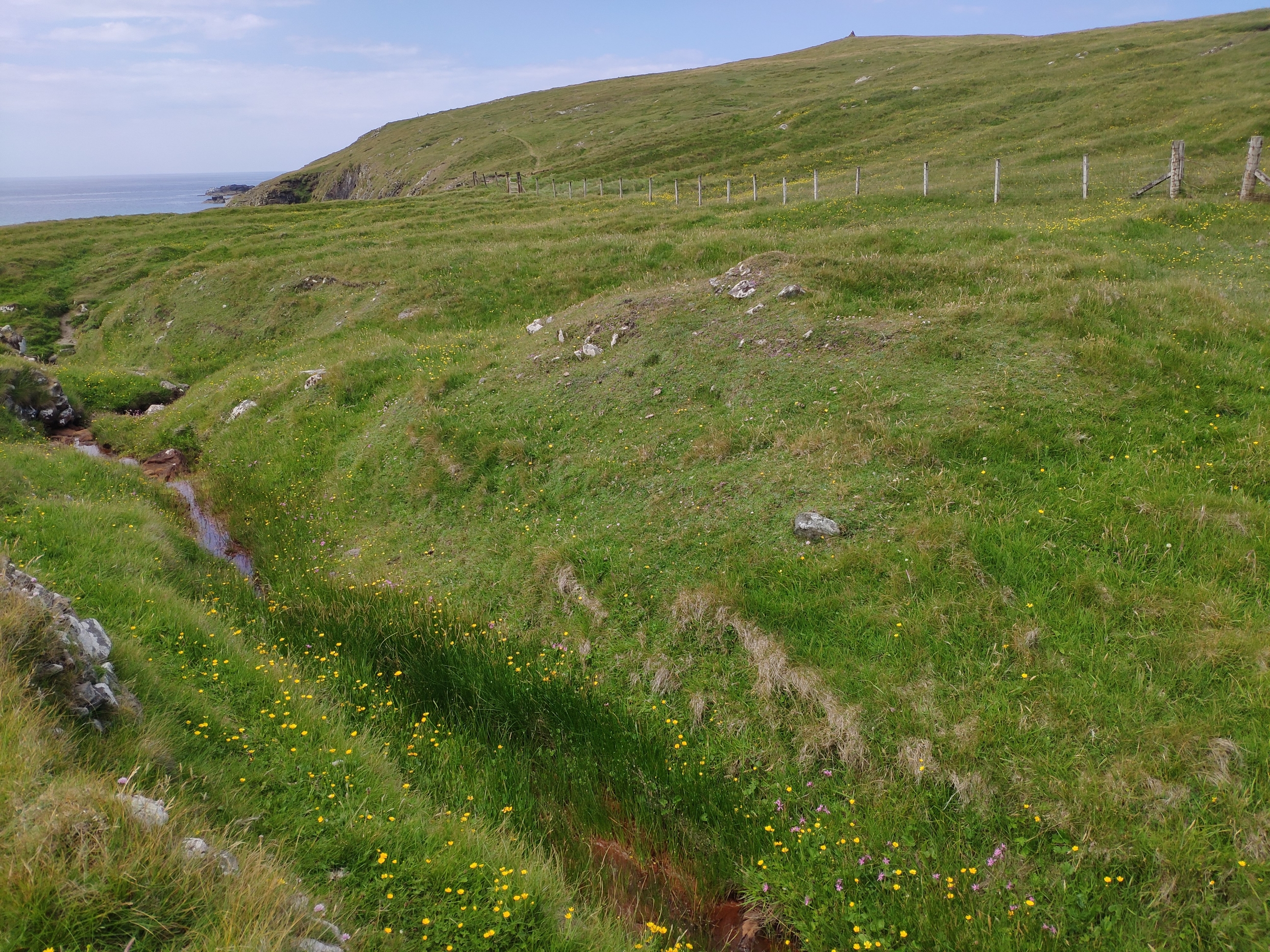
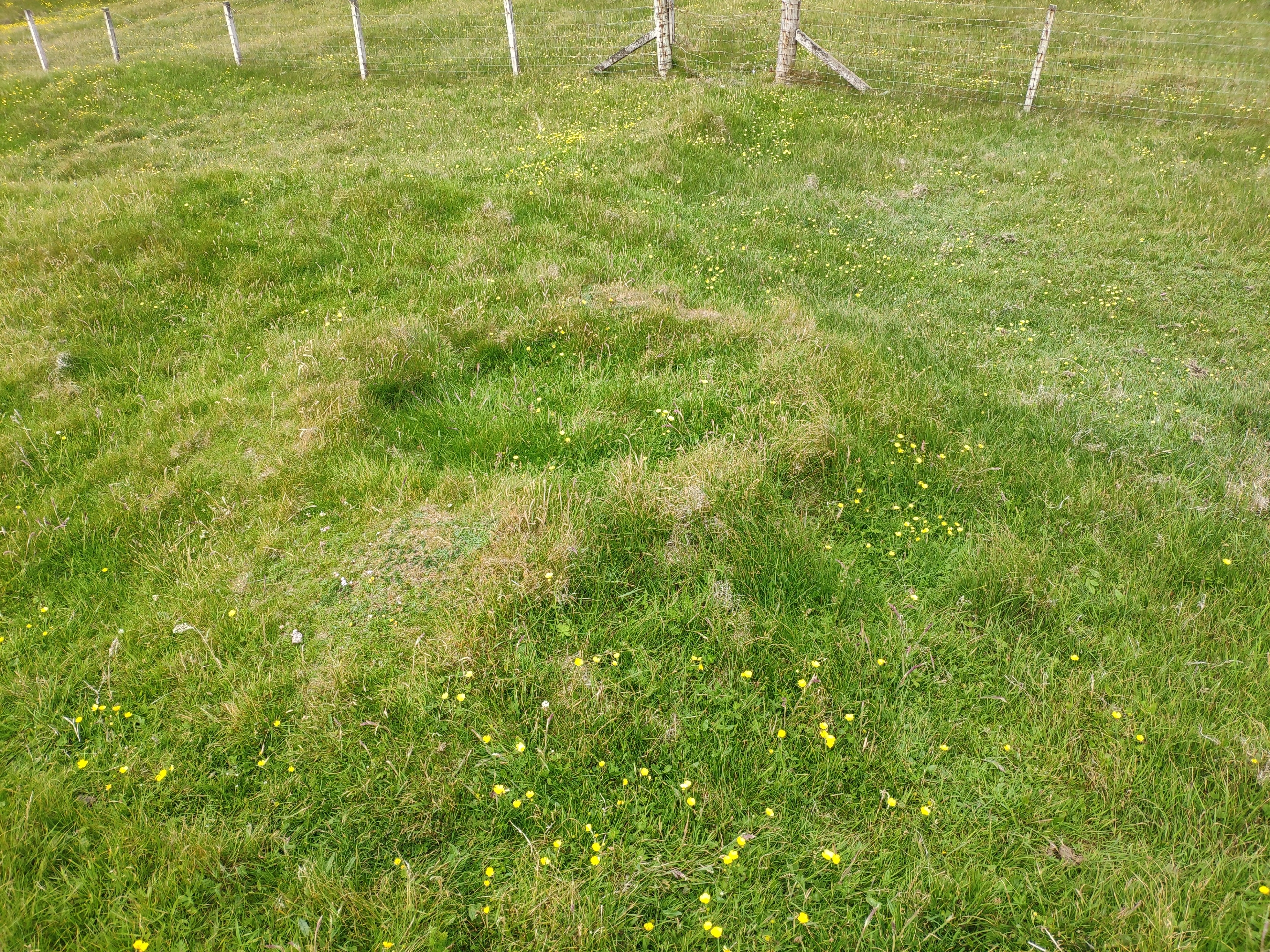
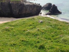
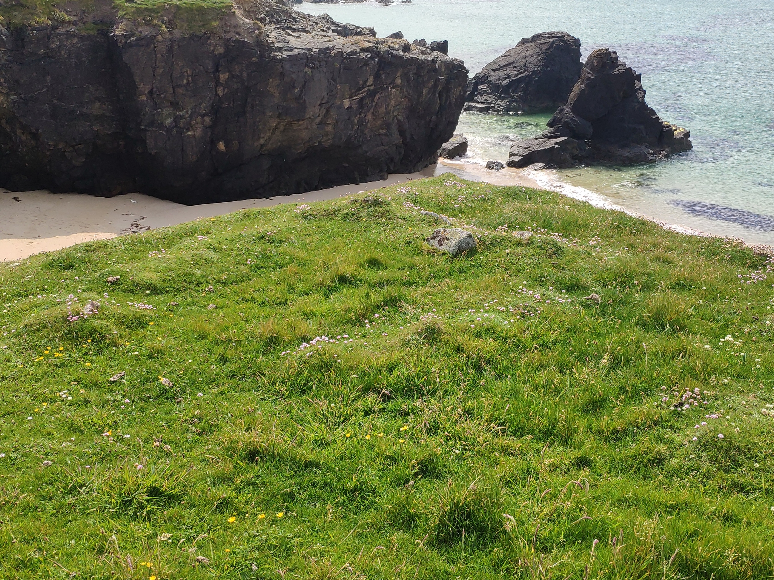
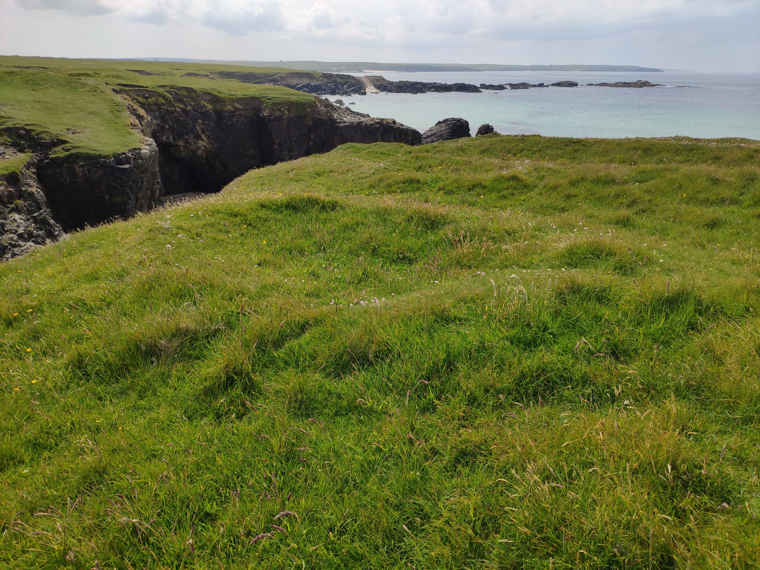
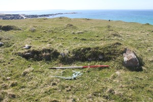
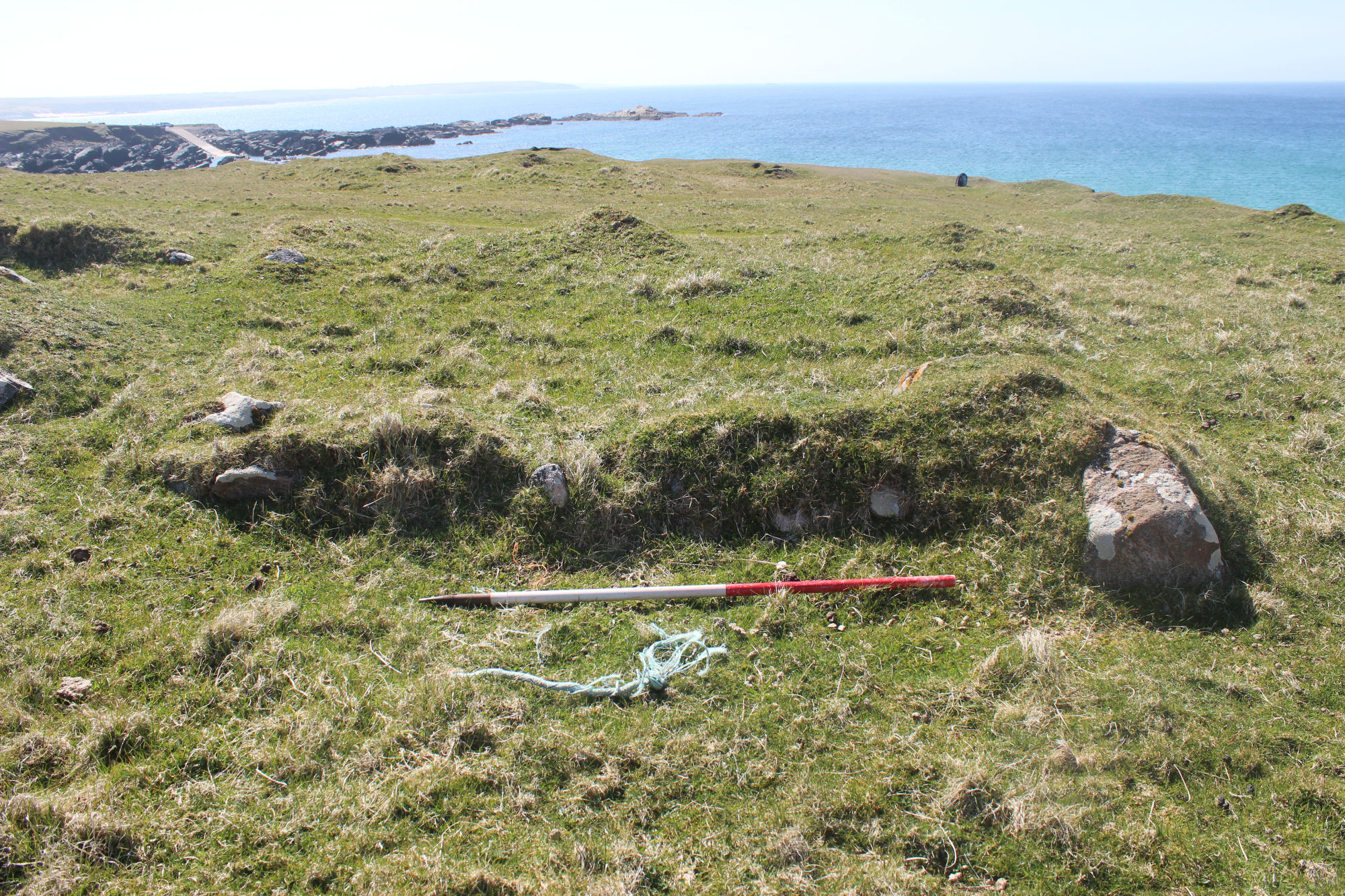
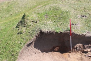
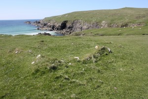
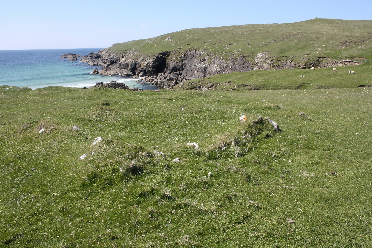
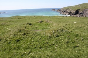
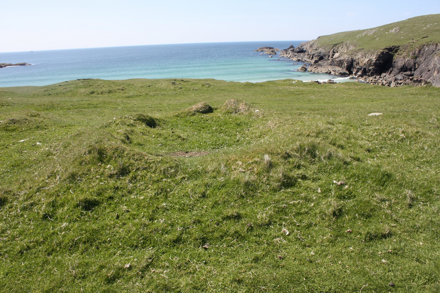
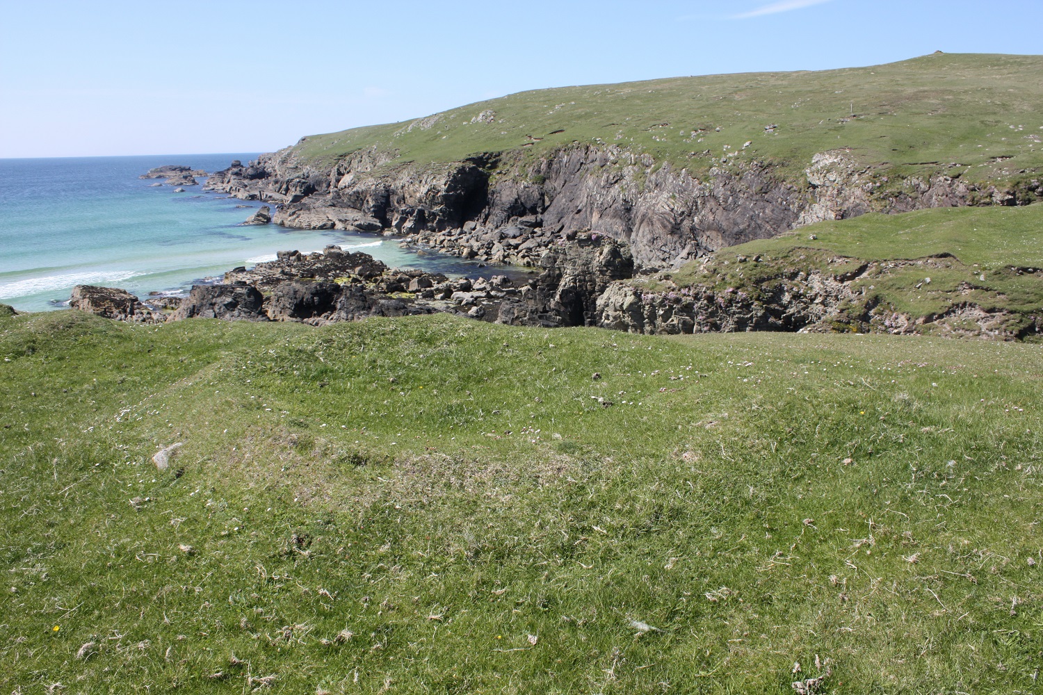
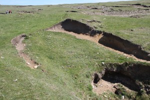
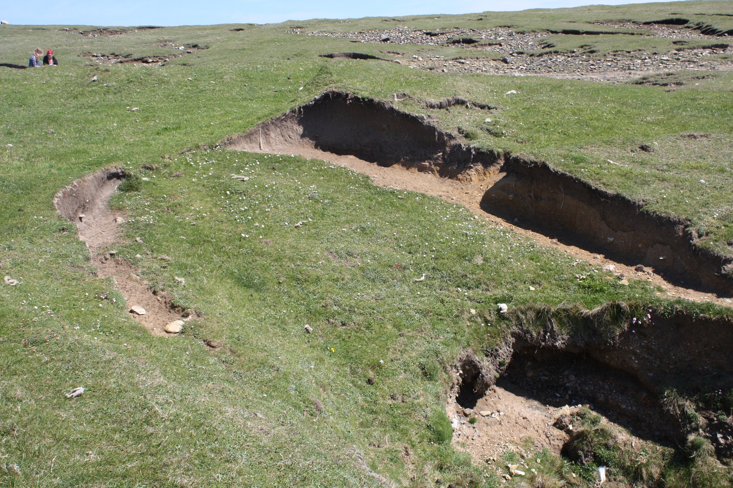
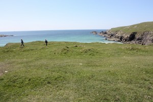
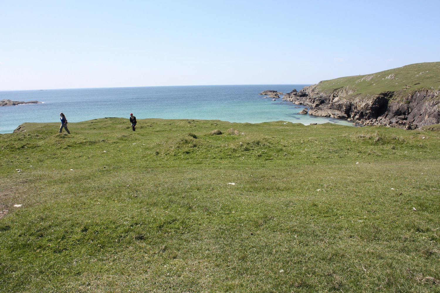
| The promontory has curving turf bank on its landward side, with a string of nine small conjoined hut buildings along its line, and four further huts inside the enclosure. The huts are oval or sub-rectangular, average 4.4m by 3.5m defined by banks 0.8m wide and 0.4m high. It has been suggested that the enclosure is prehistoric in date and the hut structures have been interpreted as sheilings of pre-clearance date. ShoreUPDATE June 2013 A series of at least 12 conjoined stone and turf small sub-circular to sub-rectangular earthworks curve across the neck of a promontory. Within the promontory area they define, there are at least 4 other clusters of earthworks, as well as 2-4 individuals. The enclosed area measures approximately 60m by 60m. Erosion scars were observed across the circular banks of one or two of the structures adjacent to the cliff edge. These small doughnut shaped earthworks have a rubble core and also occur singly and in pairs all along the cliff top in this part of Nis. They are described as sheilings, however, their location in prime agricultural land very close to settlement makes this interpretation problematical. They respect the feannagan (rig) and so may be contemporary with this period of cultivation. It has been suggested they are curing huts for fish drying. Local residents in Nis know a great deal about the inland sheilings in the area, but the origin and function of these structures is unknown. ShoreUPDATE May 2016 Cleaning of an eroded section through one of the structures on the coast edge revealed that some are wholly turf-built. This example was c.3m in diamter, c.0.7m high, buried soil horizon visible at the base of the section. However, stone walling is clearly visible in some of them, including in one of the most clearly-defined structures which form the enclosing northern boundary. |
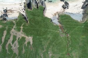
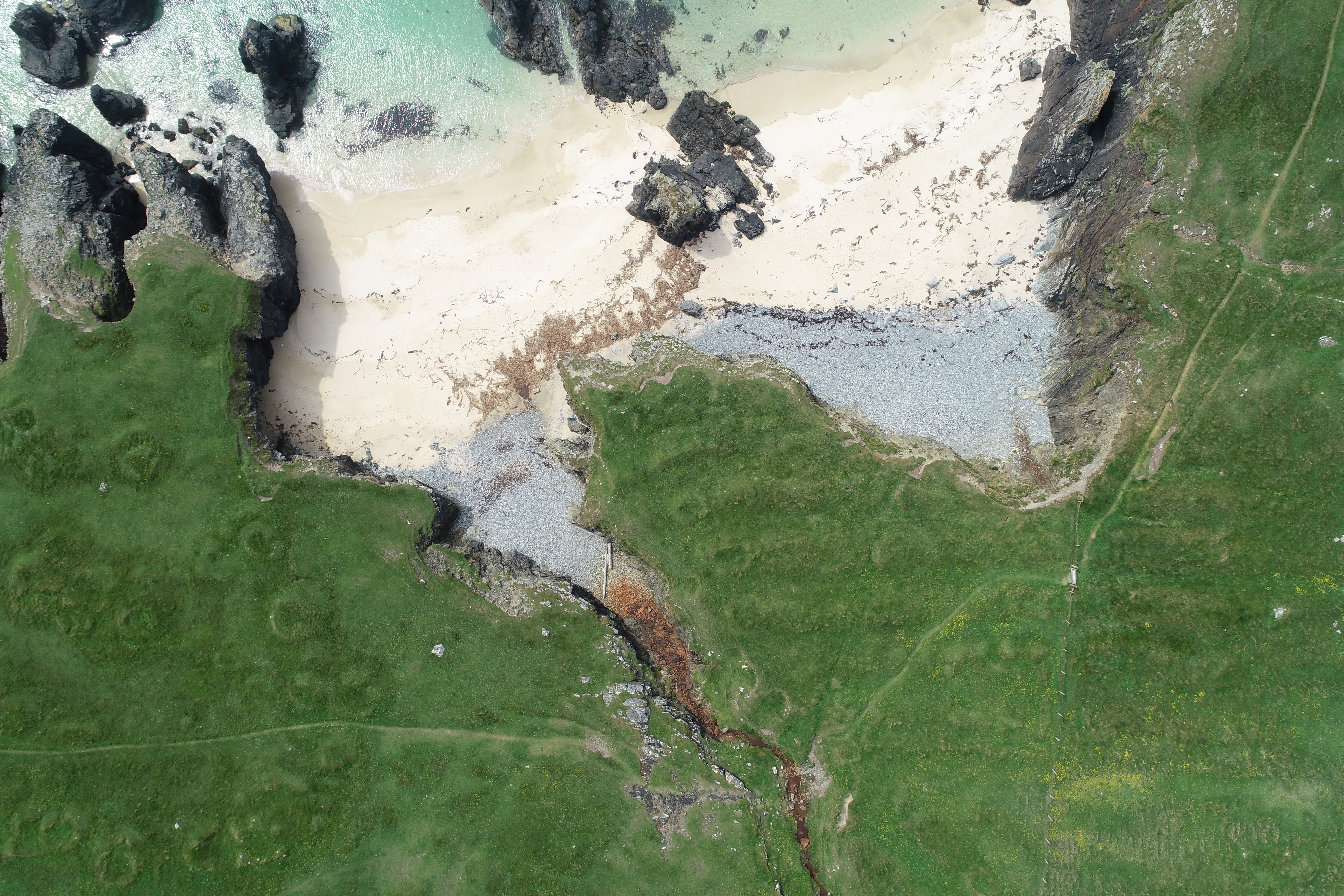
| UPDATE July 2021: Drone aerial photography and a further walkover has improved the description of this extensive earthwork site. Photographs 'Entire site annotated', 'Complex A'; 'Complex B'; and 'Complex C' should be viewed in conjunction with the following description. COMPLEX A As described previously. This group of cellular structures form a distinct complex on the promontory separate from the cultivation ridges (feannagan). At least 5 of the cellular structures have a stone element to them. Some appear to have two parts. COMPLEX B A c. 4m diameter drystone and turf squarish structure is located on the cliff edge. There is a possible opening in the east wall. A further linear wall, oriented east-west is located 9m to the north. The whole area is covered with prominent earthworks of feannagan orientated north-south. This respects the stone structures. At the south end of two of the feannagan ridges is a circular depression and bank. These appear to be distinct from the earthworks which contain stone. COMPLEX C Mound c. 6m diameter, 1-2m high with concave top adjacent to stream. Drystone structural elements visible in sides. A smaller, c. 3m 'doughnut' shaped turf mound located on the north side. |
Location
| 151230.00 | |
| 965640.00 | |
| 27700 | |
| 58.5076523 | |
| -6.2726216 |
Submitted photographs
| Image | Date | Caption | User |
|---|---|---|---|

|
01/08/2021 | Entire site annotated | joannahambly |
|
|||
|
01/08/2021 | Entire site - Complex A, B, C aerial view | joannahambly |

|
|||
|
01/08/2021 | Complex A aerial view | joannahambly |

|
|||
|
01/08/2021 | Complex C aerial view | joannahambly |

|
|||
|
01/08/2021 | Complex C: General view, prominent mound adjacent to stream in background, feannagan in foregound, looking east | joannahambly |
|
|||

|
01/08/2021 | Complex C: stone and turf mound with stream in foreground looking northwest | joannahambly |
|
|||

|
01/08/2021 | Complex C adjacent \'doughnut\' earthwork | joannahambly |
|
|||

|
01/08/2021 | Complex B aerial view | joannahambly |
|
|||
|
01/08/2021 | Complex B: Squarish stone structure on cliff edge, looking west | joannahambly |
|
|||
|
01/08/2021 | Complex B. Circular depression at end of feannagan. | joannahambly |
|
|||
|
15/06/2013 | Walling clearly visible in one structure of boundary | training1 |
|
|||
|
15/06/2013 | Eroded section through structure on coast edge | training1 |

|
|||
|
15/06/2013 | Detail of earthwork with stone elements | EllieSCHARP |
|
|||
|
15/06/2013 | Eoropie earthwork structures. | EllieSCHARP |
|
|||

|
15/06/2013 | Eoropie earthwork structure | EllieSCHARP |
|
|||
|
15/06/2013 | Eroding coast edge at site | EllieSCHARP |
|
|||
|
15/06/2013 | View of conjoined line of structures across promontory | EllieSCHARP |
|
|||
Submitted updates
No updates found