Caiplie, 'The Coves'
Alternative Names: Caiple Caves; Caplawchy
Type of Site: Hermitage; Pictish Wall Carvings
NMRS Number: NO50NE 6.00
Map reference: NO 5998 0583
Parish: Kilrenny
Council: Fife
Former District: North East Fife
Former Region: Fife
* Site Details
* Images on-line
* Collection Summary
* Digital Summary
Archaeology Notes
NO50NE 6.00 5998 0583
NO50NE 6.01 NO 5994 0581 Hermit's Well
(Name NO 5998 0584). The Coves (NAT)
OS 6" map, (1912-38)
The Coves - Two coves to the SE of Barnsmuir, on the sea shore, supposed to have been used by hermits or monks from the introduction of Christianity till the Reformation.
Original Name Book 1854
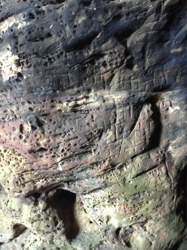
The Caves of Caiplie are situated in the parish of Kilrenny on the farm of Barnsmuir and have been formed by sea action.
One of the largest, called the Chapel Cave, measures 40ft from the entrance. It is irregular in shape and has been enlarged artificially. A wall closed it to the sea, but only the foundations remain. A pointed doorway on the S side opens into an outer narrow cave.
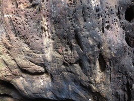
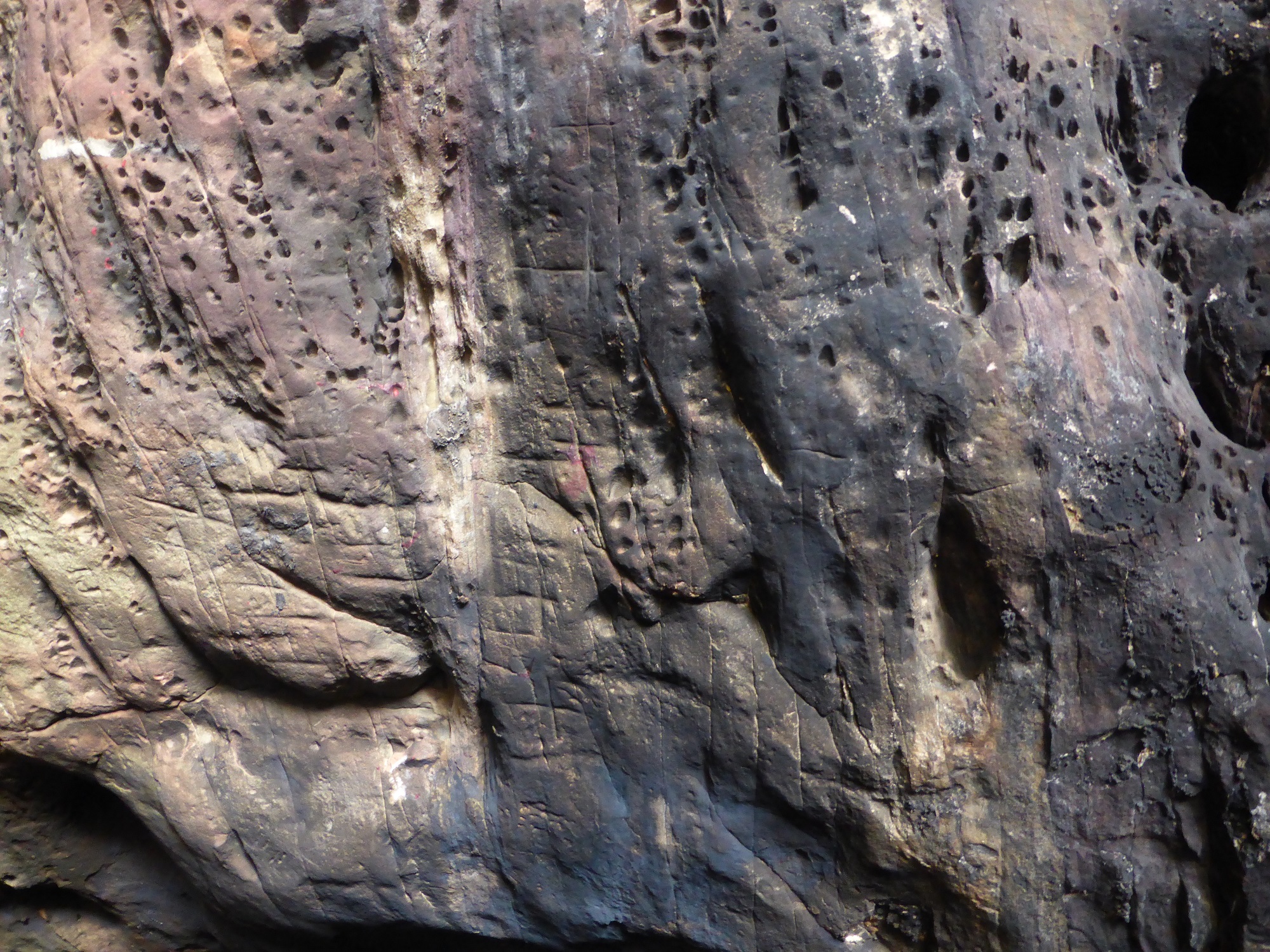
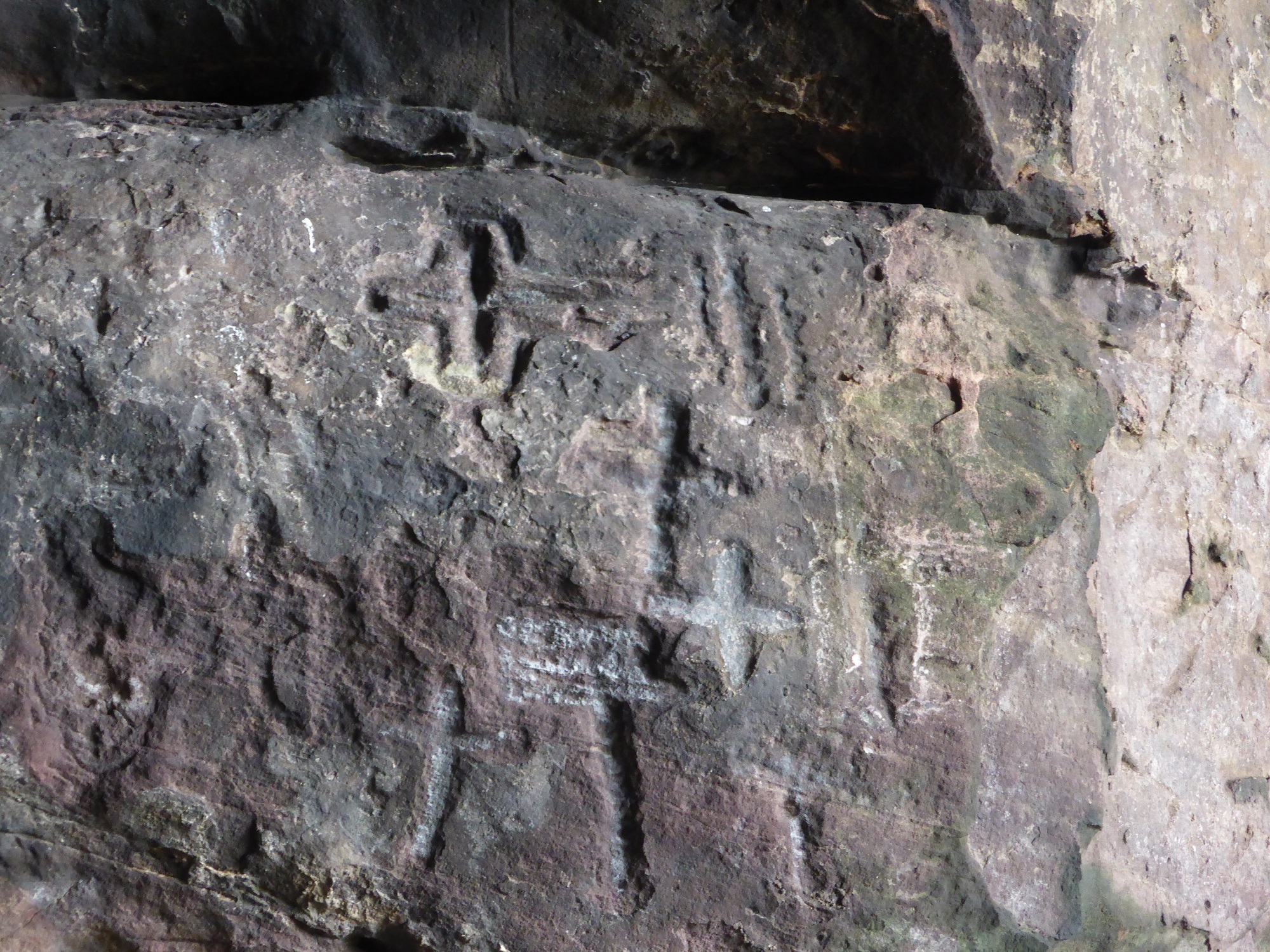
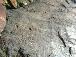
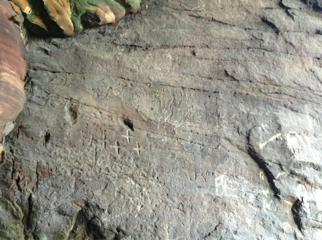
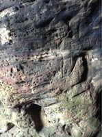
In various parts of the cave there are many small crosses on the walls, including a few modern ones, a cross of Greek form in a surrounding line, and many Latin crosses. Also in various parts of the cave, but especially in the narrow recess at the W end, holes have been cut in pairs in the rock to form "holdfasts" for passing ropes through.
About thirty six years ago, (c.1831) when Mr John Mackinlay surveyed the cave, it was more complete, in particular, a small chamber cut out of the rock above and arched over, and reached by steps cut out of the rock. This cell had later been used as a pigeon house.
In 1841, the flanking rock on the E side in front of the caves was found to be scooped out to form a niche or small grotto, with a seat in the inner end. The floor of the Chapel Cave was found to be clay, and outside the wall at its mouth was another and lower foundation, forming a terrace 4ft wide in front of the cave. The cave to the E was found
to be partly paved and partly levelled by rock. In front of this cave, human remains were found buried. Animal bones were found in front of and within the Chapel Cave.
The cave may be associated with the early preachers of the gospel. Traditionally, St Adrian founded a settlement on this part of the Fife coast about the middle of the 9th century. "Than Adriane wyth bys Cumpany "To gydder come to Caplawchy." (Wyntoun)
J Stuart 1867.
Information taken from Stuart. "There can be no doubt that Caiplie is the Caplawchy mentioned by Wyntoun as the place to which Adrian and his company came."
D H Fleming 1886.
Wace and Jehu date some crosses & animal representions on the walls of Constantine's Cave (NO61SW 6) to the Celtic Period, roughly AD800-1000, and then remark that at this time Constantine's Cave "was perhaps used as a chapel or hermitage, as apparently was the case with the caves at Caiplie, near Crail."
A V B Wace and Prof Jehu 1915.
Caiplie Cave. A natural cove artificially enlarged for use as a cell or dwelling place. The foundation of the wall at the mouth is slightly curved. The axis is NW-SE and most of the sculpturings are on the NE side.
RCAHMS 1933.
As previously described. The name "The Coves" is the only name applied to this site by the locals. The name "Chapel Cave" could not be confirmed.
Revised at 1/2500.
Visited by OS (WDJ) 26 August 1968.
There is a Z-rod in the Chapel Cave at Caiplie, but the symbol associated with it is illegible because of superimposed crosses. An arch symbol (or a crescent with circular indentation) has been carved near the far end of a small cave a little to the E.
RCAHMS 1985.
Cave used as byre for animals grazing coastal trip.
Site recorded by Maritime Fife during the Coastal Assessment Survey for Historic Scotland, Kincardine to Fife Ness 1996
References
Fleming, D H (1886 )
East Neuk of Fife,
33-5,
Guttmann, E (2002 )
'Time and tide at East Wemyss: excavations on the foreshore 1980-1995',
Tayside Fife Archaeol J, 8, 2002, Perth, 113, 122,
Jackson, A (1984 )
The symbol stones of Scotland: a social anthropological resolution to the problem of the Picts,
Kirkwall,
Murray, J E L (1963 )
'Rock-cut symbols in Caiplie Caves',
Proc Soc Antiq Scot, 94, 1960-1, 324-5,
Name Book (County) ( )
Original Name Books of the Ordnance Survey
Book No.20C, 43,
RCAHMS (1933 )
The Royal Commission on the Ancient and Historical Monuments and Constructions of Scotland. Eleventh report with inventory of monuments and constructions in the counties of Fife, Kinross, and Clackmannan
Edinburgh, 169-70, No.337,
Ritchie, J N G (1985 )
Pictish symbol stones: a handlist 1985,
Edinburgh, 5,
Simpson, J Y (1867 )
British Archaic Sculpturings,
173,
Stuart, J (1867 )
Sculptured Stones of Scotland,
2, Edinburgh, lxxxix-xc,
Thomas, C (1963 )
'The interpretation of the Pictish symbols',
Archaeol J, 120, 1963, 95,
Wace and Jehu, A J B and Professor (1915 )
'Cave excavations in East Fife',
Proc Soc Antiq Scot, 49, 1914-15, 242-4,
Wyntoun, A ( )
Orygynale Cronykil of Scotland, c.1350-1420
b VI C8,
Location
359980.00
705830.00
27700
56.2433052
-2.6473165
Submitted photographs
Image
Date
Caption
User
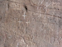
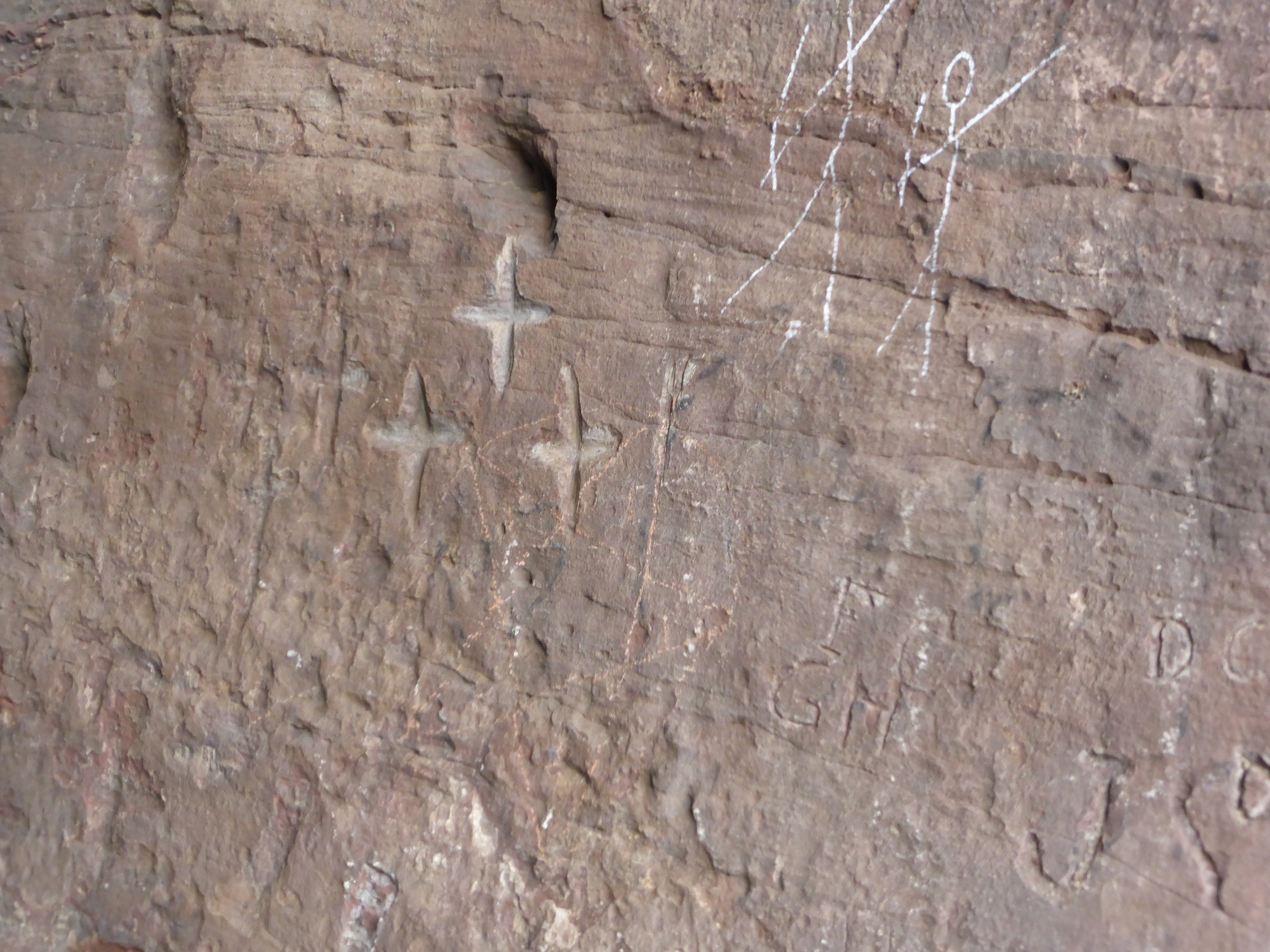
05/01/2014
Detail of numerous cross carvings, north wall towards rear of cave
training1
05/01/2014
Detail of cross carvings, north wall towards front of cave
training1
16/09/2013
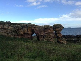
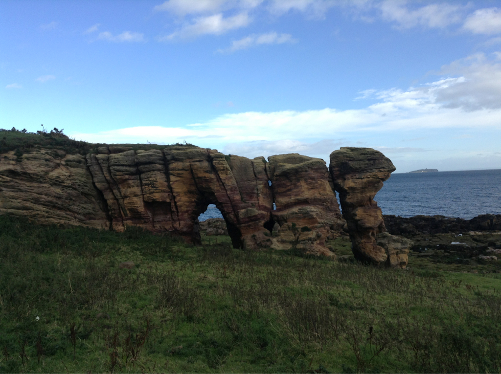
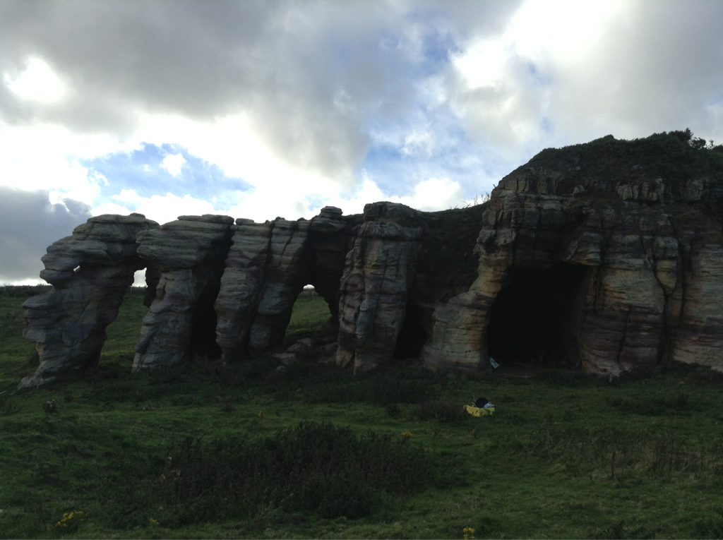
General view of Caves lookingeast northeast
joannahambly
16/09/2013
General view of Caiplie Caves looking west
joannahambly
16/09/2013
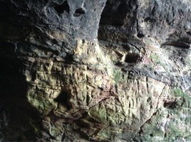
General view of main Caiplie Cave, looking northwest
joannahambly
16/09/2013
Detail of crosses on northeast face of main cave wall near the entrance
joannahambly
16/09/2013
Detail of crosses on northeast face of main cave wall near the entrance
joannahambly
16/09/2013
Detail of crosses on northeast face of main cave wall
joannahambly
05/01/2014
Detail of cross carvings and modern graffiti, middle of north cave wall
training1
Submitted updates
Update id
Date
User
1295
16/09/2013
training1
Tidal state
Low
Site located?
Yes
Proximity to coast edge
< 10m
Coastally eroding?
has eroded in the past
Threats
stock erosion; visitor erosion
Visibility above ground
Highly visible (substantial remains)
Access
easily accessible - no restrictions; accessible on foot (no footpath)
Local knowledge
is well known; is well visited; has local associations/history
Description
Caiplie, 'The Coves'
Alternative Names: Caiple Caves; Caplawchy
Type of Site: Hermitage; Pictish Wall Carvings
NMRS Number: NO50NE 6.00
Map reference: NO 5998 0583
Parish: Kilrenny
Council: Fife
Former District: North East Fife
Former Region: Fife
* Site Details
* Images on-line
* Collection Summary
* Digital Summary
Archaeology Notes
NO50NE 6.00 5998 0583
NO50NE 6.01 NO 5994 0581 Hermit's Well
(Name NO 5998 0584). The Coves (NAT)
OS 6" map, (1912-38)
The Coves - Two coves to the SE of Barnsmuir, on the sea shore, supposed to have been used by hermits or monks from the introduction of Christianity till the Reformation.
Original Name Book 1854
The Caves of Caiplie are situated in the parish of Kilrenny on the farm of Barnsmuir and have been formed by sea action.
One of the largest, called the Chapel Cave, measures 40ft from the entrance. It is irregular in shape and has been enlarged artificially. A wall closed it to the sea, but only the foundations remain. A pointed doorway on the S side opens into an outer narrow cave.
In various parts of the cave there are many small crosses on the walls, including a few modern ones, a cross of Greek form in a surrounding line, and many Latin crosses. Also in various parts of the cave, but especially in the narrow recess at the W end, holes have been cut in pairs in the rock to form "holdfasts" for passing ropes through.
About thirty six years ago, (c.1831) when Mr John Mackinlay surveyed the cave, it was more complete, in particular, a small chamber cut out of the rock above and arched over, and reached by steps cut out of the rock. This cell had later been used as a pigeon house.
In 1841, the flanking rock on the E side in front of the caves was found to be scooped out to form a niche or small grotto, with a seat in the inner end. The floor of the Chapel Cave was found to be clay, and outside the wall at its mouth was another and lower foundation, forming a terrace 4ft wide in front of the cave. The cave to the E was found
to be partly paved and partly levelled by rock. In front of this cave, human remains were found buried. Animal bones were found in front of and within the Chapel Cave.
The cave may be associated with the early preachers of the gospel. Traditionally, St Adrian founded a settlement on this part of the Fife coast about the middle of the 9th century. "Than Adriane wyth bys Cumpany "To gydder come to Caplawchy." (Wyntoun)
J Stuart 1867.
Information taken from Stuart. "There can be no doubt that Caiplie is the Caplawchy mentioned by Wyntoun as the place to which Adrian and his company came."
D H Fleming 1886.
Wace and Jehu date some crosses & animal representions on the walls of Constantine's Cave (NO61SW 6) to the Celtic Period, roughly AD800-1000, and then remark that at this time Constantine's Cave "was perhaps used as a chapel or hermitage, as apparently was the case with the caves at Caiplie, near Crail."
A V B Wace and Prof Jehu 1915.
Caiplie Cave. A natural cove artificially enlarged for use as a cell or dwelling place. The foundation of the wall at the mouth is slightly curved. The axis is NW-SE and most of the sculpturings are on the NE side.
RCAHMS 1933.
As previously described. The name "The Coves" is the only name applied to this site by the locals. The name "Chapel Cave" could not be confirmed.
Revised at 1/2500.
Visited by OS (WDJ) 26 August 1968.
There is a Z-rod in the Chapel Cave at Caiplie, but the symbol associated with it is illegible because of superimposed crosses. An arch symbol (or a crescent with circular indentation) has been carved near the far end of a small cave a little to the E.
RCAHMS 1985.
Cave used as byre for animals grazing coastal trip.
Site recorded by Maritime Fife during the Coastal Assessment Survey for Historic Scotland, Kincardine to Fife Ness 1996
References
Fleming, D H (1886 )
East Neuk of Fife,
33-5,
Guttmann, E (2002 )
'Time and tide at East Wemyss: excavations on the foreshore 1980-1995',
Tayside Fife Archaeol J, 8, 2002, Perth, 113, 122,
Jackson, A (1984 )
The symbol stones of Scotland: a social anthropological resolution to the problem of the Picts,
Kirkwall,
Murray, J E L (1963 )
'Rock-cut symbols in Caiplie Caves',
Proc Soc Antiq Scot, 94, 1960-1, 324-5,
Name Book (County) ( )
Original Name Books of the Ordnance Survey
Book No.20C, 43,
RCAHMS (1933 )
The Royal Commission on the Ancient and Historical Monuments and Constructions of Scotland. Eleventh report with inventory of monuments and constructions in the counties of Fife, Kinross, and Clackmannan
Edinburgh, 169-70, No.337,
Ritchie, J N G (1985 )
Pictish symbol stones: a handlist 1985,
Edinburgh, 5,
Simpson, J Y (1867 )
British Archaic Sculpturings,
173,
Stuart, J (1867 )
Sculptured Stones of Scotland,
2, Edinburgh, lxxxix-xc,
Thomas, C (1963 )
'The interpretation of the Pictish symbols',
Archaeol J, 120, 1963, 95,
Wace and Jehu, A J B and Professor (1915 )
'Cave excavations in East Fife',
Proc Soc Antiq Scot, 49, 1914-15, 242-4,
Wyntoun, A ( )
Orygynale Cronykil of Scotland, c.1350-1420
b VI C8,
The cross carvings were recorded in 1867 and are extremely vulnerable to damage and decay of the soft sandstone. A modern photographic survey and if possible laser scan survey would preserve them by record.