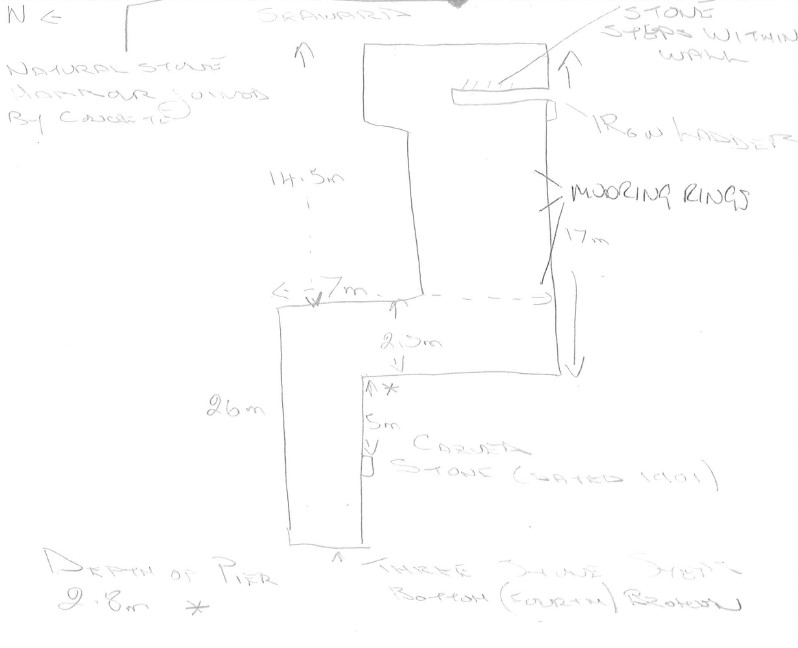
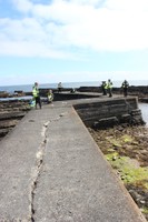
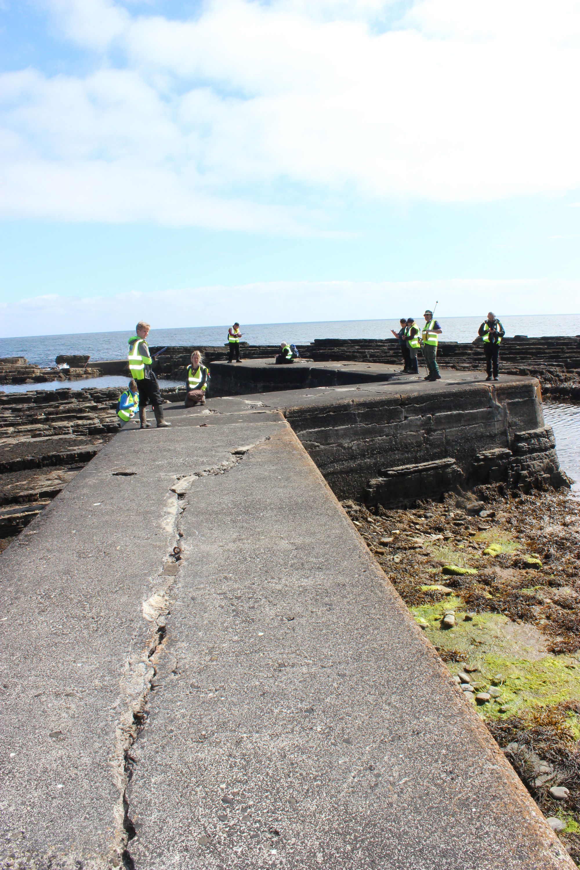
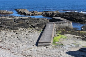
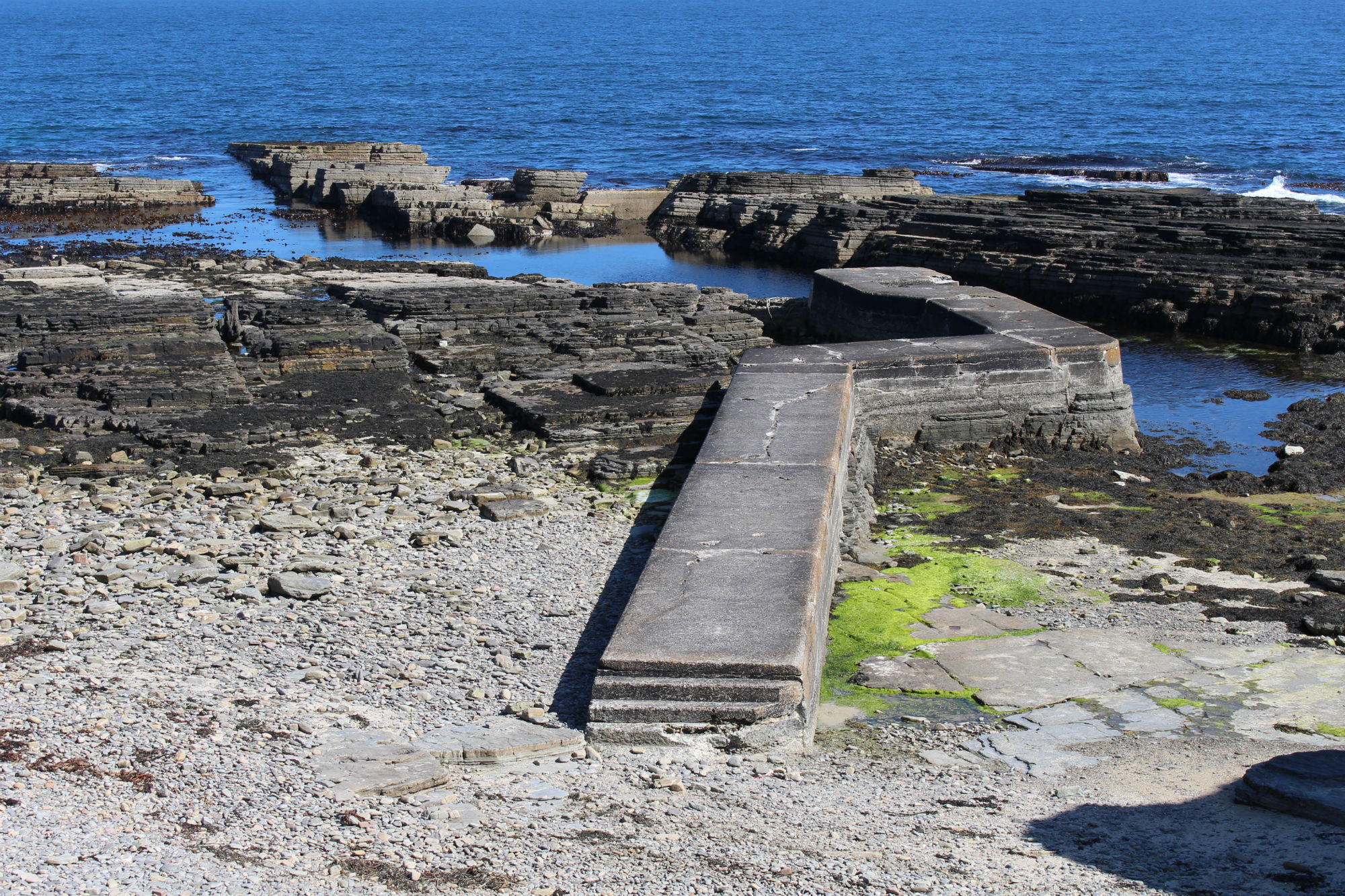
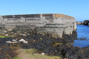
Auckengill harbour pier, dog-leg shape in plan, c.40m in length, 2.5m wide and standing up to 2.8m in height. See plan for detailed dimensions. Concrete, built onto natural bedrock outcrop.
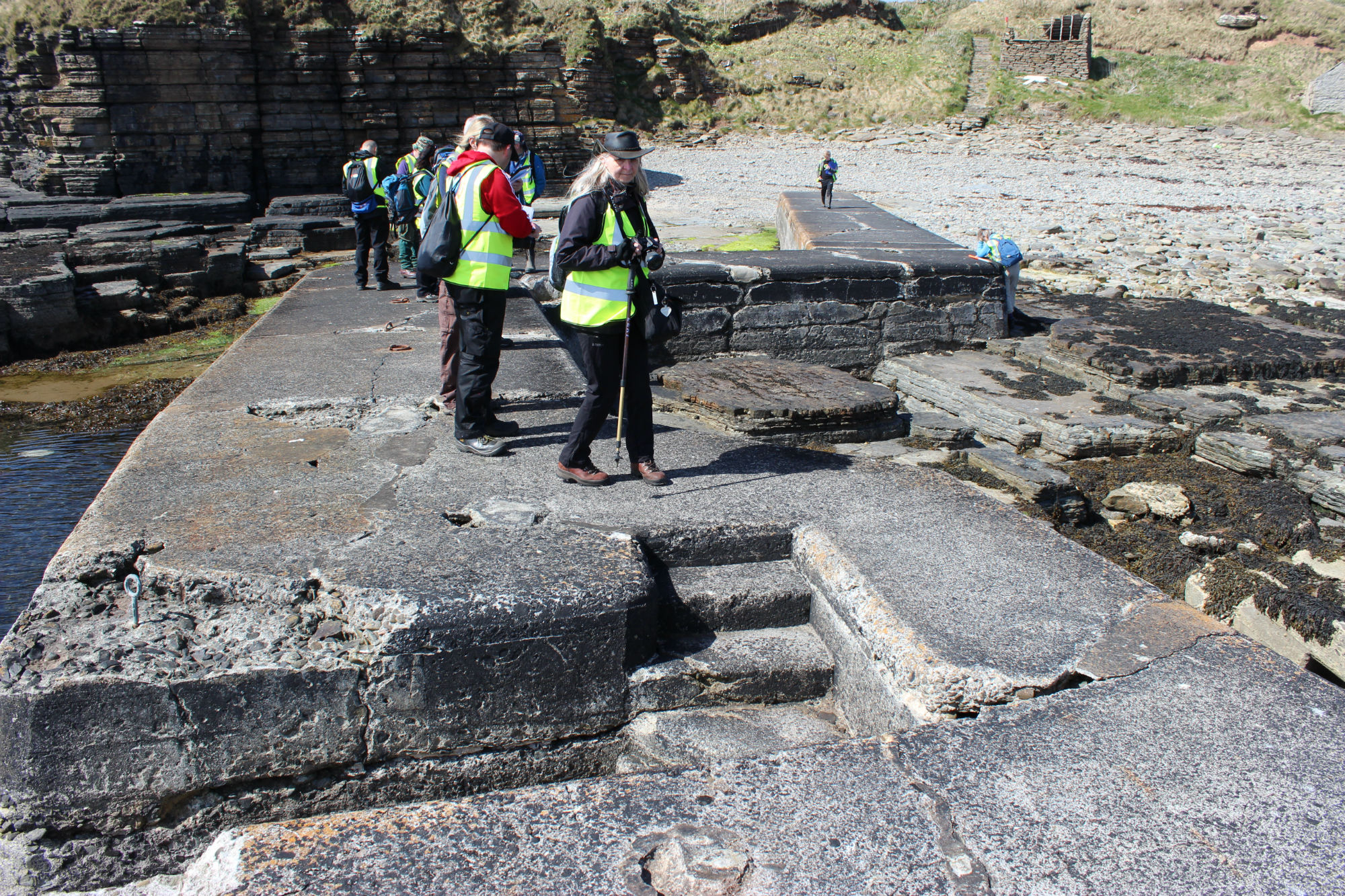
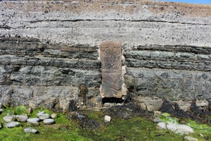
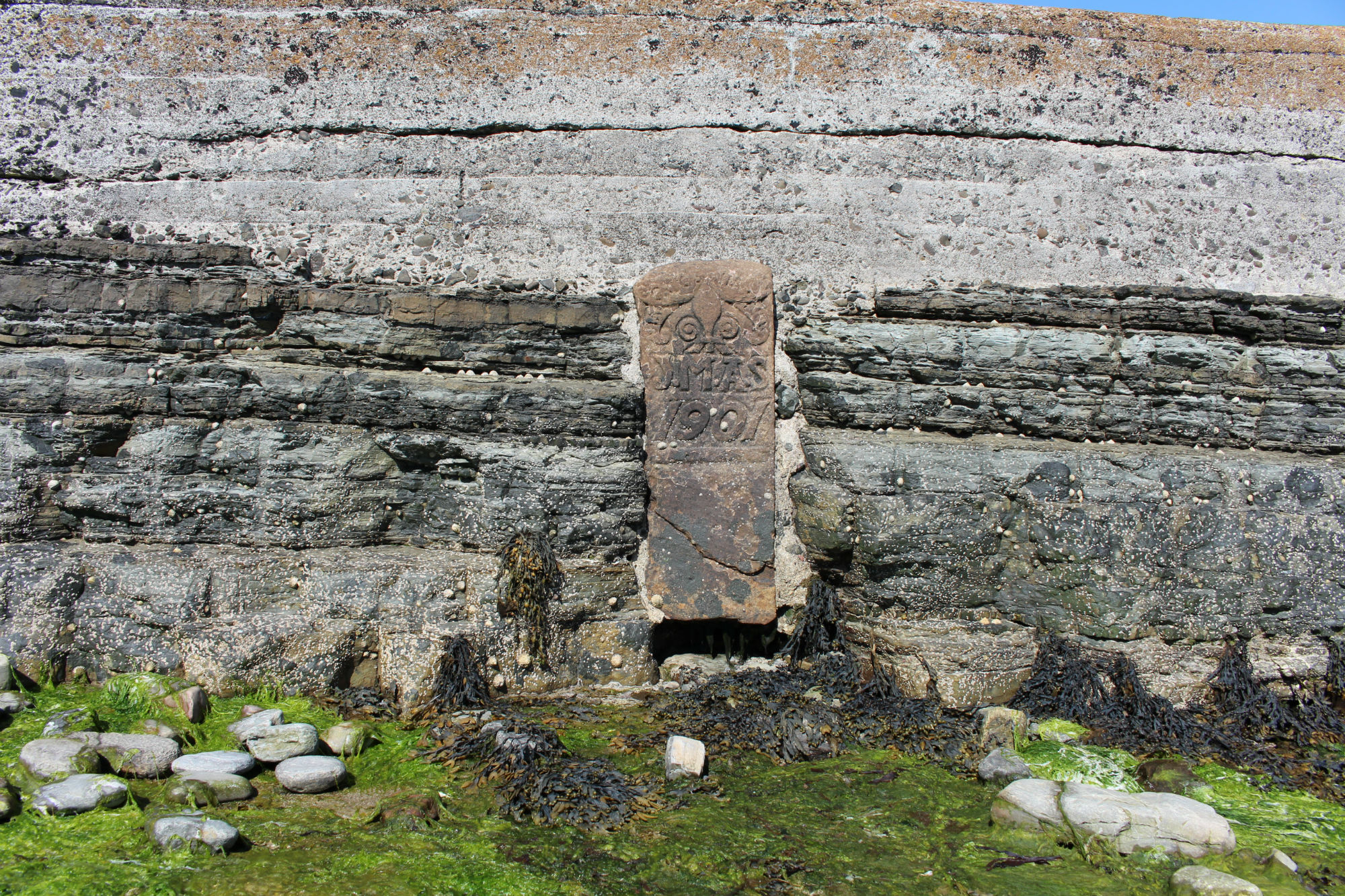
Stone steps and an iron ladder set into the seaward end of the pier, iron mooring rings set into top, and an anchor-holding cut into the natural stone at the end of the pier. Flight of steps at landward end gives access to top from the beach. A carved stone slab with the initials JMAS and the date 1901 is set into the south face of the pier, in a similar style to the Nicolson monuments in the immediate vicinity.
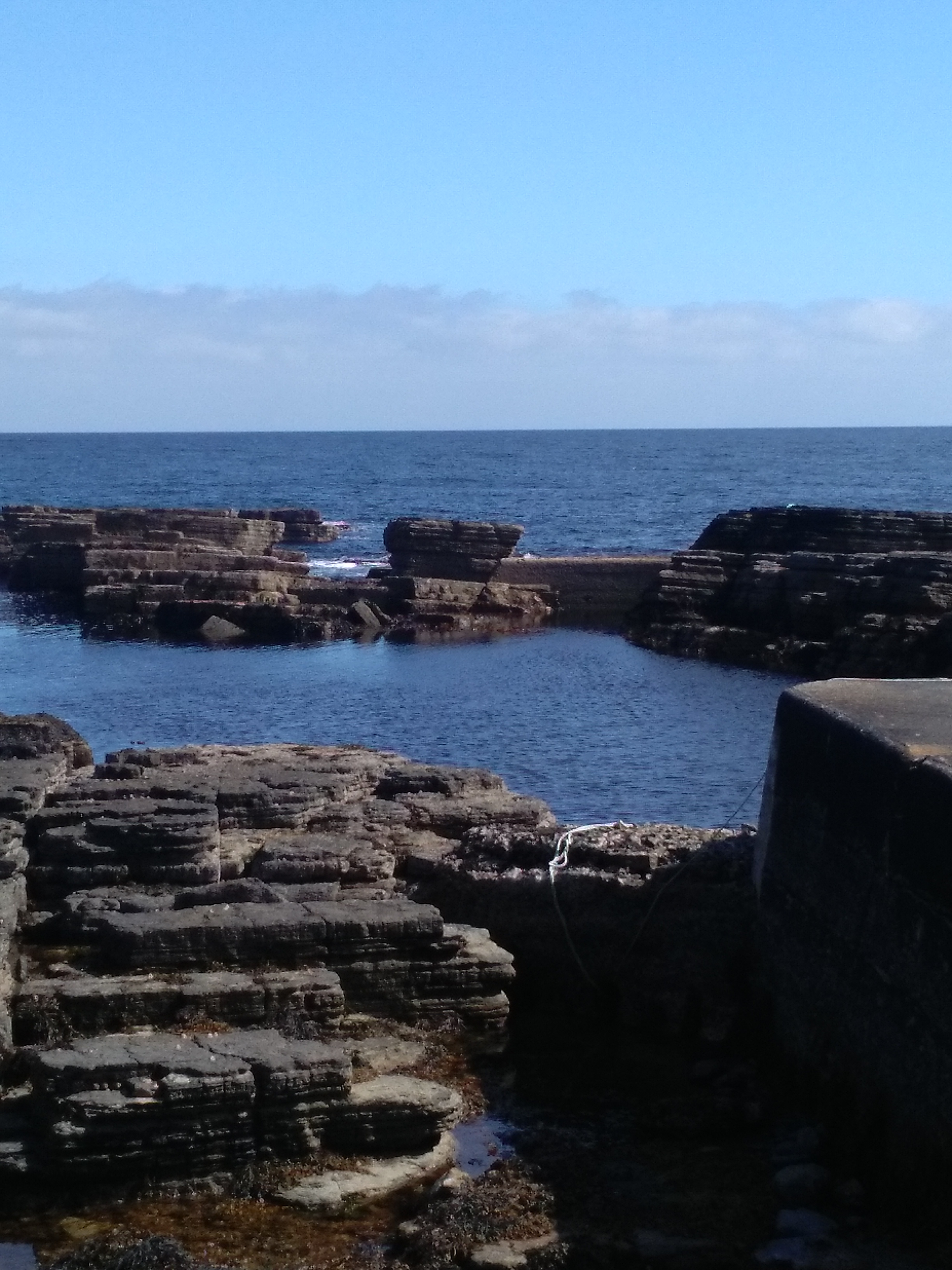
Situated to take advantage of the foreshore topography, on a higher bedrock skerry adjacent to a deeper channel (which may have been enhanced or cleared) which formed a good natural harbour, with deeper water on south side and a shallower basin on the north side. A low concrete wall forms a spur joining the seaward end of the pier to a bedrock outcrop to the north, enclosing the basin on the north side of the pier. This fills with water at high tide, but drains at low tide, possibly for dry dock activities or to form a sheltered mooring, but only suitable for very shallow-drafted boats. A short concrete wall joins two spurs of bedrock offshore of the pier, presumably to form a breakwater.
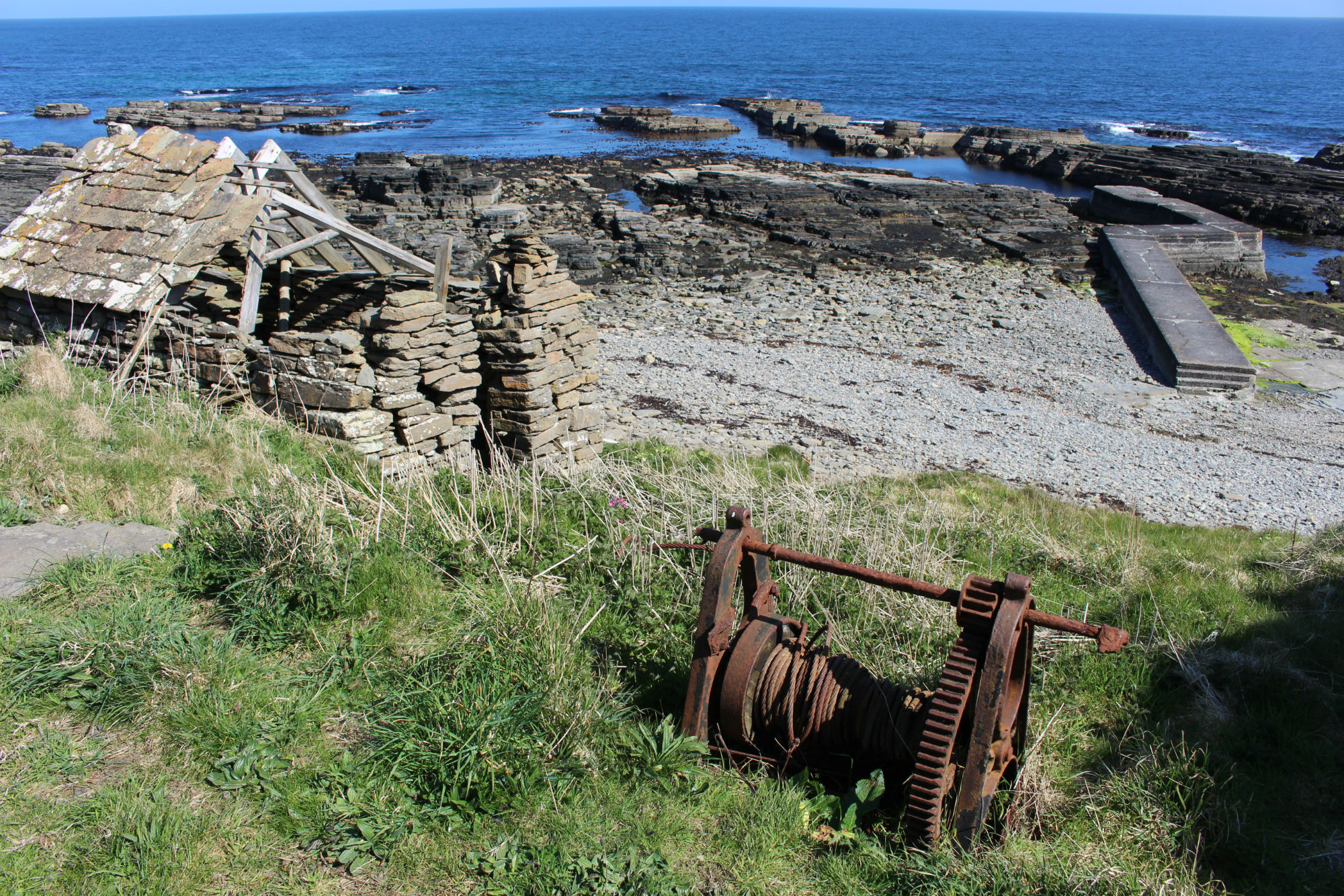
Forms part of a complex with two huts (13497, 13498), steps giving access to the shore from above, and a boat winch next to the steps.
The harbour appears to have been dredged in the past, but would still be difficult to access by boat.
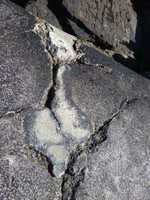
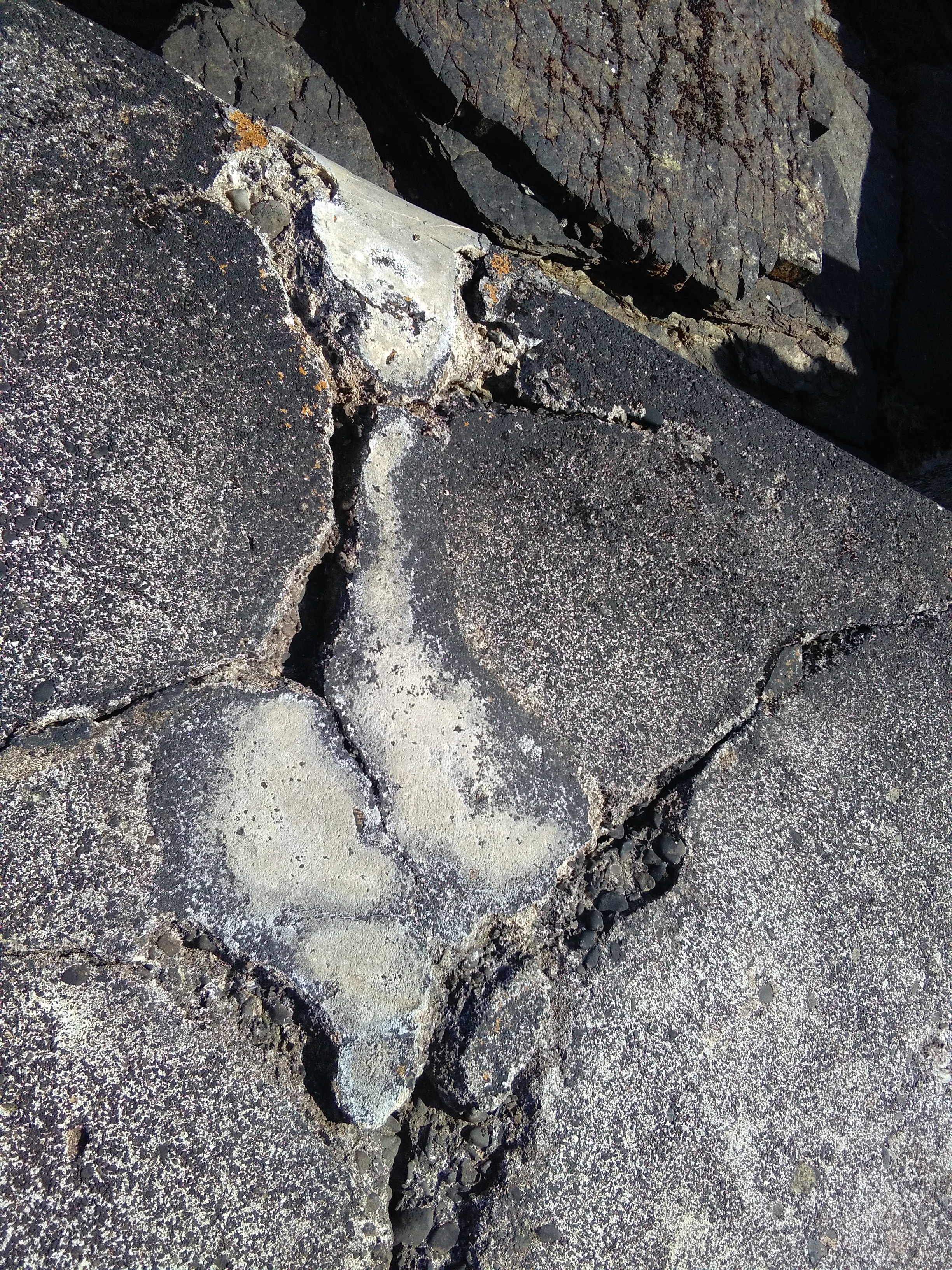
The concrete forming the surface and sides of the pier is cracked and deteriorating.
Not shown on the 1st edition OS map, but depicted on the 2nd edition.
Location
337109.00
963452.00
27700
58.5545654
-3.0824475
Submitted photographs
Image
Date
Caption
User
05/05/2017
Sketch plan of Auckengill Harbour pier
CaithnessCZAS
05/05/2017
Deterioration and cracking of concrete surface
CaithnessCZAS
05/05/2017
Steps set into pier head, and mooring rings on top
CaithnessCZAS
05/05/2017
Plan view of pier, with concrete wall joining bedrock to east
CaithnessCZAS
05/05/2017
Face of pier showing concrete structure built onto bedrock
CaithnessCZAS
05/05/2017
Pier from coast edge, showing southern hut, steps and winch
CaithnessCZAS
05/05/2017
Short stretch of concrete wall blocking gap in bedrock
CaithnessCZAS
05/05/2017
Damage to concrete on surface of pier
CaithnessCZAS
05/05/2017
Carved stone set into south face of pier
CaithnessCZAS
Submitted updates
Update id
Date
User
2946
05/05/2017
CaithnessCZAS
Tidal state
Mid
Site located?
Yes
Proximity to coast edge
Intertidal
Coastally eroding?
active sea erosion; has eroded in the past
Coastal defence
Yes
Threats
structural damage/decay
Visibility above ground
Highly visible (substantial remains)
Visibility in section
Clearly visible in section
Access
easily accessible - no restrictions
Local knowledge
has local associations/history
Description
Auckengill harbour pier, dog-leg shape in plan, c.40m in length, 2.5m wide and standing up to 2.8m in height. See plan for detailed dimensions. Concrete, built onto natural bedrock outcrop.
Stone steps and an iron ladder set into the seaward end of the pier, iron mooring rings set into top, and an anchor-holding cut into the natural stone at the end of the pier. Flight of steps at landward end gives access to top from the beach. A carved stone slab with the initials JMAS and the date 1901 is set into the south face of the pier, in a similar style to the Nicolson monuments in the immediate vicinity.
Situated to take advantage of the foreshore topography, on a higher bedrock skerry adjacent to a deeper channel (which may have been enhanced or cleared) which formed a good natural harbour, with deeper water on south side and a shallower basin on the north side. A low concrete wall forms a spur joining the seaward end of the pier to a bedrock outcrop to the north, enclosing the basin on the north side of the pier. This fills with water at high tide, but drains at low tide, possibly for dry dock activities or to form a sheltered mooring, but only suitable for very shallow-drafted boats. A short concrete wall joins two spurs of bedrock offshore of the pier, presumably to form a breakwater.
Forms part of a complex with two huts (13497, 13498), steps giving access to the shore from above, and a boat winch next to the steps.
The harbour appears to have been dredged in the past, but would still be difficult to access by boat.
The concrete forming the surface and sides of the pier is cracked and deteriorating.
Not shown on the 1st edition OS map, but depicted on the 2nd edition.
Further research on the name commemorated on the stone inset.