Hut, Summer Bank, Nybster Broch (south) (13497)
Condition
| 6 | |
| Hut | |
| Post-Medieval | |
| MHG56557 | |
| Highland |
Description
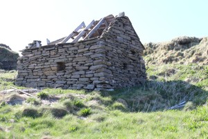
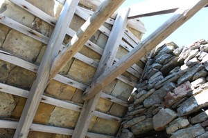
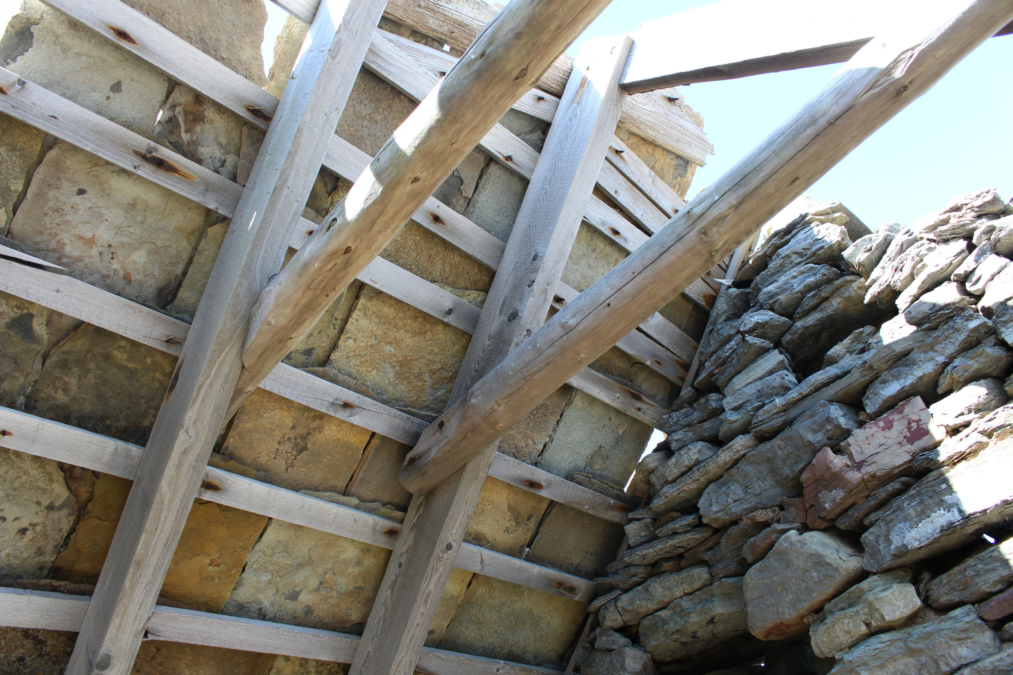
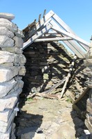
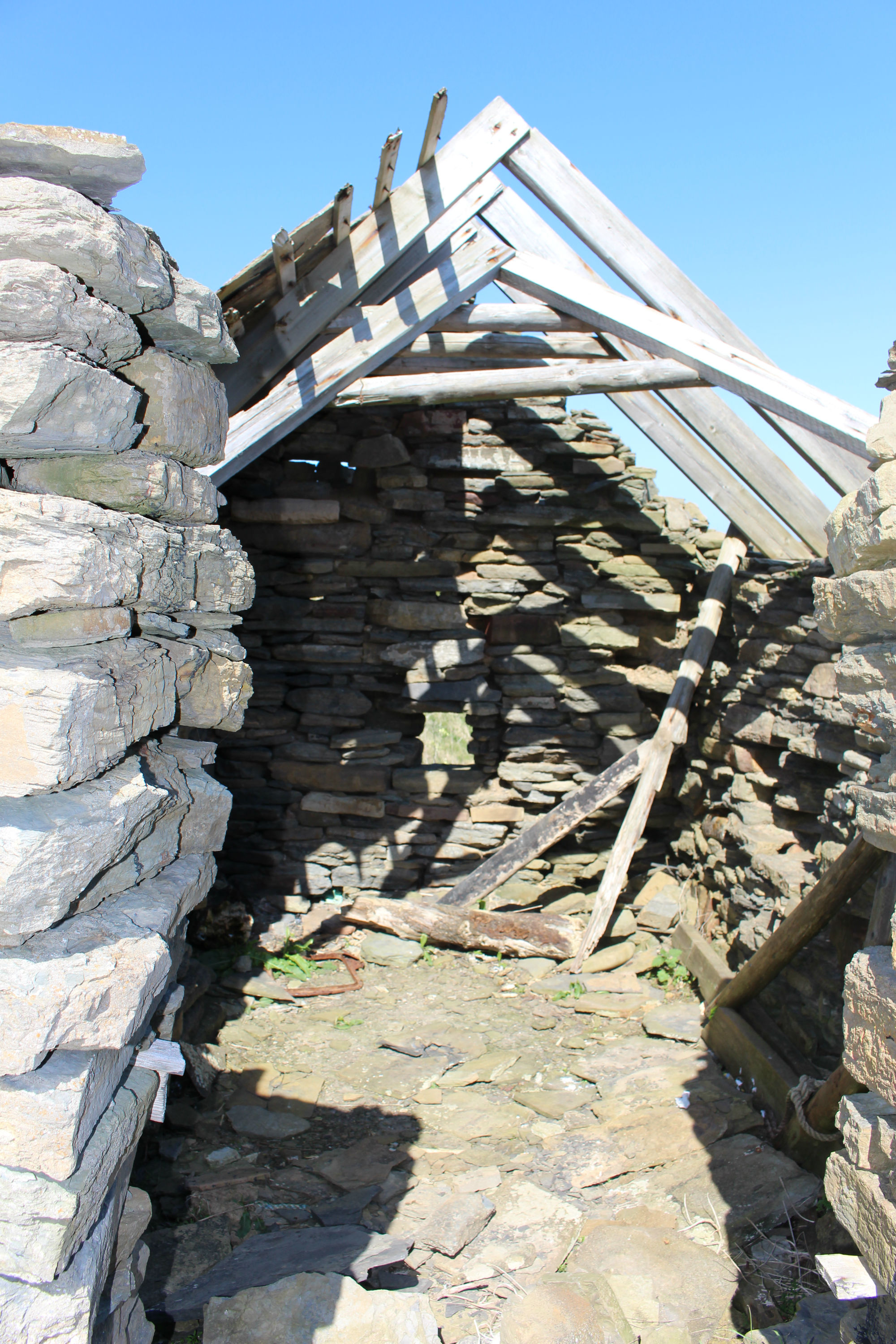
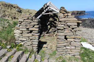
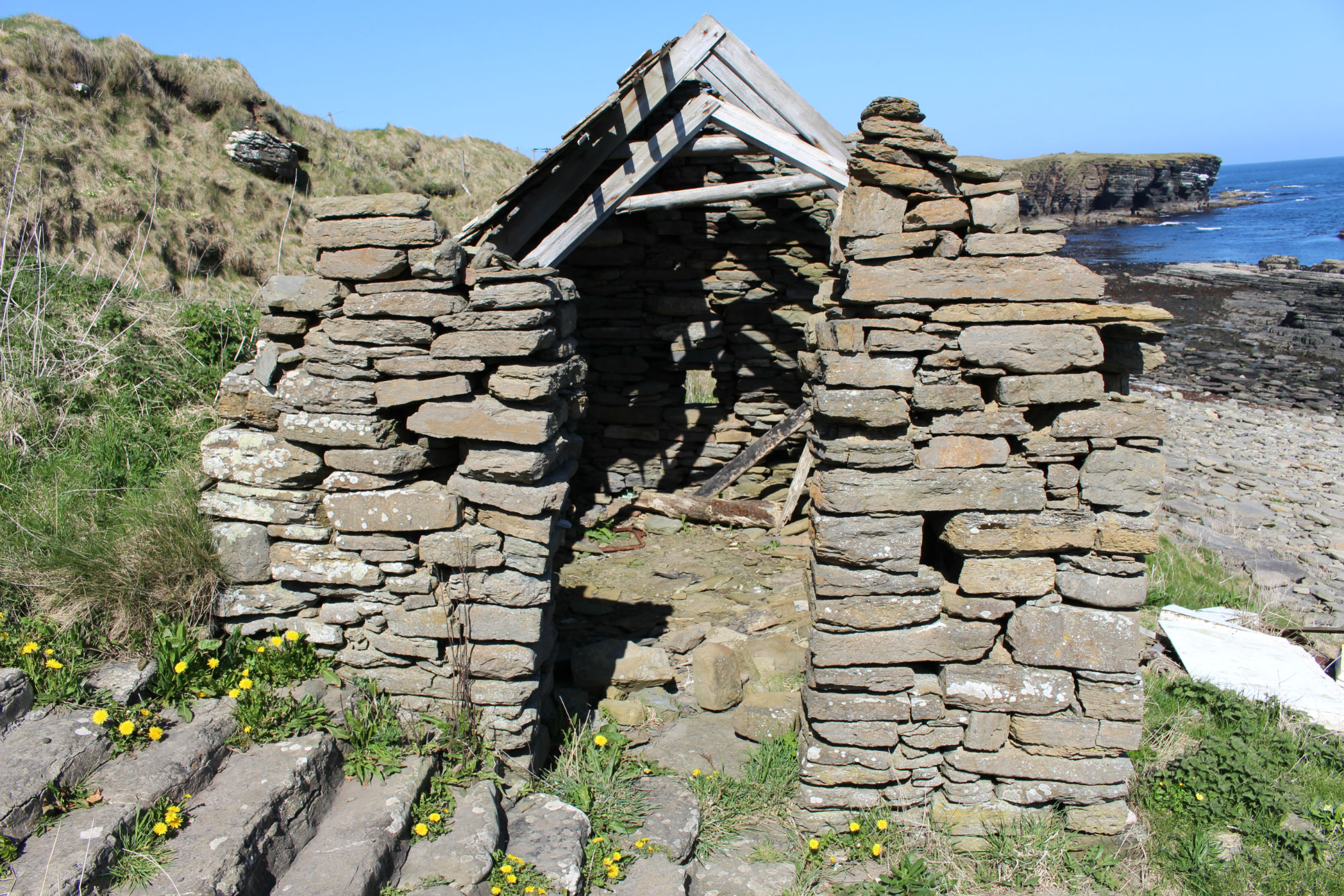
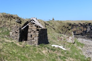
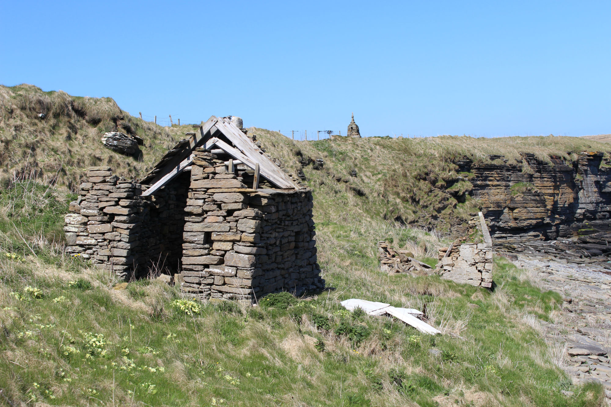
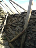
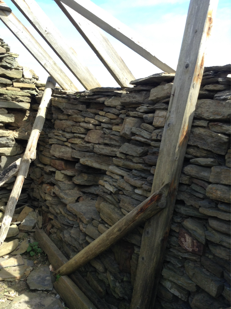
| Located on the shoreline, below and east of the car park for access to the Broch of Nybster, are two ruined buildings. One appears on the 1st edition OS Map and so dates to, at latest, 1872. The other appears on the 2nd edition OS Map and so dates to, at latest, 1906. A long stone staircase has been constructed down the steep embankment to allow access to the buildings. This staircase appears on the 2nd edition OS Map and so dates to, at latest, 1906, as well. This record refers to the southern of the two buildings, which is depicted on the 1st edition OS map. ShoreUPDATE 07/05/2017 The building is built adjacent to and onto the stone staircase. Some of the stonework appears to have been robbed from other sites, including a worked stone lintel and monumental style red sandstone blocks. Slate roof stones are lying at floor level with some wooden roof timbers still in situ. The building is dry stone built with minimal or no mortar and has at least two small window style openings, one to seaward and one to northward. The walls are about 0.5m wide and substantial but are in danger of falling, a later rebuild has helped shore up earlier work. |
Location
| 337052.00 | |
| 963479.00 | |
| 27700 | |
| 58.5547981 | |
| -3.0834343 |
Submitted photographs
| Image | Date | Caption | User |
|---|---|---|---|
|
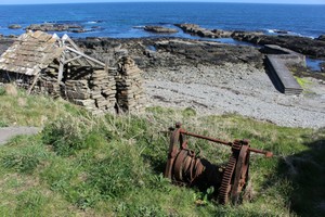
07/05/2017 | General view of south hut, steps, pier and winch | CaithnessCZAS |

|
|||
|
07/05/2017 | Seaward side of hut showing east and north elevations | CaithnessCZAS |

|
|||
|
07/05/2017 | South hut internal roof structure | CaithnessCZAS |
|
|||
|
07/05/2017 | South hut showing partially collapsed roof | CaithnessCZAS |
|
|||
|
07/05/2017 | South hut, south-facing elevation | CaithnessCZAS |
|
|||
|
07/05/2017 | South hut | CaithnessCZAS |
|
|||
|
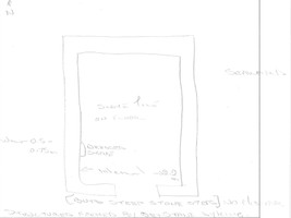
07/05/2017 | Sketch plan of hut | CaithnessCZAS |

|
|||

|
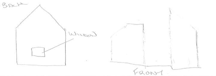
07/05/2017 | Sketch elevations of front and back of hut | CaithnessCZAS |
|
|||
|
07/05/2017 | Interior showing roof timbers | training1 |
|
|||
Submitted updates
| Update id | Date | User | ||||||||||||||||||
|---|---|---|---|---|---|---|---|---|---|---|---|---|---|---|---|---|---|---|---|---|
| 2948 | 07/05/2017 | CaithnessCZAS | ||||||||||||||||||
|
||||||||||||||||||||