Stone buildings visible in the eroding section.
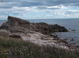
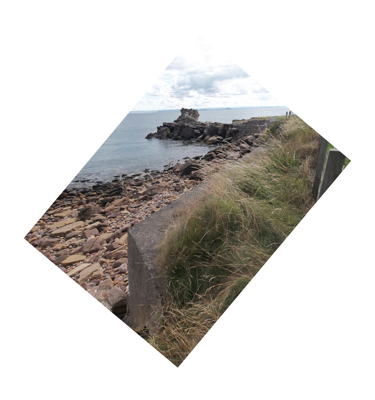
4 Aug 2013 - There are no buildings visible-- at least, none visible within two hours of high tide. There is a large rock formation that is known locally by names such as "Pulpit Rock", "Johnny Dow's Pulpit Rock", and "Pulpit Rock at Johnny Doo's Hole." Covenanter preachers allegedly held illegal religious services here called "Coventicles" in the 17th century. The area is called Billowness and is on the edge of Anstruther Wester. The site is visible from the Fife Coastal Trail, but there are signs saying "DANGER: UNSTABLE GROUND. STAY CLEAR OF AREA." The red dot on the map is located at an angle that is impossible to see from the coast and cannot easily be accessed due to the restrictions, so it is possible that there is a building there, although the traditional stories about the site make a point that the area was only ever used secretly. The rock is apparently sandstone.
11 Aug 2013 - Revisited at low tide. No manmade structures visible, although there was one rusty metal stake going through one of the rocks. Pulpit Rock can be accessed but the nearby coastal defences have signs marking them as areas not to be walked on.
Location
356200.00
702800.00
27700
56.2157478
-2.7077999
Submitted photographs
Image
Date
Caption
User
11/08/2013
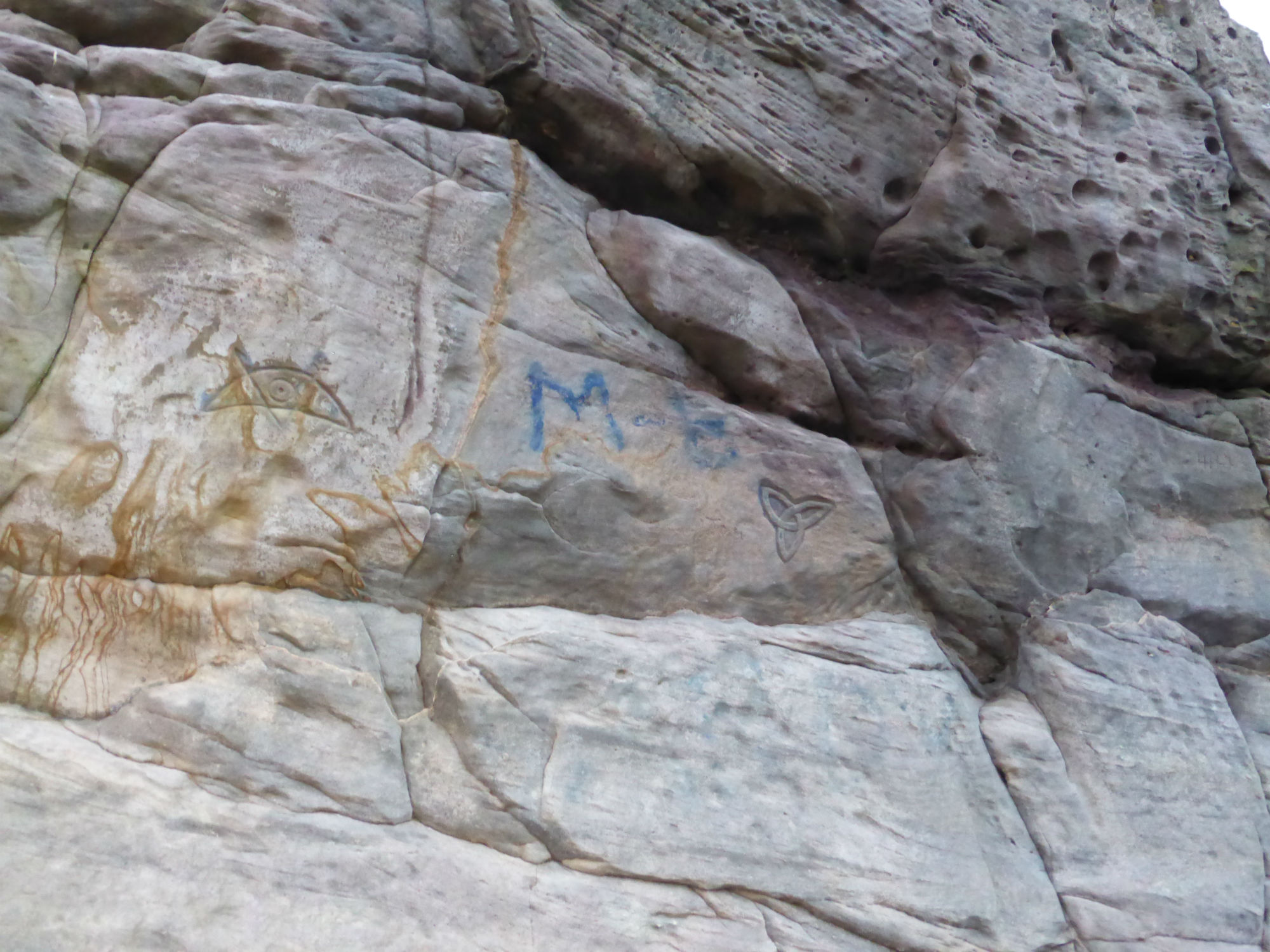
Modern 'Pictish' symbols carved onto Pulpit Rock
training1
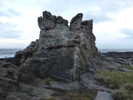
11/08/2013
Pulpit Rock, looking S
training1
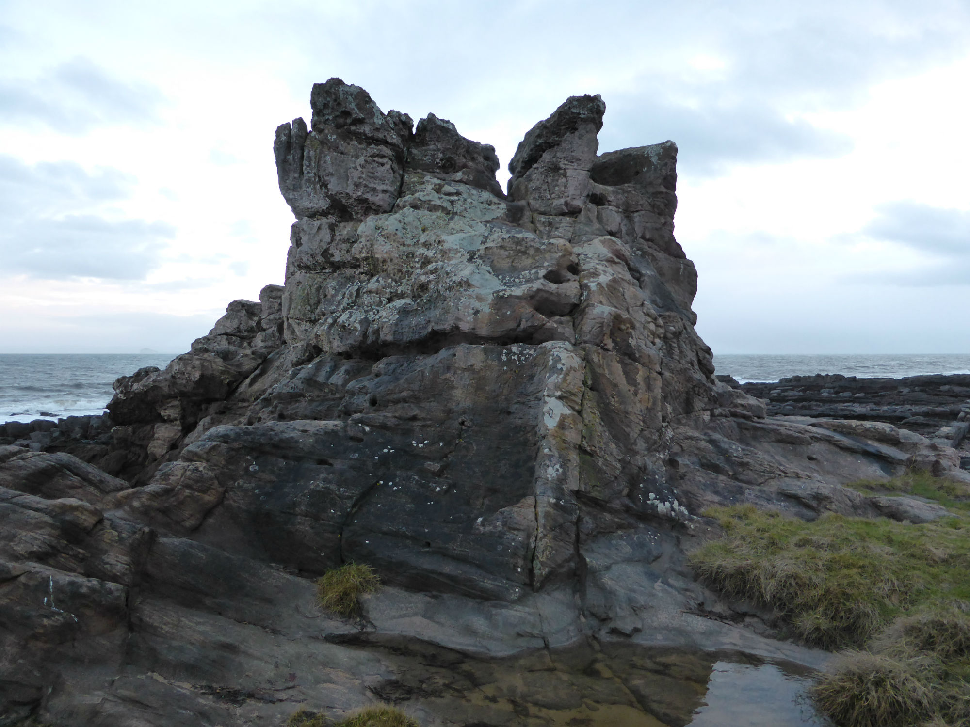
04/08/2013
Site 1339 Western Side
mahyland
04/08/2013
Site 1339 Eastern Side
mahyland
04/08/2013
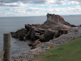
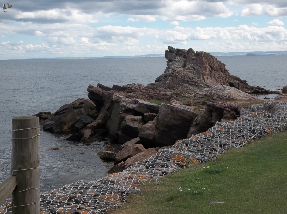
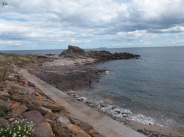
Site 1339 Western Side with Coastal Defence
mahyland
08/08/2013
Site 1339 Eastern Side with Coastal Defence" at Pulpit Rock (1339)
joannahambly
11/08/2013
Metal Shaft
mahyland
Submitted updates
Update id
Date
User
1212
11/08/2013
mahyland
Tidal state
Low
Site located?
Yes
Proximity to coast edge
Coast edge
Coastally eroding?
active sea erosion
Coastal defence
Yes
Visibility above ground
Not visible
Visibility in section
Not visible
Access
accessible - difficult terrain
Local knowledge
is well known; is well visited; has local associations/history
Description
Stone buildings visible in the eroding section.
4 Aug 2013 - There are no buildings visible-- at least, none visible within two hours of high tide. There is a large rock formation that is known locally by names such as "Pulpit Rock", "Johnny Dow's Pulpit Rock", and "Pulpit Rock at Johnny Doo's Hole." Covenanter preachers allegedly held illegal religious services here called "Coventicles" in the 17th century. The area is called Billowness and is on the edge of Anstruther Wester. The site is visible from the Fife Coastal Trail, but there are signs saying "DANGER: UNSTABLE GROUND. STAY CLEAR OF AREA." The red dot on the map is located at an angle that is impossible to see from the coast and cannot easily be accessed due to the restrictions, so it is possible that there is a building there, although the traditional stories about the site make a point that the area was only ever used secretly. The rock is apparently sandstone.
11 Aug 2013 - Revisited at low tide. No manmade structures visible, although there was one rusty metal stake going through one of the rocks. Pulpit Rock can be accessed but the nearby coastal defences have signs marking them as areas not to be walked on.
remove from priorities, it's probable that the original survey mistook natural geology for drystone walling.
1210
04/08/2013
mahyland
Tidal state
High
Site located?
Yes
Proximity to coast edge
Coast edge
Coastally eroding?
active sea erosion
Coastal defence
Yes
Visibility above ground
Not visible
Visibility in section
Not visible
Access
not accessible, but visible from public path/road/adjacent land
Local knowledge
is well known; has local associations/history
Description
Stone buildings visible in the eroding section.
4 Aug 2013 - There are no buildings visible-- at least, none visible within two hours of high tide. There is a large rock formation that is known locally by names such as "Pulpit Rock", "Johnny Dow's Pulpit Rock", and "Pulpit Rock at Johnny Doo's Hole." Covenanter preachers allegedly held illegal religious services here called "Coventicles" in the 17th century. The area is called Billowness and is on the edge of Anstruther Wester. The site is visible from the Fife Coastal Trail, but there are signs saying "DANGER: UNSTABLE GROUND. STAY CLEAR OF AREA." The red dot on the map is located at an angle that is impossible to see from the coast and cannot easily be accessed due to the restrictions, so it is possible that there is a building there, although the traditional stories about the site make a point that the area was only ever used secretly. The rock is apparently sandstone.
Revisit site at low tide to see if remains of buildings are revealed.
Comments
I think the site type should not be "buildings", but I don't know what would be better.