Boat house, Mains of Murkle (13242)
Condition
| 6 | |
| Structure | |
| Post-Medieval | |
| MHG13646 | |
| Highland |
Description
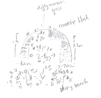
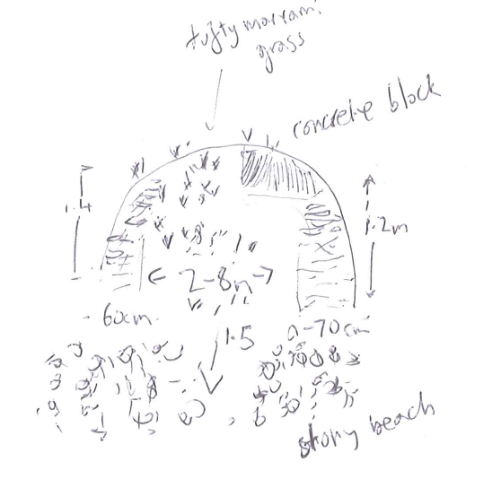
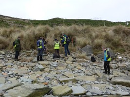
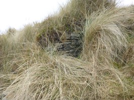
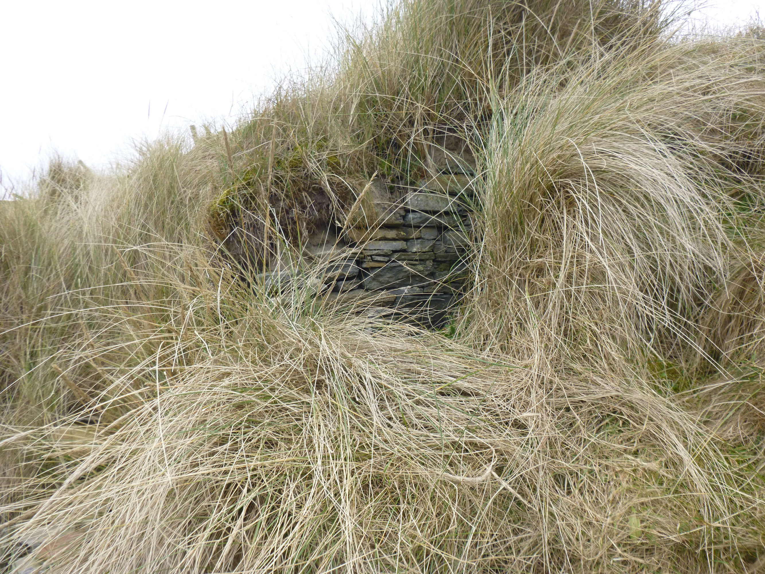
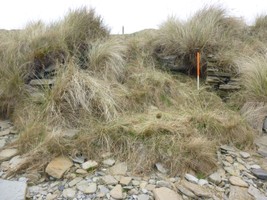
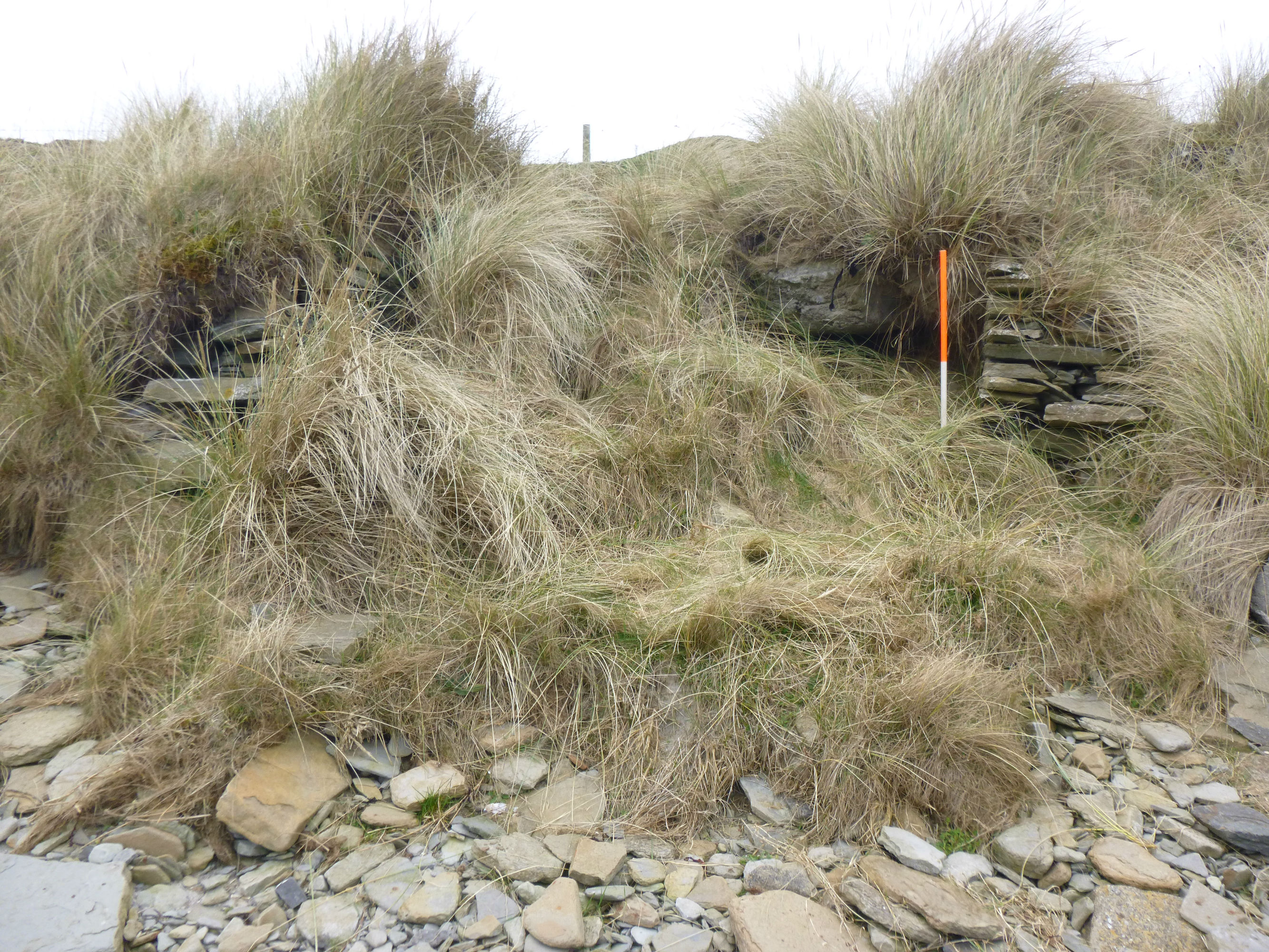
| Remains of a rectangular stone structure visible in the coast edge. Overall width 2.8m, three walls surviving. Southern wall is 0.6m wide, 1.4m high and 2m long; northern wall is 0.7m wide, 1.2m high and 1.5m long. Evidence of mortar bonding. Possibly the boat house depicted and labelled on the 1st (1873) and 2nd (1905) edition OS maps. Concrete slab inserted on top of structure, possibly associated with the WW2 defences around the bay. Sand and marram grass above. |
Location
| 316677.00 | |
| 969624.00 | |
| 27700 | |
| 58.6065407 | |
| -3.4357133 |
Submitted photographs
| Image | Date | Caption | User |
|---|---|---|---|
|
18/03/2016 | Boat house 13242 in southeast facing coast edge | CaithnessCZAS |
|
|||
|
18/03/2016 | General view of boat house | CaithnessCZAS |

|
|||
|
18/03/2016 | Internal face of south wall | CaithnessCZAS |
|
|||

|
18/03/2016 | North wall of boathouse | CaithnessCZAS |

|
|||
|
18/03/2016 | Boat house walls in section | CaithnessCZAS |
|
|||
Submitted updates
| Update id | Date | User | ||||||||||||||||||||
|---|---|---|---|---|---|---|---|---|---|---|---|---|---|---|---|---|---|---|---|---|---|---|
| 2518 | 18/03/2016 | CaithnessCZAS | ||||||||||||||||||||
|
||||||||||||||||||||||