Peat layer with remains of a submerged forest in peat.
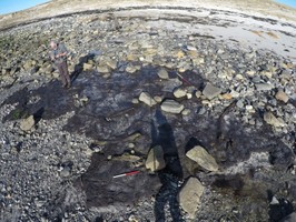
The remains comprise a series of thin peat (or mud) matrix sections c. 300mm thick extending out from below the machair sand dunes into the inter-tidal zone between the dune face and nearby tidal island of Eilean an Dunain. Study of satellite imagery and mapping shows considerable changes in the coastline in this area since it was first surveyed by the OS in 1878, a process that appears to have accelerated in recent years. (See location/context plan). This suggests that whilst some sections of the matrix nearer the HWM may have been exposed for a while, those nearer the island have remained buried by sand until relatively recently.
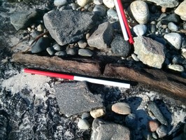
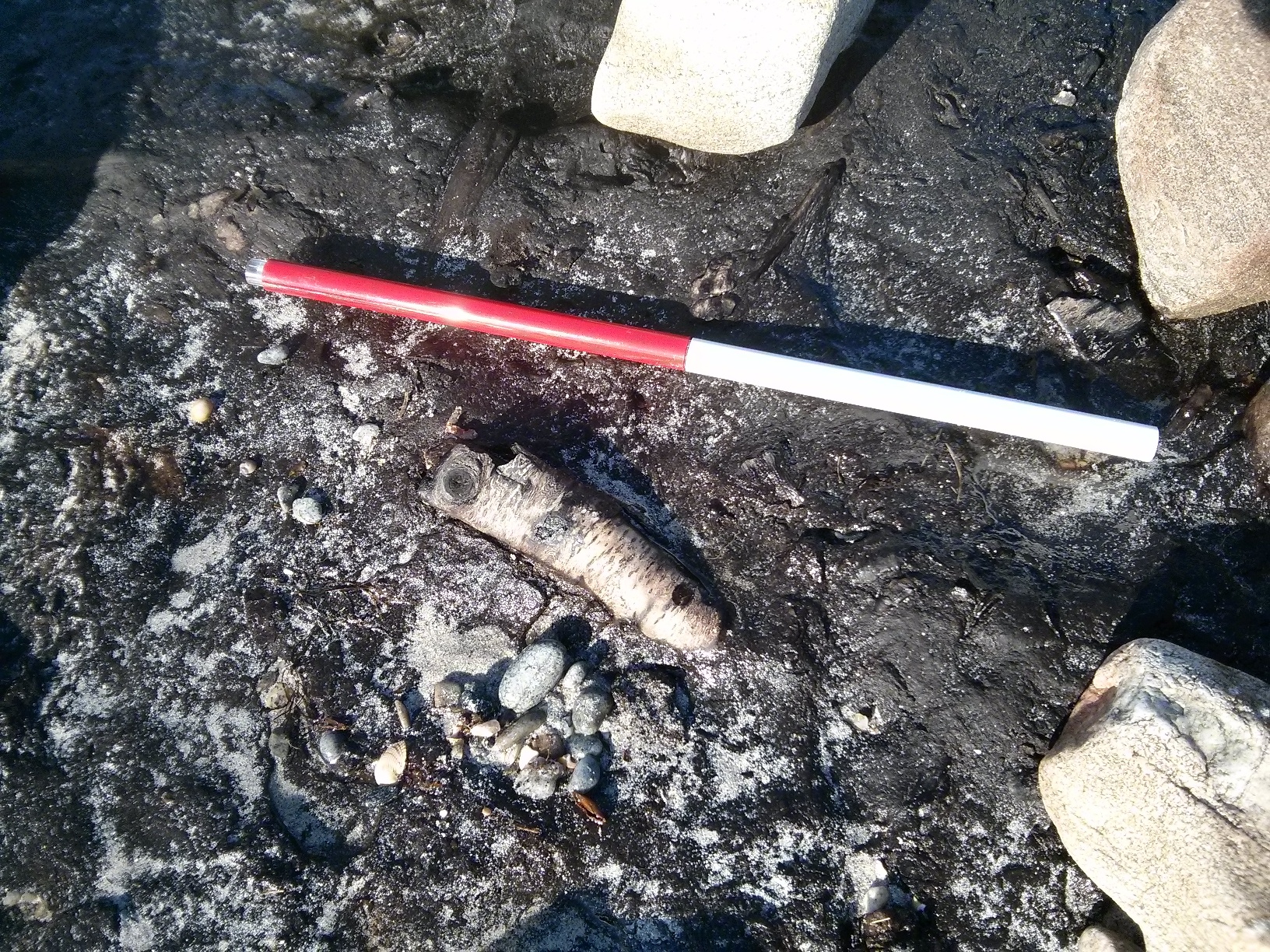
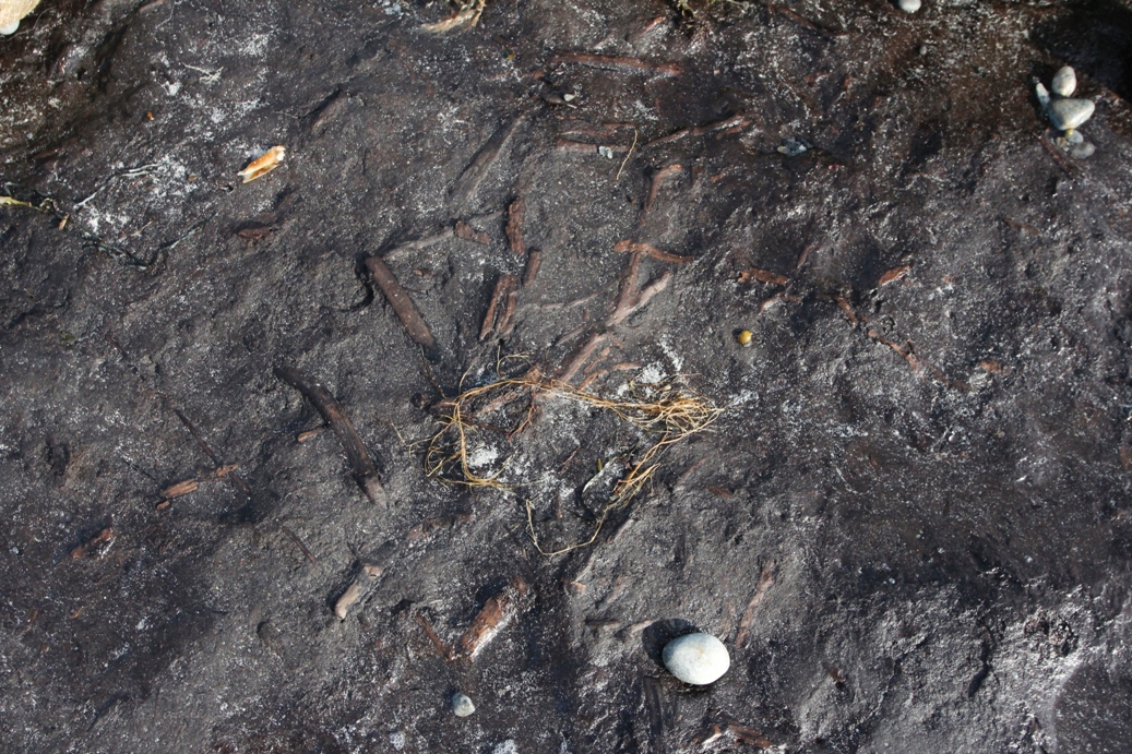
These exposures, which cover an area c.20 X 8m, differ from those further NW in that they have embedded within them a significant quantity of timber remains including brushwood, twigs, thin branches, root systems and whole trunks with bark intact up to 150mm in diameter. The distribution of the timber remains is not even; the areas to the E and SE including large quantities of smaller sized material fully embedded within the matrix (see image 2). Further E is a higher concentration of whole tree trunk sections, around a dozen in total, all roughly 100-150mm in diameter and 1 - 1.5m long and embedded in the matrix surface. 6 of these are located in a line at roughly the same E-W orientation, the others scattered about nearby (see location plan and image 3). In two places similar size tree trunk sections can be seen lying underneath and at right angles to those on the surface.
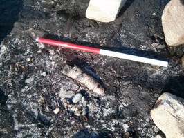
One trunk section has a possible notch cut (image 6).
In general finds like this are believed to be the remains of submerged forests buried in peat which is believed to have happened around 4-5,000 years ago as sea levels rose and the climate cooled and became wetter.
In late 2015, a small discrete patch of occupation deposit was recorded and recovered adjacent to the peat exposure. Contained peat ash and charcoal, possibly an in-situ remnant of an otherwise eroded-out floor layer, appeared partially-fired so may have been part of or close to a hearth.
07/05/2016
The site was investigated by volunteers as part of the Scotland's Coastal Heritage at Risk Project. The woodland comprised mainly willow and birch. Radiocarbon dating of the peat containing the tree remains returned early Neolithic dates of 3766-3642 cal BC (SUERC 73451) from the base of the sequence and 3645-3389 cal BC (SUERC 73452) from the top of the sequence.
Location
89570.00
880094.00
27700
57.7030525
-7.2133560
Submitted photographs
Image
Date
Caption
User
27/02/2016
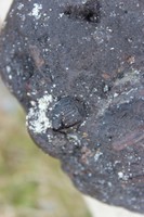
Detail of hazelnut in peat layer
training1
27/02/2016
Section of test pit dug during sampling work
training1
27/02/2016
Fieldwork for recording and sampling project
training1
27/02/2016
Image 6 detail of notched branch
DavidNewman
27/02/2016
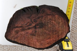
Image 5 detail of cut through loose trunk
DavidNewman
27/02/2016
Image 4 detail of silver birch branch
DavidNewman
27/02/2016
Image 3 view of embedded trunks
DavidNewman
27/02/2016
Image 2 detail of brushwood
DavidNewman
27/02/2016
Location/context plan
DavidNewman
Submitted updates
Update id
Date
User
2495
27/02/2016
DavidNewman
Tidal state
Mid
Site located?
Yes
Proximity to coast edge
Intertidal
Coastally eroding?
active sea erosion
Visibility above ground
Limited visibility (partial remains)
Visibility in section
Limited visibility in section
Access
accessible on foot (no footpath)
Local knowledge
is not locally known
Description
Peat layer with remains of a submerged forest in peat.
The remains comprise a series of thin peat (or mud) matrix sections c. 300mm thick extending out from below the machair sand dunes into the inter-tidal zone between the dune face and nearby tidal island of Eilean an Dunain. Study of satellite imagery and mapping shows considerable changes in the coastline in this area since it was first surveyed by the OS in 1878, a process that appears to have accelerated in recent years. (See location/context plan). This suggests that whilst some sections of the matrix nearer the HWM may have been exposed for a while, those nearer the island have remained buried by sand until relatively recently.
These exposures, which cover an area c.20 X 8m, differ from those further NW in that they have embedded within them a significant quantity of timber remains including brushwood, twigs, thin branches, root systems and whole trunks with bark intact up to 150mm in diameter. The distribution of the timber remains is not even; the areas to the E and SE including large quantities of smaller sized material fully embedded within the matrix (see image 2). Further E is a higher concentration of whole tree trunk sections, around a dozen in total, all roughly 100-150mm in diameter and 1 - 1.5m long and embedded in the matrix surface. 6 of these are located in a line at roughly the same E-W orientation, the others scattered about nearby (see location plan and image 3). In two places similar size tree trunk sections can be seen lying underneath and at right angles to those on the surface.
One trunk section has a possible notch cut (image 6).
In general finds like this are believed to be the remains of submerged forests buried in peat which is believed to have happened around 4-5,000 years ago as sea levels rose and the climate cooled and became wetter.
In late 2015, a small discrete patch of occupation deposit was recorded and recovered adjacent to the peat exposure. Contained peat ash and charcoal, possibly an in-situ remnant of an otherwise eroded-out floor layer, appeared partially-fired so may have been part of or close to a hearth.
07/05/2016
The site has been recorded by volunteers working on SCHARP, and samples from each piece of wood have been recovered for identification. Samples of the peat layers have been recovered for dating and pollen analysis.
Needs expert visit reasonably urgently.
This site was recorded and samples recovered for analysis, dating and wood ID, as part of SCHARP.
Comments
The remains comprise a series of thin peat (or mud) matrix sections c. 300mm thick extending out from below the machair sand dunes into the inter-tidal zone between the dune face and nearby tidal island of Eilean an Dunain. Study of satellite imagery and mapping shows considerable changes in the coastline in this area since it was first surveyed by the OS in 1878, a process that appears to have accelerated in recent years. (See location/context plan). This suggests that whilst some sections of the matrix nearer the HWM may have been exposed for a while, those nearer the island have remained buried by sand until relatively recently.
These exposures, which cover an area c.20 X 8m, differ from those further NW in that they have embedded within them a significant quantity of timber remains including brushwood, twigs, thin branches and whole trunks with bark intact up to 150mm in diameter. The distribution of the timber remains is not even; the areas to the E and SE including large quantities of smaller sized material fully embedded within the matrix (see image 2). Further E is a higher concentration of whole tree trunk sections, around a dozen in total, all roughly 100-150mm in diameter and 1 - 1.5m long and embedded in the matrix surface. 6 of these are located in a line at roughly the same E-W orientation, the others scattered about nearby (see location plan and image 3). In two places similar size tree trunk sections can be seen lying underneath and at right angles to those on the surface.
Detailed study of the timber suggests the most likely species is Silver Birch (image 4), and a cut through a recovered loose trunk section suggests an age of perhaps 15-20 years (image 5). One trunk section has a possible notch cut (image 6).
In general finds like this are believed to be the remains of submerged forests buried in peat which is believed to have happened around 4-5,000 years ago as sea levels rose and the climate cooled and became wetter. Despite that, at this location there is the possibility of a different explanation, in that perhaps these are the remains of a manmade timber track leading between an old lake shore and Eilean an Dunain where several cist burials were recorded in times past (SCHARP 9047), though now washed away.