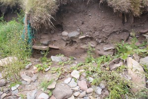
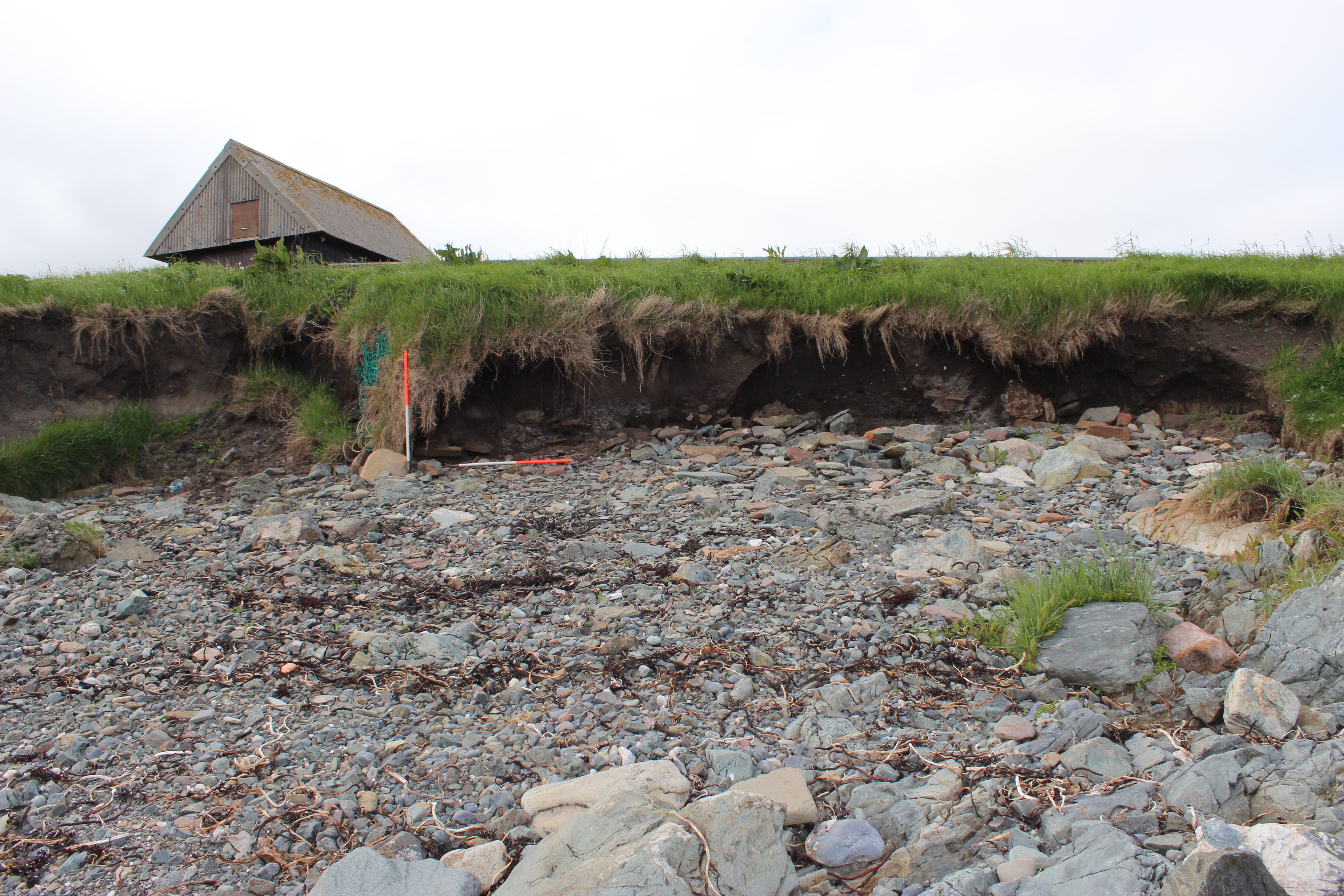
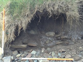
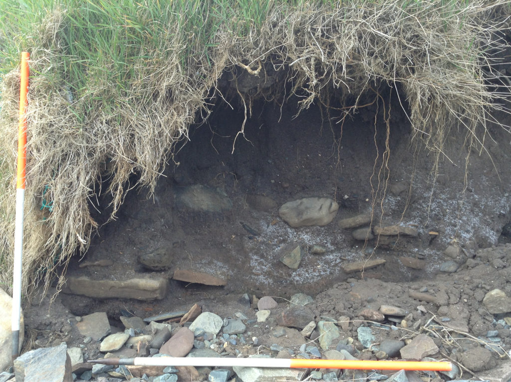
Coastal exposure on the seaward side of current cemetery. Approx 11m long, 1m high. Deep rich soil containing moderate small frags of bone. Human and animal bone observed. Below the topsoil in an approx 3m length of the section a line of flat stones overlies peat ash.
Approx. 20m west a further 2m wide by 1m high coastal exposure contains thick cultivation soil with animal bone fragments.
Visited 30th Sept 2015 - slightly more erosion than recorded in 2014 but has not changed significantly.
26 Feb 2018:
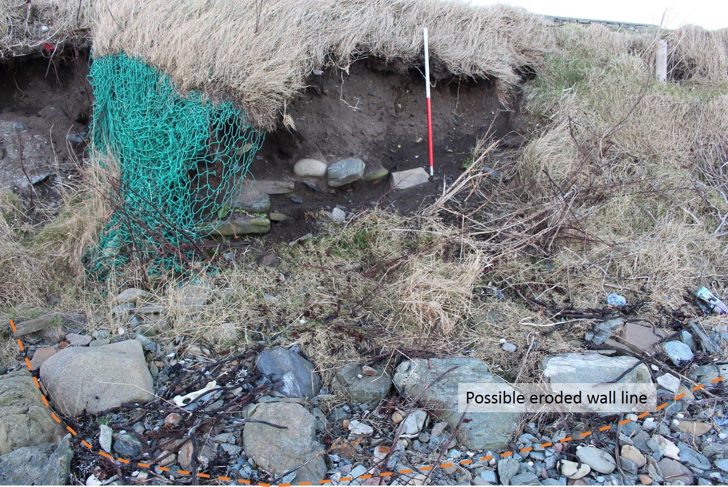
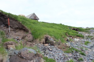
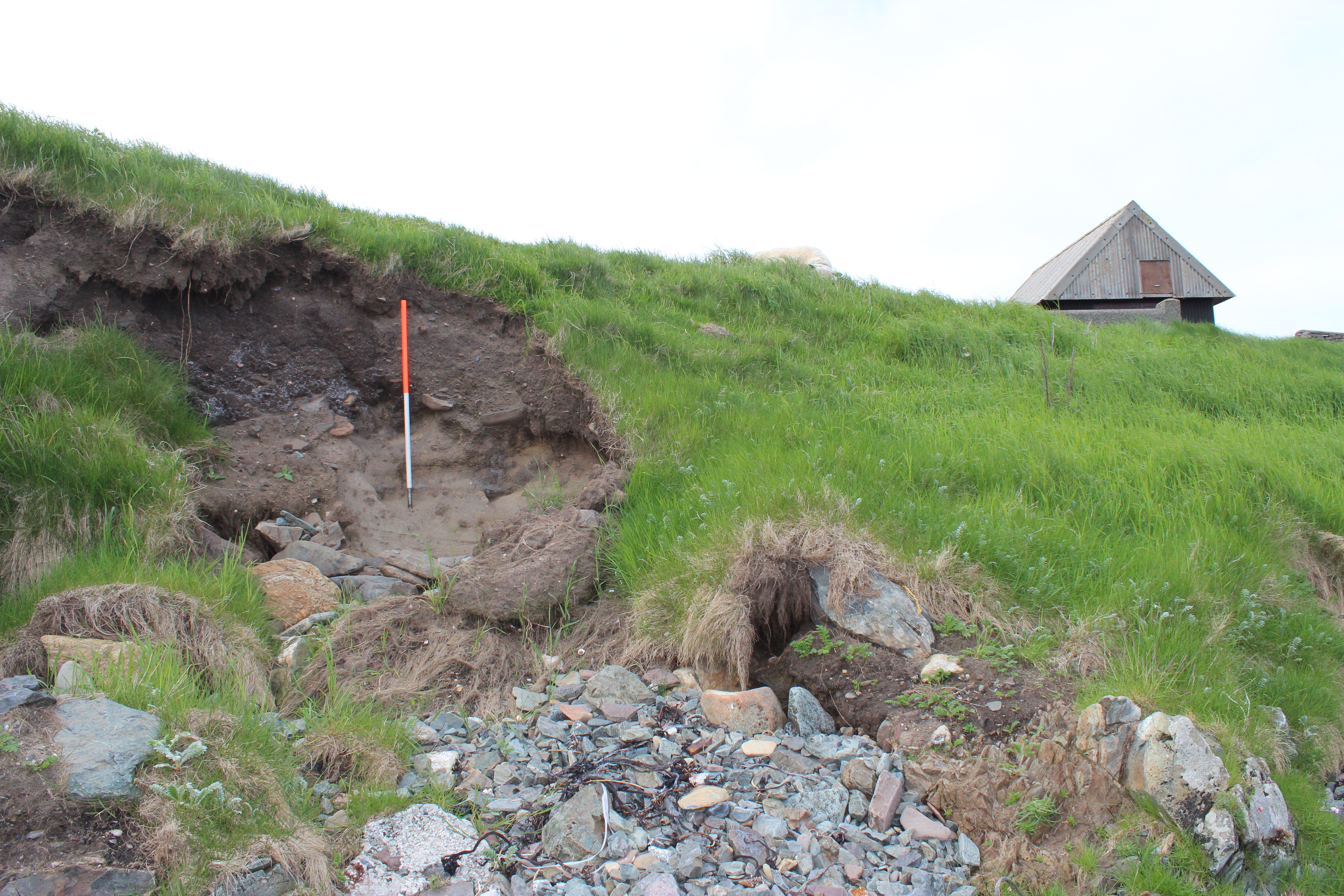
Coast edge slumped and stabilising compared to 2014. Semi-circular arrangement of boulders on the beach in front of the section may represent the eroded footprint of the structure, which is more noticeable now than previously due to continuing erosion of beach here.
Location
443293.00
1127910.00
27700
60.0336800
-1.2248486
Submitted photographs
Image
Date
Caption
User
27/05/2014
Feb 2018: possible outline of eroded circular structure on beach in front of section
joannahambly
27/05/2014
Feb 2018: Stones in section. Large boulders on beach in front of section may represent the eroded remains of a wall, possibly part of this structure
joannahambly
30/09/2015
Site 12784 coastal exposure
EstherR
27/05/2014
General view
training1
27/05/2014
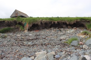
View of both exposures looking northwest
training1
27/05/2014
Western exposure
training1
27/05/2014
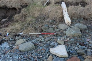
12784 Bur Ness detail of stone overlying peat ash
training1
Submitted updates
Update id
Date
User
3103
26/02/2018
training1
Tidal state
Mid
Site located?
Yes
Proximity to coast edge
Coast edge
Coastally eroding?
active sea erosion; has eroded in the past
Visibility above ground
Not visible
Visibility in section
Limited visibility in section
Access
easily accessible - no restrictions; accessible on foot (no footpath)
Local knowledge
is not locally known
Description
Coastal exposure on the seaward side of current cemetery. Approx 11m long, 1m high. Deep rich soil containing moderate small frags of bone. Human and animal bone observed. Below the topsoil in an approx 3m length of the section a line of flat stones overlies peat ash.
Approx. 20m west a further 2m wide by 1m high coastal exposure contains thick cultivation soil with animal bone fragments.
Visited 30th Sept 2015 - slightly more erosion than recorded in 2014 but has not changed significantly.
26 Feb 2018:
Coast edge slumped and stabilising compared to 2014. Semi-circular arrangement of boulders on the beach in front of the section may represent the eroded footprint of the structure, which is more noticeable now than previously due to continuing erosion of beach here.
Continue to monitor this stretch of coastline regularly. Observations over the previous 4 years has shown that episodic erosion is taking place here and new archaeological material is continuing to be exposed and damaged/destroyed.
2225
30/09/2015
EstherR
Tidal state
High
Site located?
Yes
Proximity to coast edge
Coast edge
Coastally eroding?
active sea erosion
Visibility above ground
Not visible
Visibility in section
Clearly visible in section
Access
accessible on foot (footpath)
Local knowledge
is not locally known
Description
Coastal exposure on the seaward side of current cemetery. Approx 11m long, 1m high. Deep rich soil containing moderate small frags of bone. Human and animal bone observed. Below the topsoil in an approx 3m length of the section a line of flat stones overlies peat ash.
Approx. 20m west a further 2m wide by 1m high coastal exposure contains thick cultivation soil with animal bone fragments.
Visited 30th Sept 2015 - slightly more erosion than recorded in 2014 but has not changed significantly.
1647
27/05/2014
training1
Tidal state
Low
Site located?
Yes
Proximity to coast edge
Coast edge
Coastally eroding?
active sea erosion
Visibility above ground
Not visible
Visibility in section
Limited visibility in section
Access
accessible on foot (no footpath)
Local knowledge
don't know
Description
Coastal exposure on seaward side of current cemetery. Approx 11m long, 1m high. Deep rich soil containing moderate small frags of bone. Human and animal bone observed. Below the topsoil in an approx 3m length of the section A line of flat stones overlies peat ash.
Approx. 20m west a further 2m wide by 1m high coastal exposure contains thick cultivation soil with bone (animal) frags.
Further investigation. Clean and record section. Assign to priority 2.