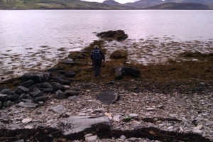
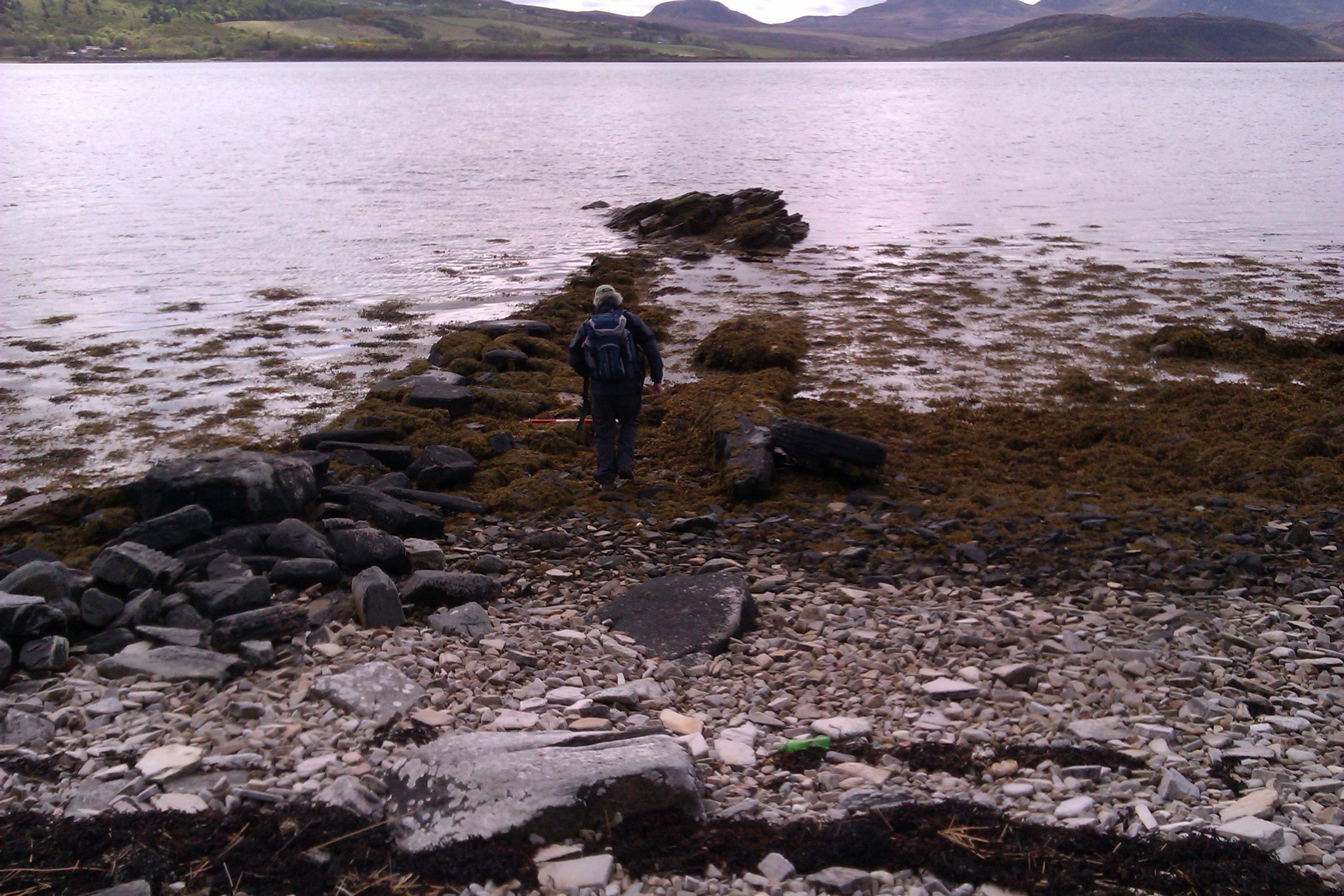
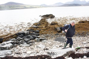
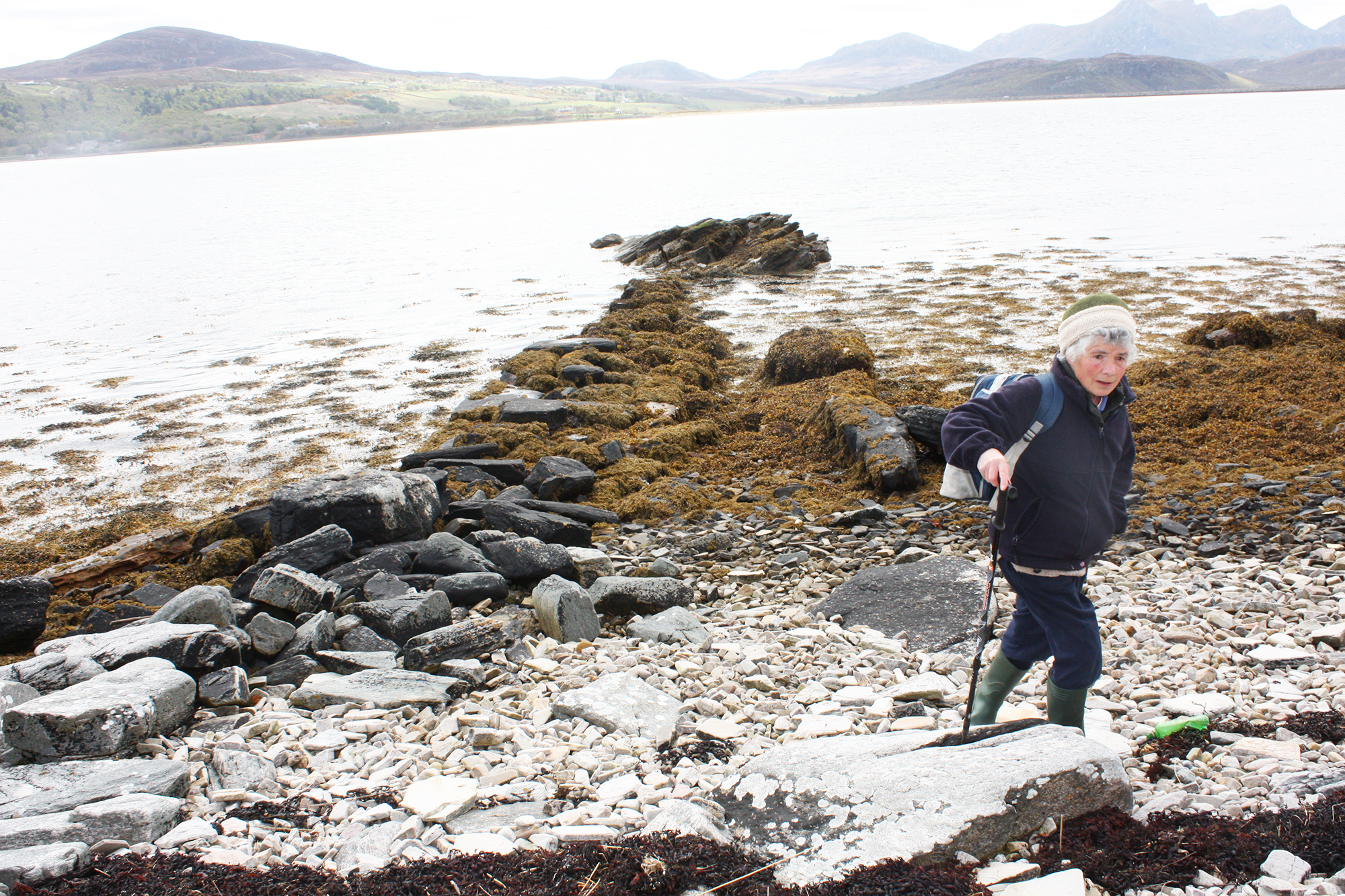
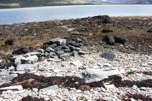
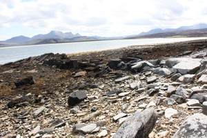
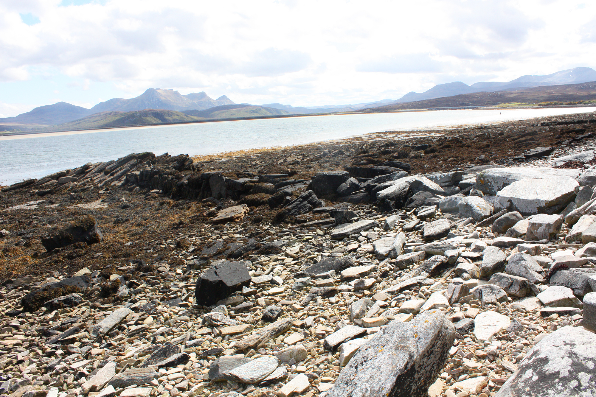
Substantial drystone built jetty, 4-5m wide and c. 22m long. Constructed with very large squared and rectangular blocks to form the side walls with a rubble core. There is no surviving surface. The jetty links an outcrop of bedrock to the shore. It is possible that the bedrock outcrop was once incorporated into the structure.
There is evidence of cleared area on both sides of the jetty.
This is the northernmost of 3 jetties (other sites 12534 and 12535) between Achuvoldrach and Melness.
A feature in this location is shown on the OS 6 inch 1st edition (1843-1882) but not on the 2nd edition (1892-1905)
Location
257970.00
959991.00
27700
58.5048637
-4.4392099
Submitted photographs
Image
Date
Caption
User
30/05/2013
Mid tide looking southeast
training1
26/05/2013
Jetty at mid tide looking SE
training1
26/05/2013
Jetty at low tide looking SE. Bedrock outcrop at east end visible.
training1
26/05/2013
Side view of jetty at low tide looking S. Bedrock outcrop clearly visible at seaward end.
training1
Submitted updates
Update id
Date
User
1164
26/05/2013
evelix
Tidal state
Low
Site located?
Yes
Proximity to coast edge
Intertidal
Coastally eroding?
active sea erosion
Threats
structural damage/decay
Visibility above ground
Limited visibility (partial remains)
Access
accessible - difficult terrain
Local knowledge
don't know
Description
Substantial drystone built jetty, 4-5m wide and c. 22m long. Constructed with very large squared and rectangular blocks to form the side walls with a rubble core. There is no surviving surface. The jetty links an outcrop of bedrock to the shore. It is possible that the bedrock outcrop was once incorporated into the structure.
There is evidence of cleared area on both sides of the jetty.
This is the northernmost of 3 jetties (other sites 12534 and 12535) between Achuvoldrach and Melness.
A feature in this location is shown on the OS 6 inch 1st edition (1843-1882) but not on the 2nd edition (1892-1905)
Historical research and more detailed survey. This is one of 3 stone jetties along a short stretch of coastline. It would be interesting to find out more about their date and function and how they relate to landward features and sites. Was this jetty out of use by the late 19th century as is suggested on the map evidence?
assign priority 3 on basis of group value with 12535, 12534, 12558