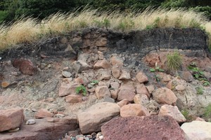
Surface mining, (Coal) with stone / mortar buildings in section
ShoreUPDATE 31st Aug 2013:
Only one wall visible during site visit. Looked like a free standing boundary wall buried under coal waste. Sandstone with clay bonding.
SCHARP comment Jan 2017:
Information from Fife SMR suggests the wall may be associated with the 600 yard firing stance of the 19th century military rifle range related to St Clair Battery.
Location
331307.00
693918.00
27700
56.1330147
-3.1067951
Submitted photographs
Image
Date
Caption
User
31/08/2013
Wall buried in bing section, looking N
training1
Submitted updates
Update id
Date
User
1267
31/08/2013
training1
Tidal state
Low
Site located?
Unsure
Proximity to coast edge
Coast edge
Coastally eroding?
active sea erosion
Threats
structural damage/decay
Other threats
Collapse of bing material
Visibility above ground
Not visible
Visibility in section
Limited visibility in section
Access
accessible - difficult terrain
Local knowledge
don't know
Description
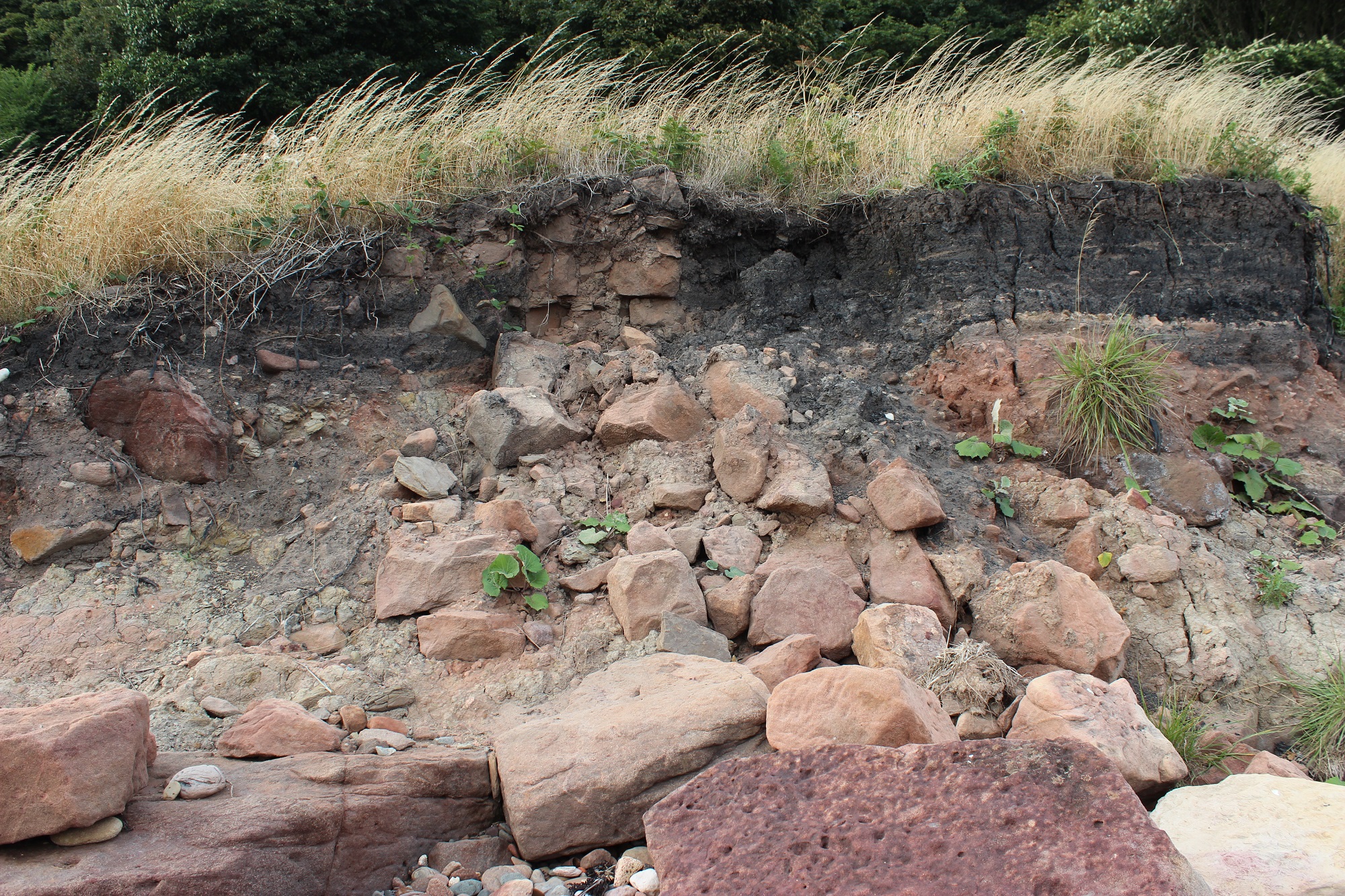
Surface mining, (Coal) with stone / mortar buildings in section
ShoreUPDATE 31st Aug 2013:
Only one wall visible during site visit. Looked like a free standing boundary wall buried under coal waste. Sandstone with clay bonding.
SCHARP comment Jan 2016:
Information from Fife SMR suggests the wall may be associated with the 19th century military rifle range related to St Clair Battery.