Skateraw Harbour (10022)
Description
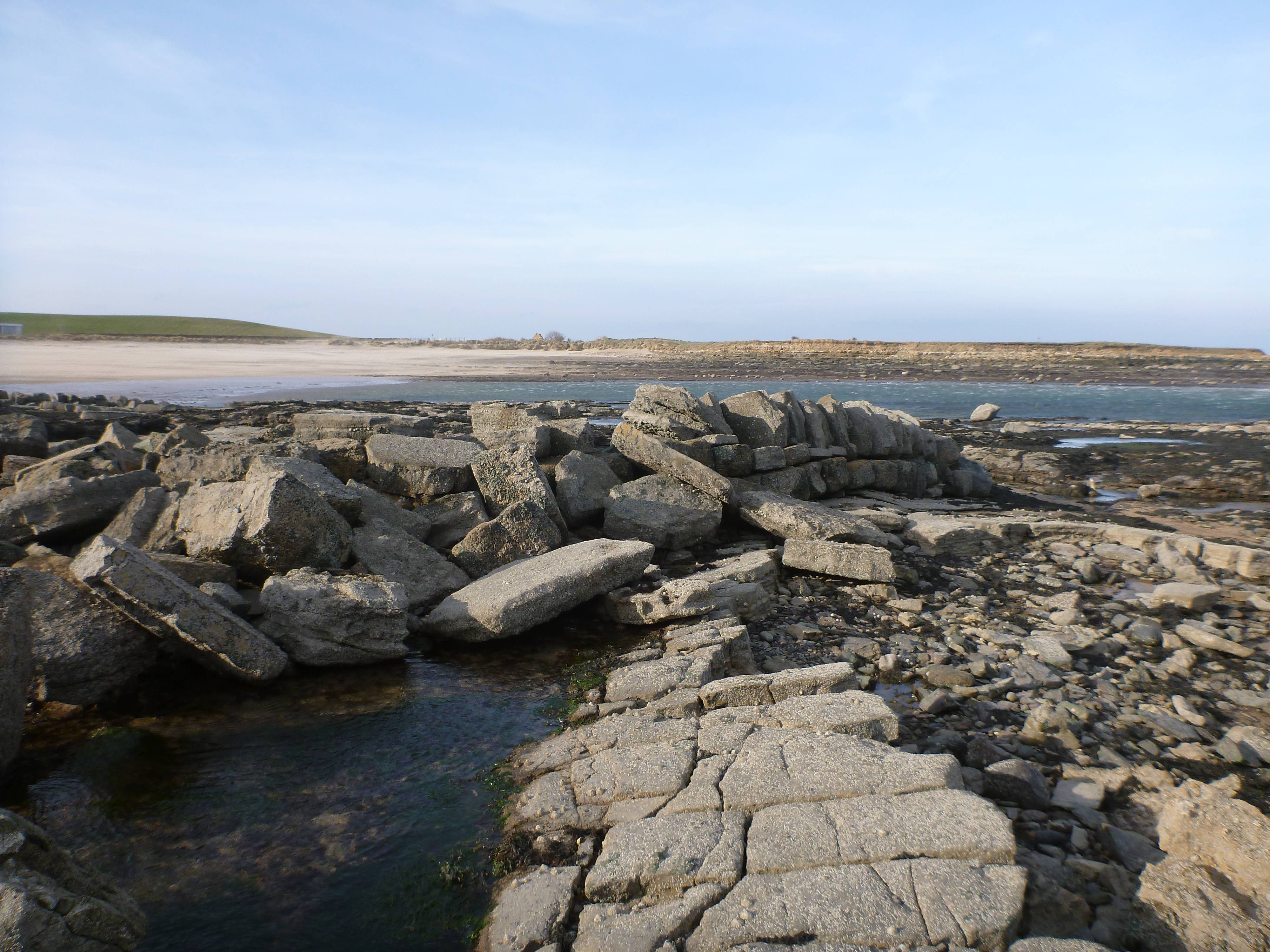
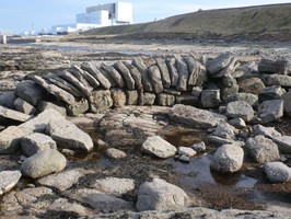
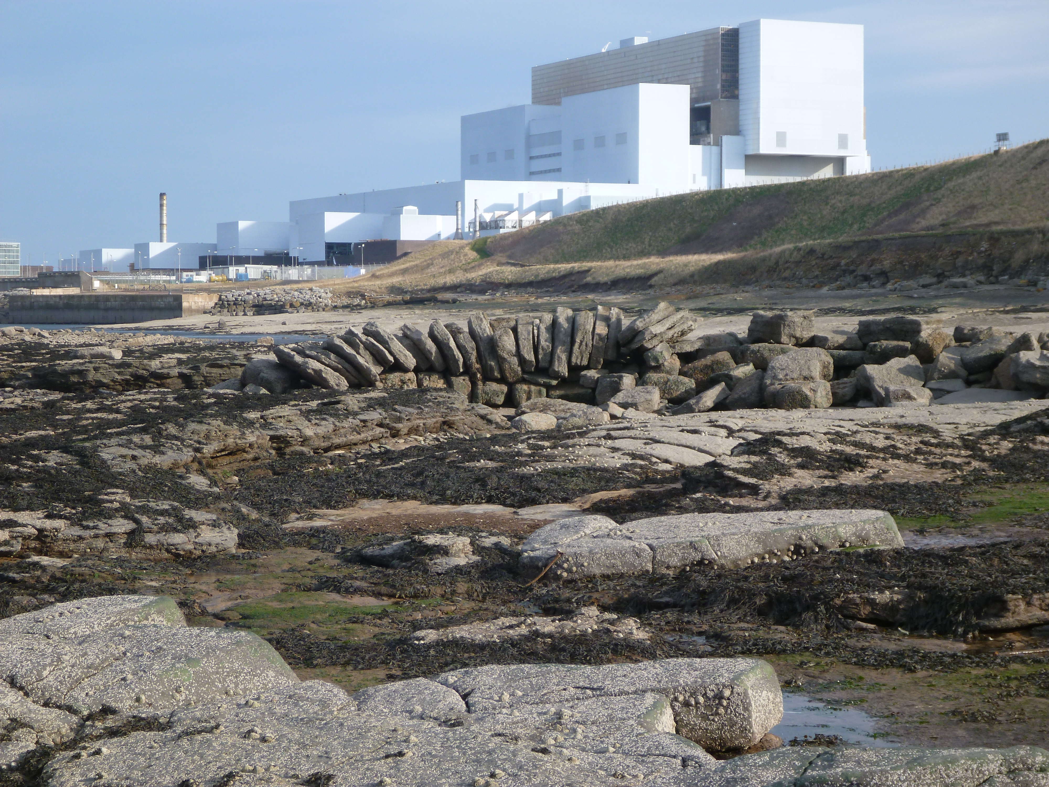
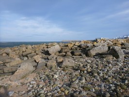
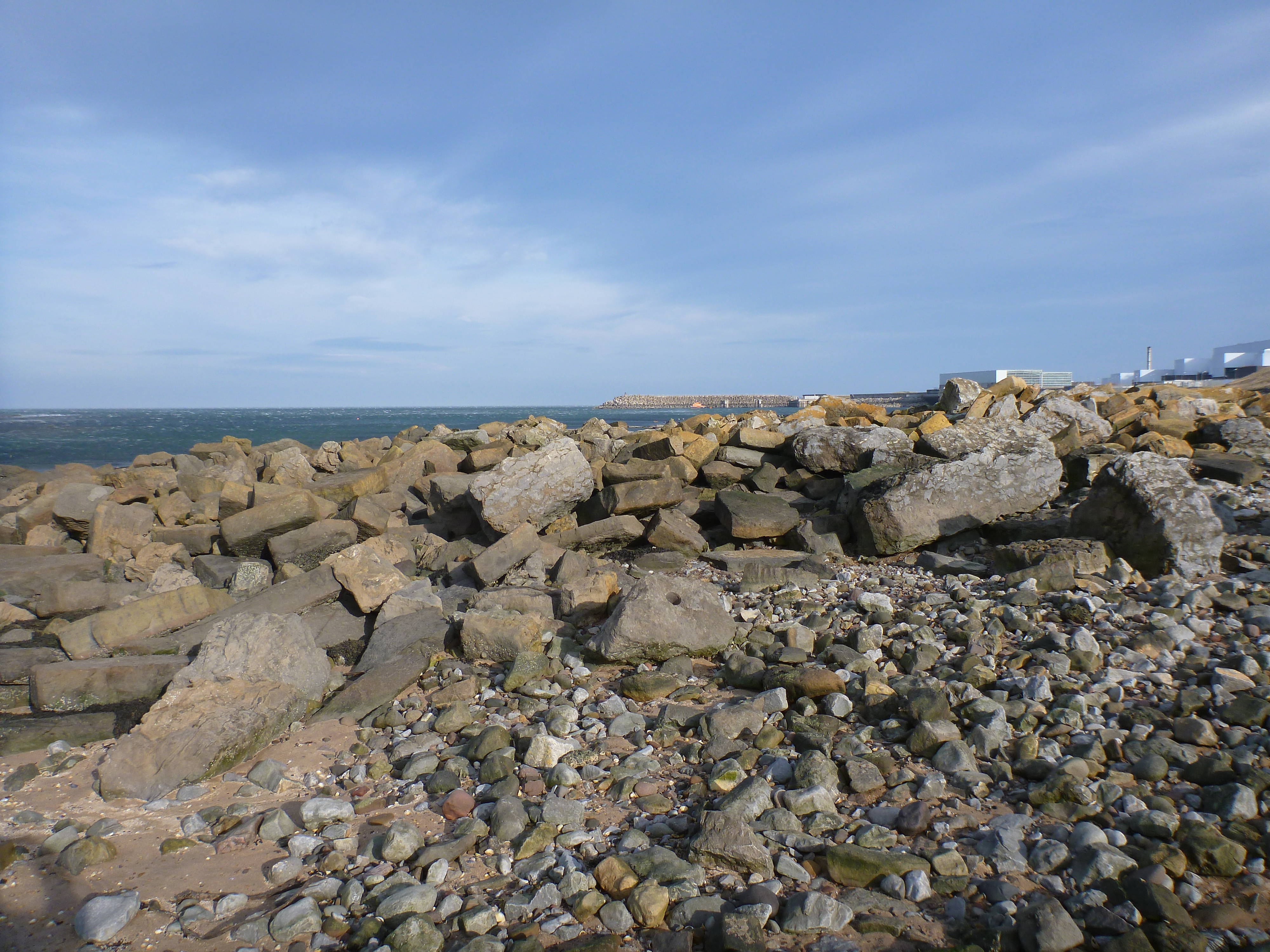
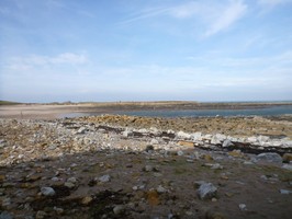
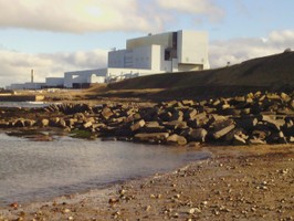
| The remains of Skateraw, or Skate Row, Harbour, comprising of both in situ and ex situ masonry, can be found amongst storm beach deposits on and around the HWM. The harbour was built between 1799 and 1825 by the owners of the nearby limestone quarry and kiln to facilitate the export of lime and import of coal. It occupies a natural harbour, between rocky points, with a sandy beach behind. It was equipped with a breakwater pier and is shown on the 1st edition 6" OS map (1853). It was destroyed by the sea between 1853 and 1892 and was not rebuilt. The remnants of the built elements extend over a 50m (N- S) by 20m area. Shoreupdate 24/02/2014 Some structure still visible amongst piles of very large rectangular blocks which are all that remains of the harbour. |
Location
| 373880.00 | |
| 675450.00 | |
| 27700 | |
| 55.9713326 | |
| -2.4200625 |
Submitted photographs
| Image | Date | Caption | User |
|---|---|---|---|
|
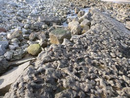
17/03/2014 | Skateraw Harbour showing an iron bolt attached to the bedrock. By Laurens McGregor | EllieSCHARP |
|
|||
|
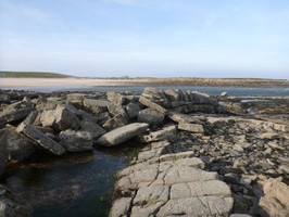
17/03/2014 | Skateraw Harbour showing the remains of the harbour wall. By Laurens McGregor | EllieSCHARP |
|
|||
|
17/03/2014 | Skateraw Harbour detail of the surviving stonework of the harbour wall. By Laurens McGregor | EllieSCHARP |

|
|||

|
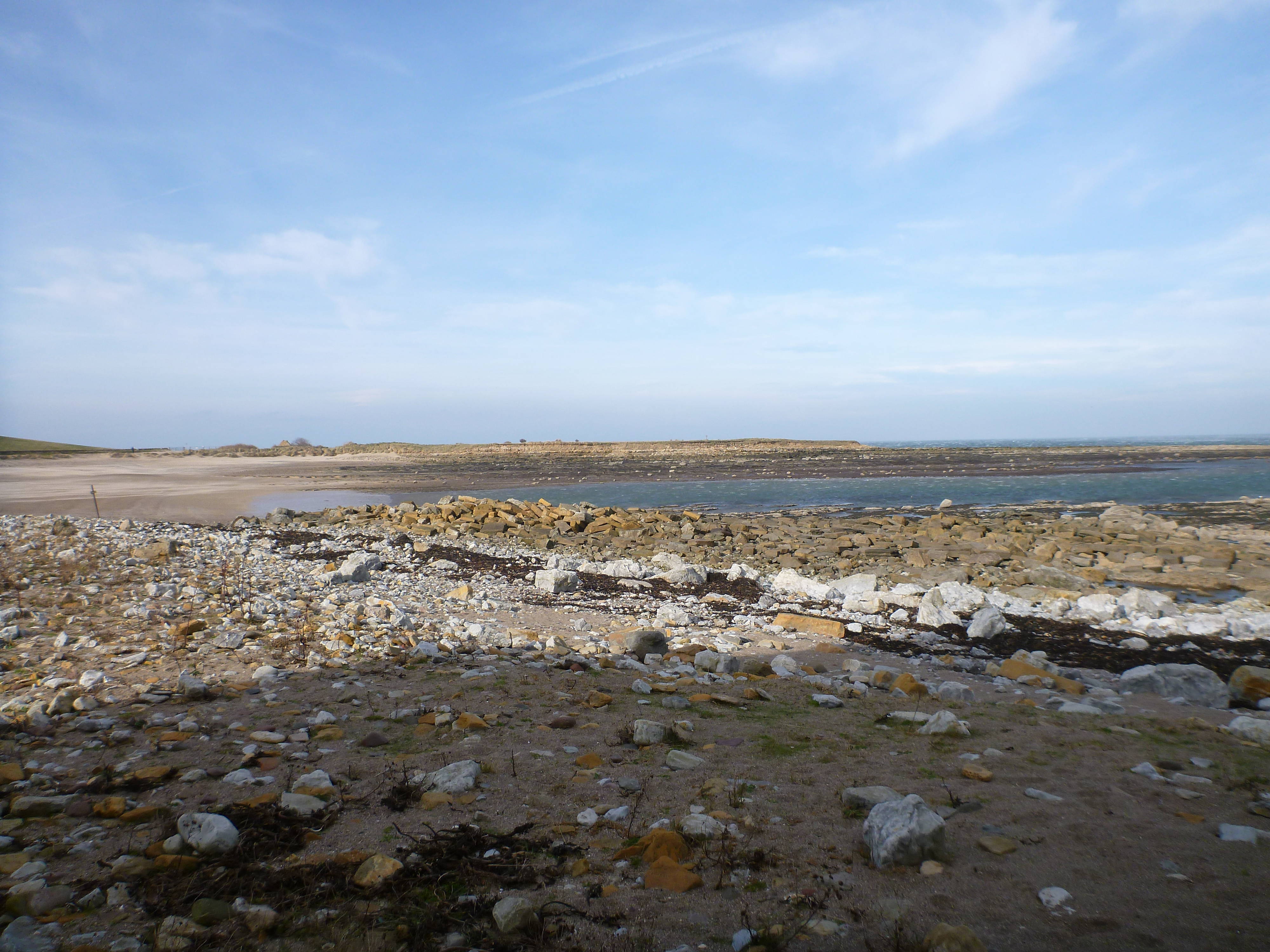
17/03/2014 | Skateraw Harbour showing remains of harbour wall. By Laurens McGregor | EllieSCHARP |
|
|||
|
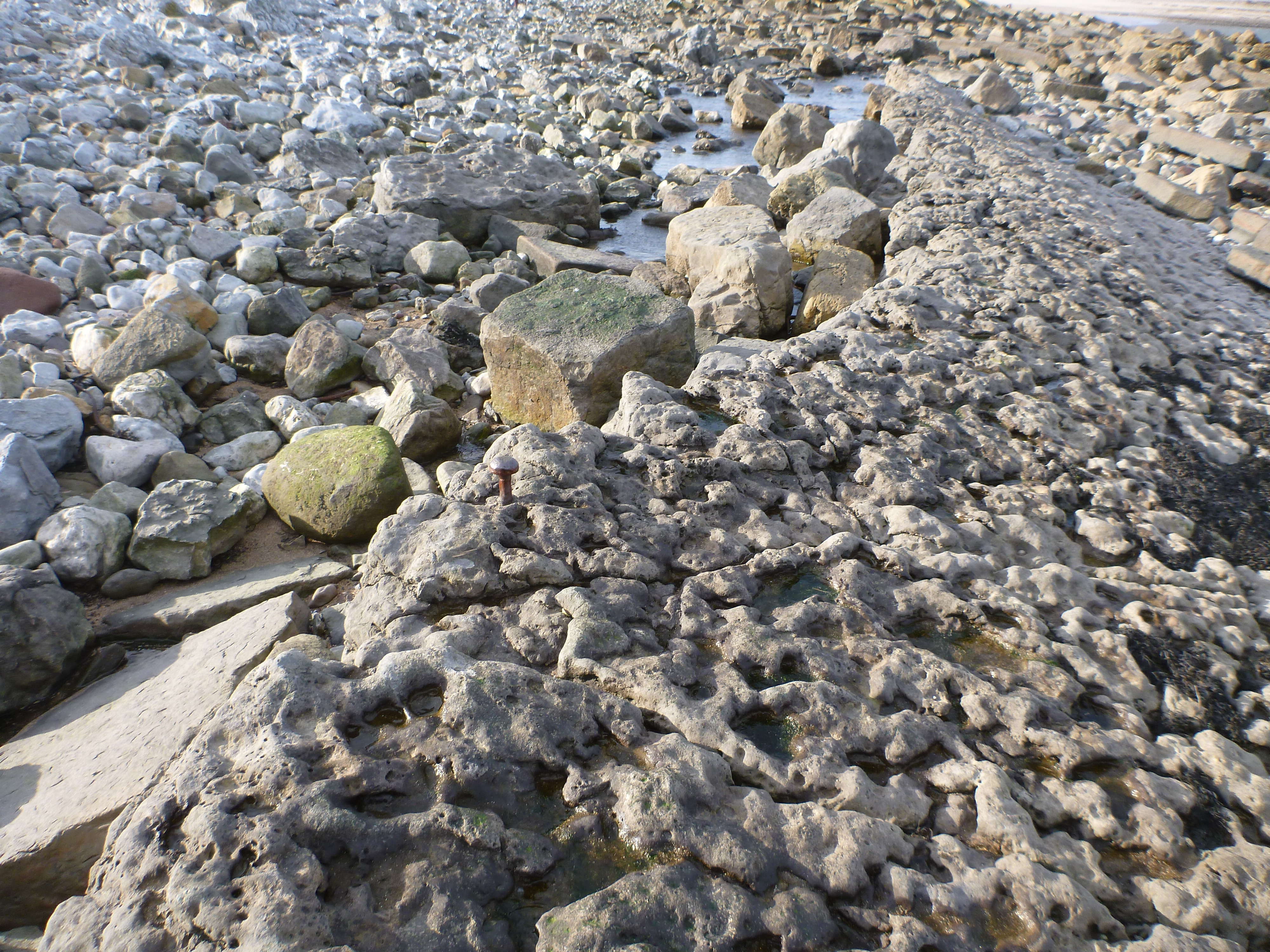
17/03/2014 | Skateraw Harbour showing dressed stone in masonry pile. By Laurens McGregor | EllieSCHARP |
|
|||
|
17/03/2014 | Skateraw Harbour showing piles of masonry from harbour walls. By Laurens McGregor | EllieSCHARP |
|
|||
|
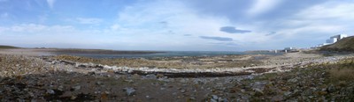
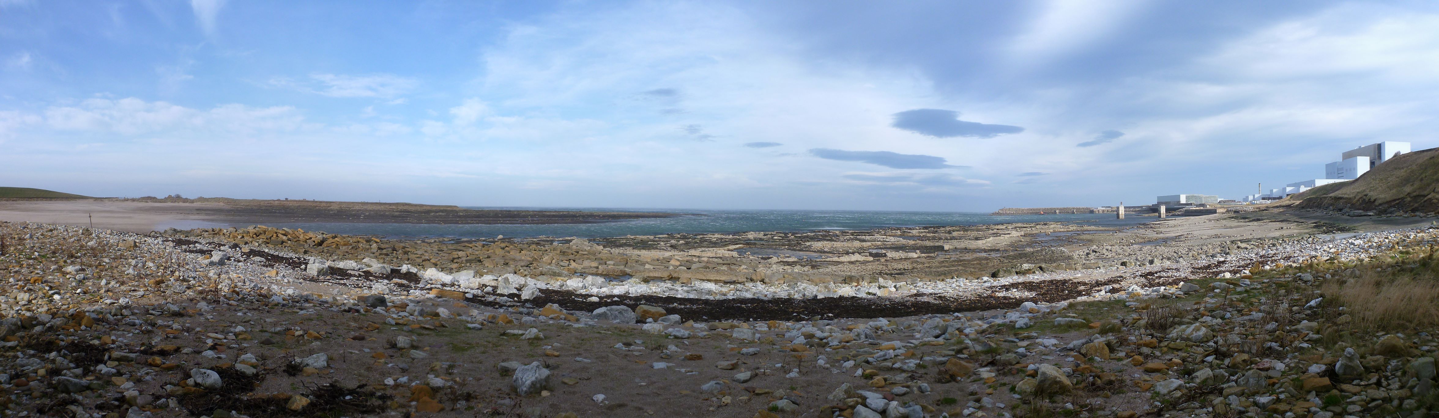
17/03/2014 | Skateraw Harbour panorama from Chapel Point to Torness Point. By Laurens McGregor | EllieSCHARP |
|
|||
|
24/02/2014 | Skateraw harbour showing surviving structure and out of situ masonry | training1 |

|
|||
Submitted updates
| Update id | Date | User | ||||||||||||||||||
|---|---|---|---|---|---|---|---|---|---|---|---|---|---|---|---|---|---|---|---|---|
| 1571 | 24/02/2014 | training1 | ||||||||||||||||||
|
||||||||||||||||||||